
Antique Prints, Maps, & Books of Natural History, Botanicals, & More
Lot 9858:
Description
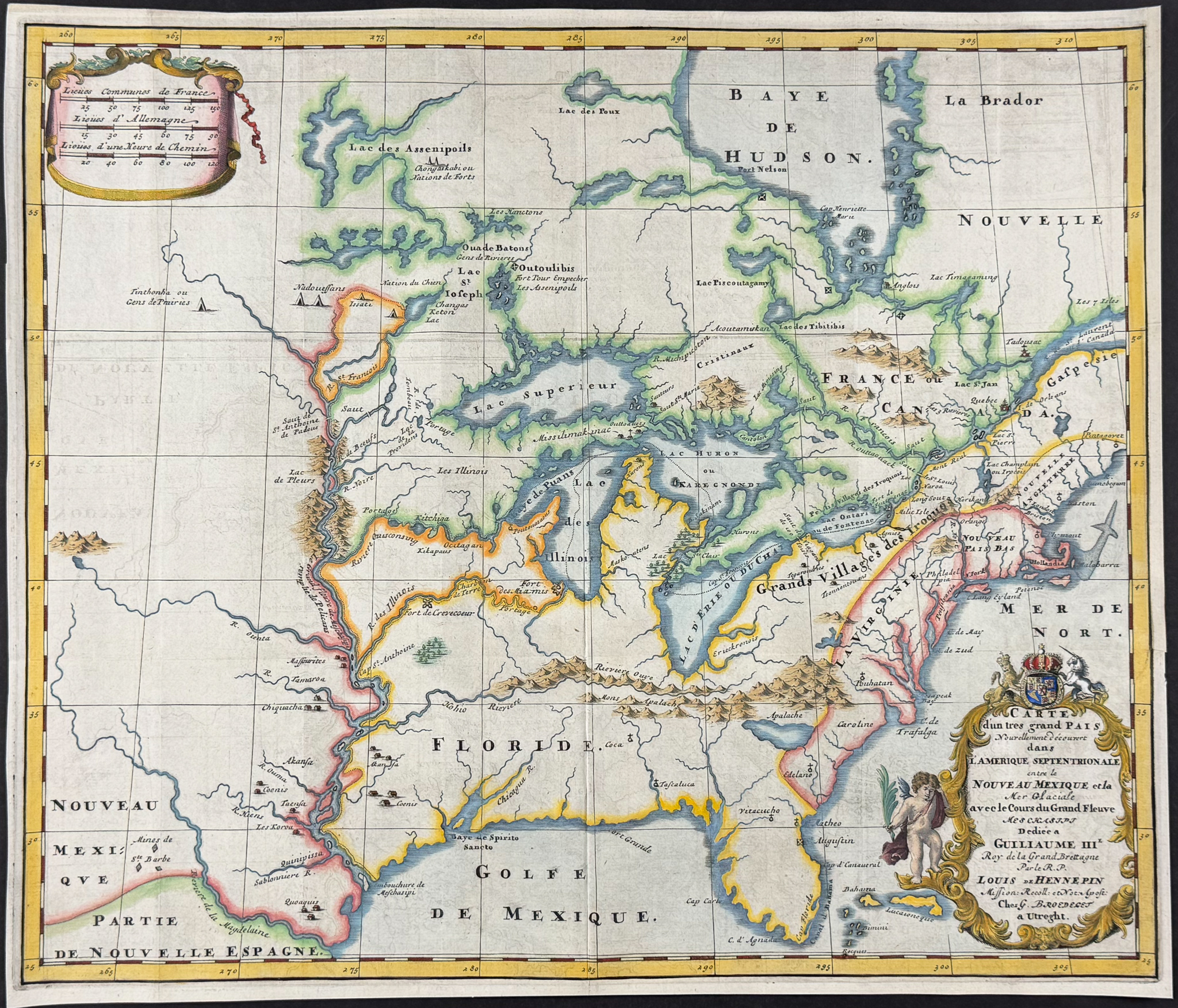
This rare, first edition map is from Louis Hennepin’s
Nouvelle decouverte d’un tres grand pays Situe dans l’Amerique, entre Le Nouveau Mexique, et La Mer Glaciale. The work was published in Utrecht in 1697 by Guillaume Broedelet.
His work detailed Hennepin’s travels through the United States and Canada including traversing the Mississippi River. This exploration of the Upper Mississippi was the furthest west detailed by any European to that time. (Burden) He was "the first to describe the Niagara Falls." (Howgego) His works influenced further European interest in North American colonization.
Father Louis Hennepin (1626-1704) was a Belgian priest and Recollect Franciscan missionary. He came to America via Quebec in 1675 alongside explorer René-Robert Cavalier de La Salle. He helped found a mission at Fort Frontenac (now Kingston).
He was part of some scandal, having claimed to descend the Mississippi prior to La Salle’s exploration in 1682. Rueben Gold Thwaites speaks of his work as "… invaluable contributions to the sources of American history; they deserve study, and to this day furnish rare entertainment. We can pardon much to our erretic friar, when he leaves to us such monuments as these." American historian Francis Parkman has called many of Hennepin’s accounts into question.
Provenance: Early paper has signature of Sophie Notacka (spelling?)
Paper Size: ~ 17 5/8 – 18 1/4" by 15 1/2" (Fold Out)
Paper Type or Special Features: Engraving with Professional Hand-coloring
Condition report:
The work is in very good to excellent condition overall. There has been some re-maringing at the right edge, about 3/4 down with no loss to image. There were some closed tears to the maps with archival tape repair to verso. There may be a few minor imperfections or faint marks to be expected with age. Please review the image carefully for condition and contact us with any questions.
Share this lot: