
Antique Prints, Maps, & Books of Natural History, Botanicals, & More
Lot 9857:
Description
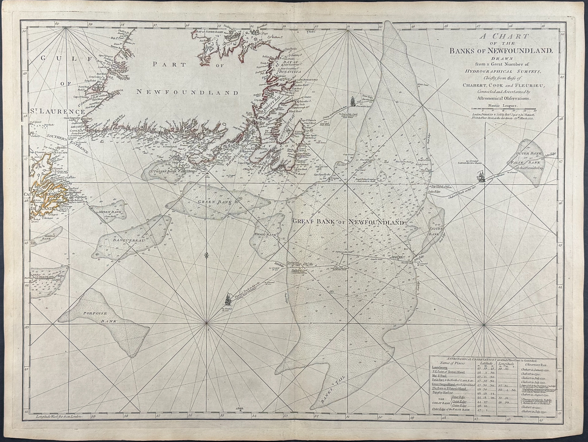
This rare, historic map is Thomas Jefferys’s
The American Atlas; or, a Geographical Description of the Whole Continent of America; Wherein are Delineated at Large its Several Regions, Countries, States, and Islands; and Chiefly the British Colonies. The map was published in London in 1775 by R. Sayer and J. Bennett.
Robert Sayer and John Bennett were Jefferys’s successors and compiled this 1775 edition of
The American Atlas. It is considered the most important 18th century atlas of America, showing the colonies at the time of the American Revolution.
Ristow noted of the atlas that it was a "geographical description of the whole continent of America, as portrayed in the best available maps in the latter half of the eighteenth century … as a major cartographic reference work it was, very likely, consulted by American, English, and French civilian administrators and military officers during the Revolution."
The atlas was of particular note for including Brassier’s map of Lake Champlain, Braddock Meade’s ‘A Map of the Most Inhabited Parts of New England’ (largest and most detailed to that date), Samuel Holland’s ‘The Provinces of New York and New Jersey’, William Scull’s ‘A Map of Pennsylvania’ (first to include the western portion), Joshua Fry and Peter Jefferson’s ‘A Map of the Most Inhabited Part of Virginia’ (best to date for the Chesapeake Region), Lt. Ross’s ‘Course of the Mississippi’ (first chart of the river based on English sources), and ‘A new Map of the Province of Quebec’.
Thomas Jefferys (1719-1771) was a leading English cartographer. He produced some of the most significant maps of the English / American colonies and the early American landscape. He was the appointed Geographer to the Prince of Wales and eventually to the King (1761). His official appointments granted him access to some of the very best surveys and were often considered "official work" for England.
Paper Size: Image ~ 19 1/2" by 26"
Paper Type or Special Features: Engraving with Original Outline Color
Condition report:
The work is in very good to excellent condition overall. There may be some faint toning of the paper from age. There may be some faint offset due to the fold out nature of the plate. There may be a few minor imperfections or faint marks to be expected with age. Please review the image carefully for condition and contact us with any questions. (Some of the pictures are digitially stitched to show how the plate would appear joined.)
Share this lot: