
Antique Prints, Maps, & Books of Natural History, Botanicals, & More
Lot 7059:
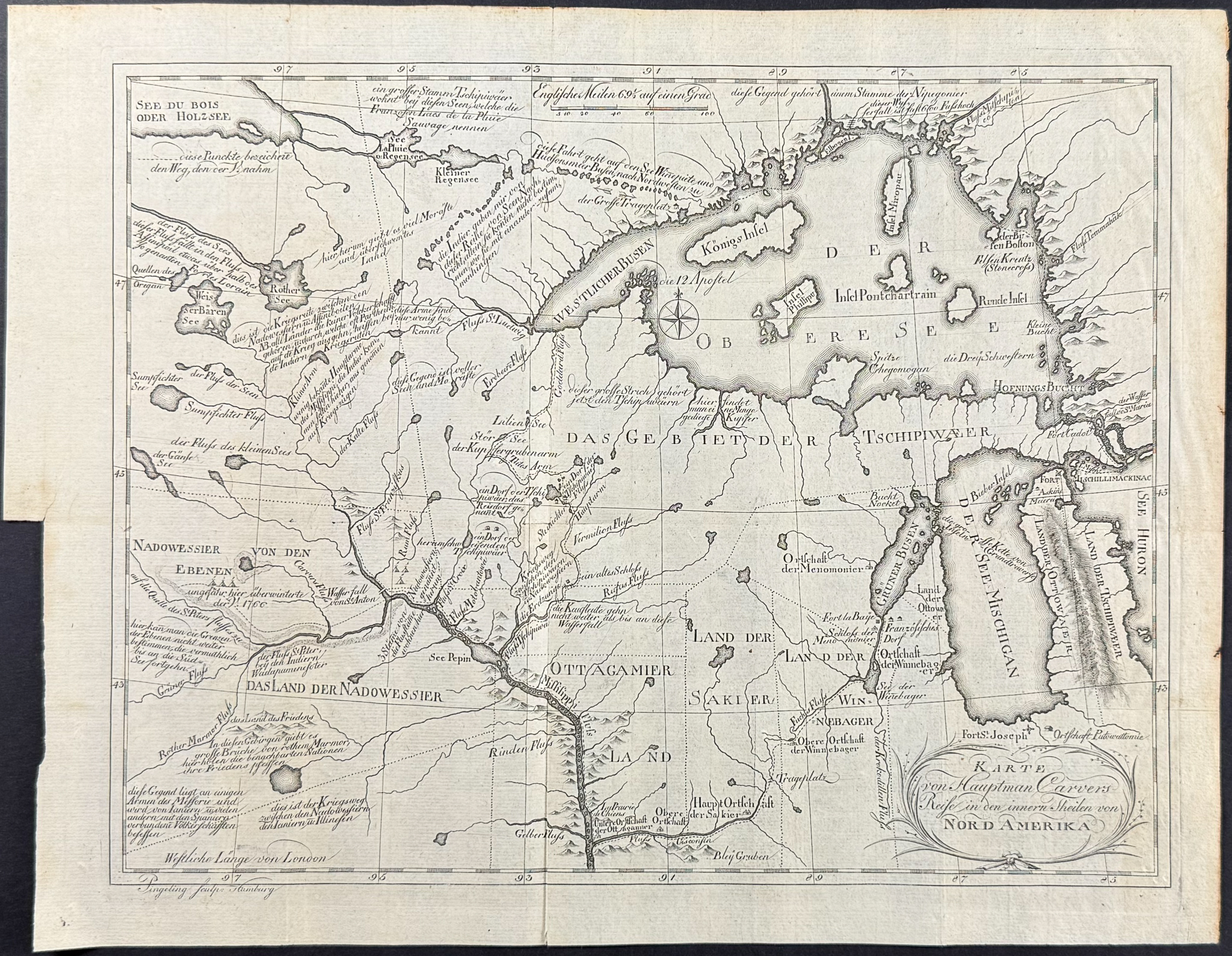
Description
This historic map is from the German edition of Jonathan Carver’s
Travels Through The Interior Parts of North-America, In the Years 1766, 1767, and 1768 entitled
Reisen durch die innern gegenden von Nord-Amerika in den Jahren 1766, 1767, und 1768, mit einer Landtarte aus dem Englischen. The work was published in Hamburg in 1780 by Carl Ernst Bohn.
Carver’s work was an essential study of the American West. "(…) His Travels only appeared in 1778, but then quickly went through 23 editions and became one of the most popular travel works about North America. In addition to the description of the trip, the work contains rich observations about customs and… Customs, religion and language of the Indians. The name ‘Oregon’ is also found for the first time as a name for the ‘Great West River, ‘ which ‘near the Anian Street in the Pacific flows into it.’" (Henze 518)
Jonathan Carver (1710-1780) was an English-American colonial captain. He was wounded in the massacre at For William Henry in 1757. Carver helped lead the way for future western exploration in America going father than any other English explorer before the Revolution. (Howes) "In 1766 Carver was employed … to explore to the west of the Great Lake in an attempt to contact the Sioux Indians. … After wintering with the Indians on the Ste Croix River, Carver set out to return to Mackinac, but at the mouth of the Wisconsin met Captain James Tute, in command of a party send out to explore a route to the Pacific Ocean." (Howgego)
Provenance: F. O. Forstin Med Drs (sp?)
Paper Size: ~ 14 7/8 – 15 3/8" by 11 7/8" (Fold Out)
Paper Type or Special Features: Engraving
Condition report:
The maps from the work are in generally very good to excellent condition. Due to age, some of the maps may exhibit handling or minor marks to be expected with age. There may be some light offset due to the fold out nature of the engraving. There may be a few minor imperfections or faint marks to be expected with age. Please review the image carefully for condition and contact us with any questions.
Share this lot: