
Antique Prints, Maps, & Books of Natural History, Botanicals, & More
Lot 5436:
Description
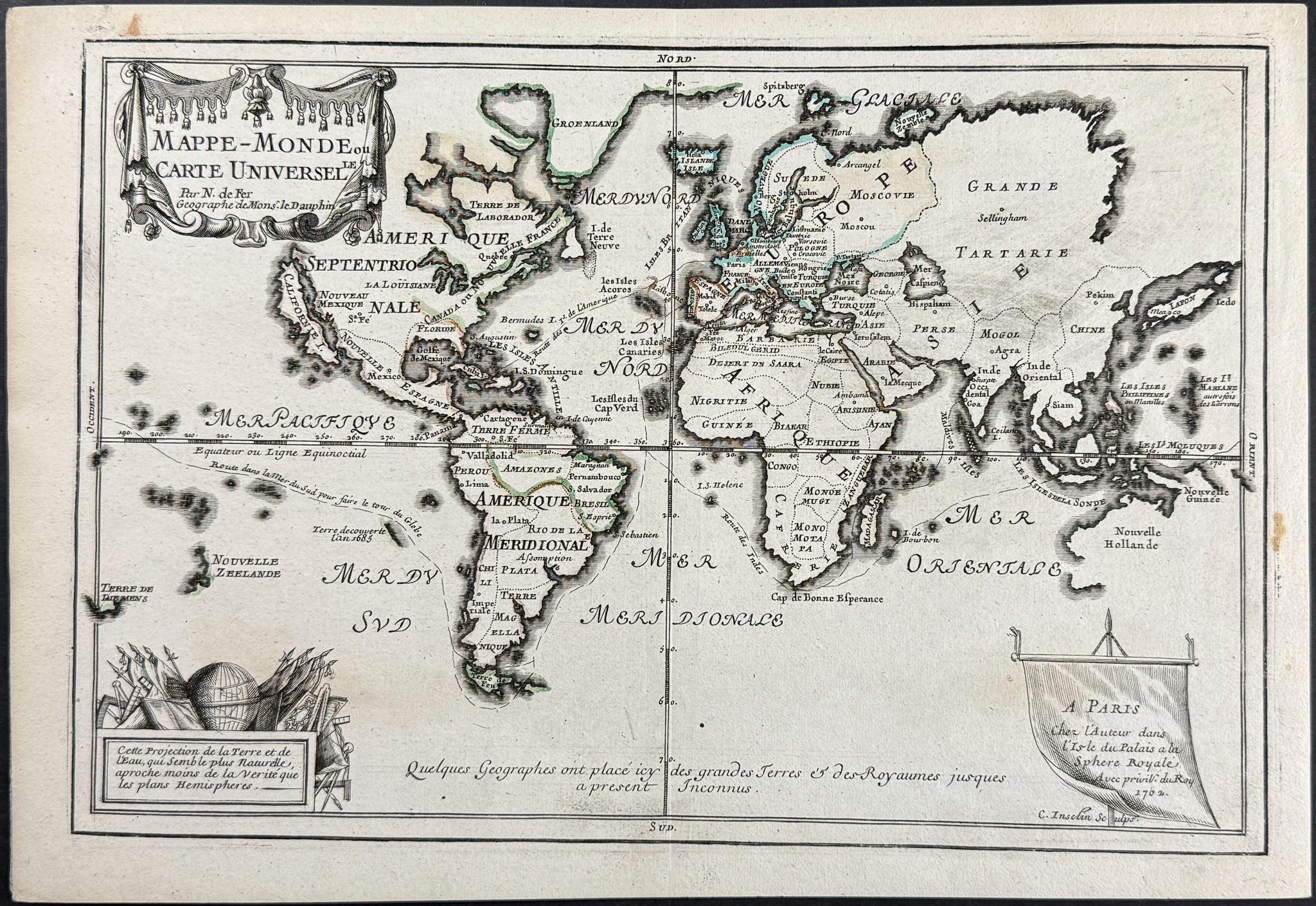
This world map from Nicolas De Fer and Charles Inselin is entitled
Mappe-monde ou carte universelle. It was published in Paris by Nicolas de Fer in 1702.
This is a fine example of the 1702 edition of De Fer’s world map. The world is presented on a Mercator projection, showing the routes of numerous explorers around the globe. The coastal geography from Russia to Australia remains highly incomplete, with the northwest coast of America shown as almost connected. California is depicted as an island. Charles Inselin engraved the map.
Nicholas de Fer (1646-1720) was one of the most famous French cartographers. He was apprenticed Louis Spirinx, an engraver, from the age of 12. His father was a print and map seller, and Nicholas eventually inherited his business after his passing. He was appointed as geographer of the Grand Dauphin and eventually the Geographer of the Kings of France and Spain.
Paper Size: ~ 14 3/8" by 10"
Paper Type or Special Features: Engraving with some Outline Color
Condition report:
The work is in very good to excellent condition overall. There may be a few minor imperfections or faint marks or fox marks to be expected with age. Please review the image carefully for condition and contact us with any questions.
Share this lot: