
Antique Maps & Prints of Natural History, Botanicals, & More
Lot 2601:
Description
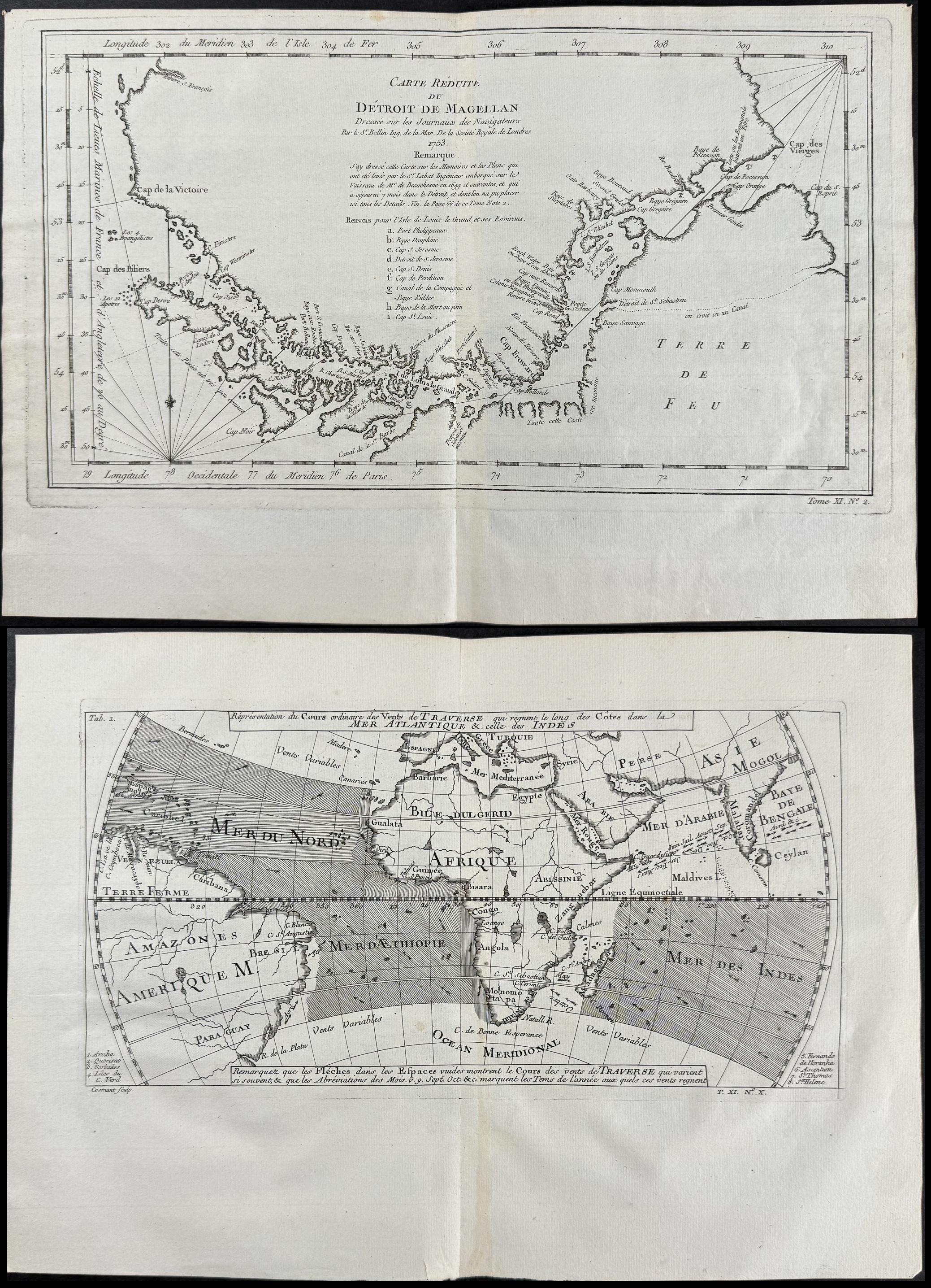
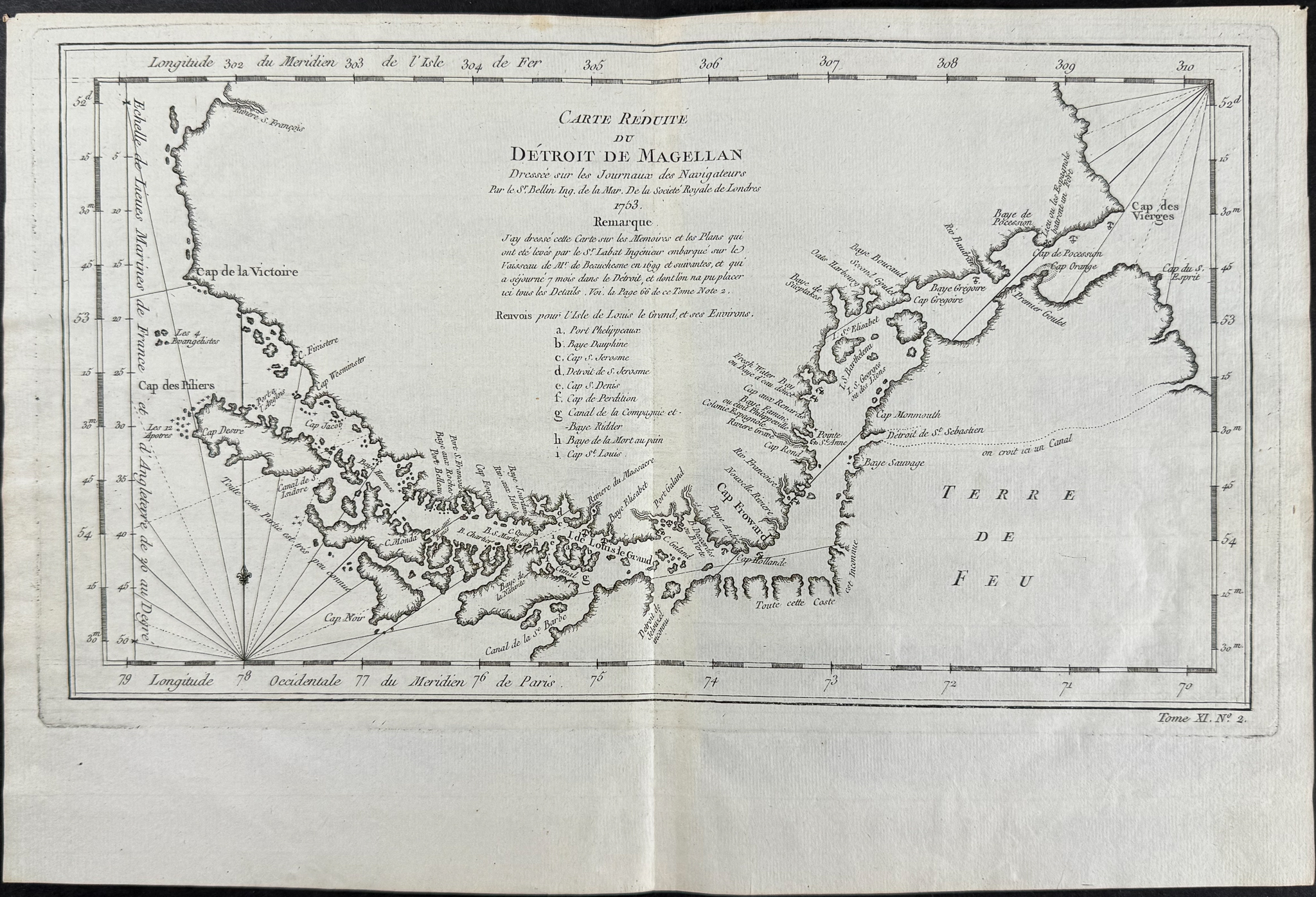
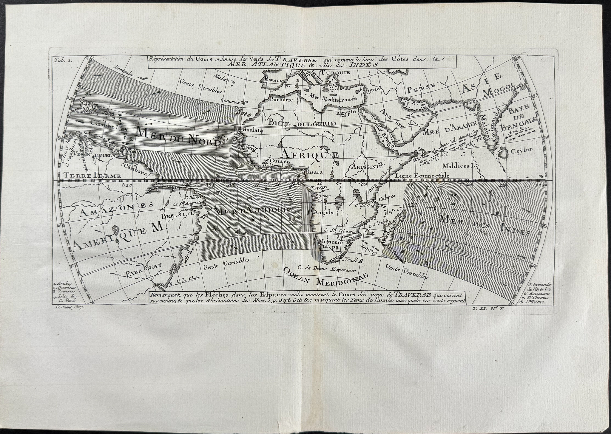
Two maps from Prevost after Bellin:
Chart of the Magellan Strait
Chart of the Winds through the south Atlantic and Indian Oceans with part of South America, Africa, southern Europe & Asia
Description of the work:
This fine engraving is from Antoine-Francois Prevost d’Exiles’s Histoire Générale des Voyages, ou nouvelle collection de toutes les relations de voyages par mer et par terre, qui ont été publiées jusqu’à present dans les différentes langues de toutes les nations connues. The work was published by Pierre De Hondt in The Hague between 1746 and 1770.
This is part of an expansive work that referenced China, the East Indies, Asia, the Americas, early Austrlian voyages, New Guinea, Palau Islands, Africa, and voyages in the Pacific including those of Magellan, Schouten, and Le Maire, Drake, Sarmiento, Cavendish, Spilbergen, Narborough, Rogers, Cowley, Frazier, and Anson. The work included particularly full accounts are given of the Dutch and French voyages to the East Indies, voyages to China, and the British East India Company’s voyages to India and Ceylon. (Hill)
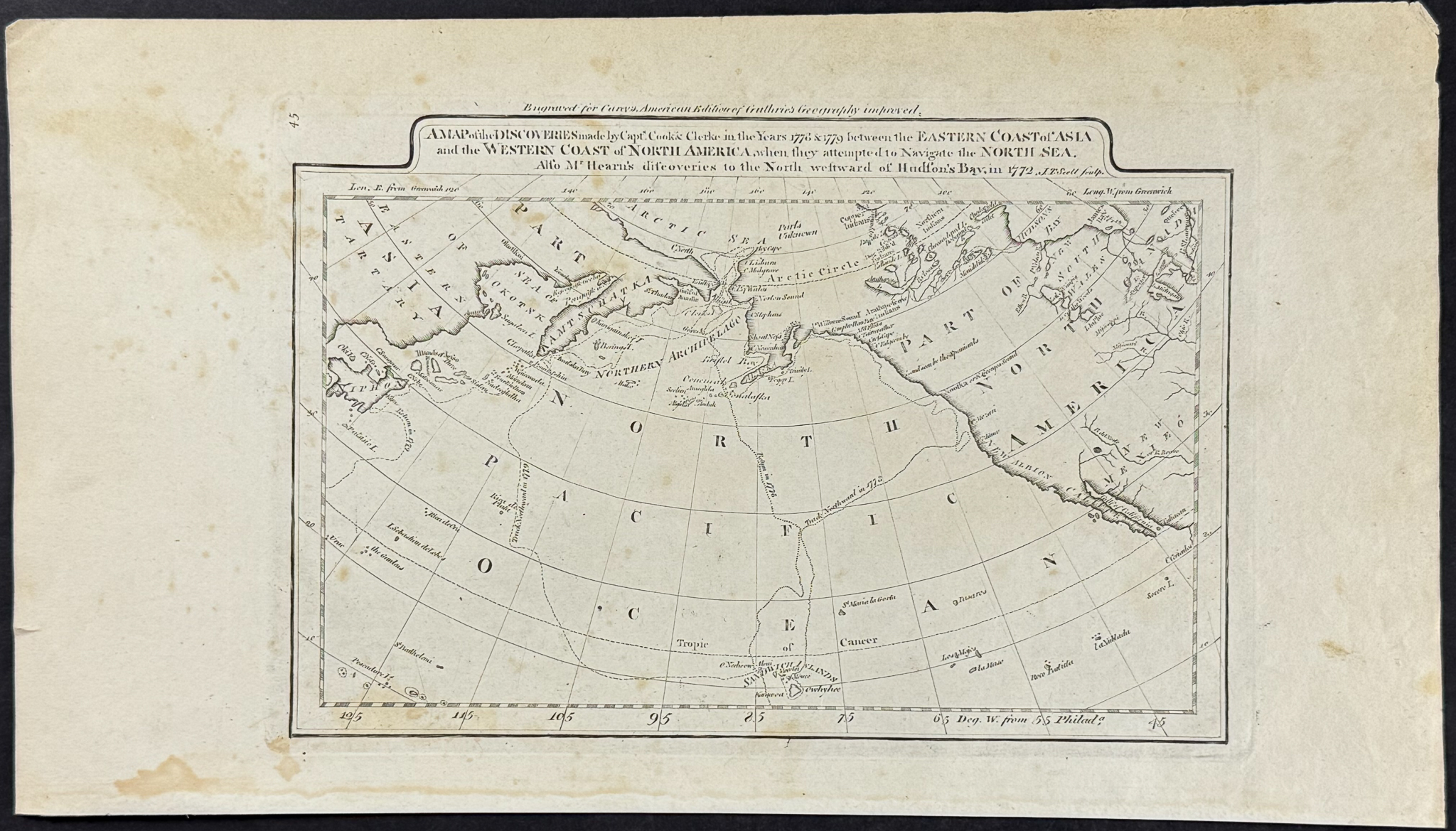
One map from Carey:
Map of the Discoveries made by Captain Cook in the Years 1778 & 1779 (Part of Asia & America, North Sea Navigation)
Description of the work:
This fine map engraving is from one of the ealiest American atlases published in the states: Mathew Carey’s
General Atlas. This is a rare edition of the work which was published in Philadelphia by Carey in 1800 but with some maps from the work dated to 1794.
It was an important early American Atlas showing the early states and the developing landscape of America to that point. The atlas also included numerous maps of Europe as well as world maps, Africa, Asia, South America, polar projection, and the West Indies.
The atlas itself was first issued in 1795, thus some of the maps available from this work are dated prior to the first official publication. This atlas also included first publication of two important maps, "Seven Ranges of Townships…" (showing what is now Ohio) and "Part of the North Western Territory" (showing the greater Midwest, dated 1796). The work also included one of the first printed maps of Tennessee (spelled Tennassee) as well as the Ohio Territory map before it was named in 1802.
"Following the Revolution, there was considerable activity in the United States by American mapmakers and publishers. One of them, Mathew Carey, was a pioneer in producing cartographic works. In 1795 Carey published
The General Atlas for Carey’s Edition of Guthrie’s
Geography Improved. William Guthrie’s popular textbook was originally issued in London in 1770 . The sixteen maps of American states included were reprinted with five others in his
American Atlas, which was also published in 1795. The engravers of the maps in both atlases were Barker, Scott, James Thackara, and John Vallance, all of Philadelphia, Samuel Hill of Boston, Amos Doolittle of New Haven, and Benjamin Tanner of New York" (Ristow).
Mathew Carey (1760-1839) was one of the most important figures of early American cartography. He was an Irish immigrant that established the first American cartographic publishing firm. He recruited craftsman for engraving, printing, and coloring of his maps.
Paper Size: ~ 14" by 10" (Fold Out)
~ 17" by 9 1/2"
Paper Type or Special Features: Engraving
Condition report:
The work is in good to excellent condition overall. Some of the engravings in the work will have some faint toning or minor separation at the folds. There can be some very light offset, fox marks or toned spots. There may be a few minor imperfections due to age. Please review the image carefully for condition and contact us with any questions.
Share this lot: