
Antique Prints, Maps, & Books of Natural History, Botanicals, & More
Lot 66658:
Description
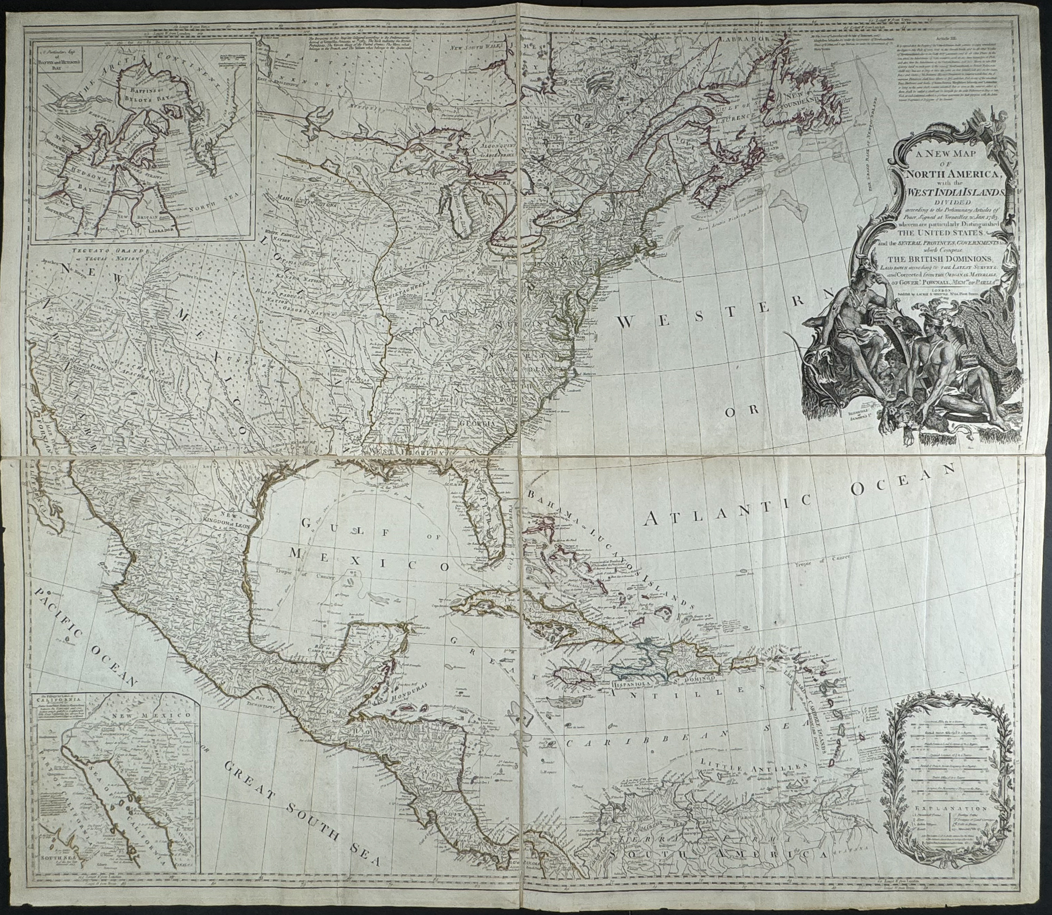
This historic map is from Emanuel Bowen and John Gibson and entitled
A New Map of North America, with the West India Islands. Divided according to the preliminary articles of peace, signed at Versailles, 20, Jan. 1783. wherein are particularly distinguished the United States, and the several provinces, governments &ca which compose the British Dominions; laid down according to the latest surveys, and corrected from the original materials, of Goverr. Pownall, Member of Parliamt. The map was published by Robert Laurie & James Whittle in London in 1794. This is a large-scale wall map comprised of four joined sheet and hand-colored in outline.
Bowen & Gibson’s map was first issued in 1755, with the present map first issued following the Treaty of Paris ending the American revolution. This map is also sometimes referred to as the Pownall Map of North America because of the important contributions from Pownall, the Governor of Massachusetts. It is a detailed map including Native American placenames in the west, tribal regions, notes and routes for early roads, forts on the Mississippi and Appalachians, and includes inset maps of Baffin and Hudson’s Bays. A notation on the map reads: "The Divisions in this map are coloured according to the preliminaries signed at Versailles [sic.], January 20th. 1783. The Red indicates the British posessions; the Green those of the United States; the Blue what belongs to the French , and the Yellow what belongs to the Spaniards."
Paper Size: ~ 41 3/8" by 47 1/2" (Four Sheets joined)
Condition report:
The work is in very good to excellent condition overall. There may be general signs of age and handling due to the large nature and age of the engravings. There may be a few minor imperfections or faint marks to be expected with age. Please review the image carefully for condition and contact us with any questions.
Share this lot: