
Antique Maps & Prints of Natural History, Botanicals, & More
Lot 309:
Description
Included in this lot:
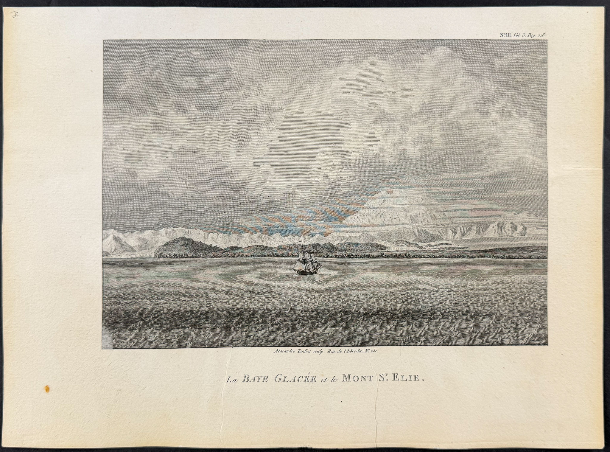
La Baye Glacee et le Mont St. Elie
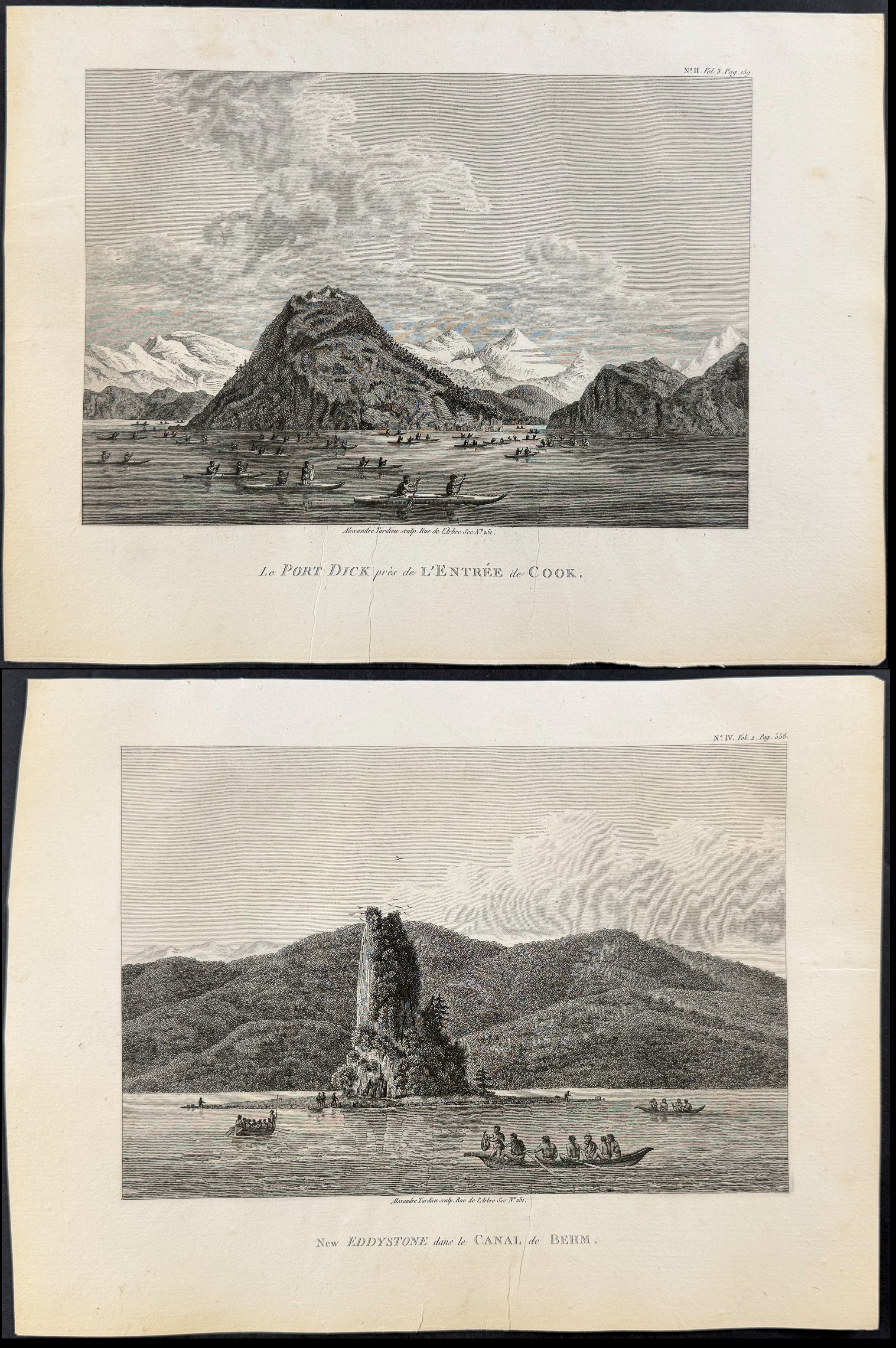
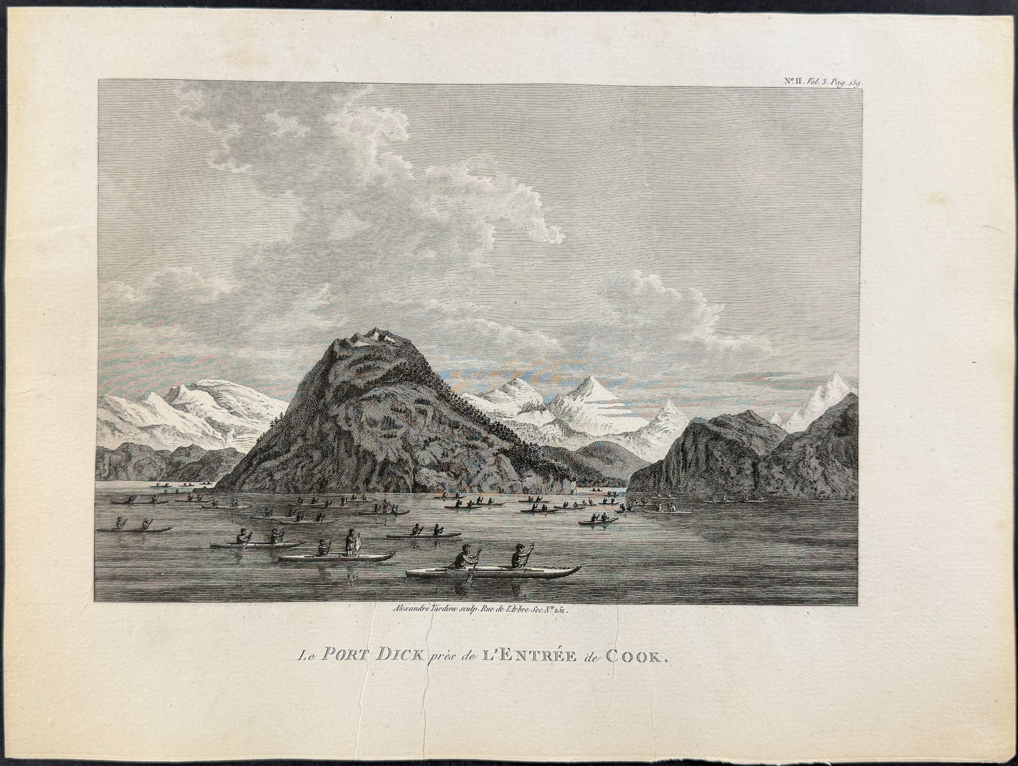
Le Port Dick pres de l’Entree de Cook
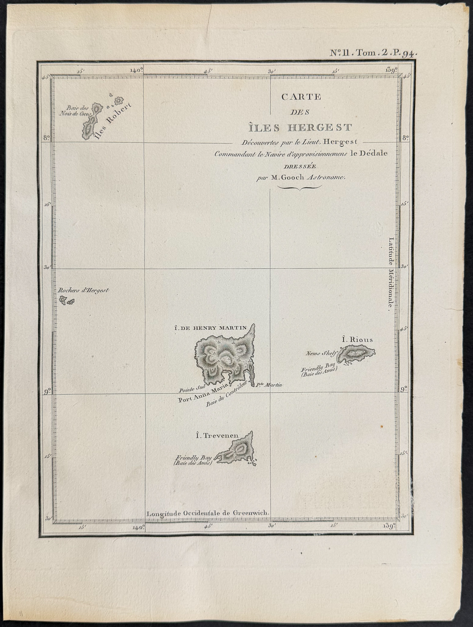
Carte des Iles Herget
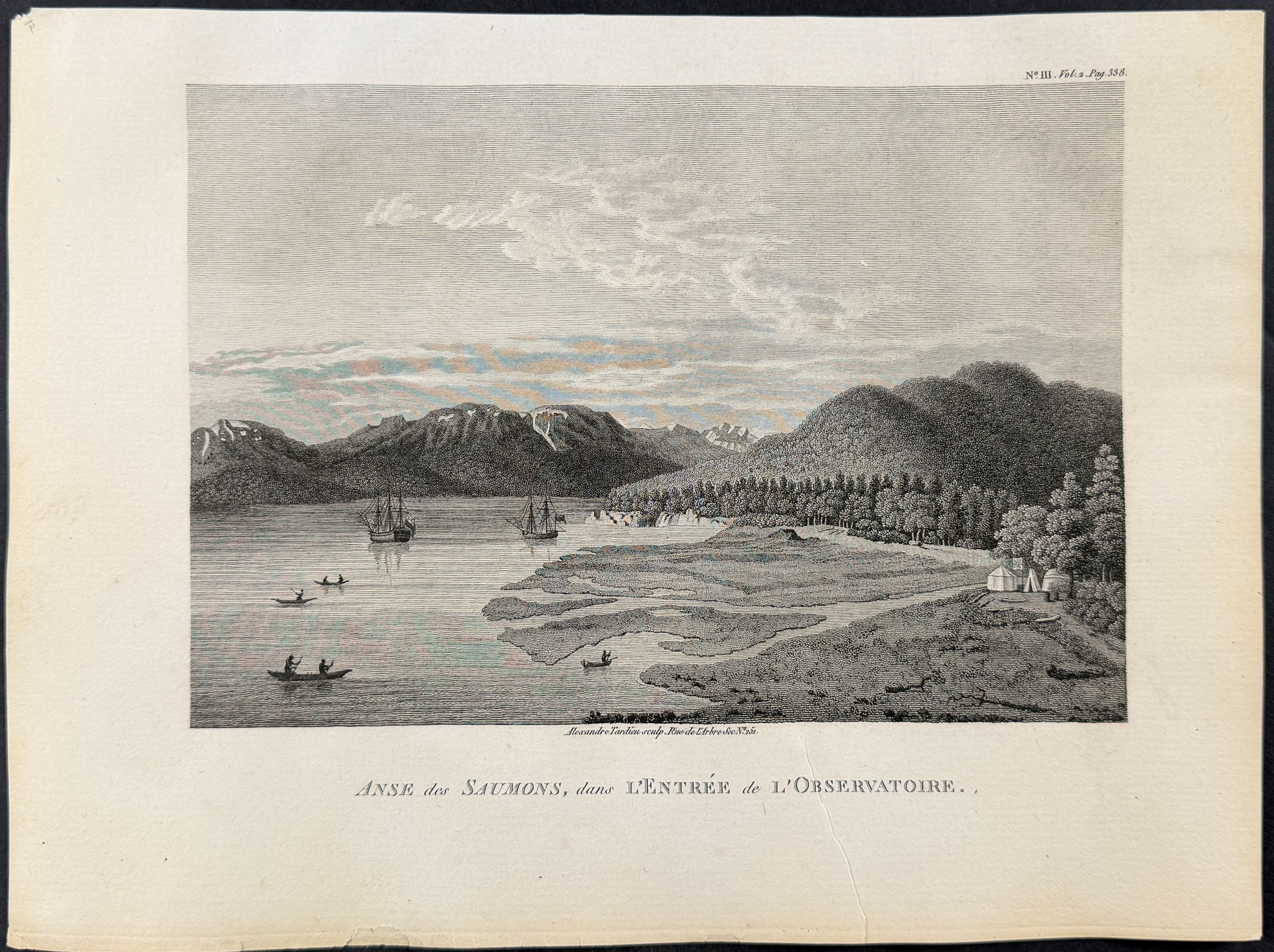
Anse des Saumons, dans l’entrée de l’Observatoire
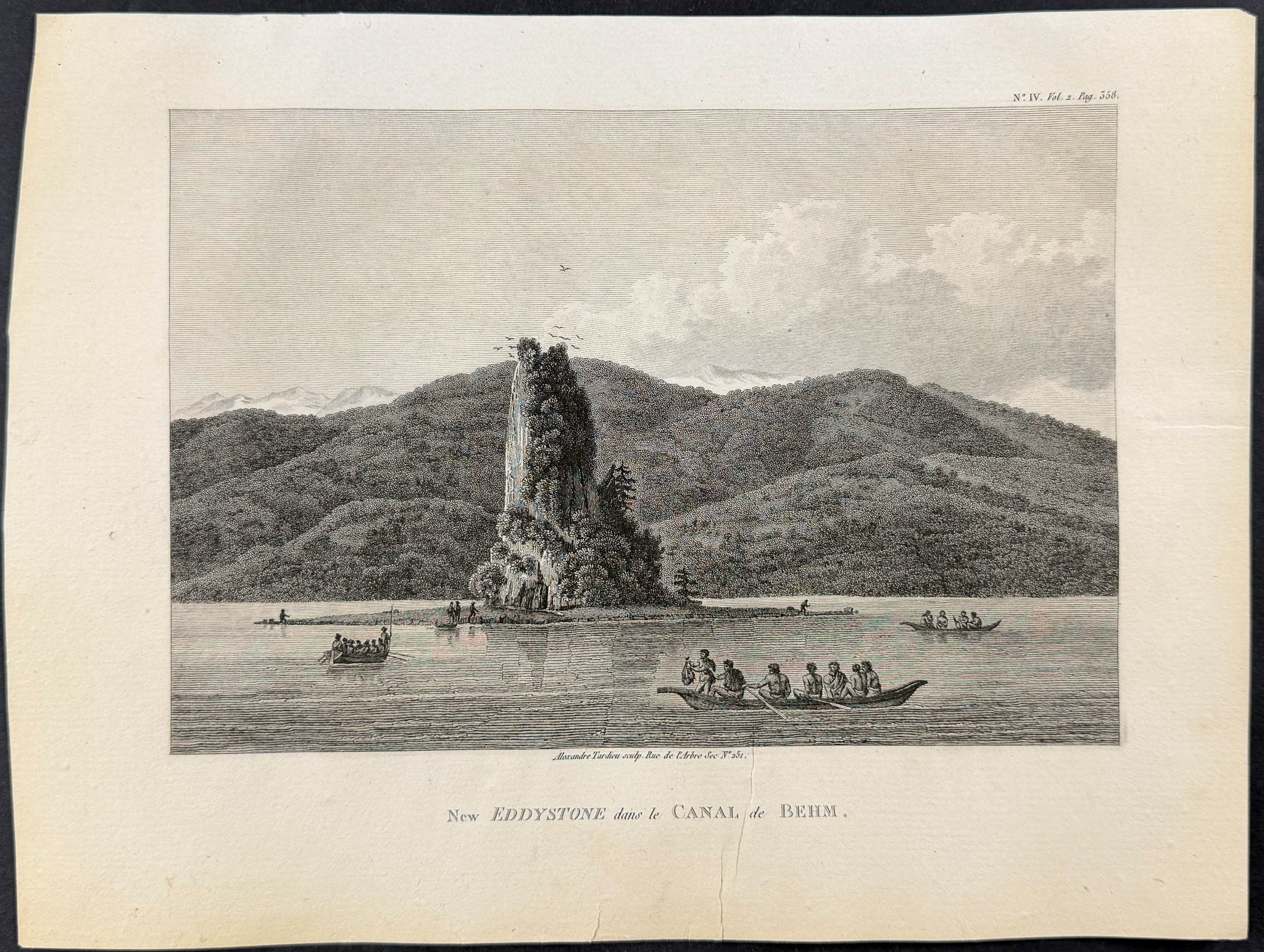
New Eddystone dans le Canal de Behm
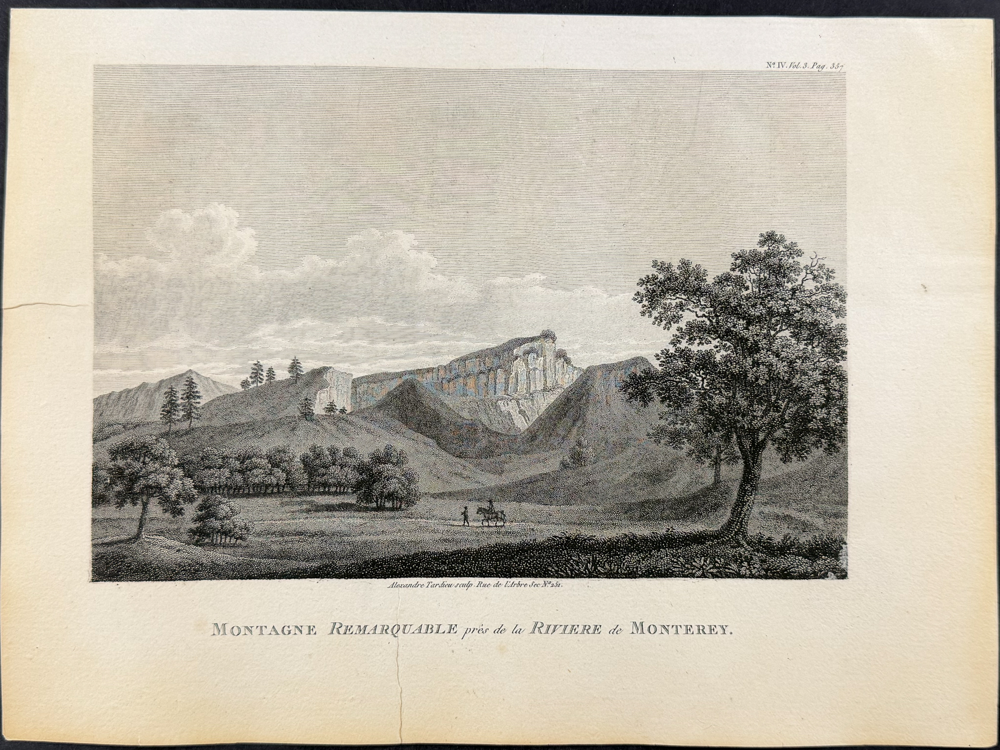
Montagne Remarquable pres de la Riviere de Monterey
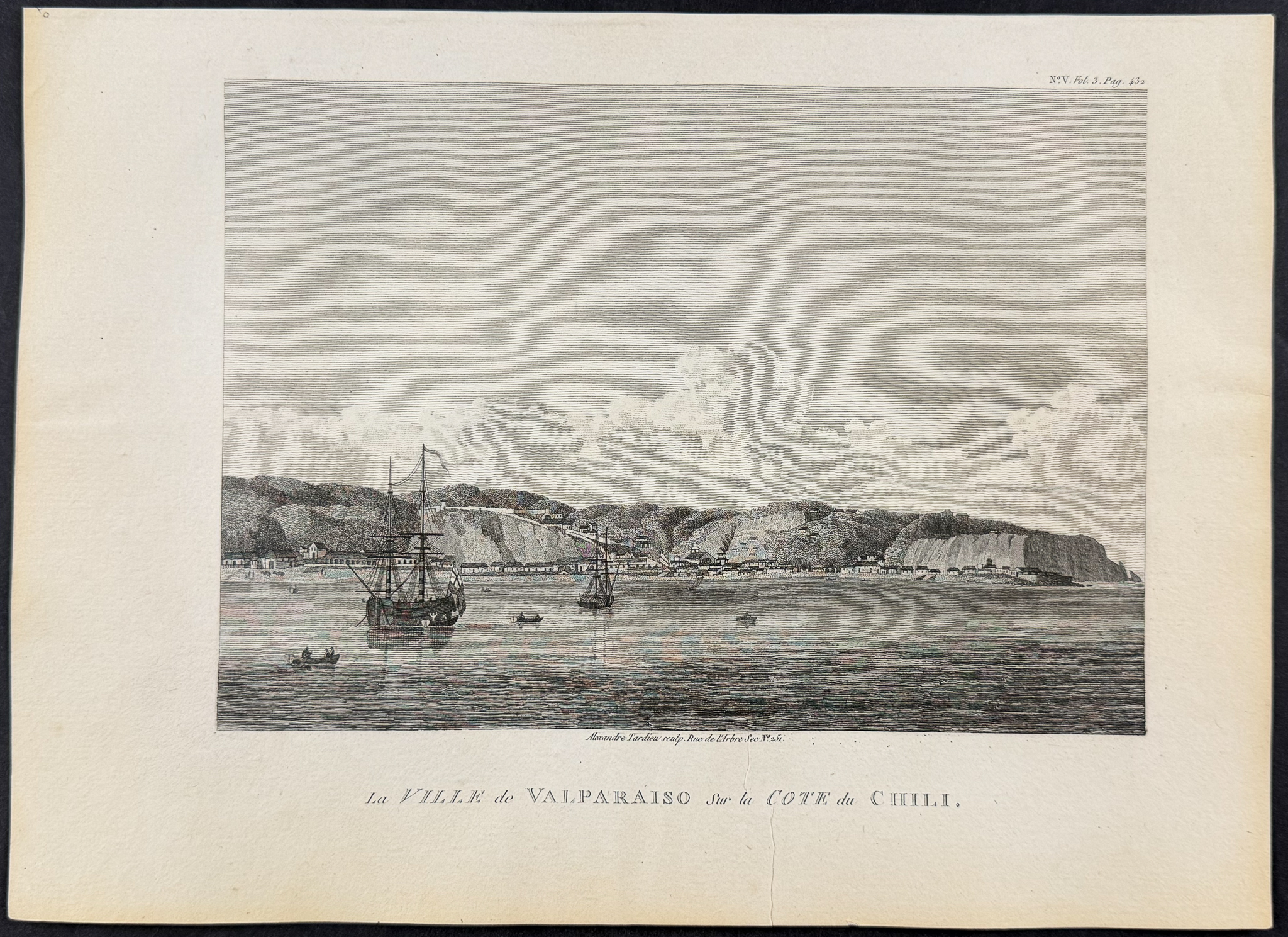
La Ville de Valparaiso sur la Cote du Chili
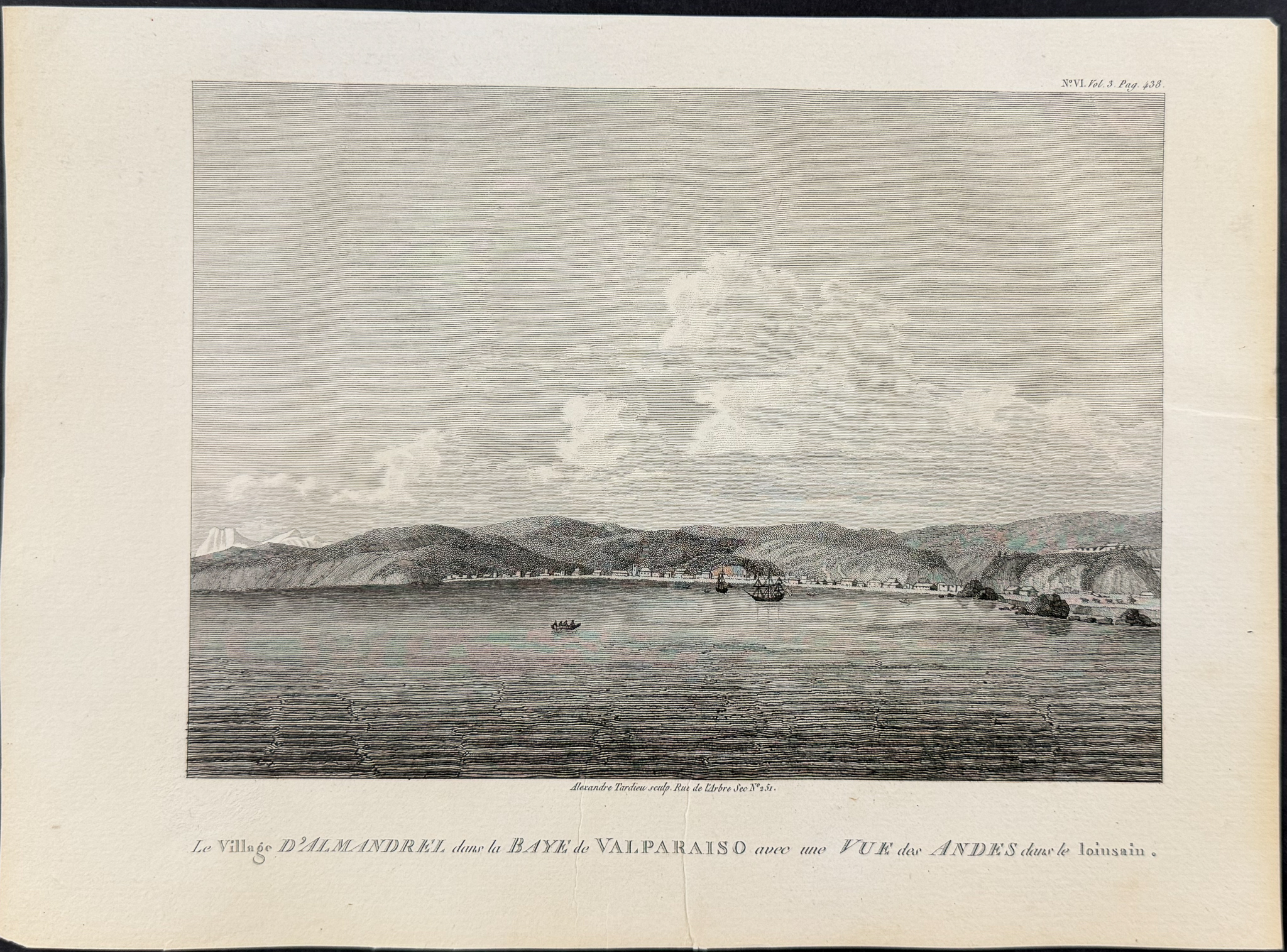
Le Village d’Almandrel dans la Baye de Valparaiso avec une Vue des Andes dans le loinsain
Description of the work:
This historic engraving is from George Vancouver’s
Voyage de découvertes à l’Océan Pacifique du Nord, et autor du monde or
A Voyage of Discovery to the North Pacific Ocean, and Round the World. This is from the first French edition published in Paris by Imprimerie de la Republique between 1799 and 1800. The French translation was completed by J. N. Demeunier and C. Morellet.
George Vancouver (1757-1798) was a British explorer. He sailed with Captain James Cook on his second and third voyages. Under the direction of George III of England, Vancouver set out in 1792 to survery the Spanish settlements and coast-line from La Paz in Baja to San Francisco, California as well as to the coast discovered by Captain James Cook. His hydographical work made him one of Britain’s foremost navigators.
Howes & Hill said of the work, "This voyage became one of the most important ever made in the interests of geographical knowledge." (Howes V23, Hill 1754) "Most of the three years occupied was spent on the California and Northwest coasts which where now the accurately charted. Of all modern exploring voyages to the Pacific those of Cook, La Perouse, and Vancouver were the most important." (Howes)
Streeter described the first edition in 1798 saying: "This narrative is one of the most important accounts of the exploration of the Pacific Northwest and New Zealand, and valuable source information about Tahiti and the Hawaiian Islands in the last decade of the eighteenth century. Cowan considered the account to be superior to any of its kind and the chief authority on the areas explored during this period.
Vancouver (1758-1798) was an extraordinarily capable explorer, having sailed with Cook on the second and third voyages (1772-4, 1776-80) and served under Rodney and Alan Gardner. It was Gardner who recommended him for a voyage in search for a northwest passage to the Great Lakes. The present narrative is the complete account of that voyage, accompanied by an atlas of maps and views of the areas explored.
Vancouver died on May 10, 1798, his brother John completing the task of preparing and editing the narrative. Among the important features of the narrative are the engraved views.of the Mission of San Carlos and the Presidio of Monterey, probably the first published views of California. It is possible that the artist sailing with La Perouse, who visited Monterey in 1786, drew a sketch of the Mission, but no views of California scenery appear in the La Perouse atlas." (Streeter Sale 3497)
Paper Size: ~ 11 7/8" by 8 7/8"
Paper Type or Special Features: Engraving
Condition report:
The work is in very good condition overall. The engravings have a binders or printers crease to the margins. There may be a few minor imperfections or faint marks to be expected with age. Please review the images carefully for condition and contact us with any questions.
Share this lot: