
Antique Prints, Maps, & Books of Natural History, Botanicals, & More
Lot 118:
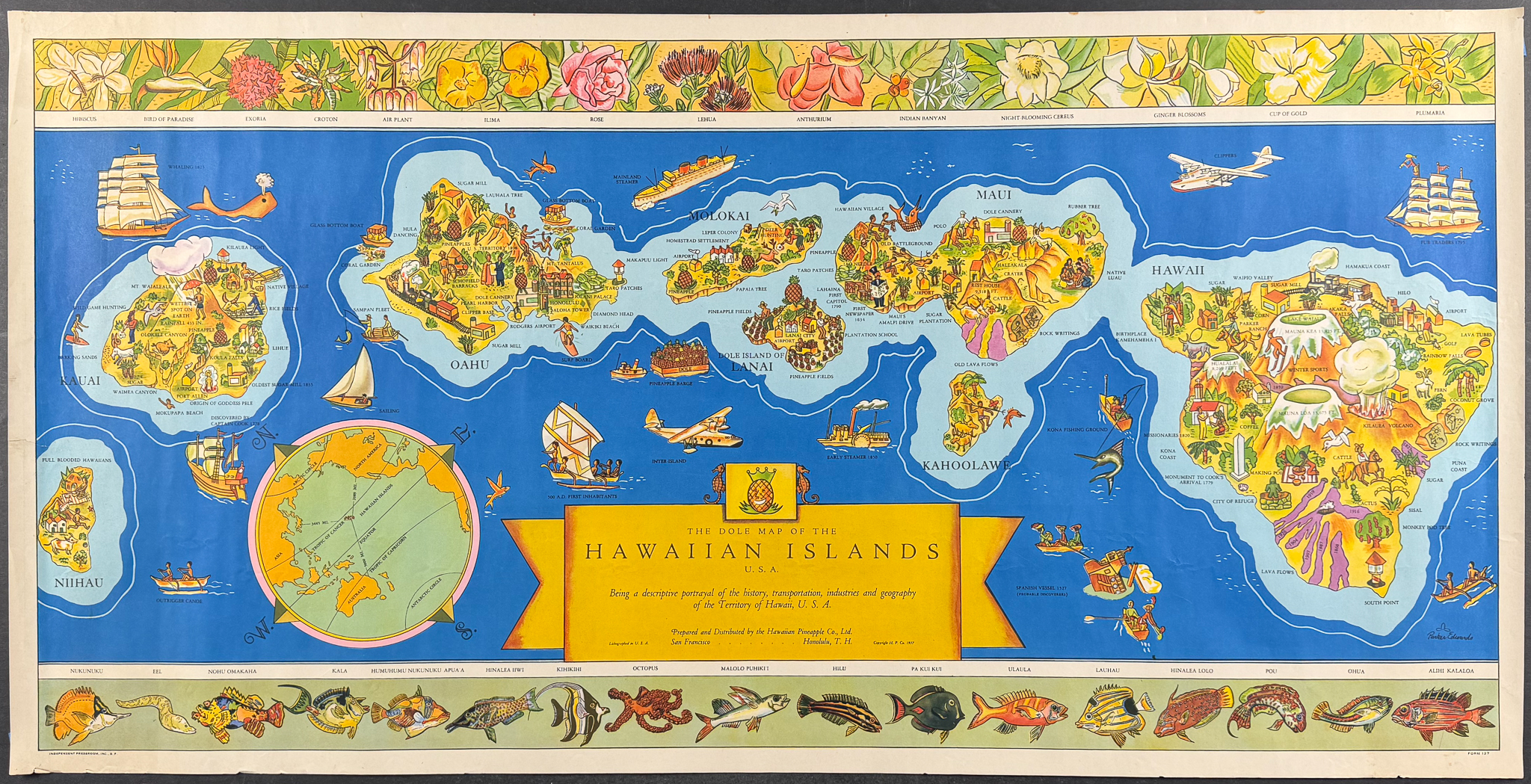
Description
This iconic and rare pictorial map of Hawaii is from Parker Edwards and entitled
The Dole Map of the Hawaiian Islands, U. S. A.: Being a descriptive portrayal of the history, transportation, Industries and geography of the Territory of Hawaii, U. S. A.. It was published in 1937 in San Francisco and Honolulu by Hawaiian Pineapple Co., Ltd.
The map was commission by James Dole’s Hawaiian Pineapple Company. Parker Edwards (1911-1987) was a native Californian artist that created the original painting for this printed map.
It depicts the eight main islands of Hawaii with unique characteristics of each displayed. There are people, activities, and historic boats and planes. The upper and lower edges feature native Hawaiian flowers and fish. The map includes the original mailing tube with branded address label.
Paper Size: ~ 36 5/8" by 18 1/2"
Paper Type or Special Features: Colorful Printed Map
Condition report:
The work is in very good to excellent condition overall. There is a cleanly closed 1 1/4 tear at left margin, just within the image, but unobtrusive. There are a few minor marks in the margins, otherwise clean and vibrant. There may be a few minor marks to be expected with age. Please review the image carefully for condition and contact us with any questions.
Share this lot: