
Antique Prints, Maps, & Books of Natural History, Botanicals, & More
Lot 9254:
Description
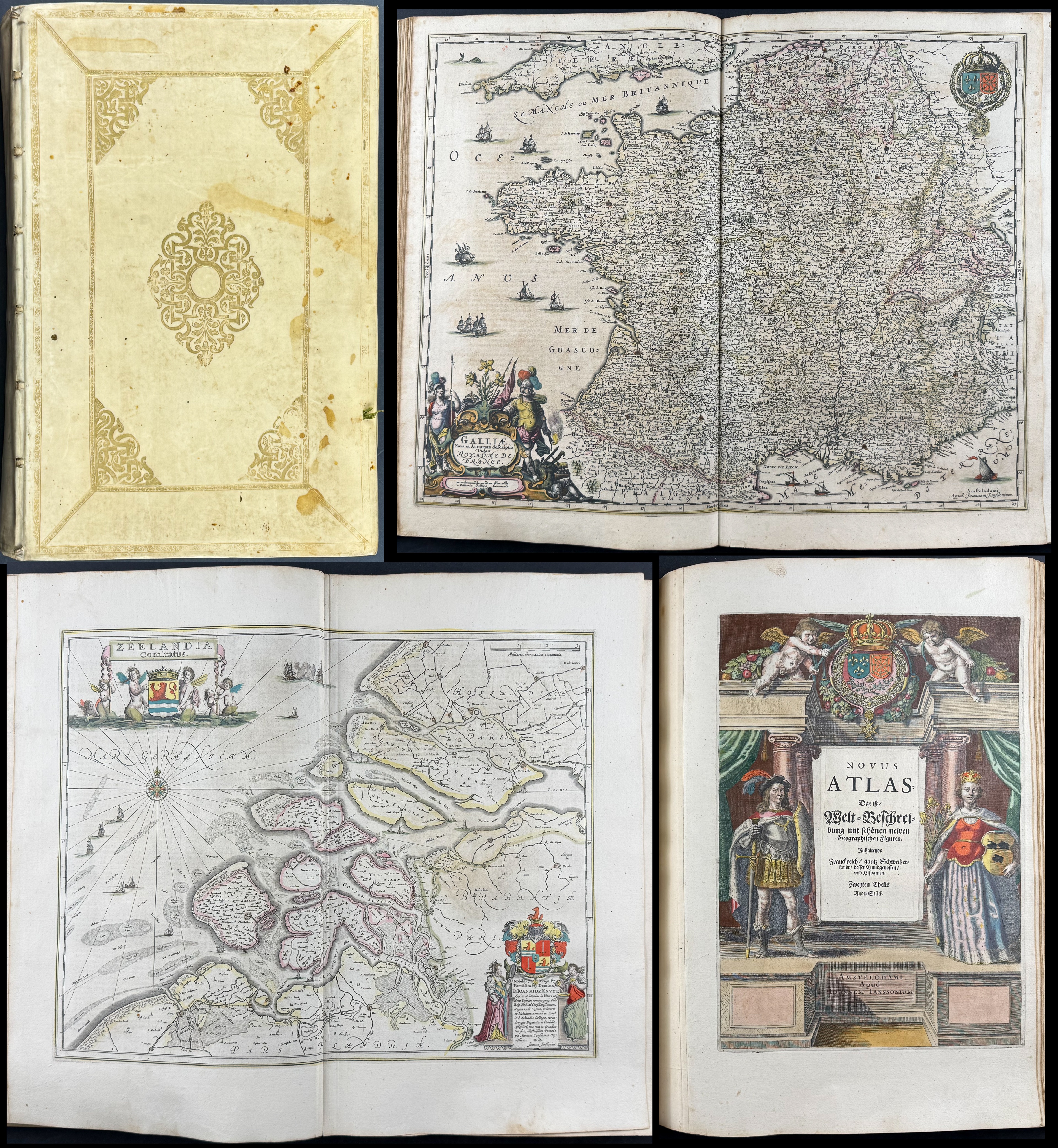
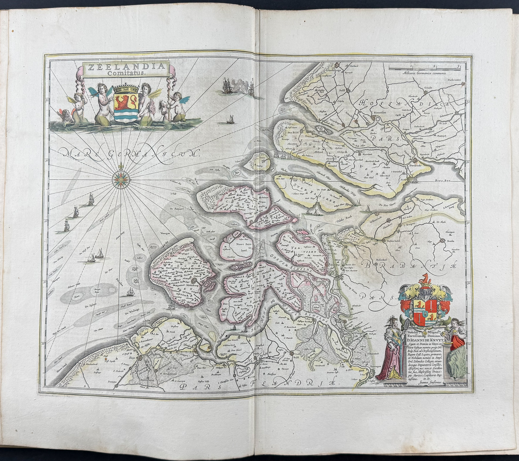
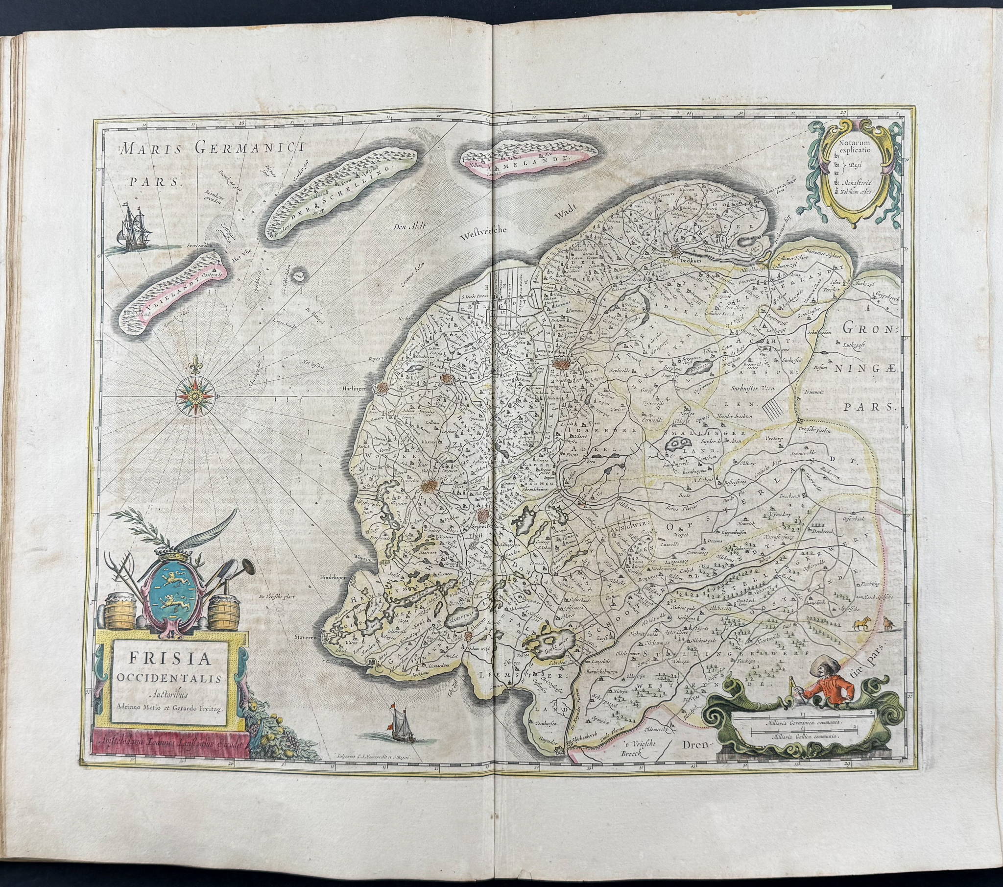
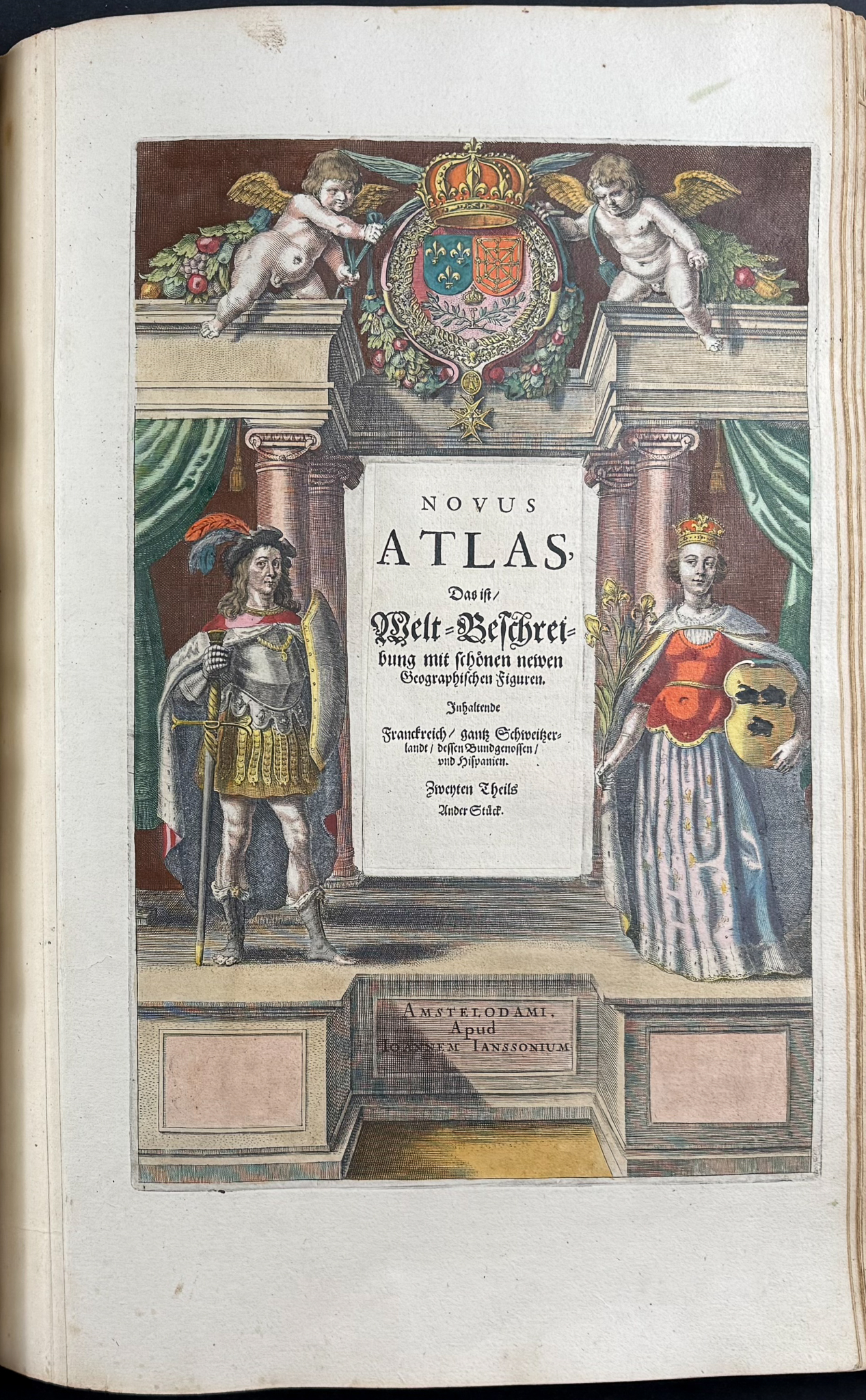
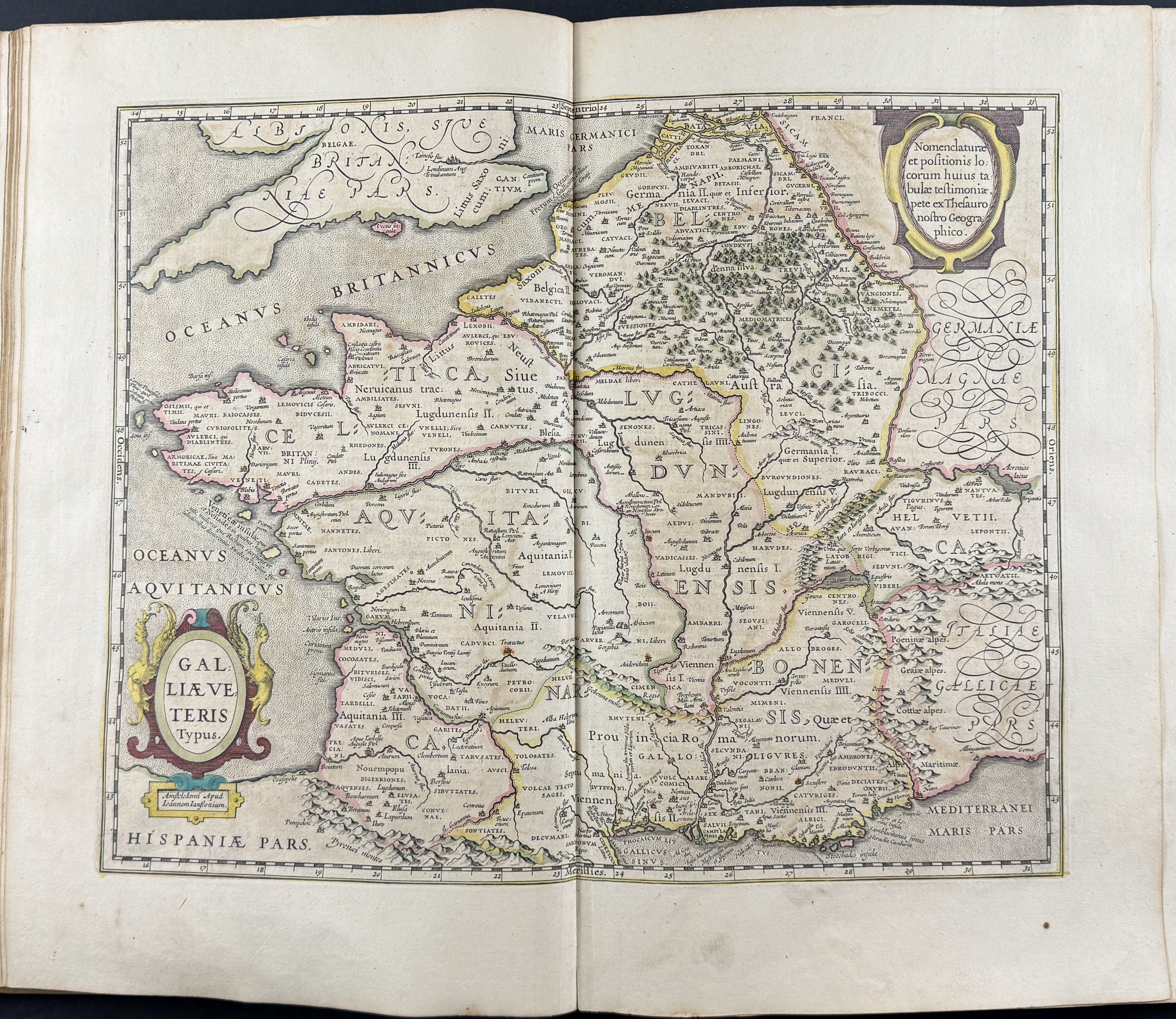
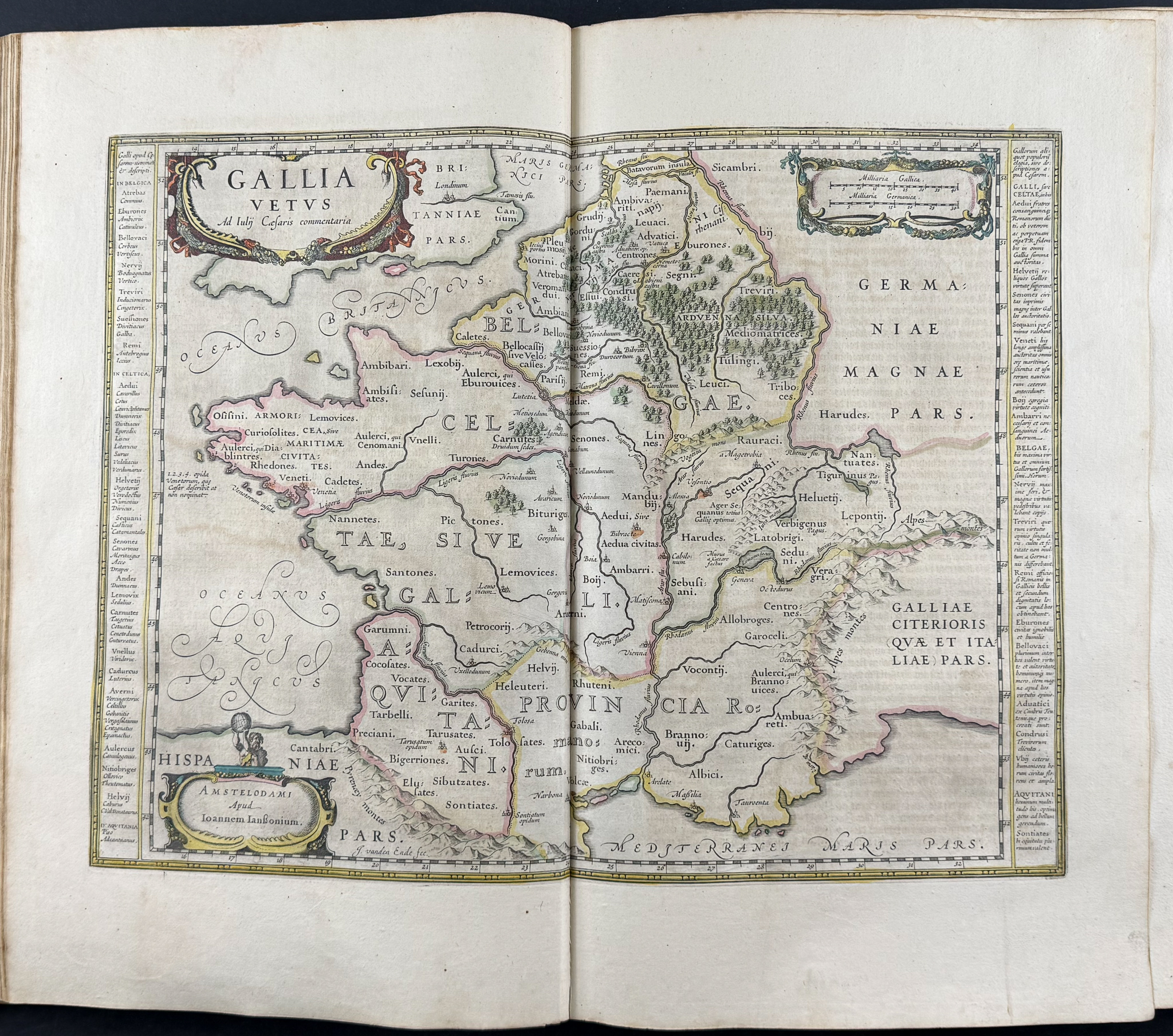
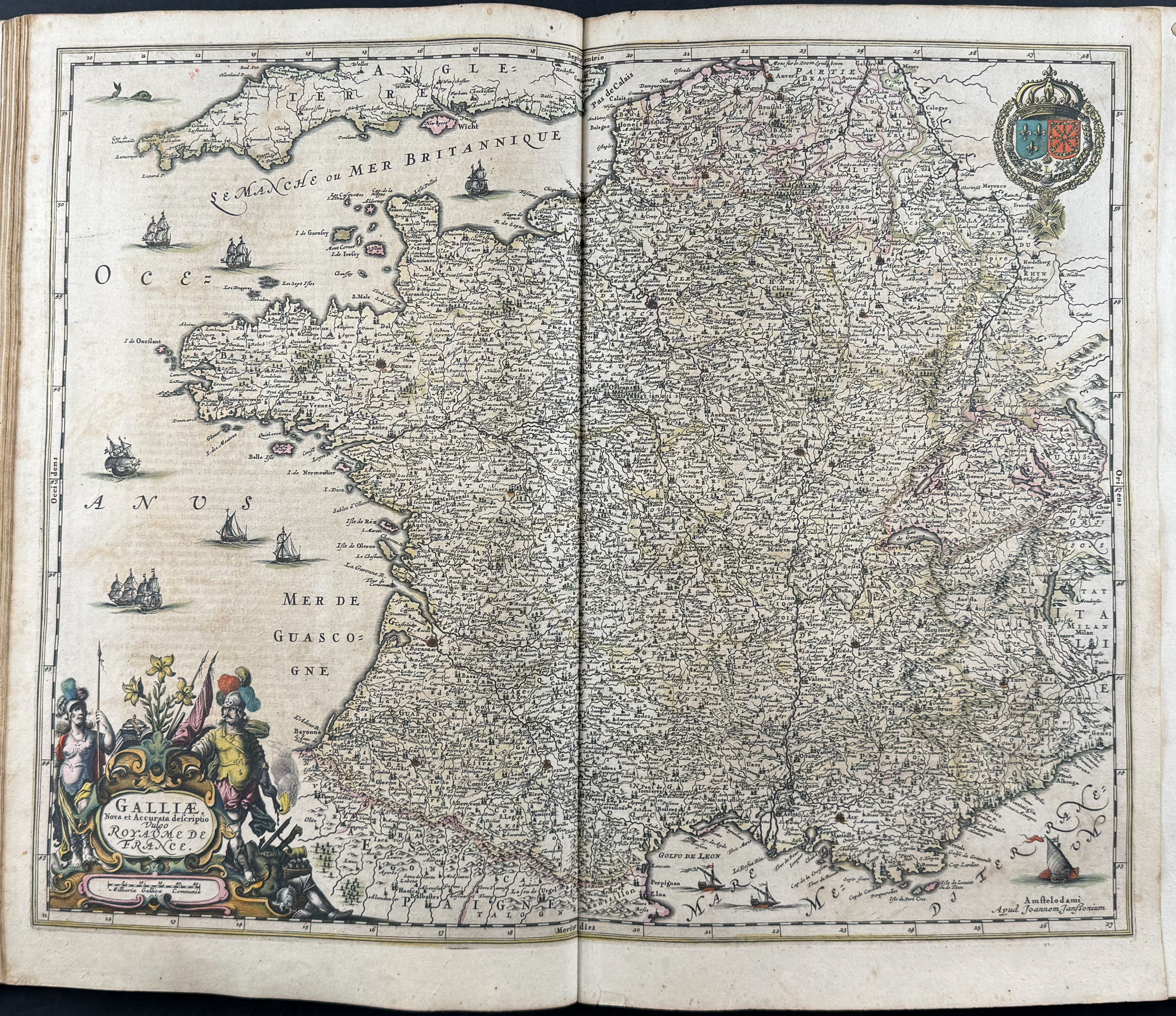
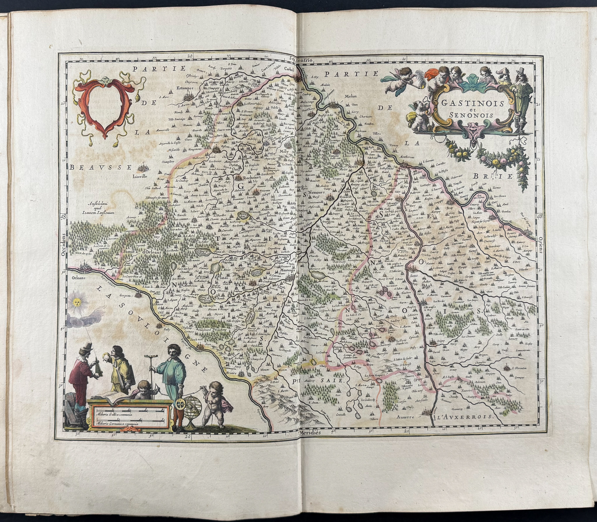
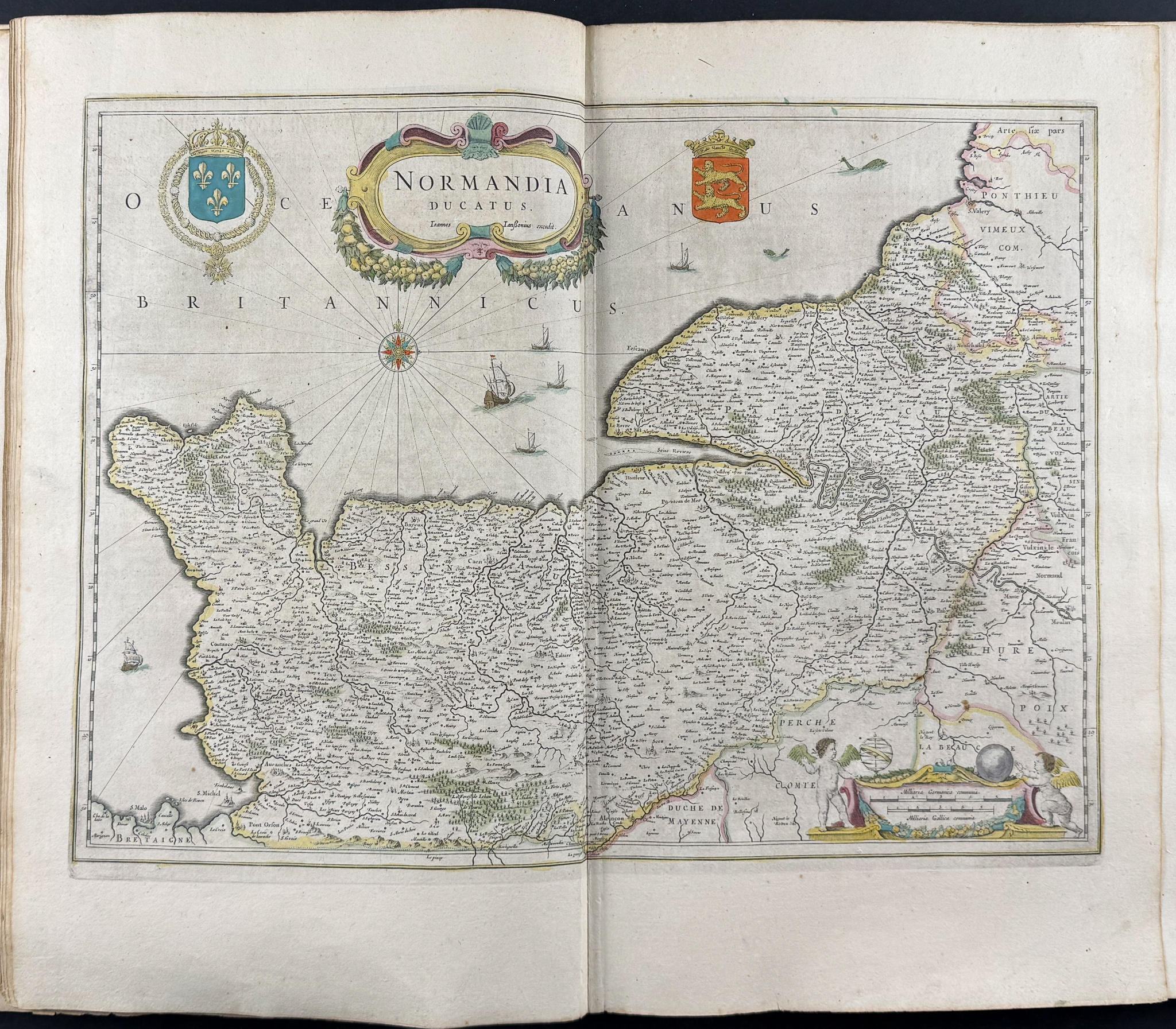
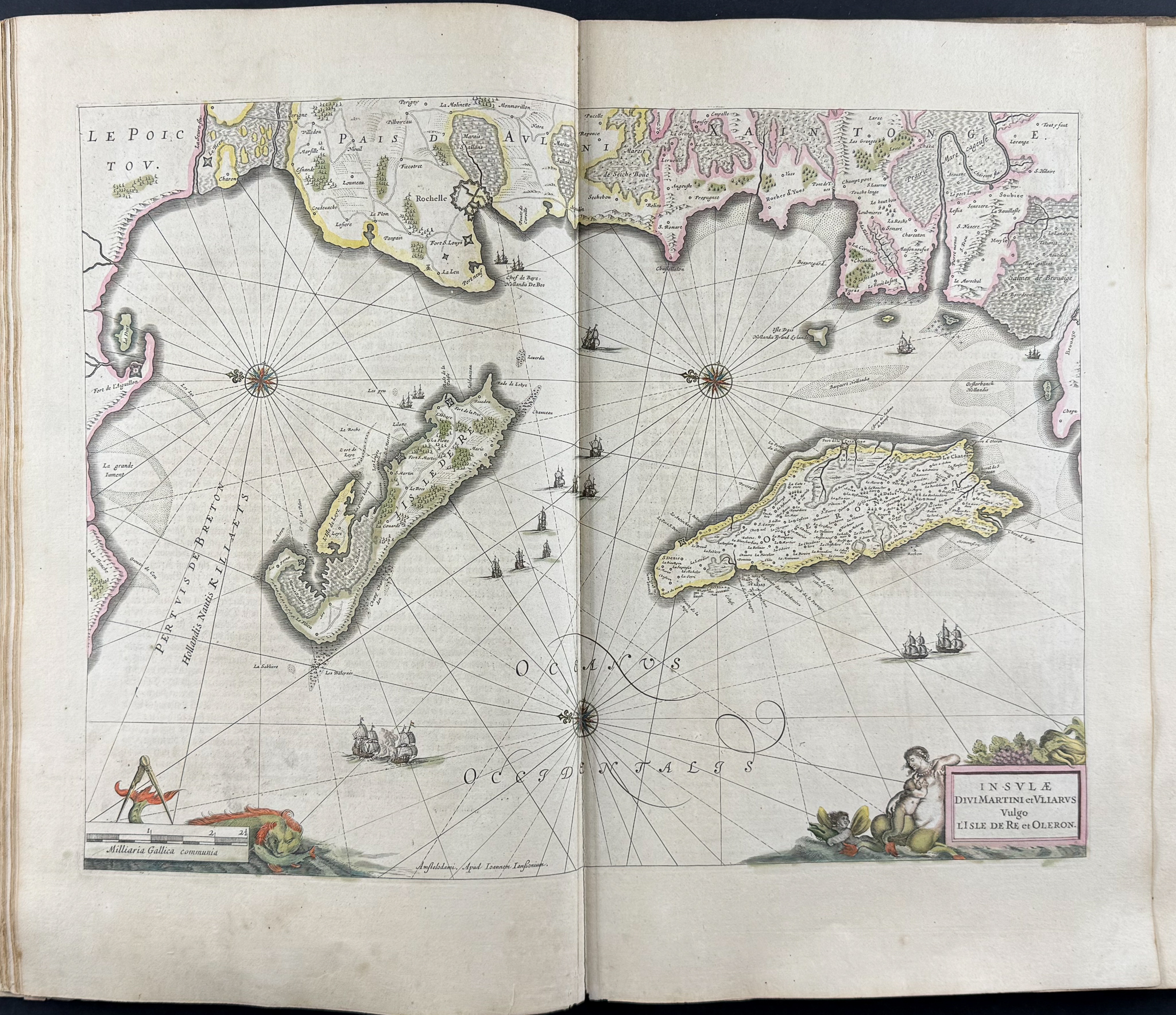
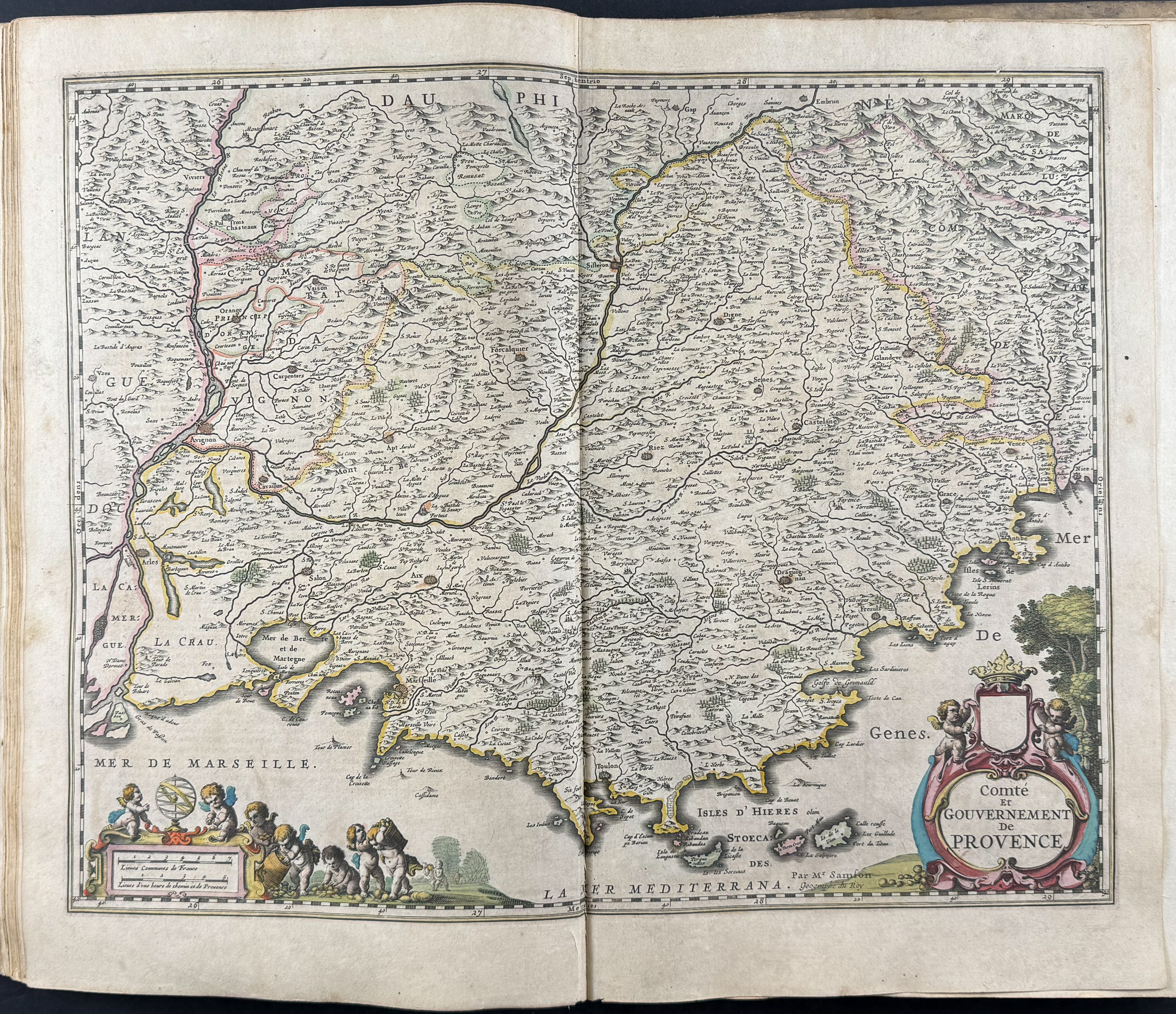
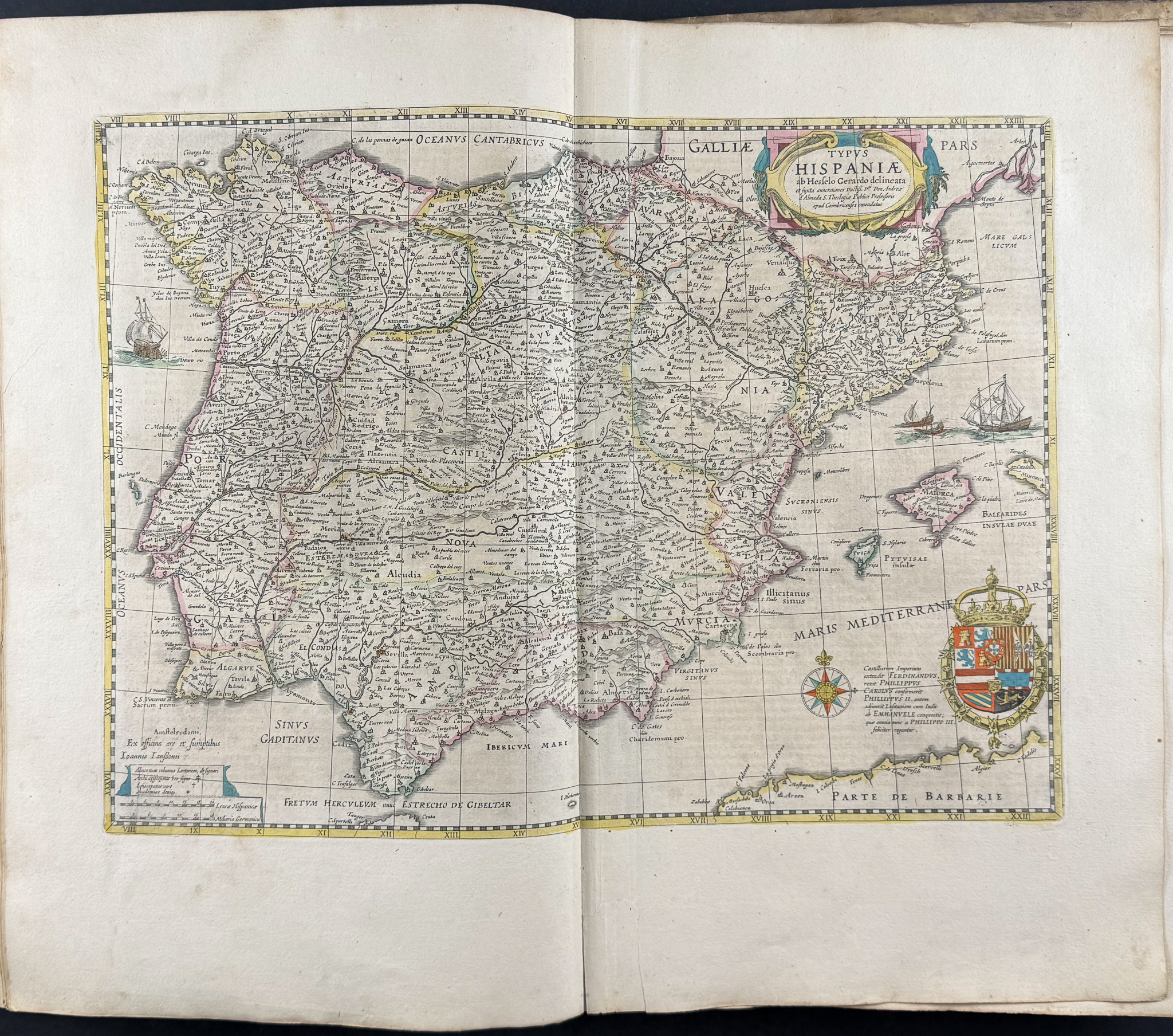
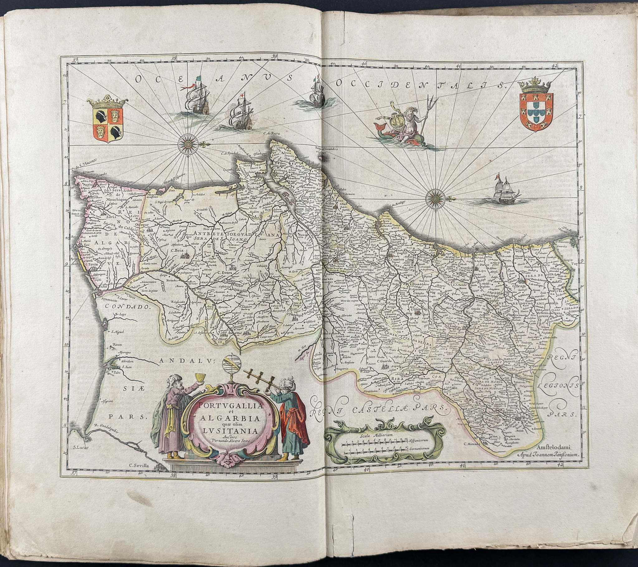
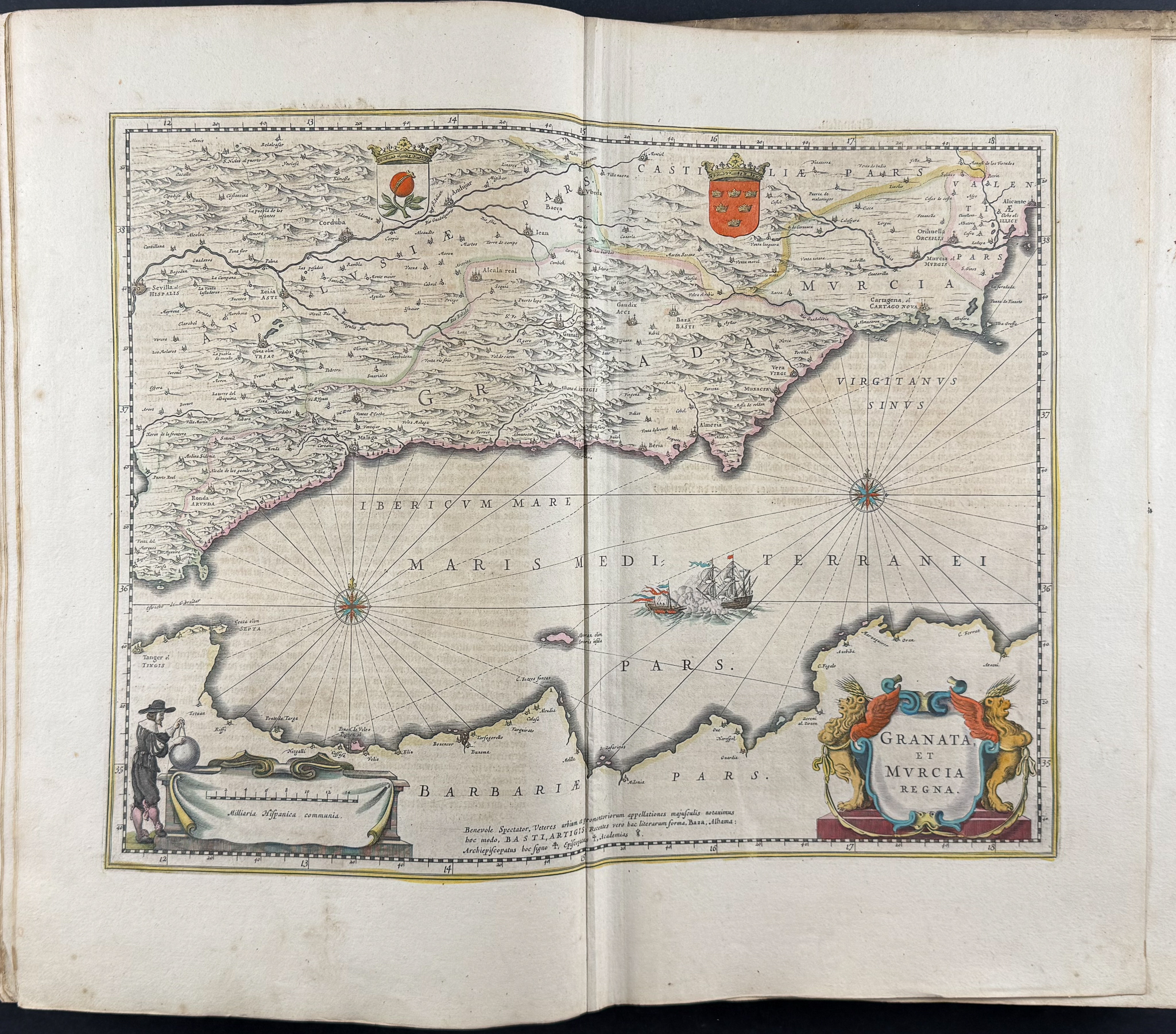
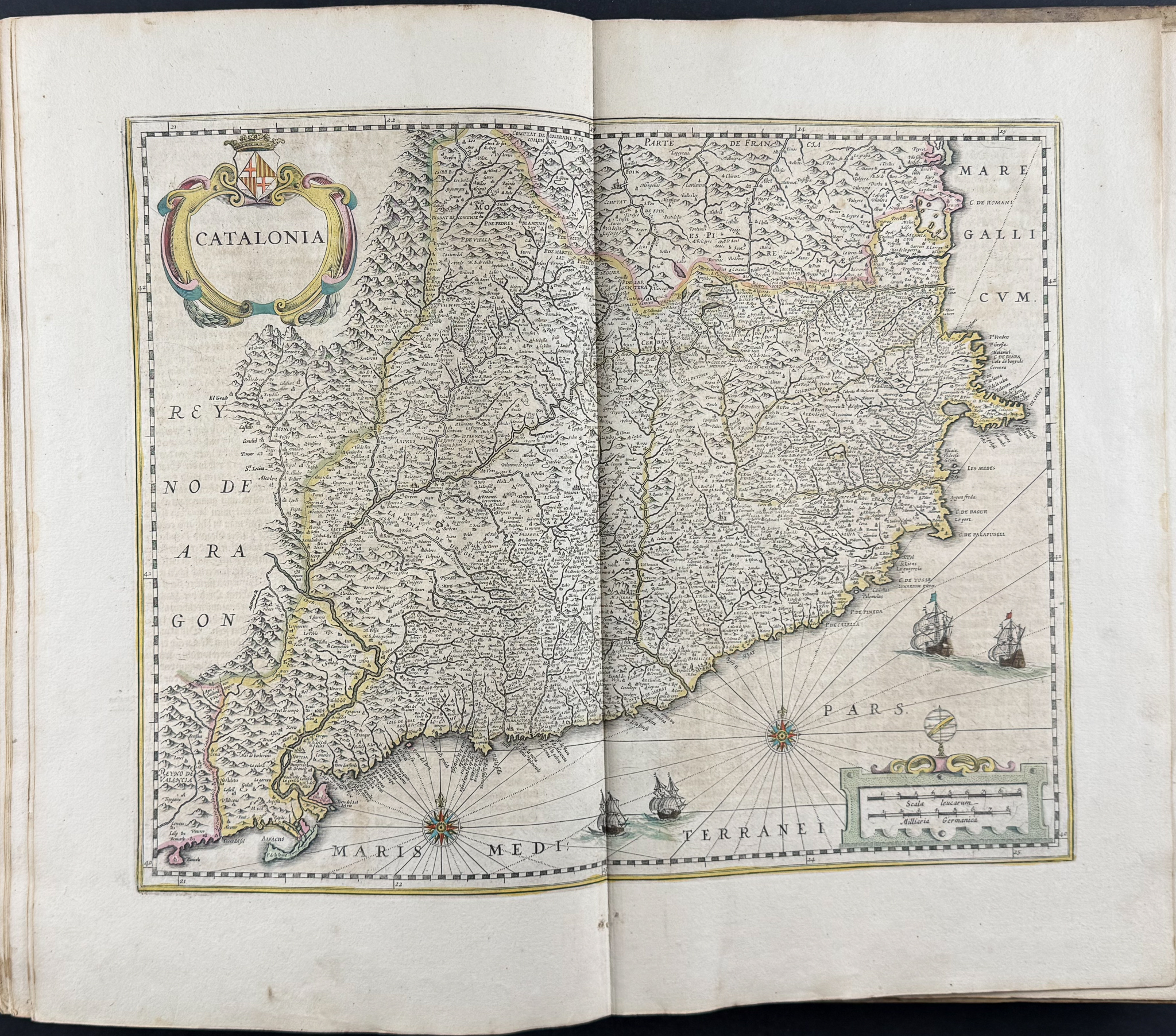
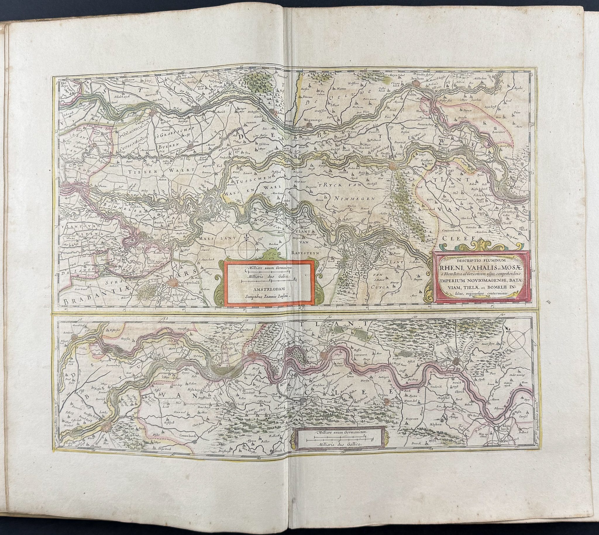
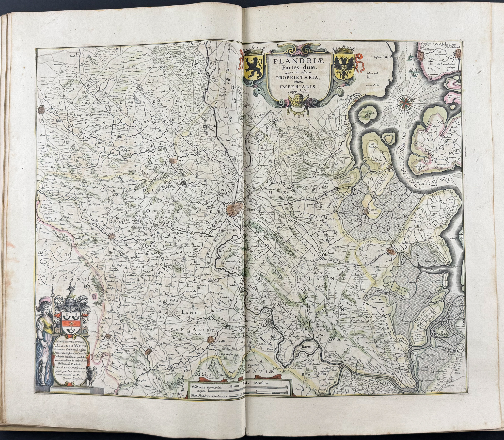
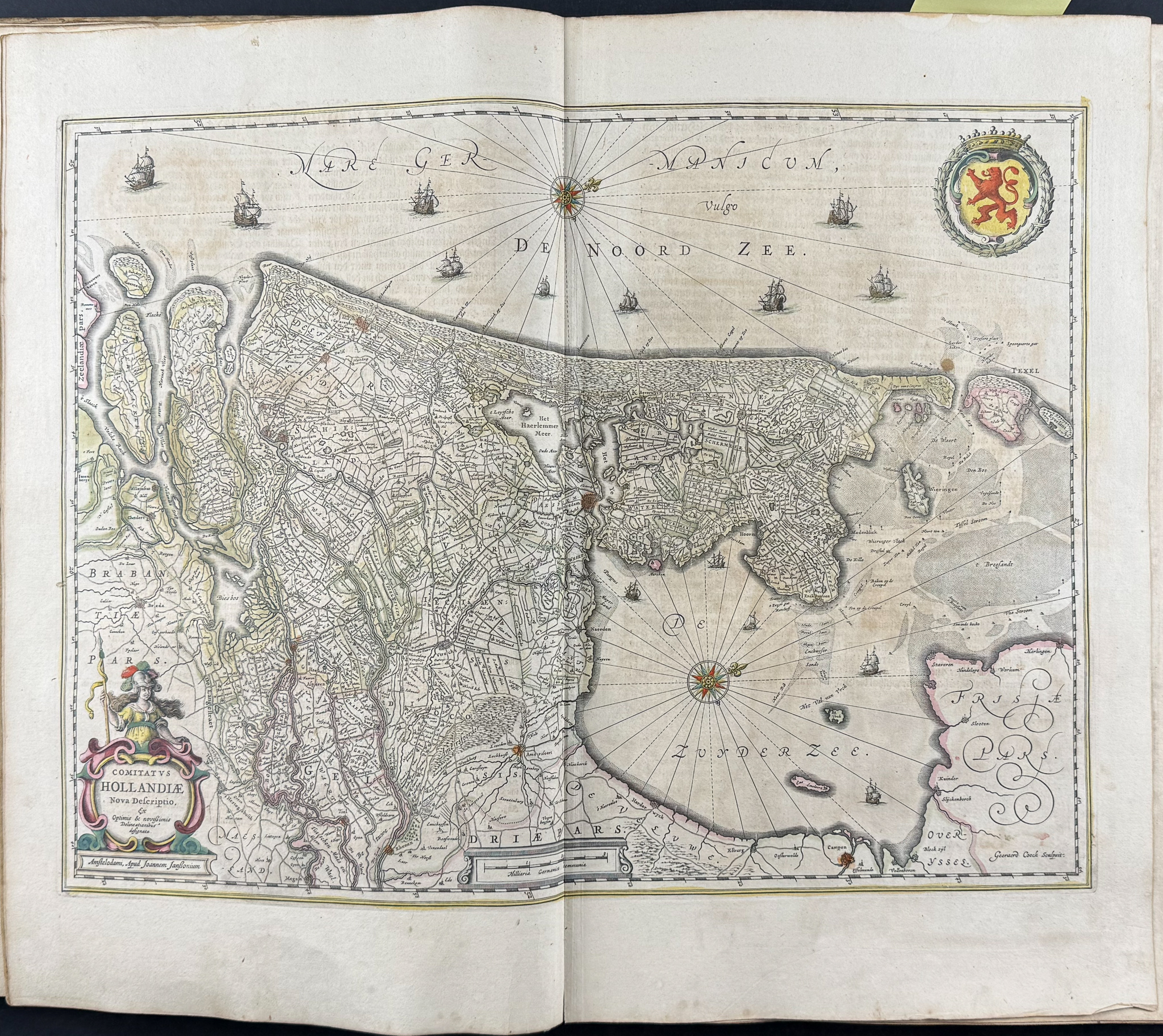
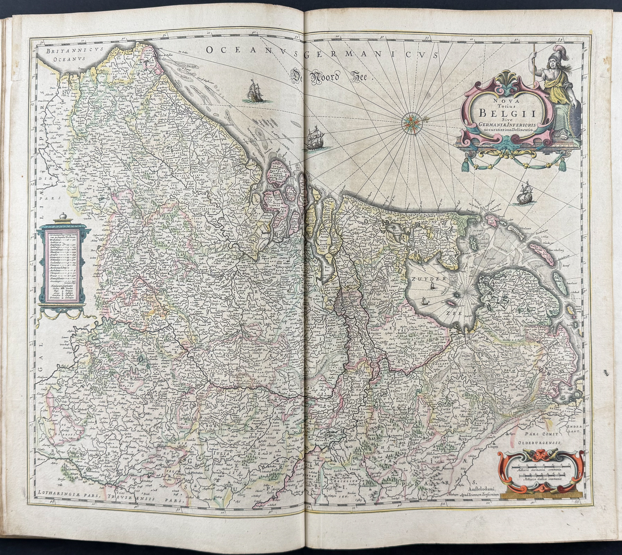
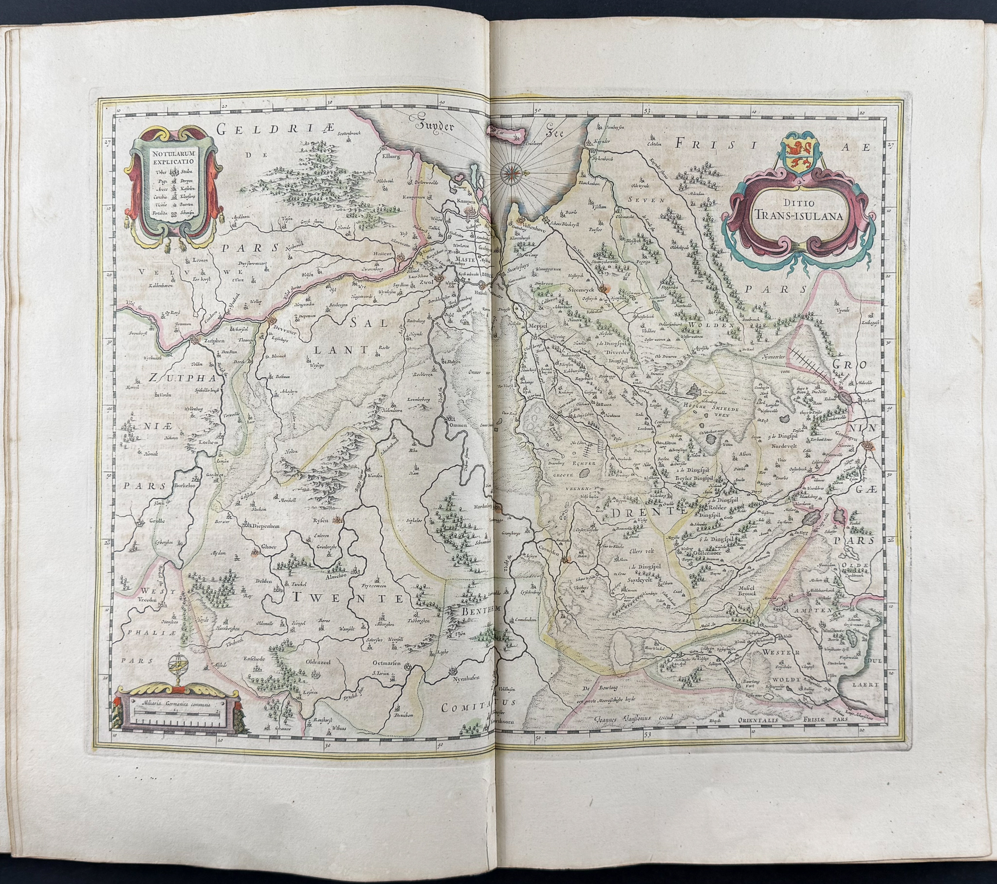
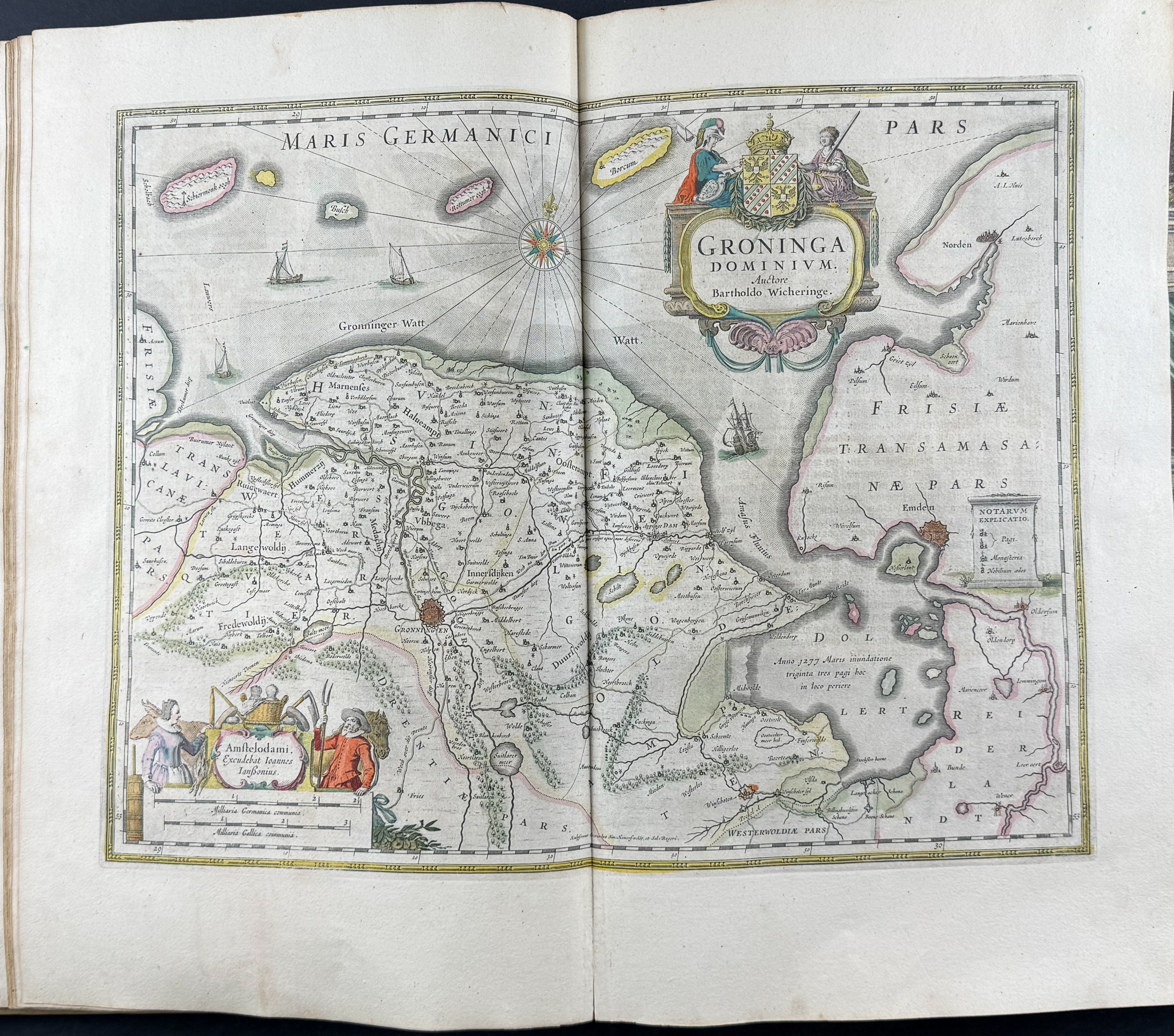
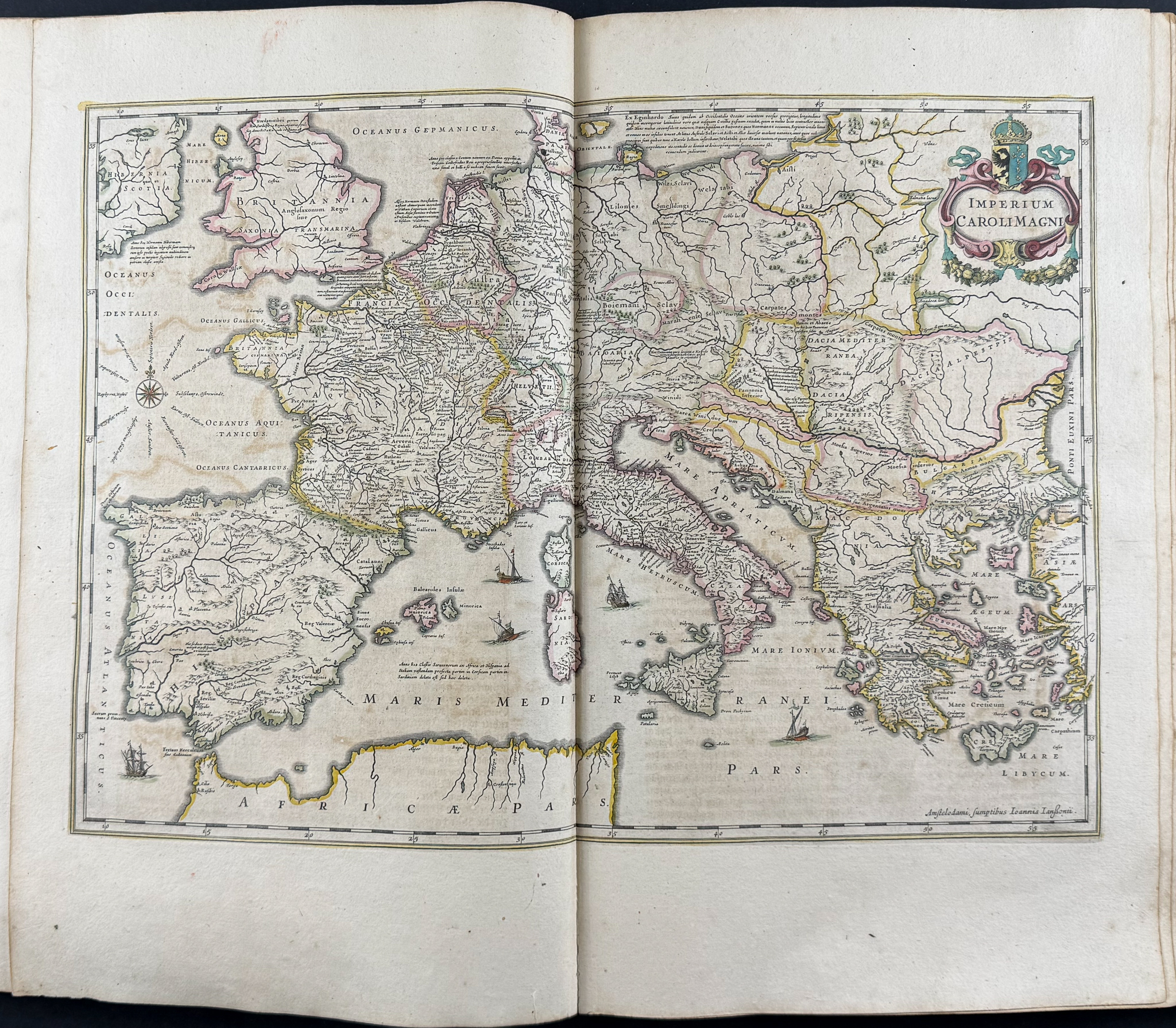
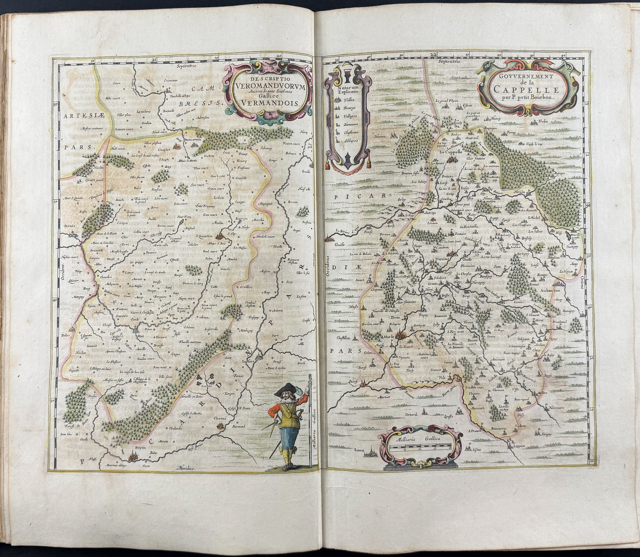
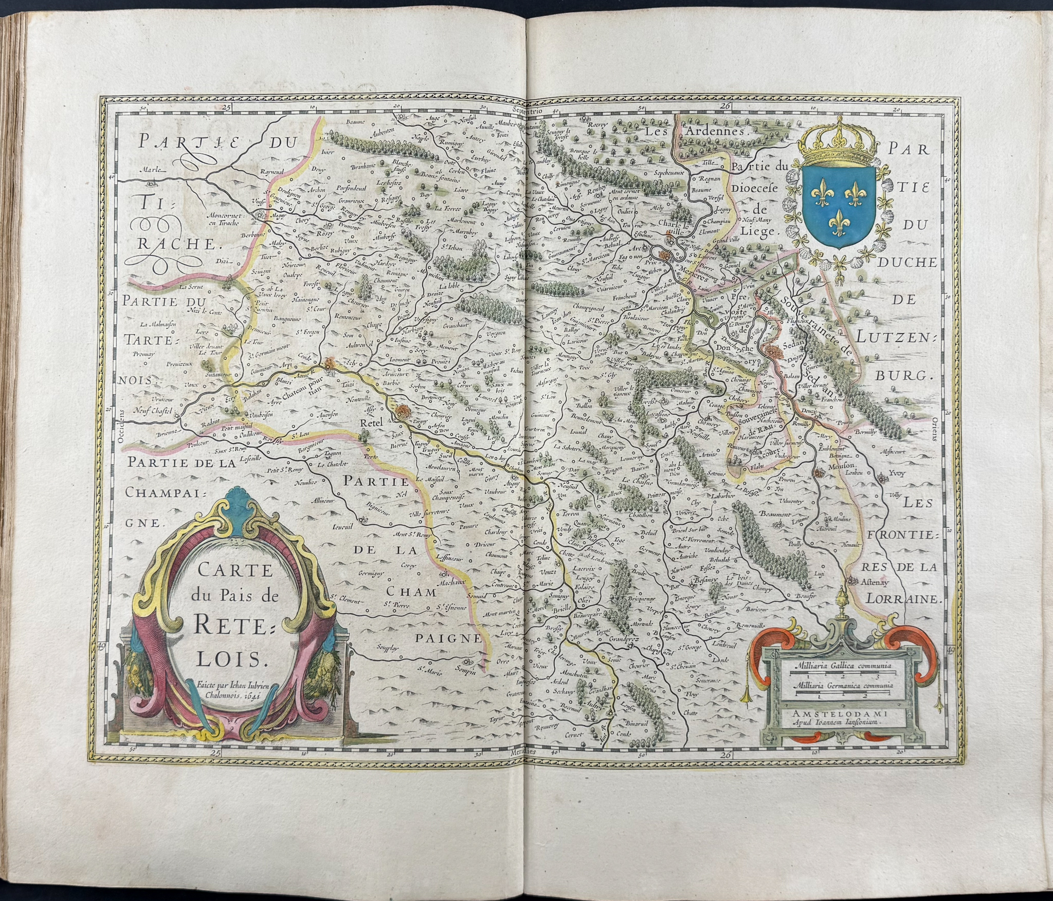
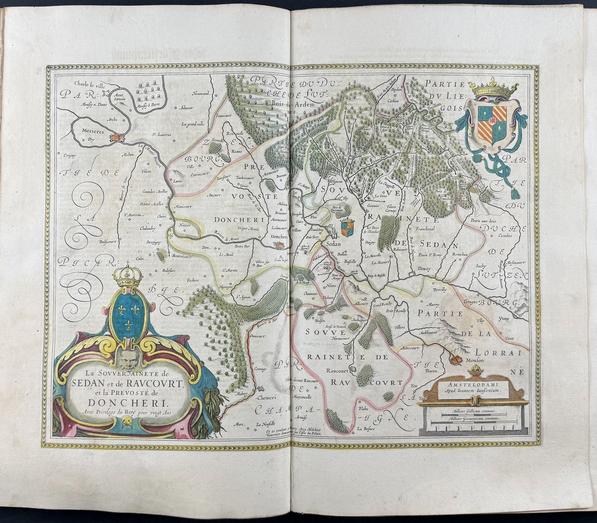
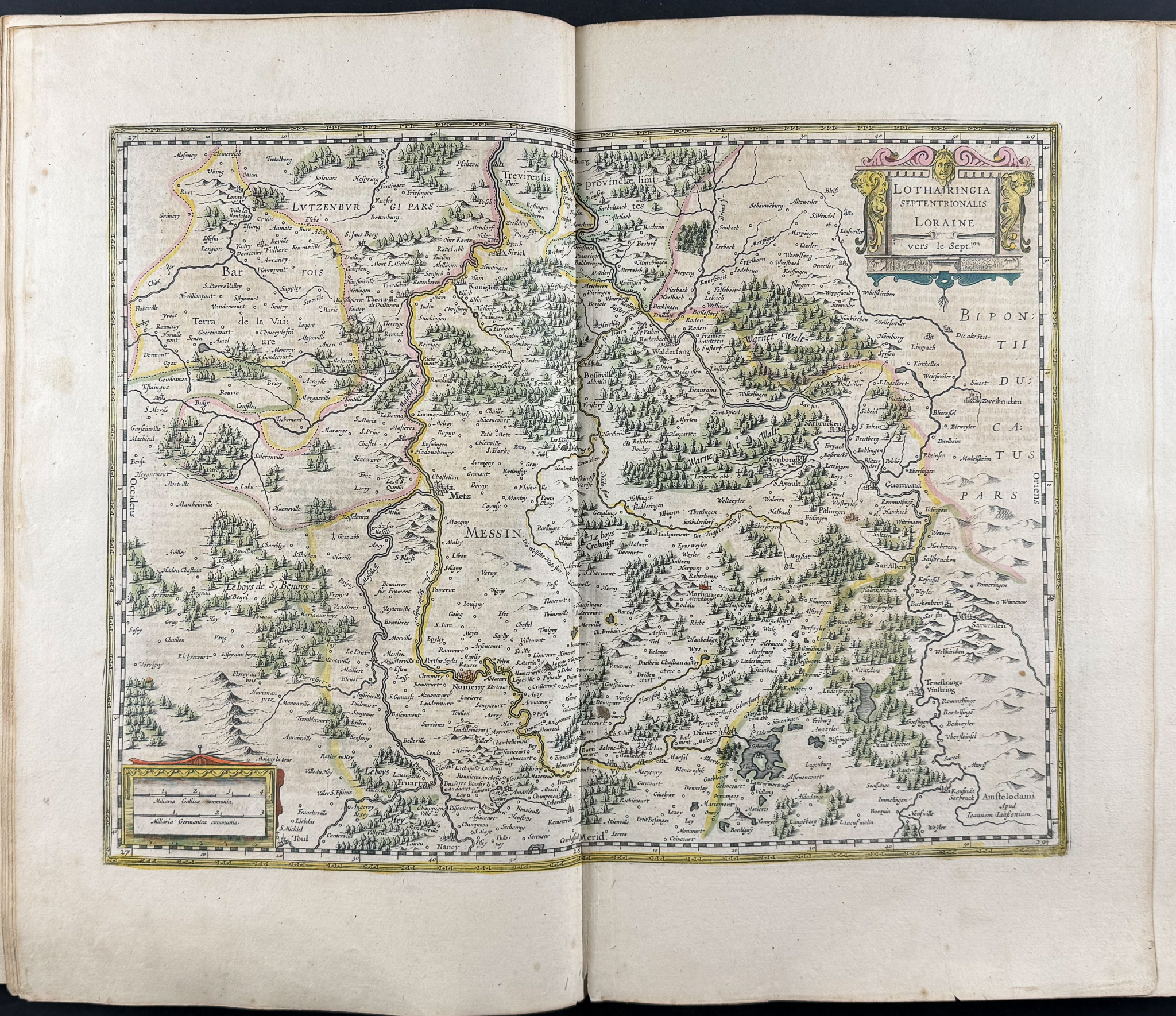
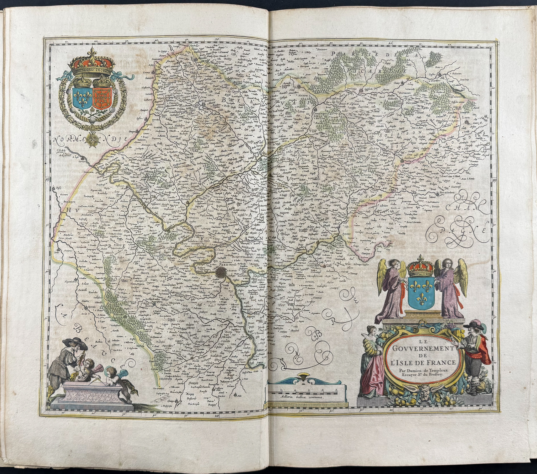
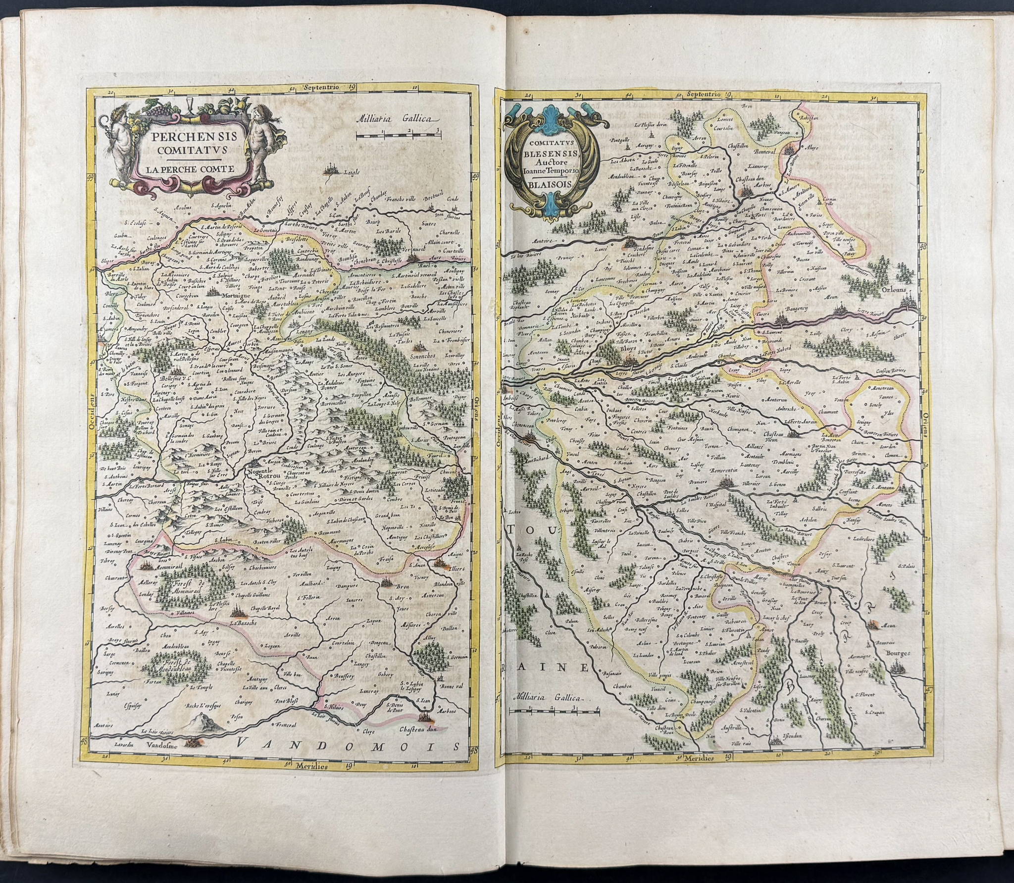
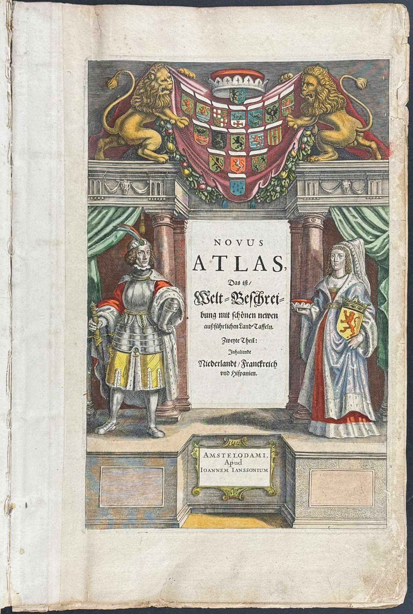
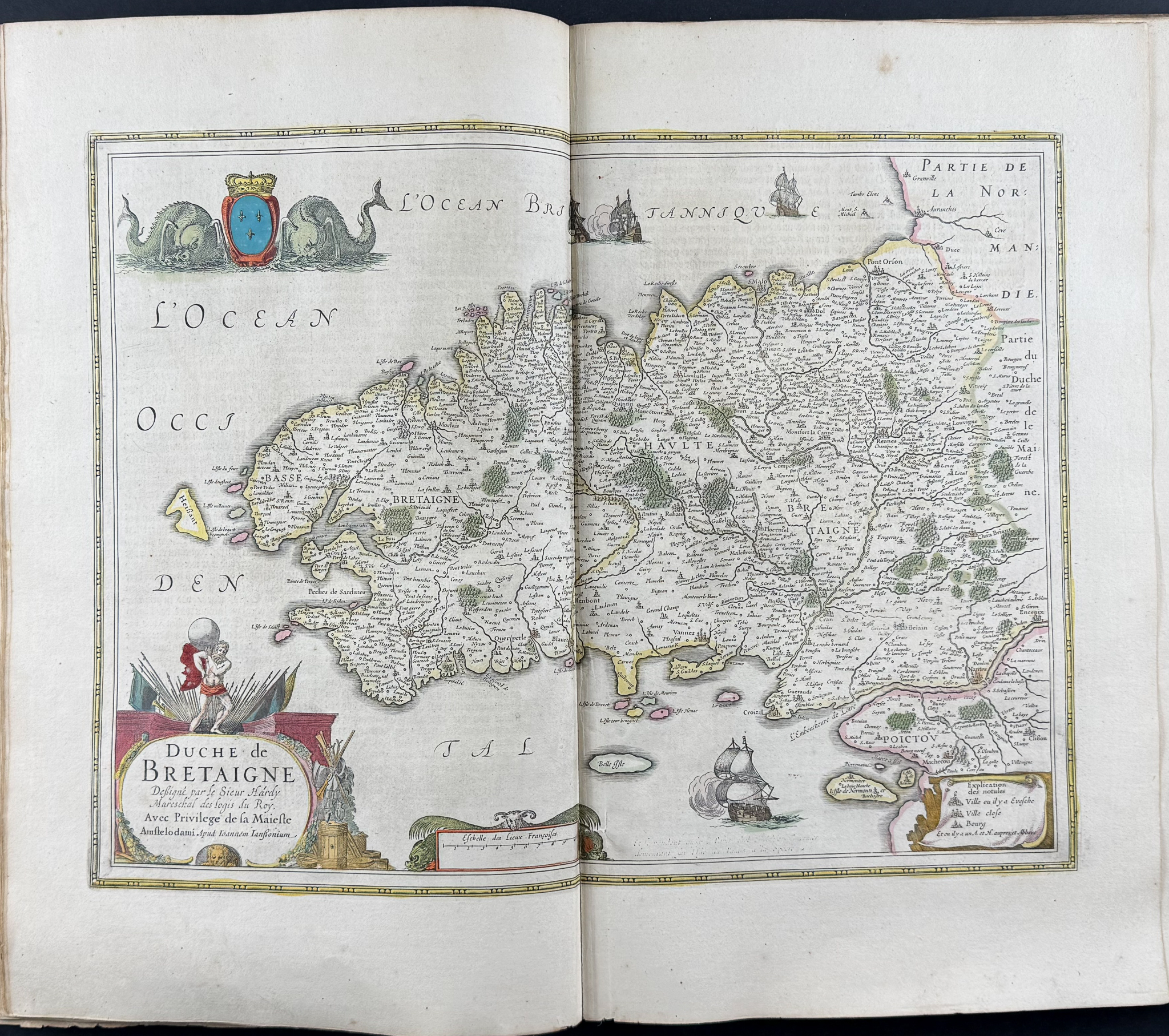
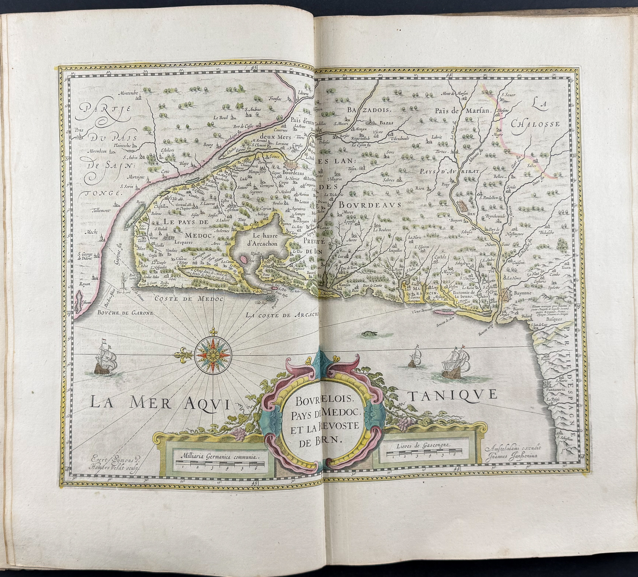
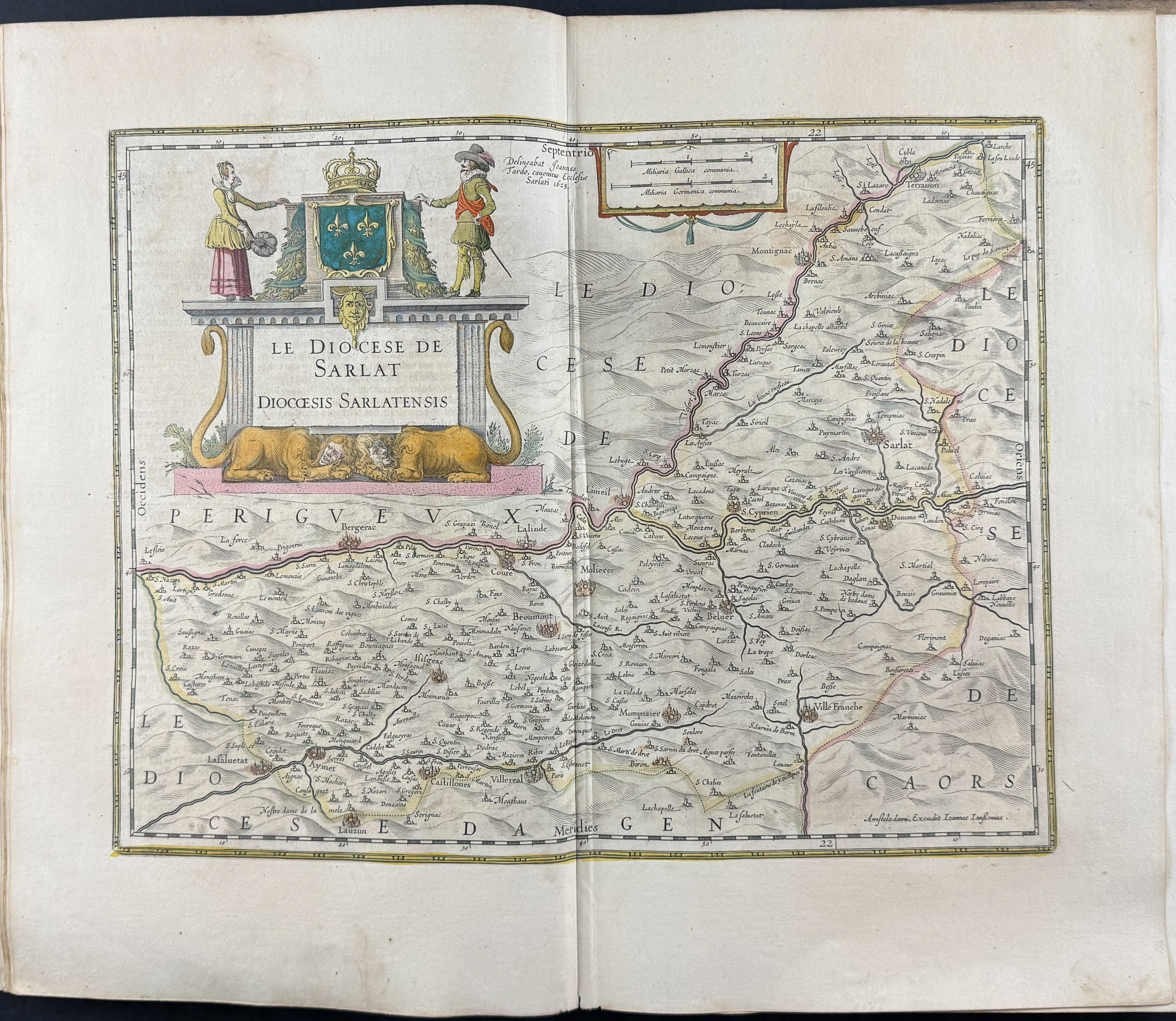
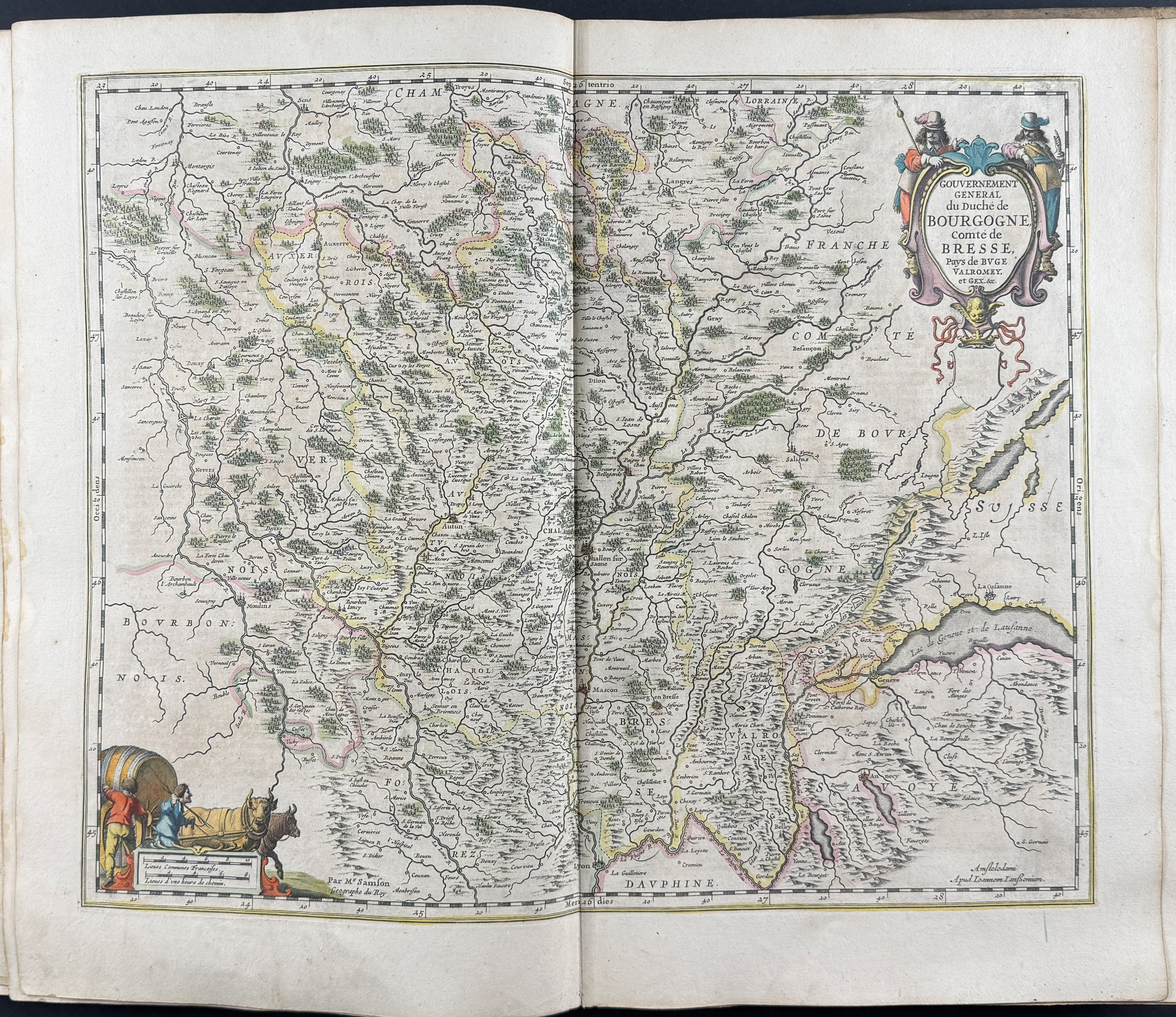
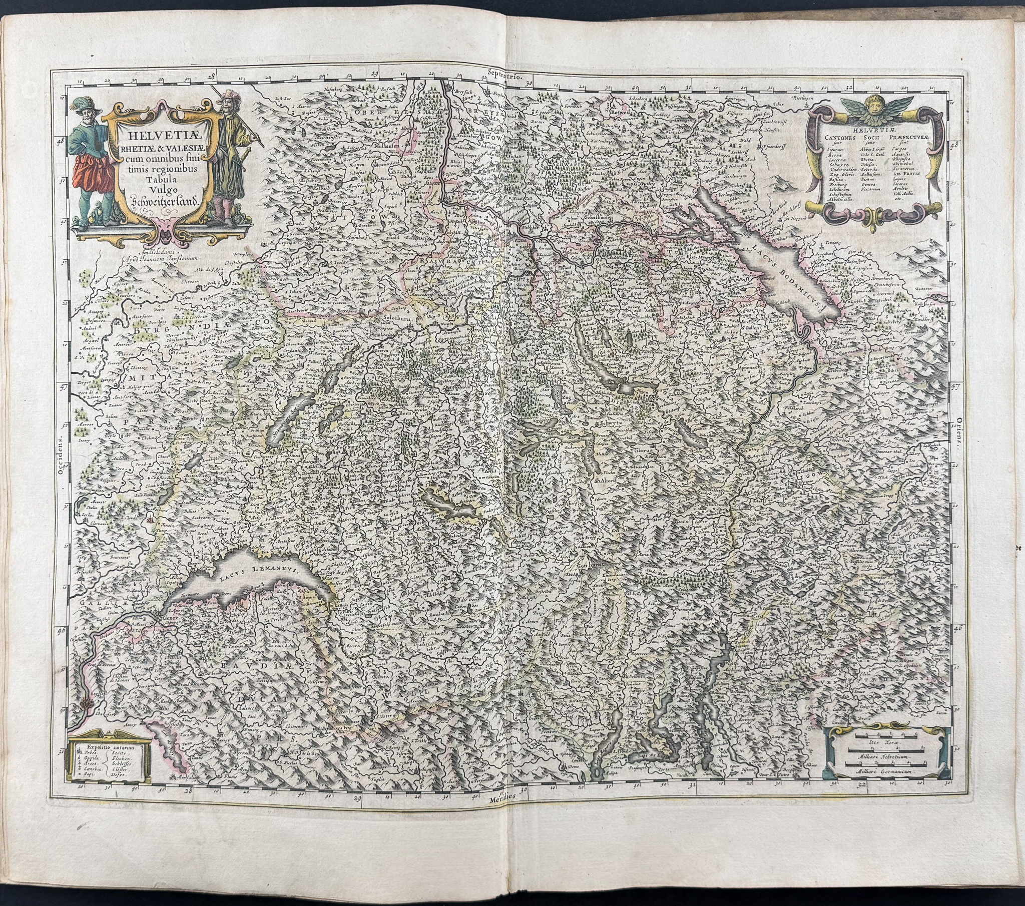
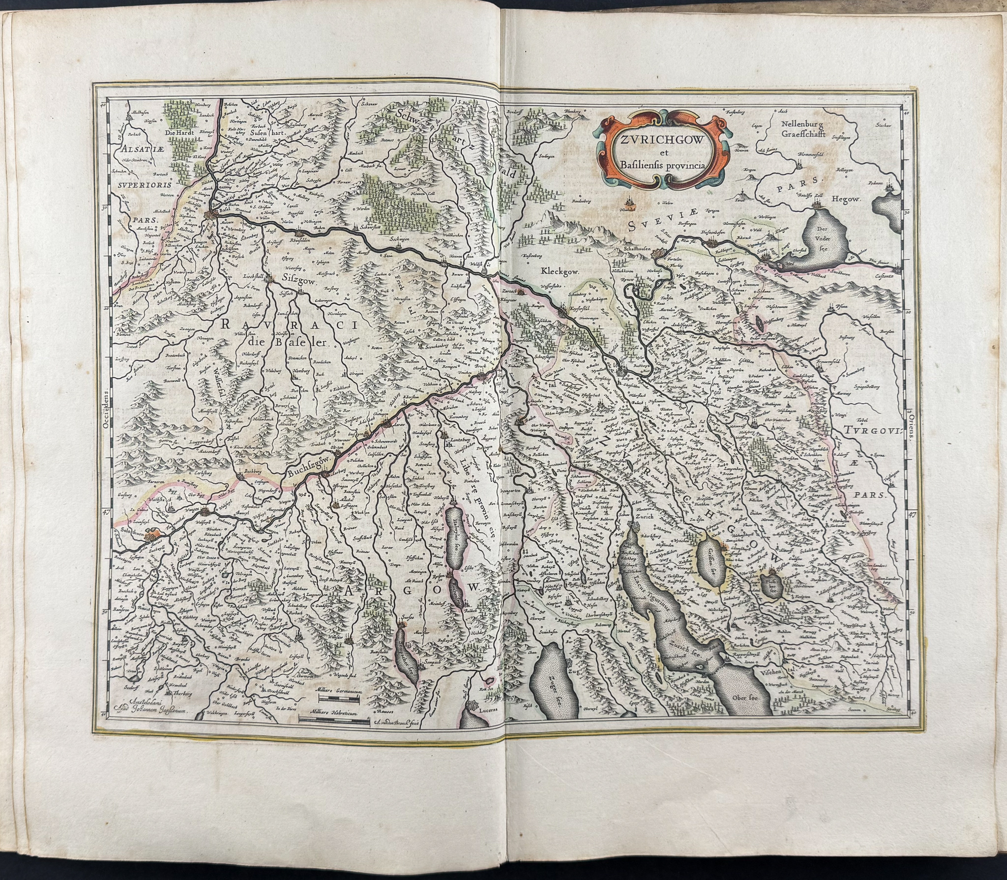
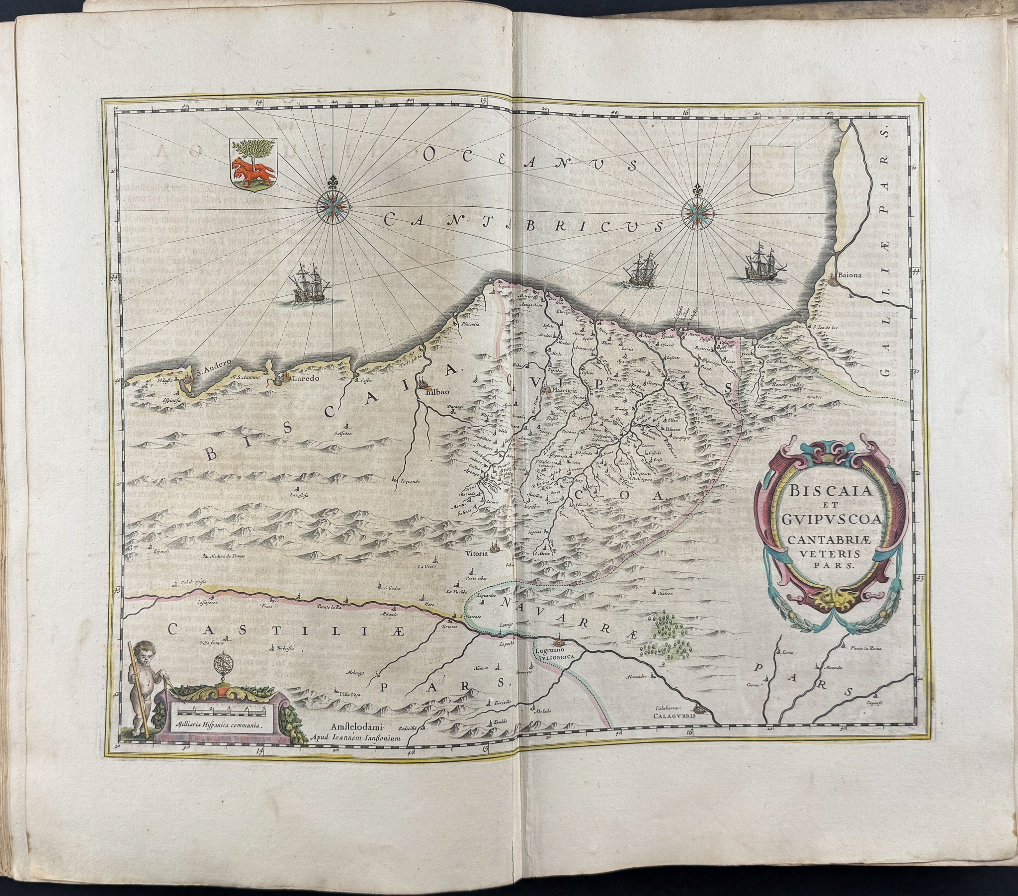
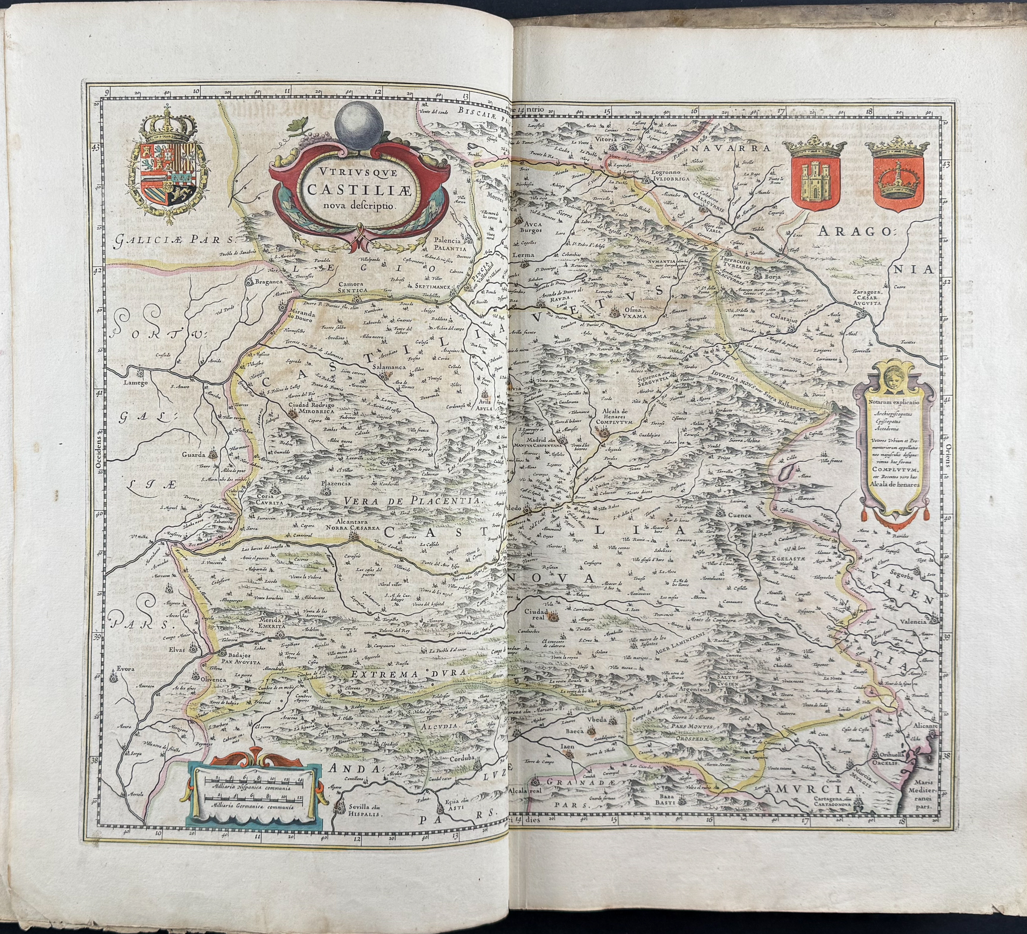
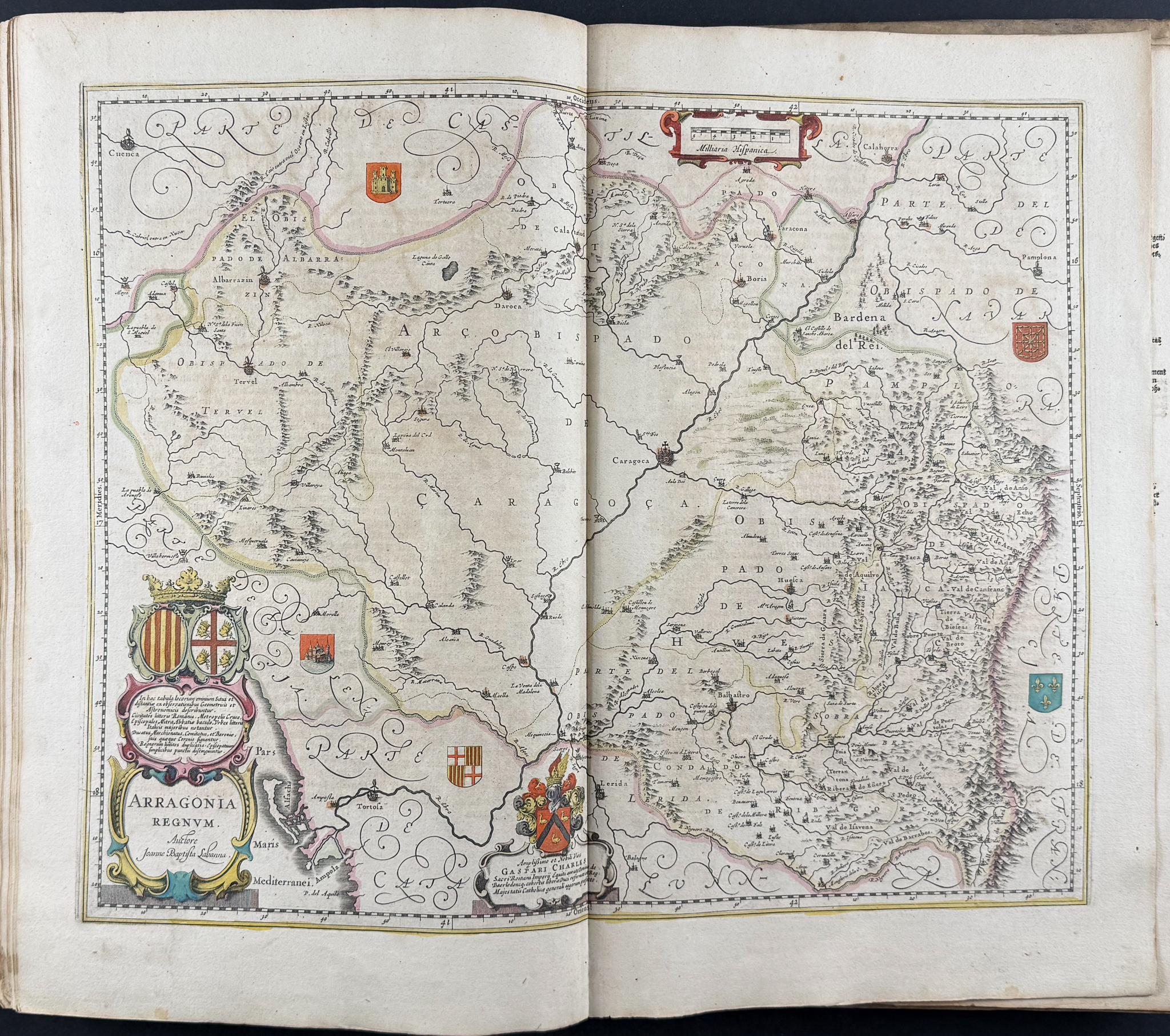
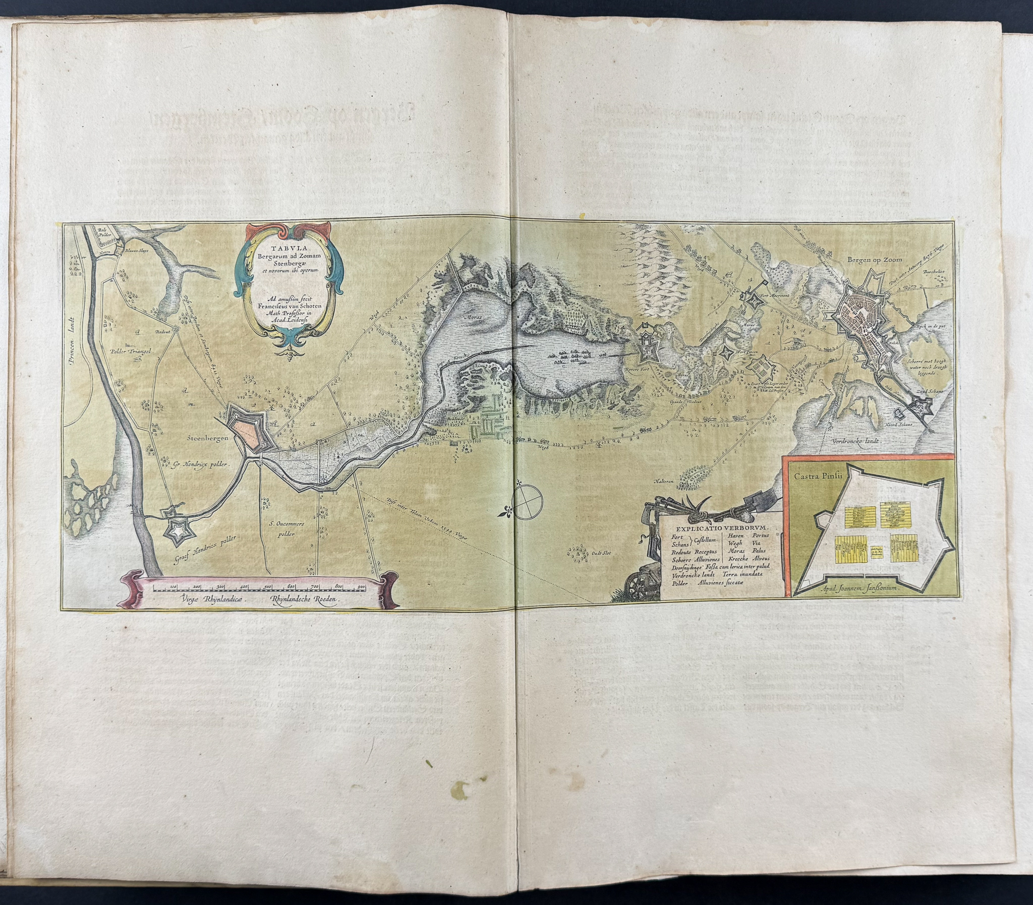
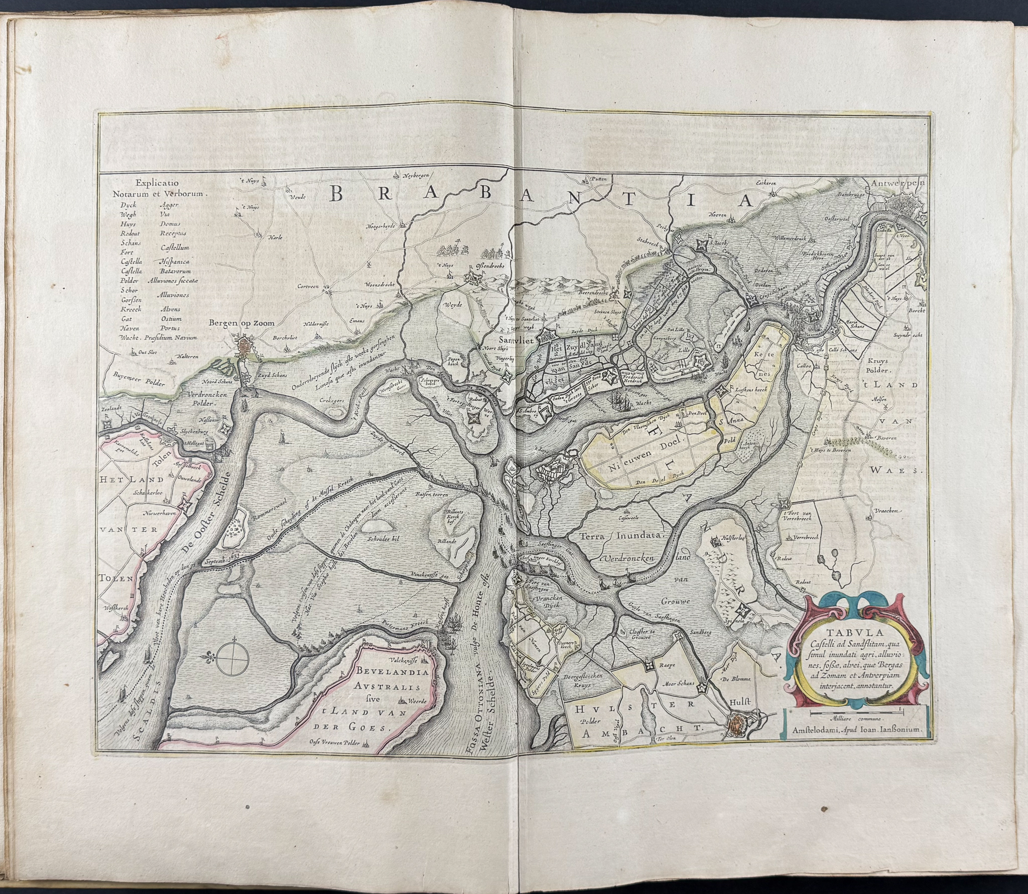
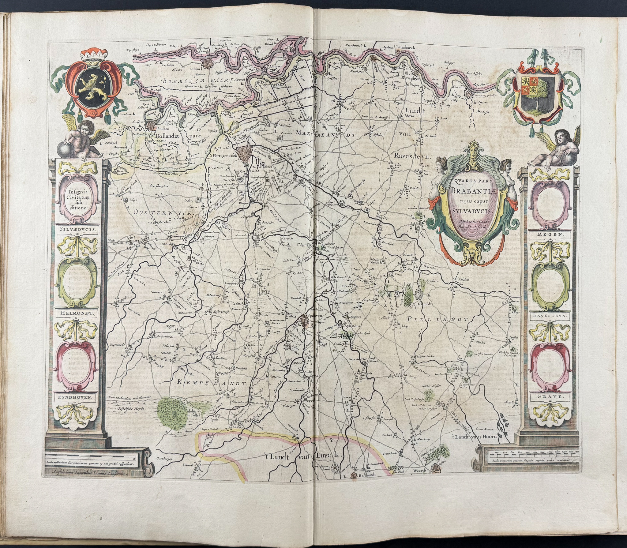
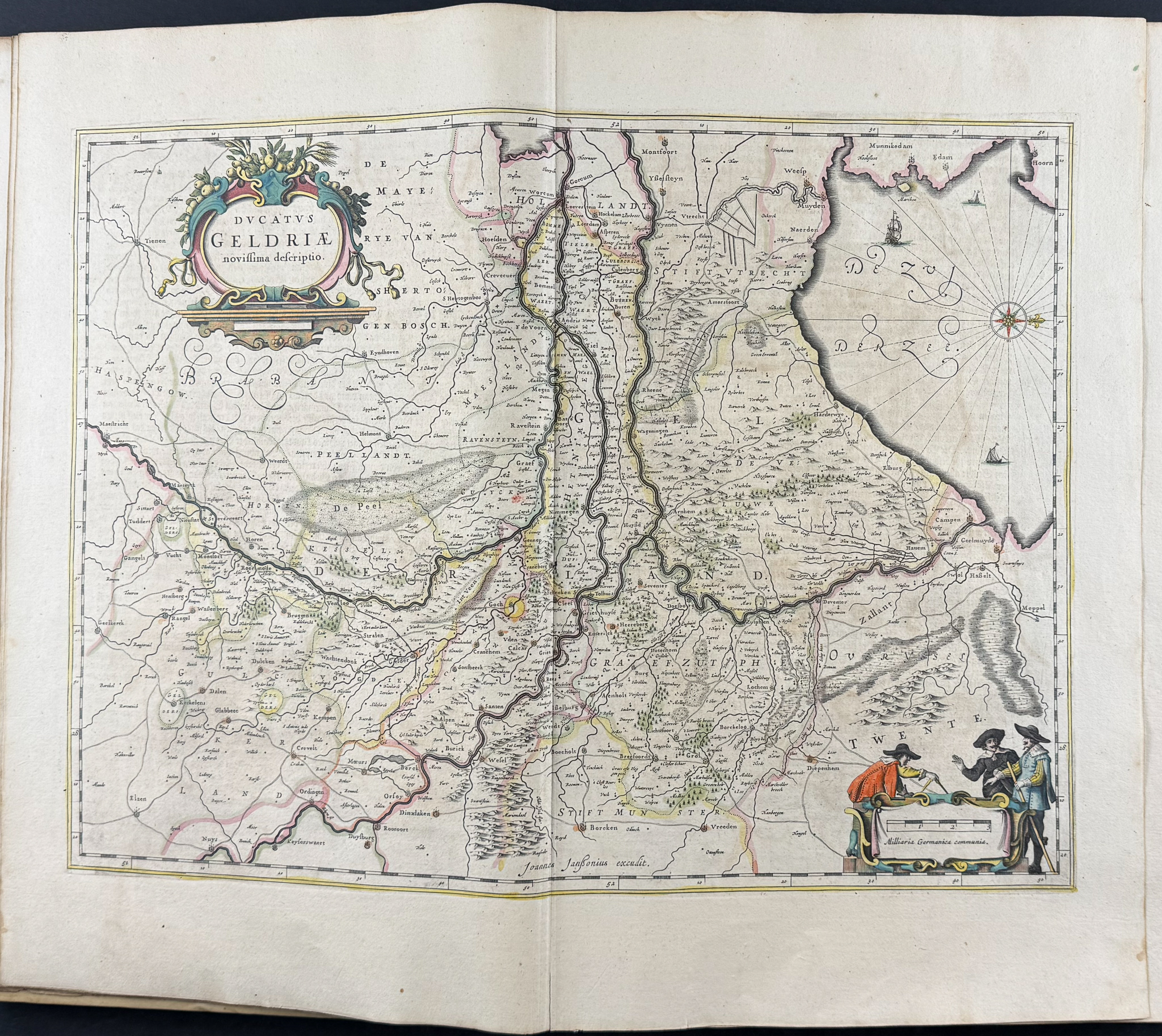
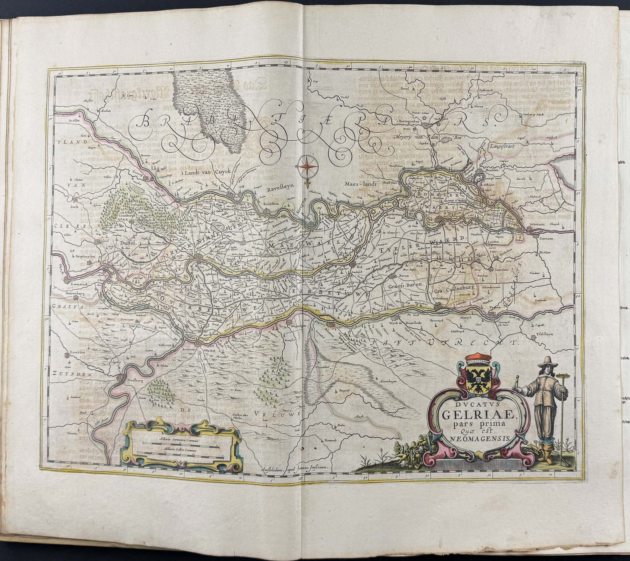
This is volume two with 114 originally hand-colored maps is from Jan Jansson’s
Novus Atlas, Das ist, Welt-beschreibung mit schonen newen auBfuhrlichen Taffeln inhaltende die Konigreiche und Lander des gantzen Erdreichs. This is from the German edition of the work which was published in Amsterdam in 1656 by the author and Henricus Hondius. Hondius & Jansson were prominent cartographers at the height of the Golden Age of Dutch cartography.
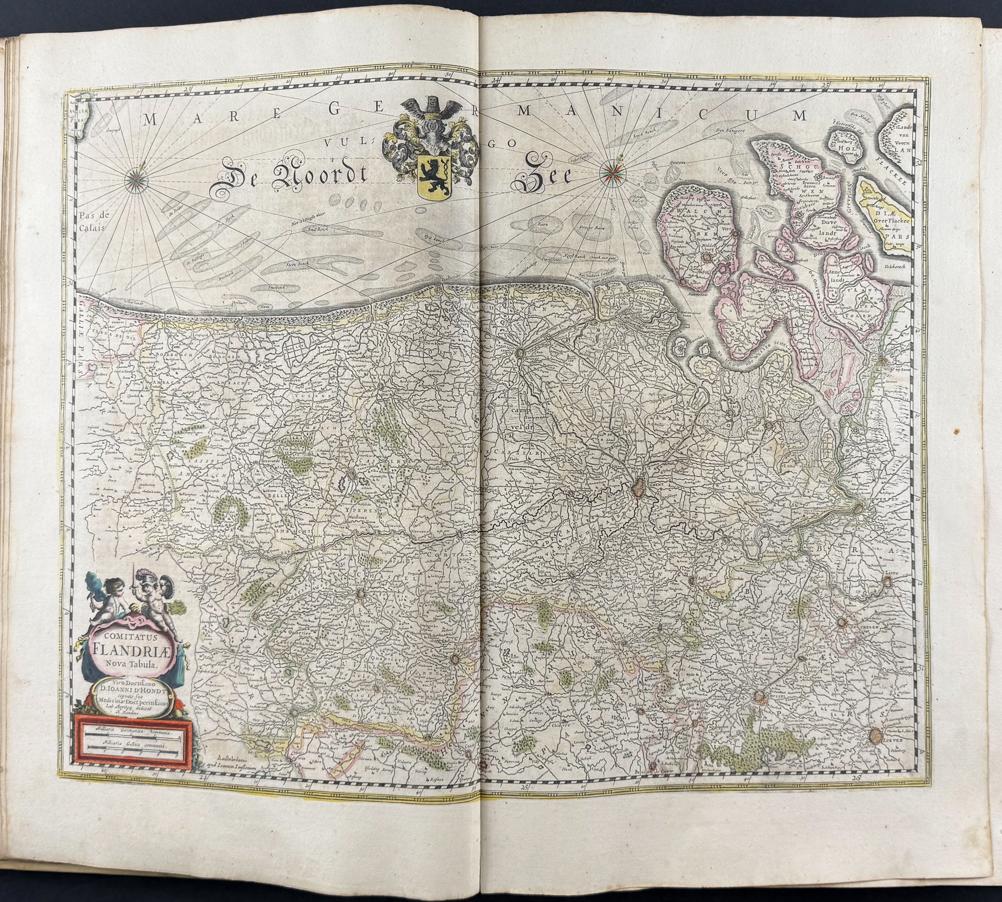
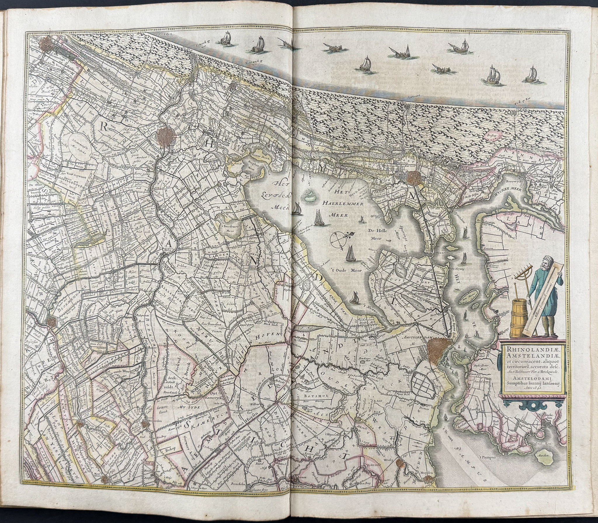
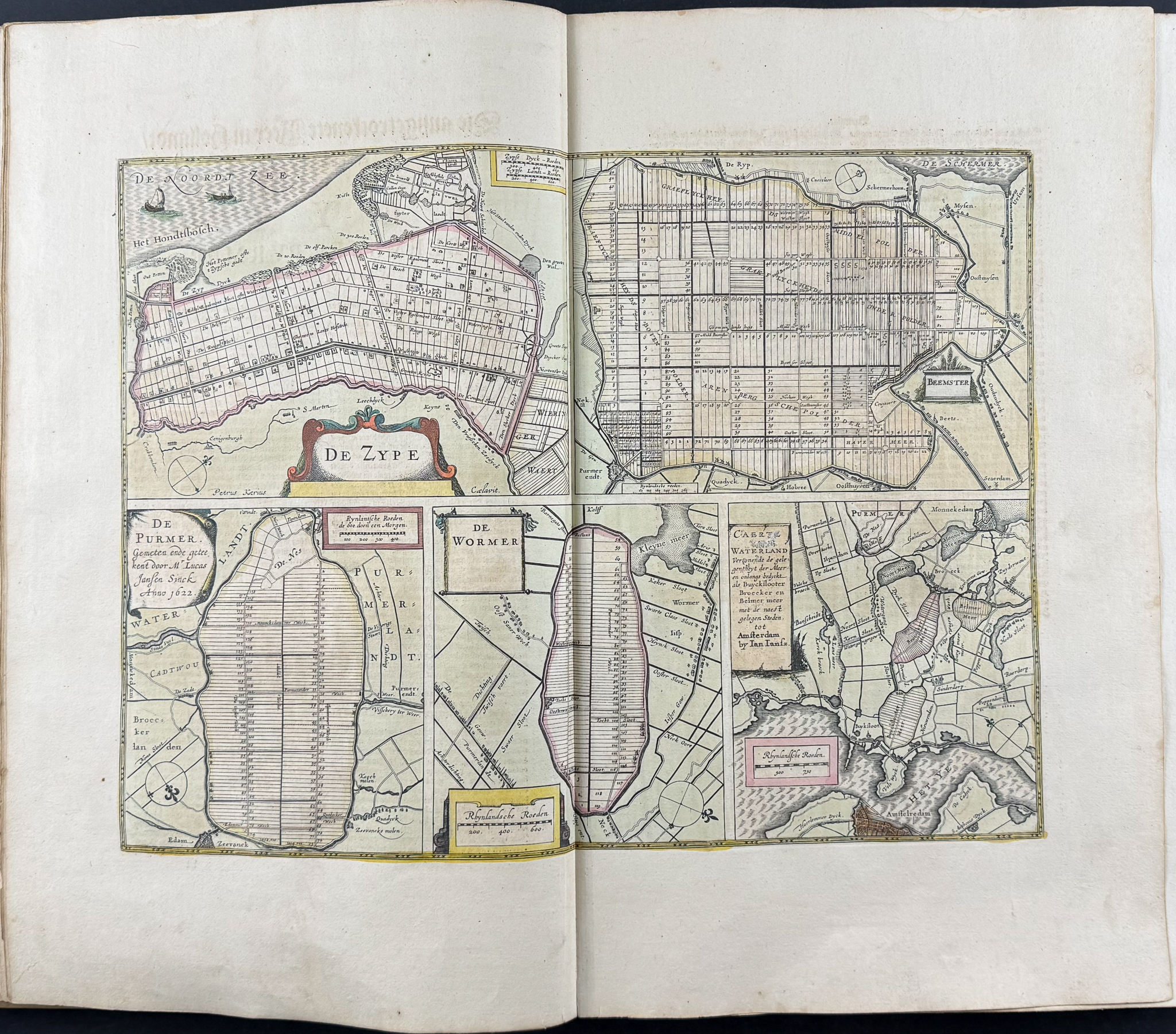
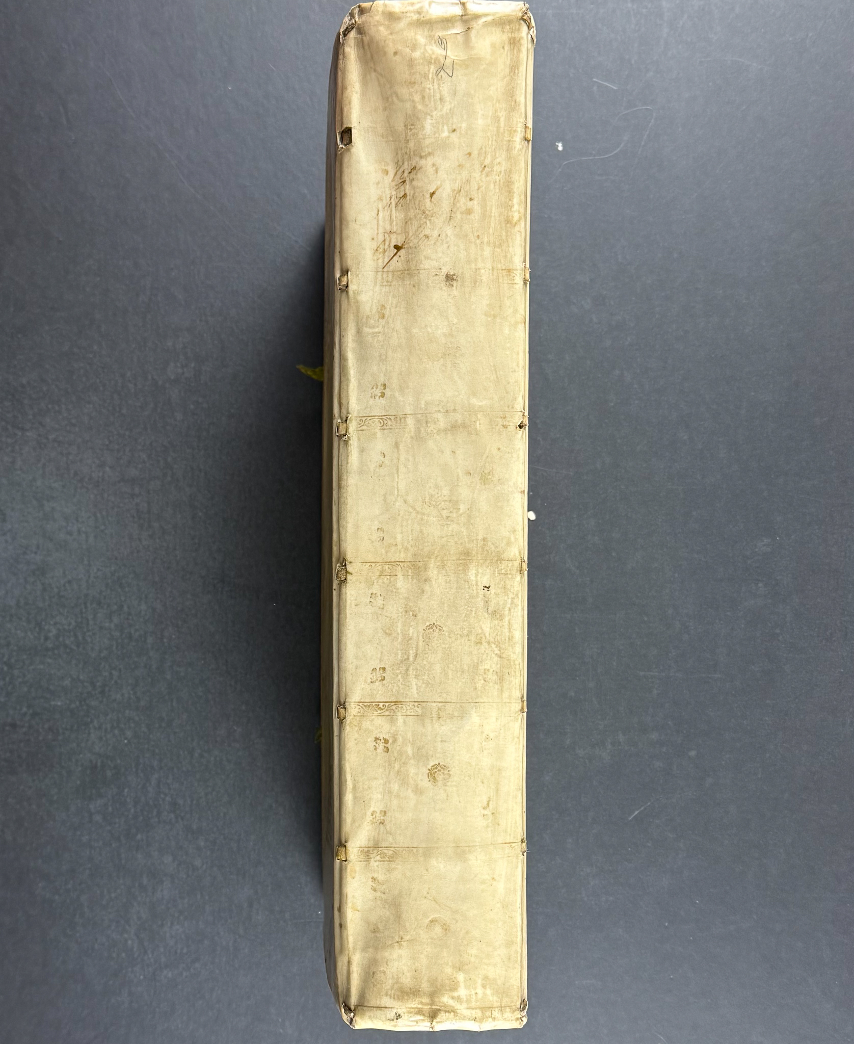
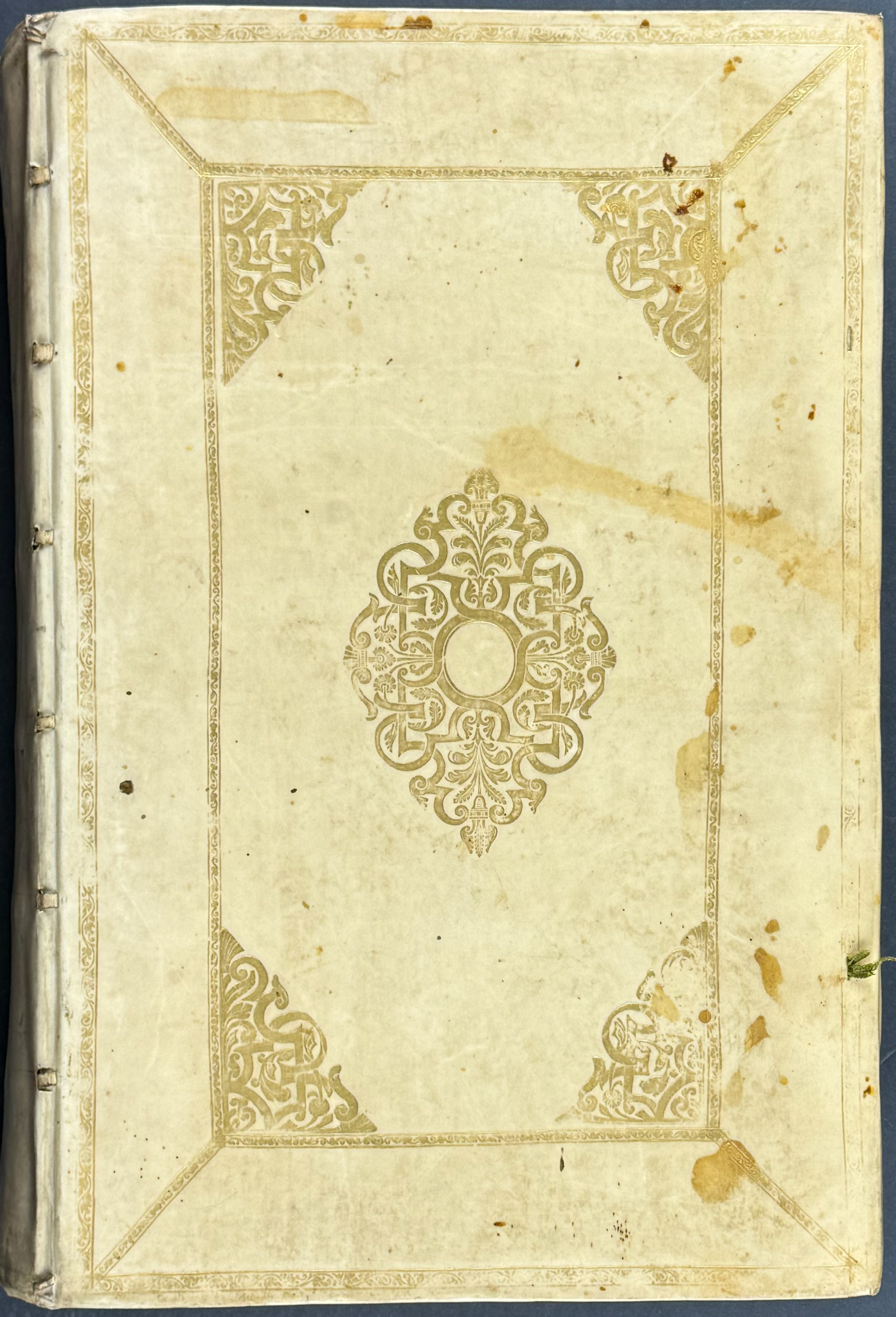
The volume features two title pages and 114 originally hand-colored maps. It is in the original publisher’s binding in cream vellum with gold-leaf gilt designs. The maps cover mostly the Netherlands, France, and Spain.
Jan Janssonius (also known as Johann or Jan Jansson or Janszoon) (1588-1664) was part of an important family of Dutch publishers, printers, and booksellers. They were responsible for many important publications. Jan Jansson was a noted geographer in his own right. He married the daughter of another prominent mapmaker, Jodocus Hondius, and also worked with her brothers Henricus & Jodocus II.
Henricus Hondius (1597-1651) & Jodocus Hondius (1593-1629) were Dutch engravers and mapmakers. They learned the trade from their father, Jodocus Hondius, an engraver and geographer. He was involved with the republishing of Mercator’s atlas as well. The brothers worked closely together and took over their father’s engraving business. He would later start his own shop in 1621 where he would eventually partner with Jan Janssonius and continued publishing Mercator’s work where it would eventually be referred to as the Mercator-Hondius-Janssonius atlas.
Paper Size: ~ 23 1/4" by 19 1/4" (Fold Out)
Paper Type or Special Features: Volume 2 with 114 Originally Hand-colored Maps
Condition report:
The work is in overall good to very good condition. A few maps have some chipping from handling. They may exhibit some light toning or offset. There is some staining to the margins of several of the maps. The first title page has a larger chip just to the image area. Typically in good very good condition overall with normal signs of defects from this period. Sold as is. It has 114 maps, but uncollated, believed complete. \"In a typical complete German edition of this specific volume, the total map count is approximately 101 to 114 maps.\" (Ruderman Maps) There may be a few minor imperfections or faint marks or fox marks to be expected with age. Please review the image carefully for condition and contact us with any questions.
Share this lot: