
Antique Prints, Maps, & Books of Natural History, Botanicals, & More
Lot 8043:
Description
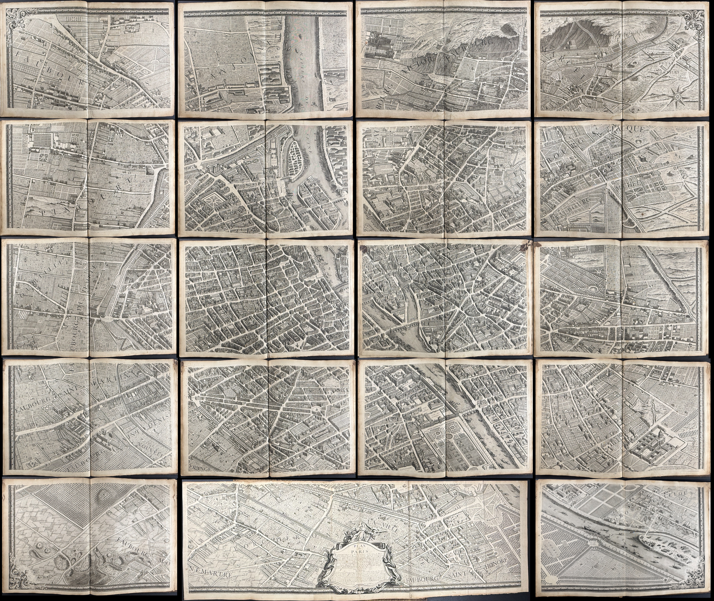
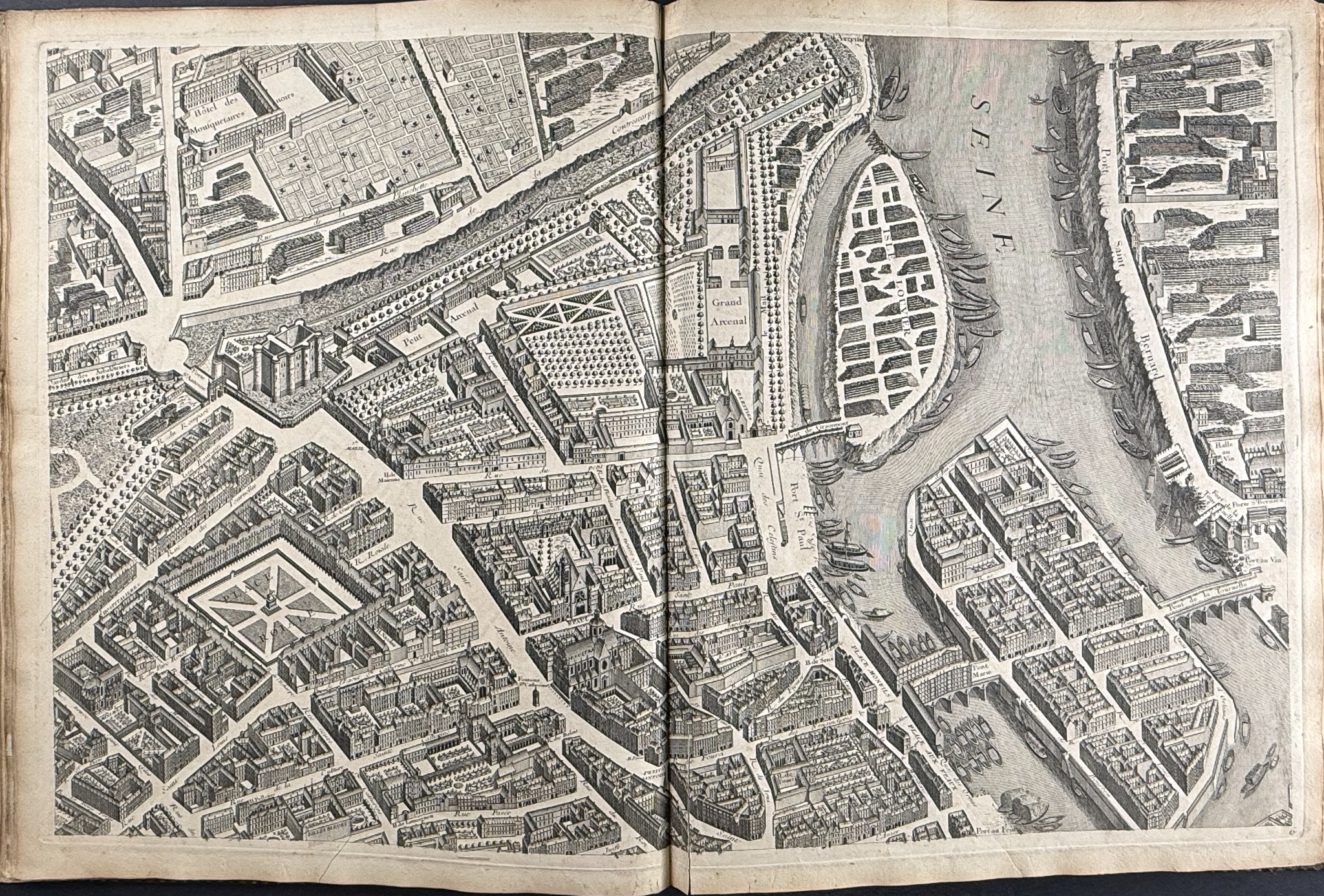
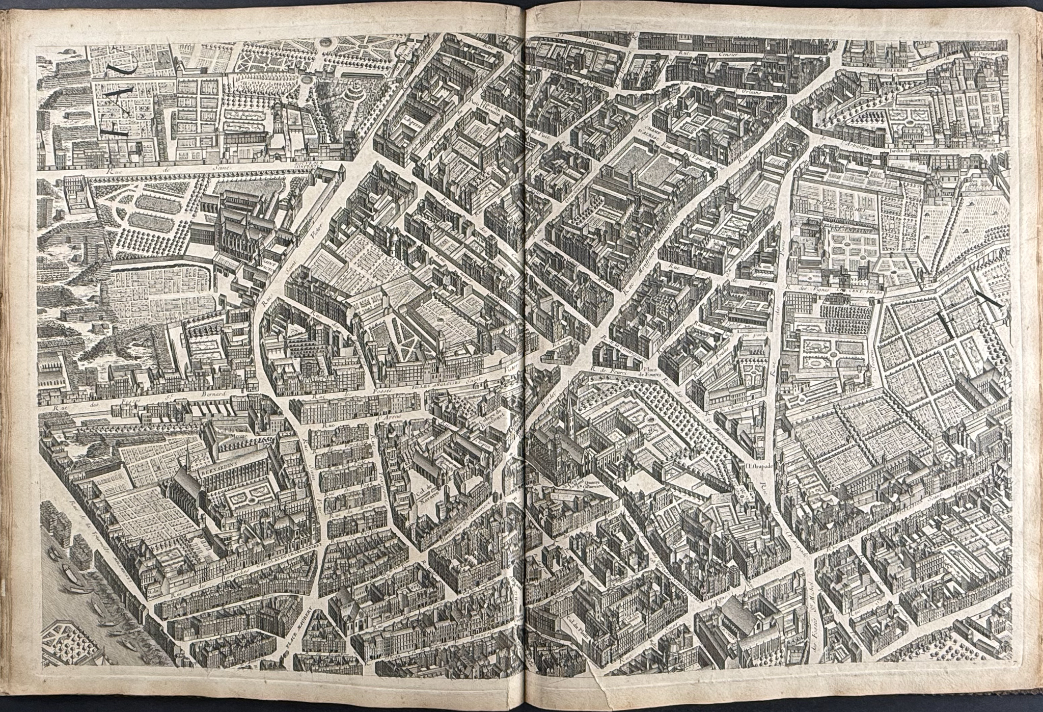
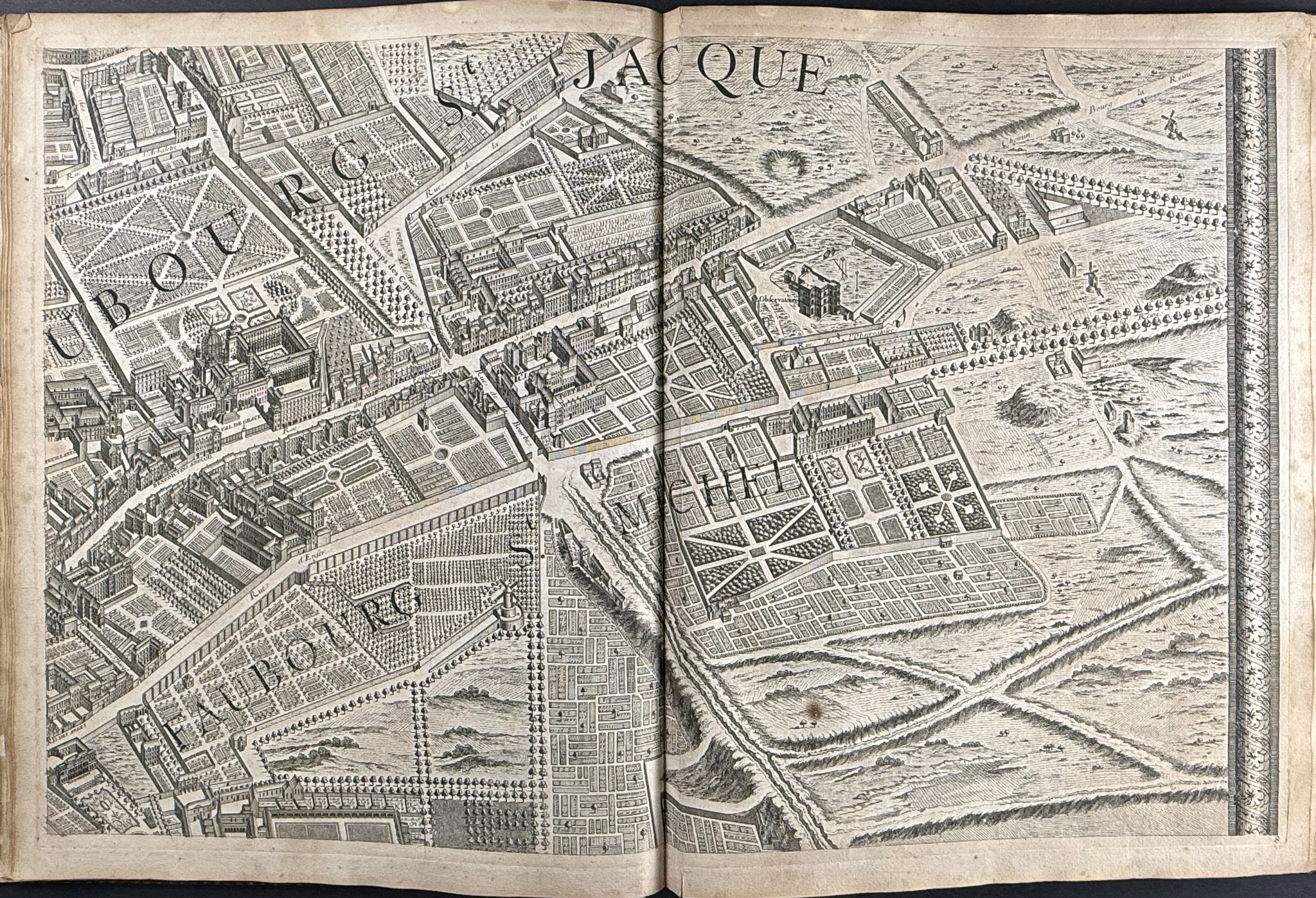
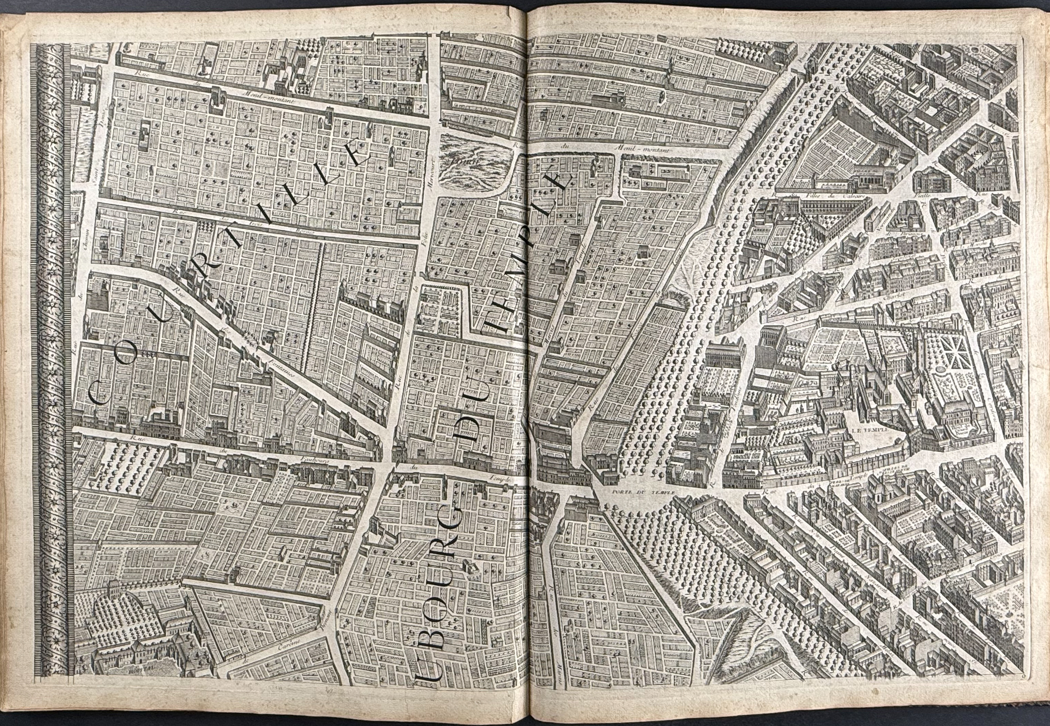
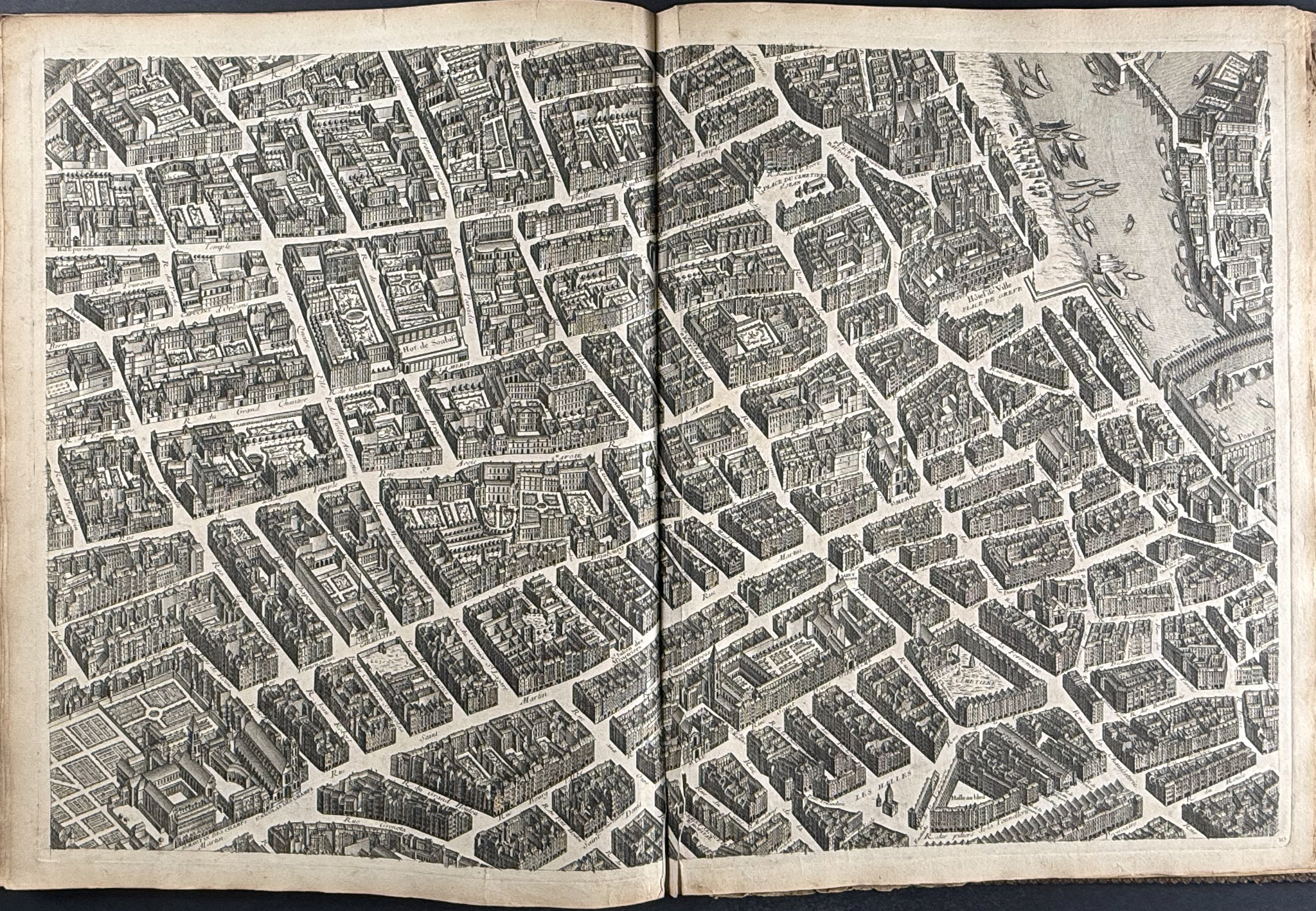
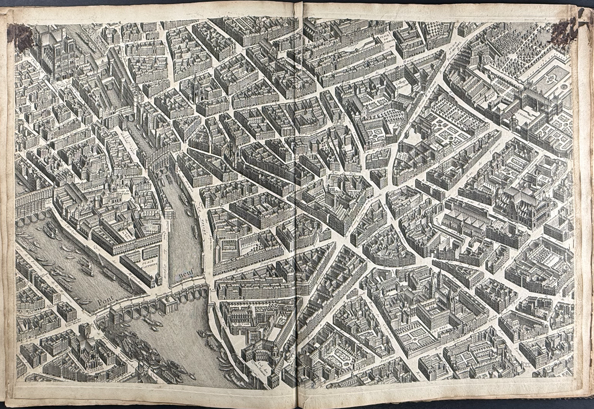
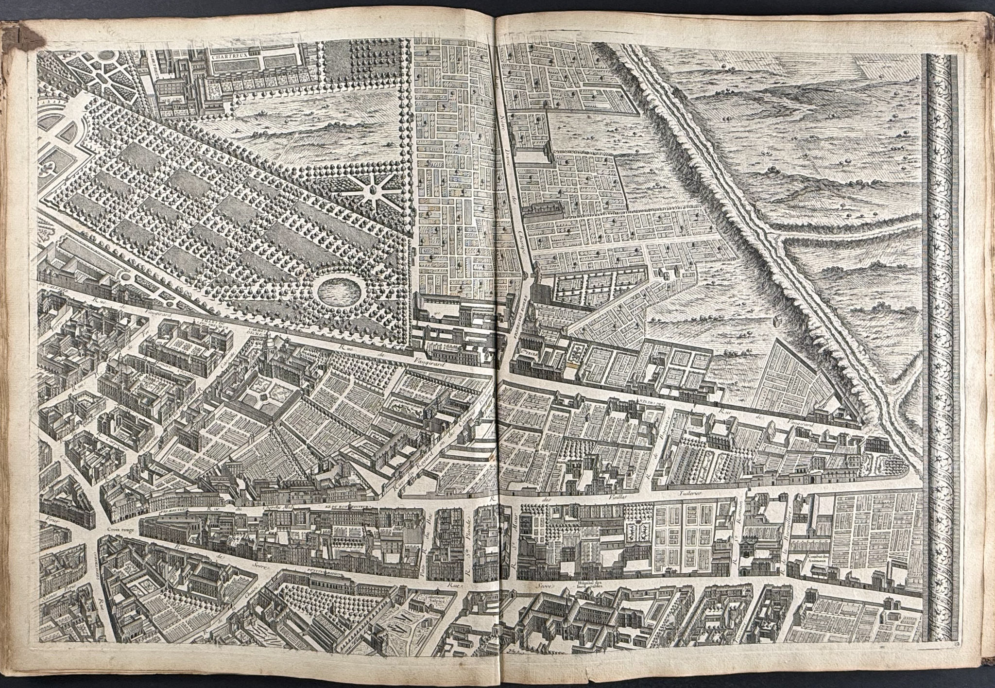
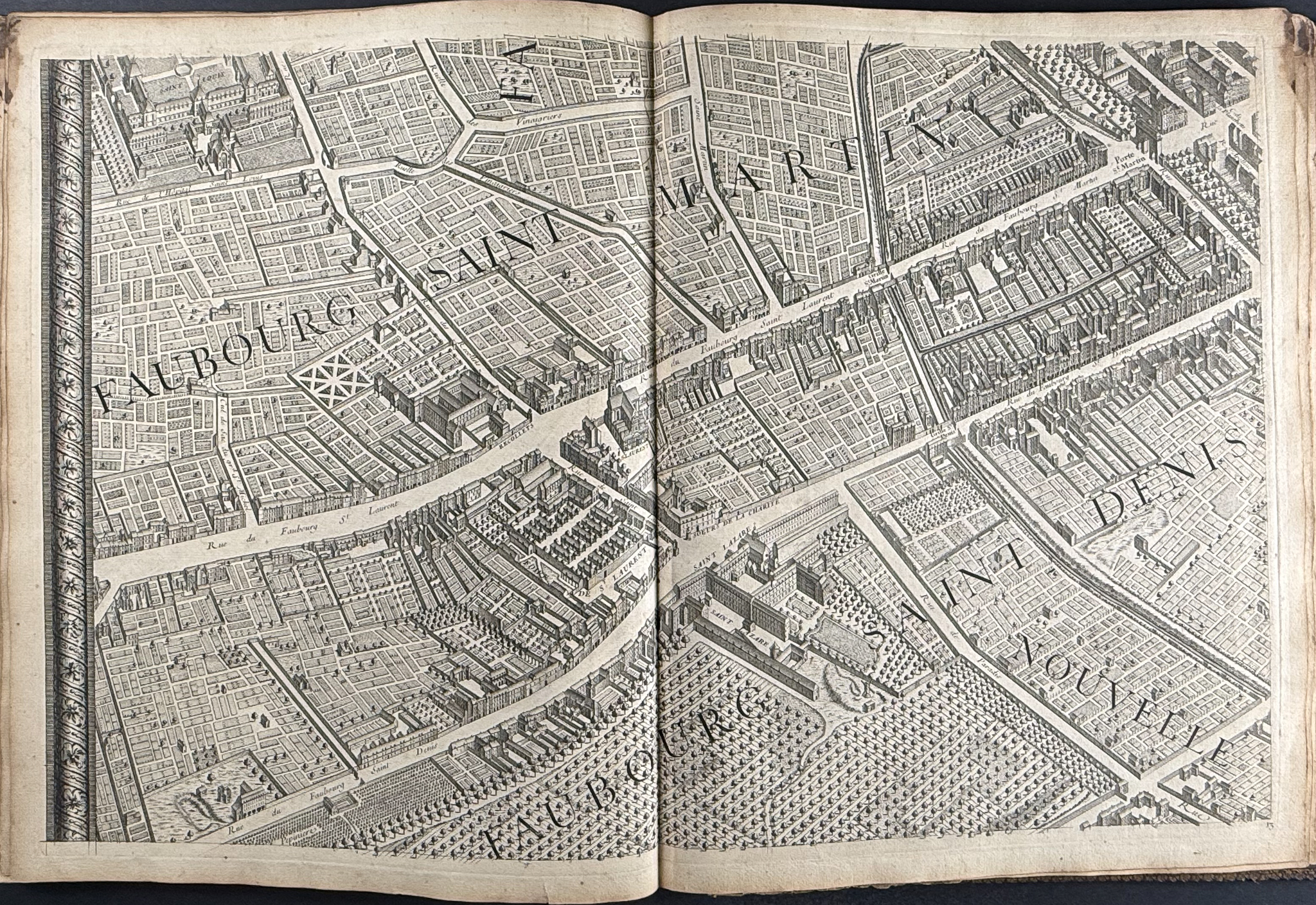
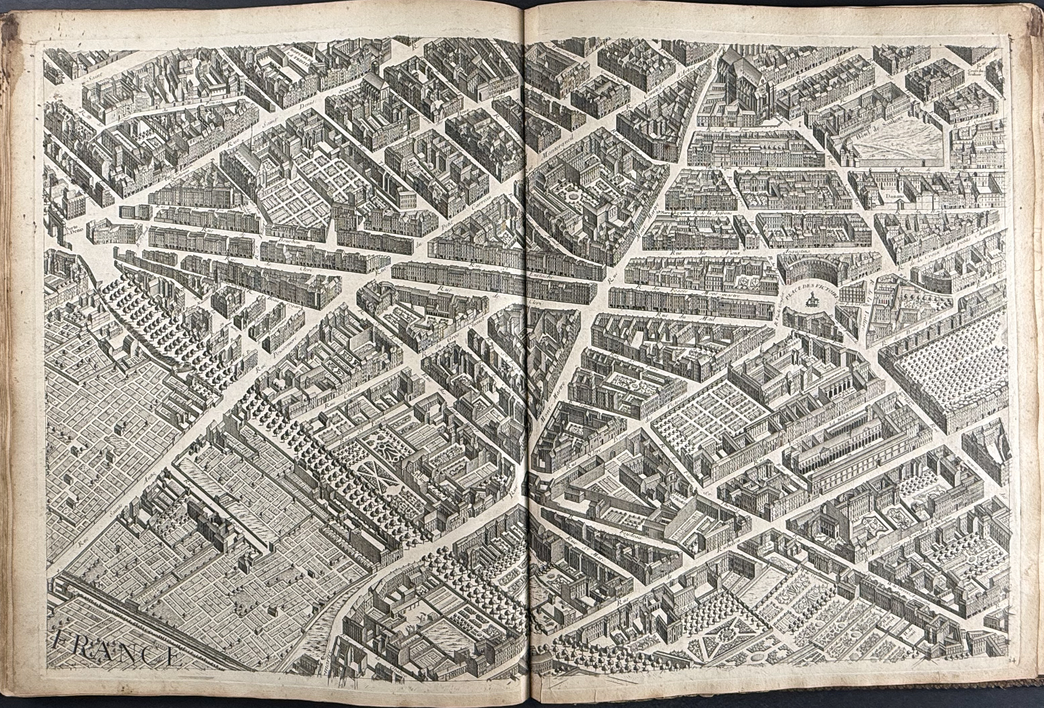
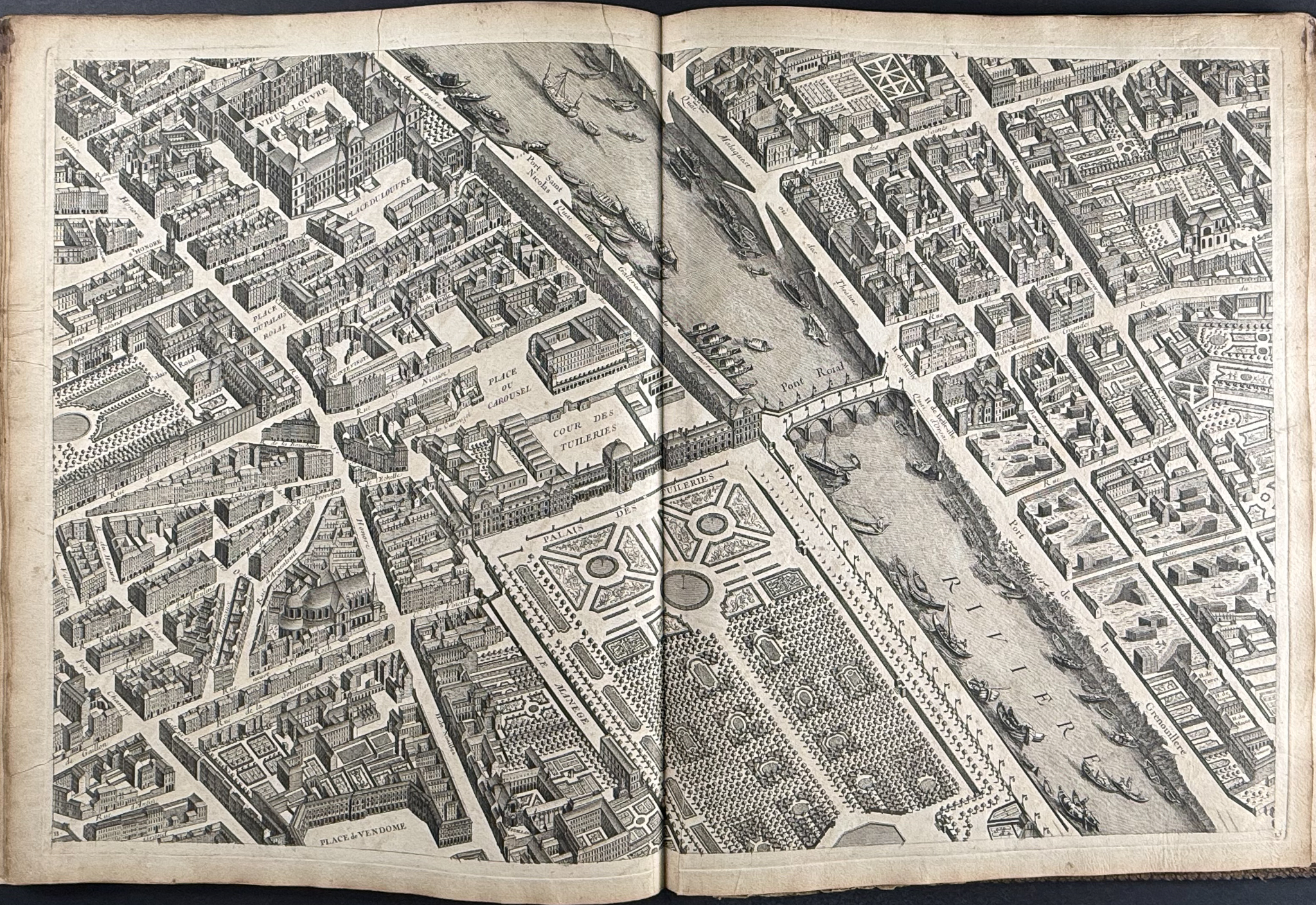
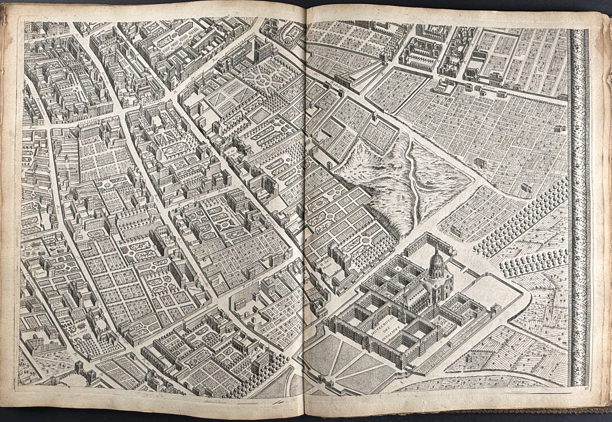
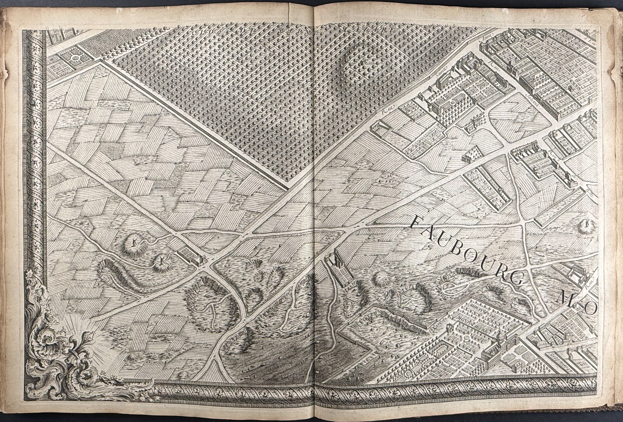
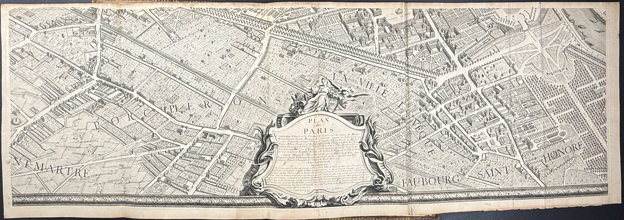
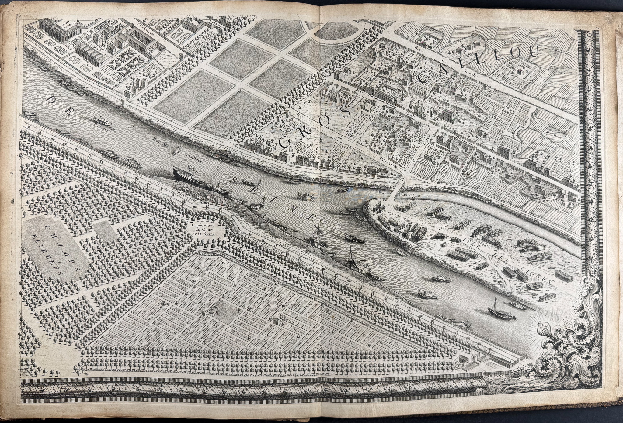
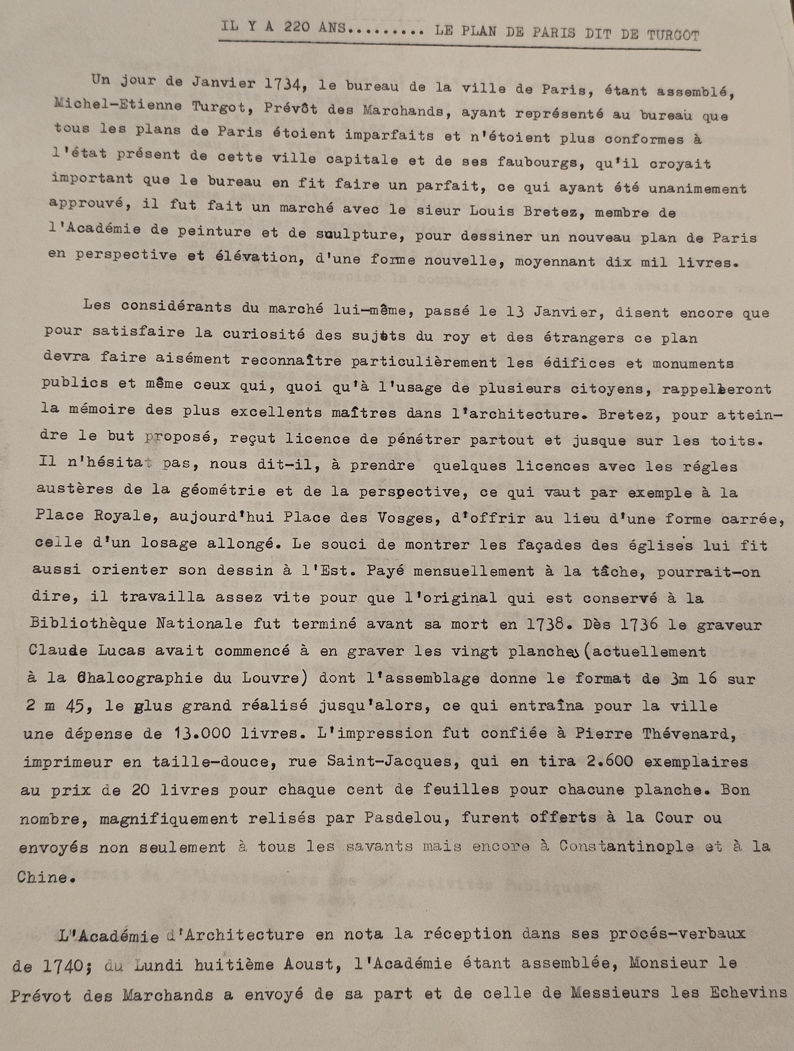
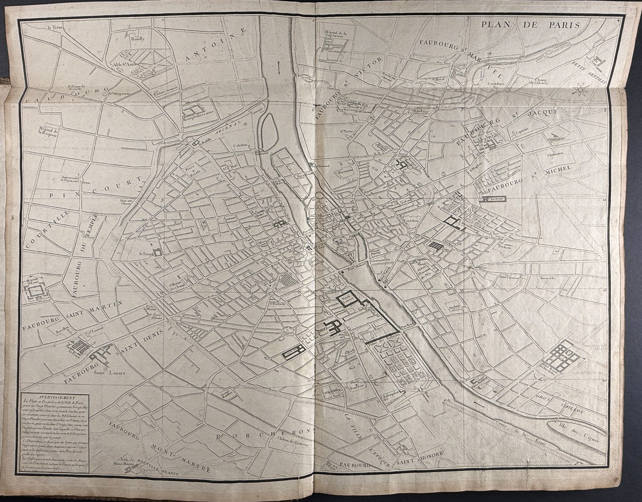
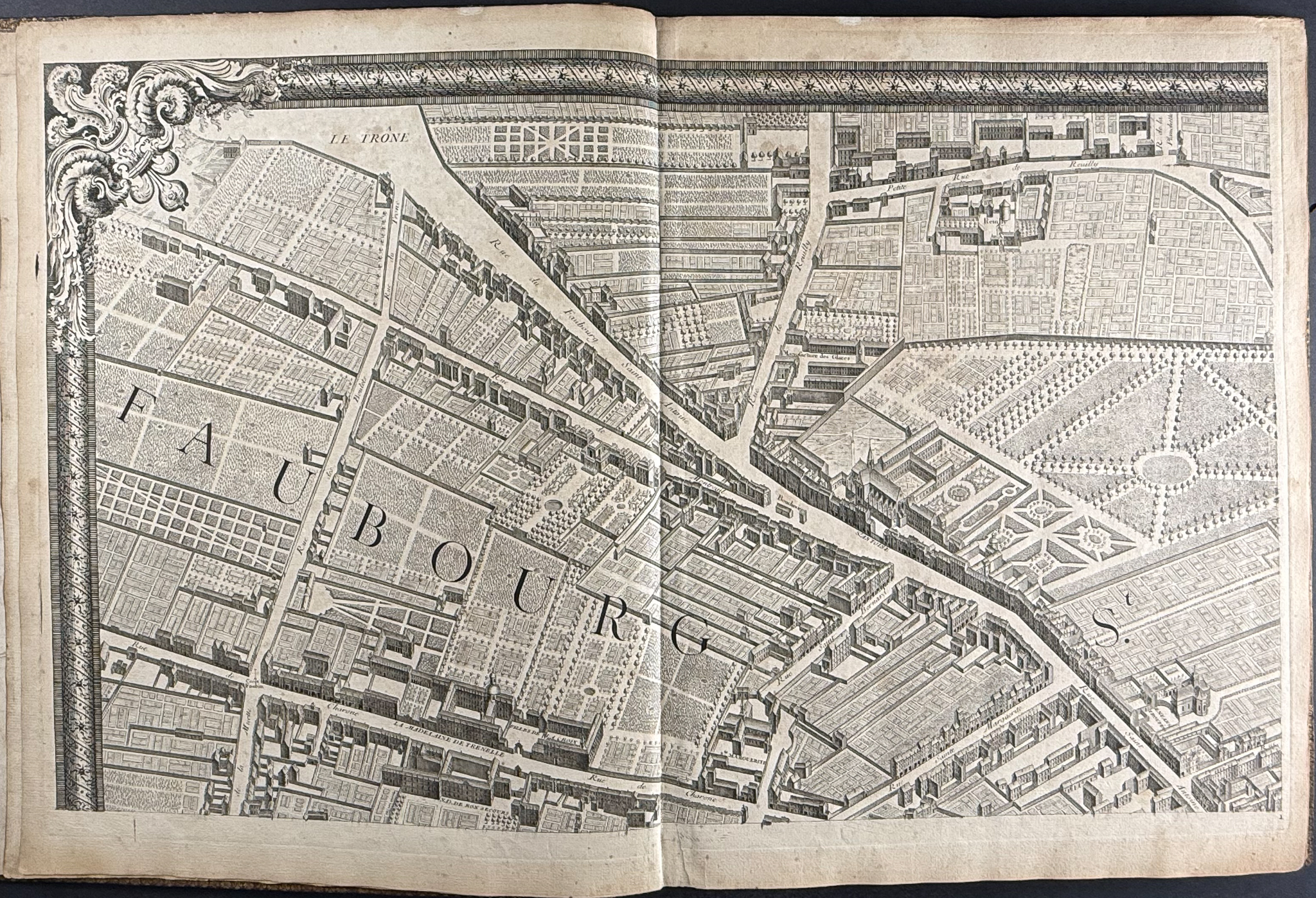
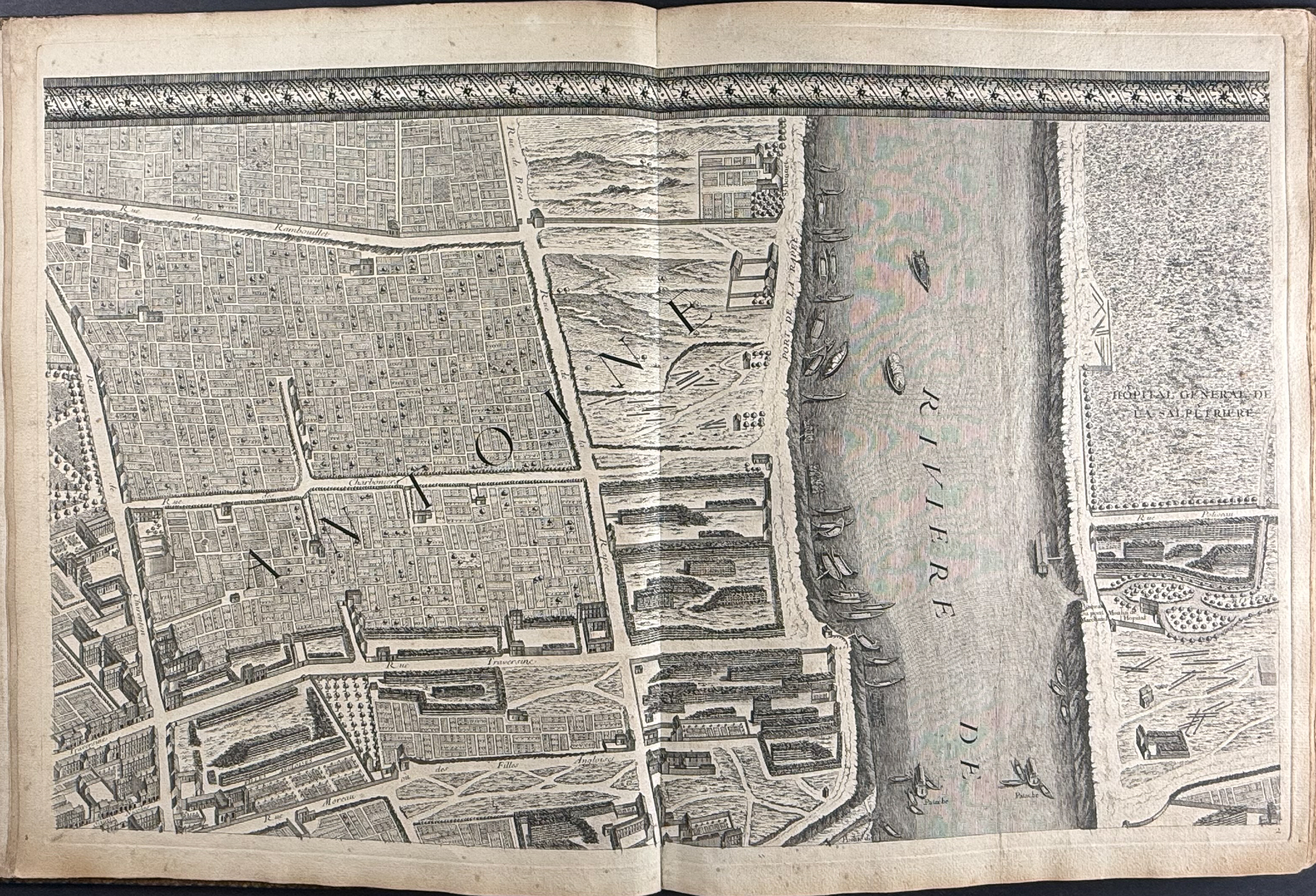
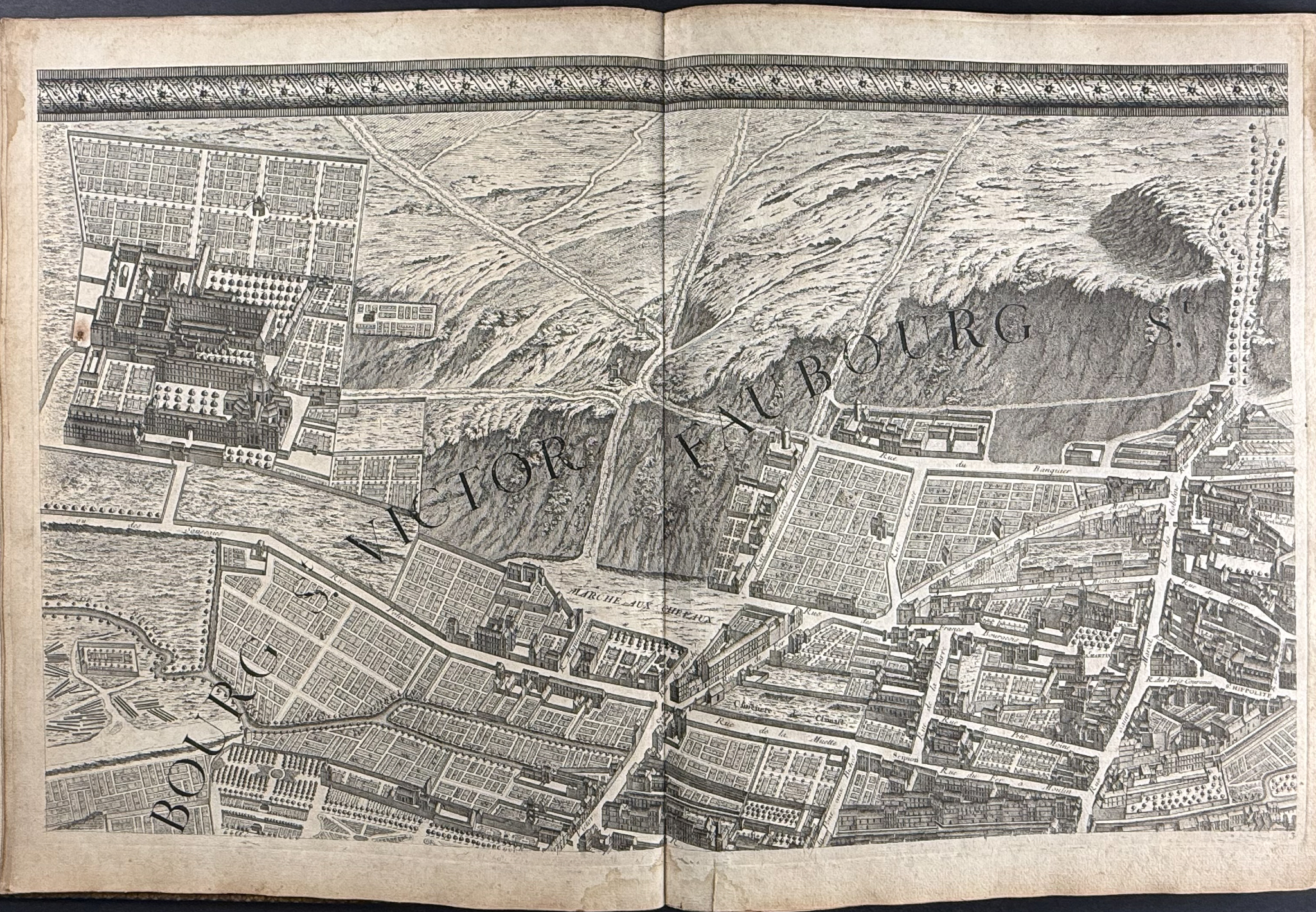
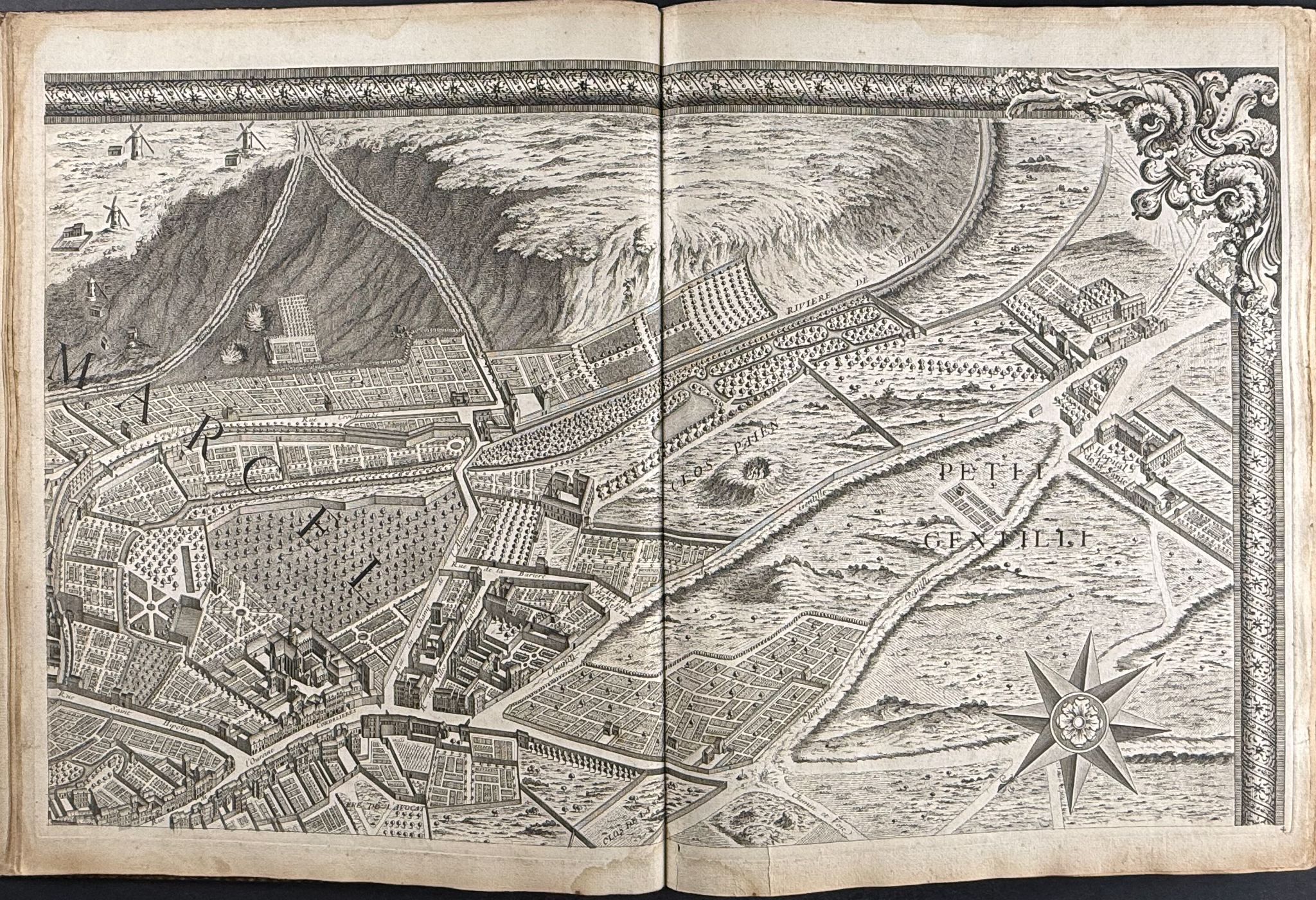
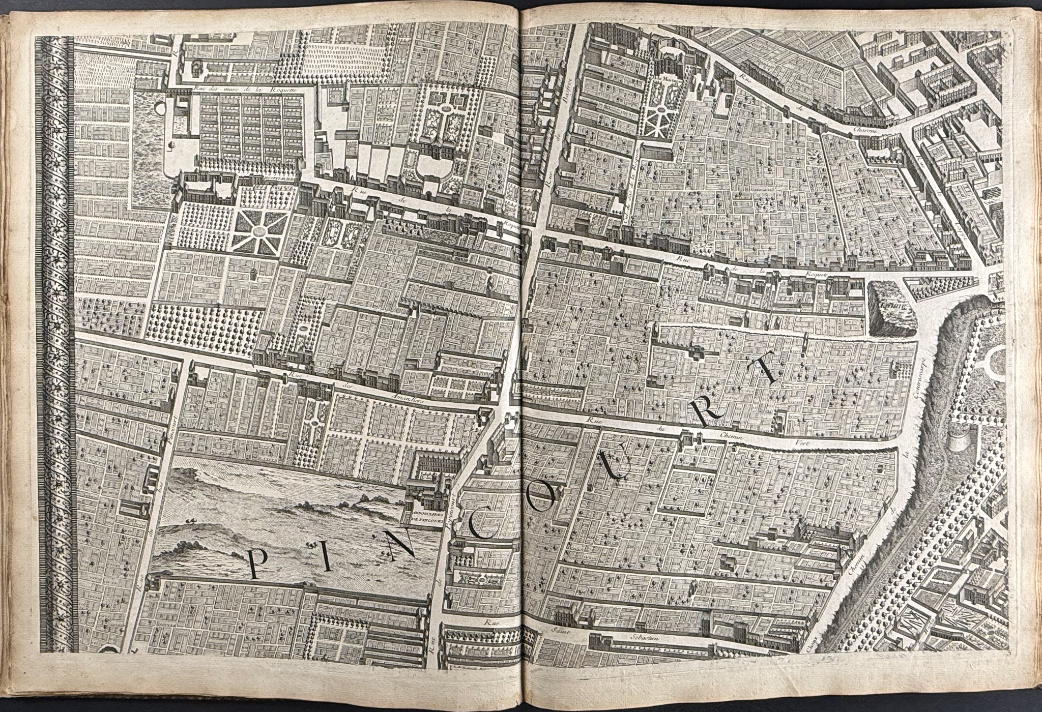
This extraordinary large format map of Paris in 19 double-page engravings if Michel-Etienne Torgot, Louis Bretez, & Claude Lucas’s
Plan de Turgot or
Plan de Paris. The map was published in Paris in 1739.
This is a scarce map to find complete, and one of the finest maps of Paris ever completed. It is a truly expansive urban mapping, and remarkably impressive for the age. It captures Paris before the re-design in the 19th century by Baron Georges Eugène Haussmann. This was "the first all-comprising graphical inventory of the capital, down to the last orchard and tree, detailing every house and naming even the most modest cul-de-sac." (Blom, Enlightening the World..)
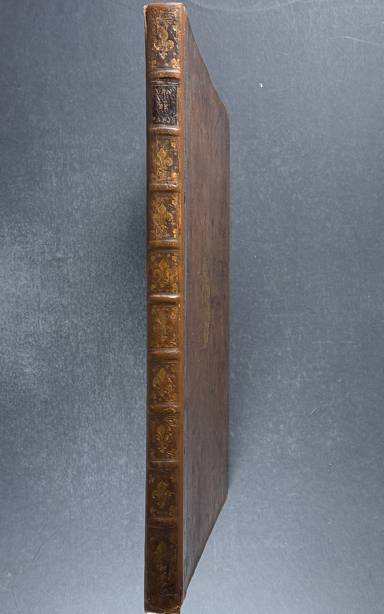
The series of engravings is bound in full calf with gold gilt detailing to boards and spines. The map is comprised of 19 fold out engravings, one of which is double fold out. It also includes the engraved advertisement plan of Paris.
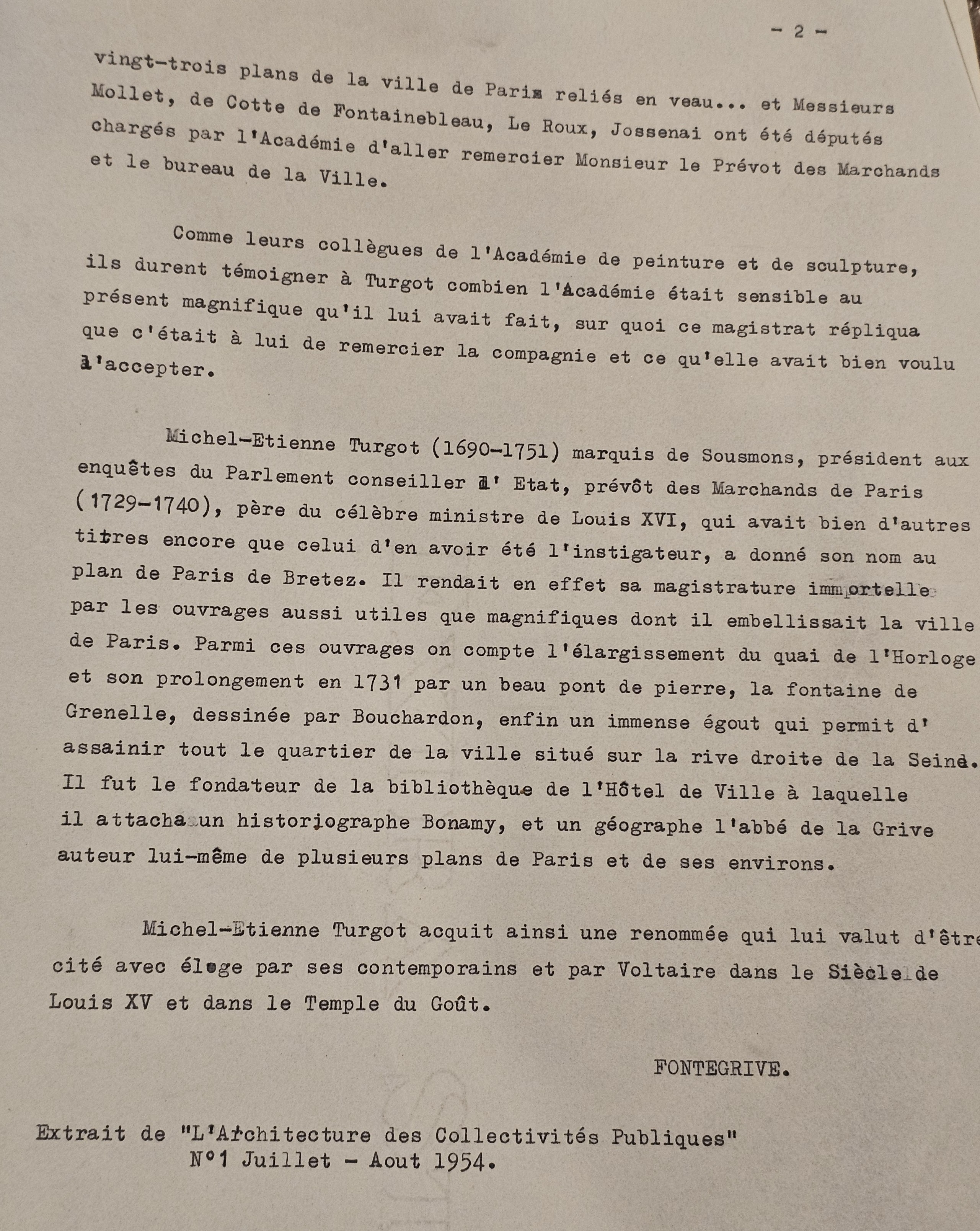
Michel-Etienne Torgot (1690-1751) was a French magistrate and businessman. He held the office of Prevôt des Marchands de Paris. He commissioned Louis Bretez and Claude Lucas to produce the map. They were granted permits to entire every building in Paris, and it took nearly five years to complete the survey and assemble the map.
Paper Size: Book ~ 17 1/2" by 22"; Advertisement Plan ~ 32 7/8" by 25 5/8"; Fold Out Plan Pages ~ 32 1/2" by 21 3/4"; Double Fold Out ~ 64 1/2" by 21 1/2"; Fully assembled this will measure approximately ~ 8′ by 10′ or 2.4 by 3 meters
Paper Type or Special Features: Extraordinary Large Scale Map of Paris in 19 Parts Bound in Full Calf
Condition report:
The work is in very good to excellent condition overall. There are two couple plates with some staining at the corners. There may be a few minor imperfections or faint marks or fox marks to be expected with age. Please review the image carefully for condition and contact us with any questions.
Share this lot: