
Antique Maps & Prints of Natural History, Botanicals, & More
Lot 7841:
Description
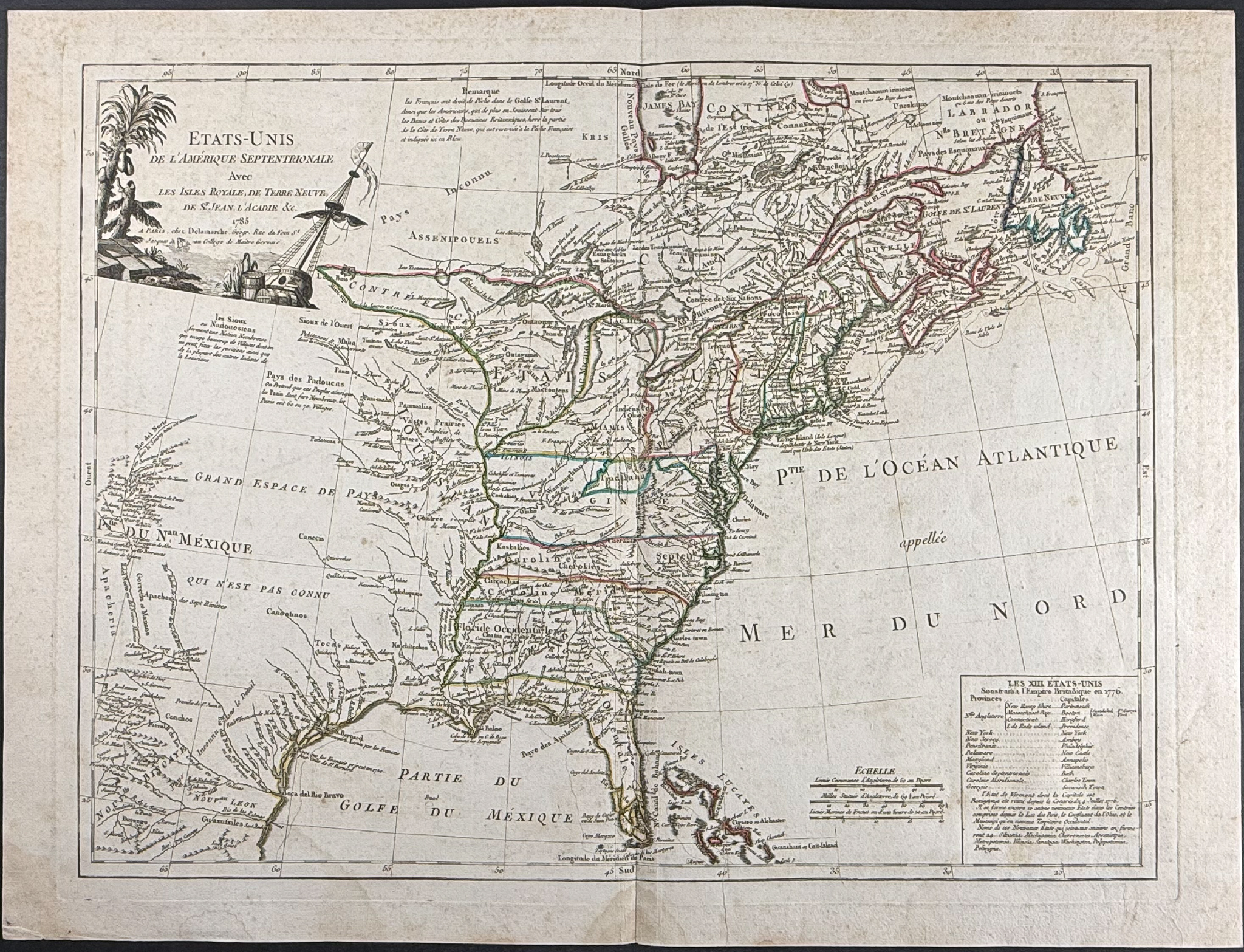
This historic map of North America is by Gilles Robert de Vaugondy and was entitled
Etats-Unis de l’Amerique Septentrionale avec les Isles Royale, de Terre Neuve and part of his
Atlas Universel. It was published in Paris in 1786 by Charles-Francois Delamarche.
The map depicted the newly independent United States of America. The boundaries were newly established before the publication of the map by the terms of the Treaty of Paris of 1783. It also describes the ten new states proposed in Jefferson’s Ordinance of 1784. It depicts along the Atlantic coast from Labrador to the Bahamas, reaching westward across the Louisiana Territory to the Rio del Norte (Rio Grande).
Paper Size: ~ 28 1/2" by 21 1/2" (Fold Out)
Paper Type or Special Features: Engraving
Condition report:
The work is in very good to excellent condition overall. There is some staining to the margins / edges. There may be some faint offset due to the fold out nature of the plate. There may be a few minor imperfections or faint marks or fox marks to be expected with age. Please review the image carefully for condition and contact us with any questions.
Share this lot: