
Antique Prints, Maps, & Books of Natural History, Botanicals, & More
Lot 7615:
Description
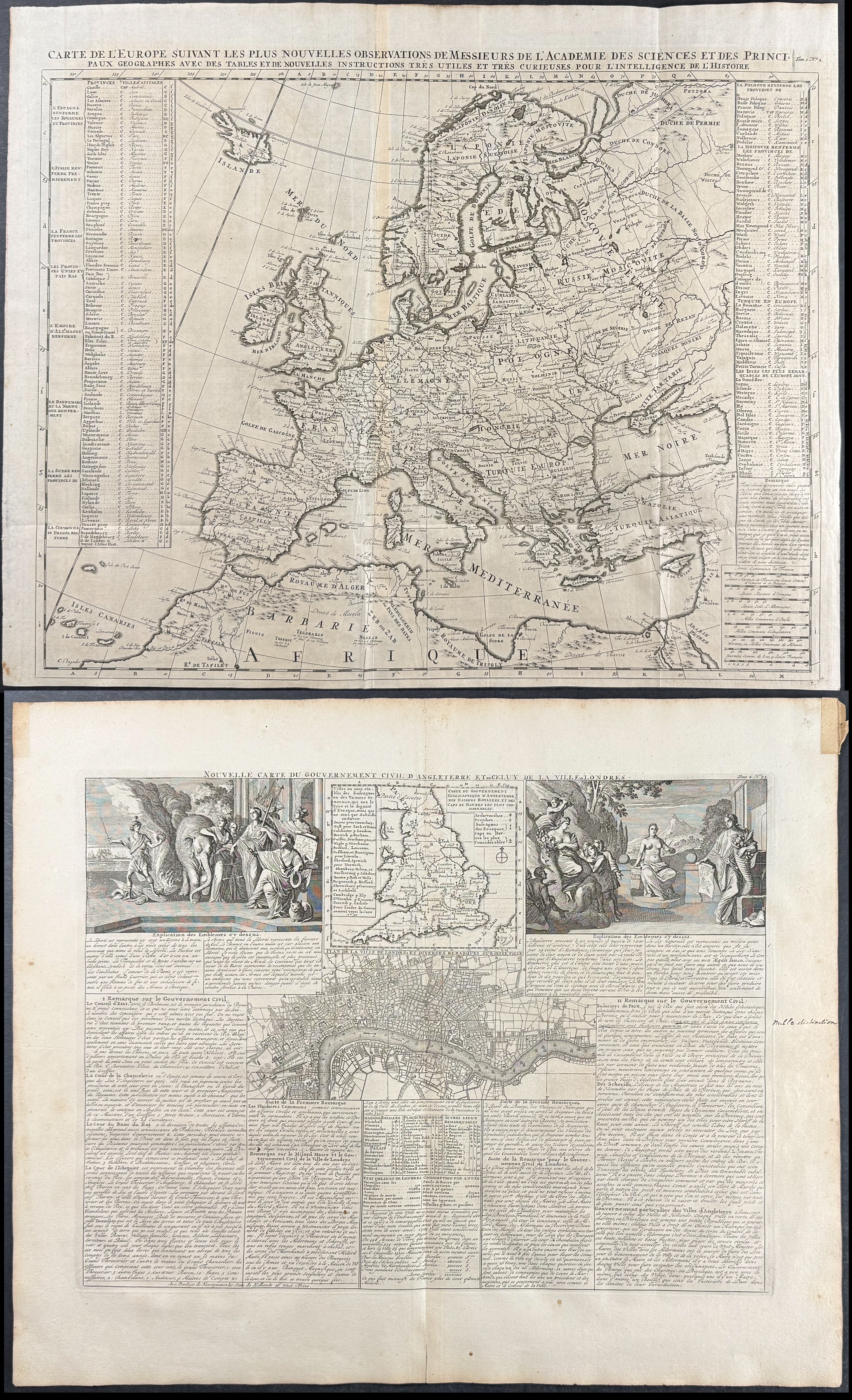
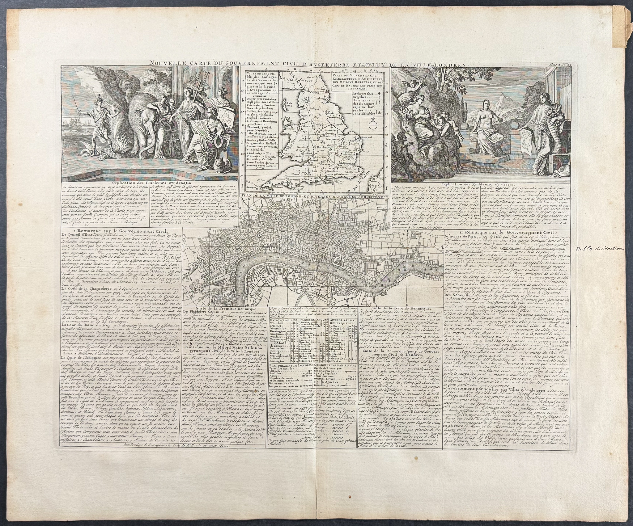
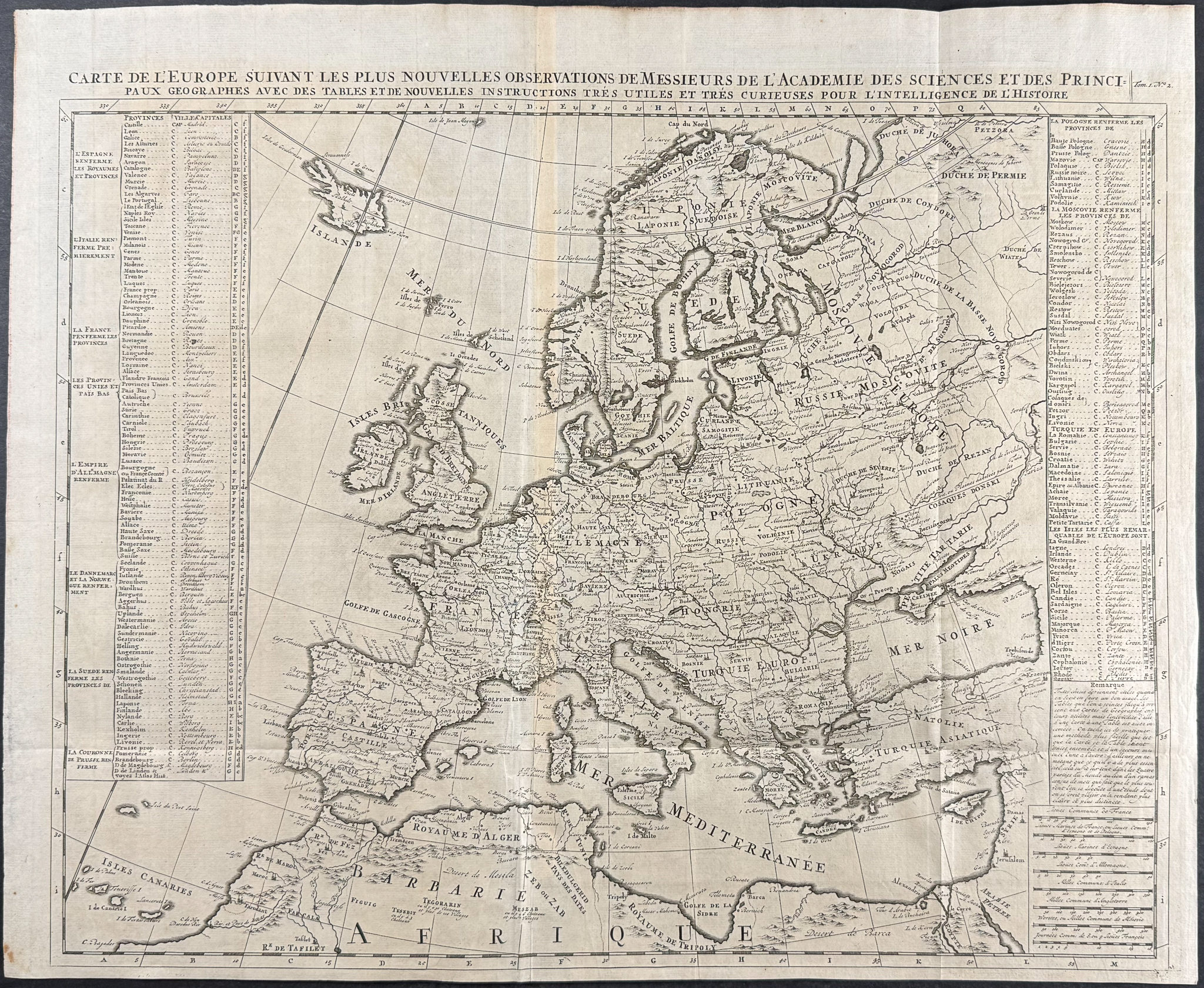
This historic engraving is from Henri Abraham Chatelain’s
Atlas Historique. The work was published by the author in Amsterdam between 1718 and 1720.
The text was compiled by Gueudeville & Garillon. The maps were completed by Chatelain with some influenced by Guillaume de l’Isle’s work.
Atlas Historique was a highly ambitious and groundbreaking work covering genealogy, cosmography, topography, heraldry, and chronology. It was intended for the general public and the increased fascination with the recently conquered colonies and the new discoveries. Chatelain’s maps are an outstanding example of the golden age of French mapmaking.
Paper Size: ~ 22" by 18 1/4" (Fold Out) & ~ 24 3/4" by 20 1/4" (Fold Out)
Paper Type or Special Features: Engraving
Condition report:
The work is in very good to excellent condition overall. There is some separation of the paper at the lower fold of the England plate. There may be some archival tape at verso of folds. There may be a few minor imperfections or faint marks to be expected with age. Please review the image carefully for condition and contact us with any questions.
Share this lot: