
Antique Prints, Maps, & Books of Natural History, Botanicals, & More
Lot 6835:
Description
Included in this lot:
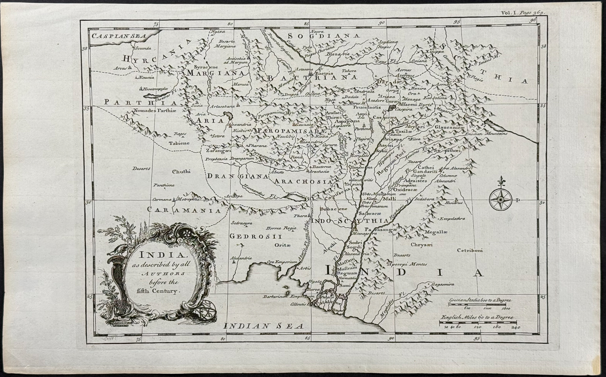
Map of India
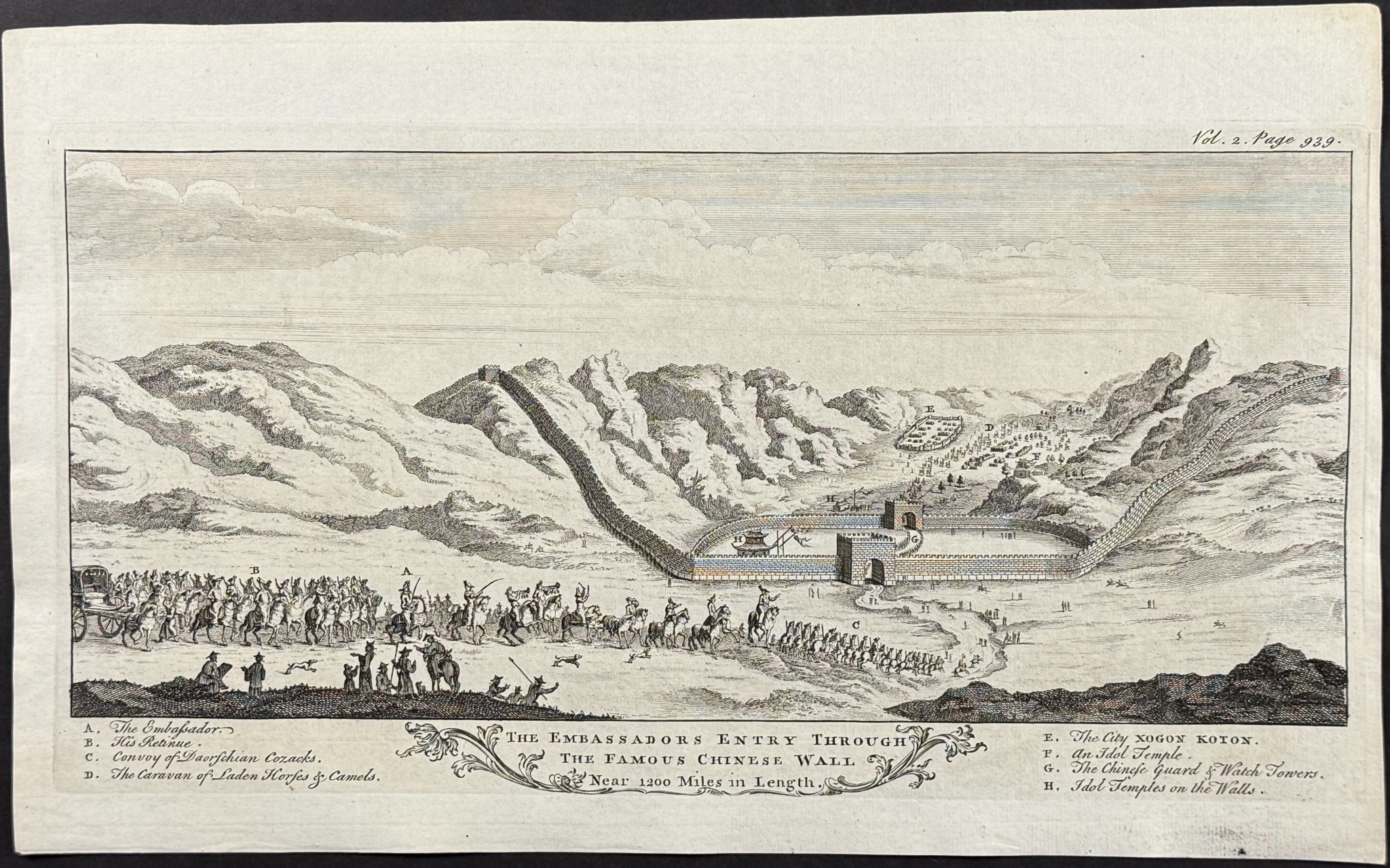
The Embassadors Entry through the Famous Chinese Wall (Great Wall of China), Near 1200 Miles in Length
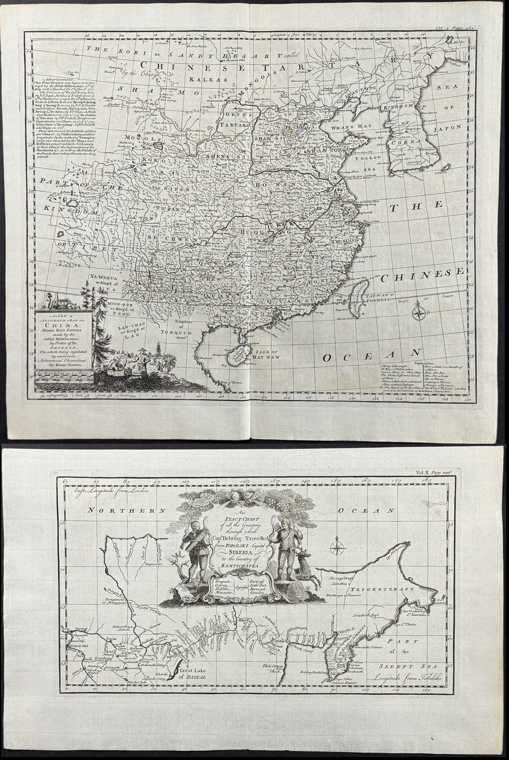
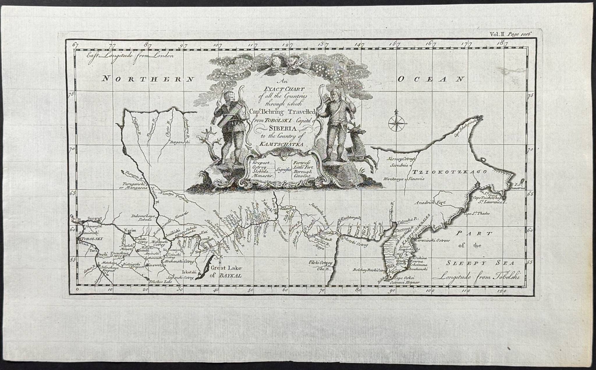
An Exact Chart of all the Countries through which Captain Behring Travelled from Tobolski, Capital of Siberia, to the Country of Kamtschatka
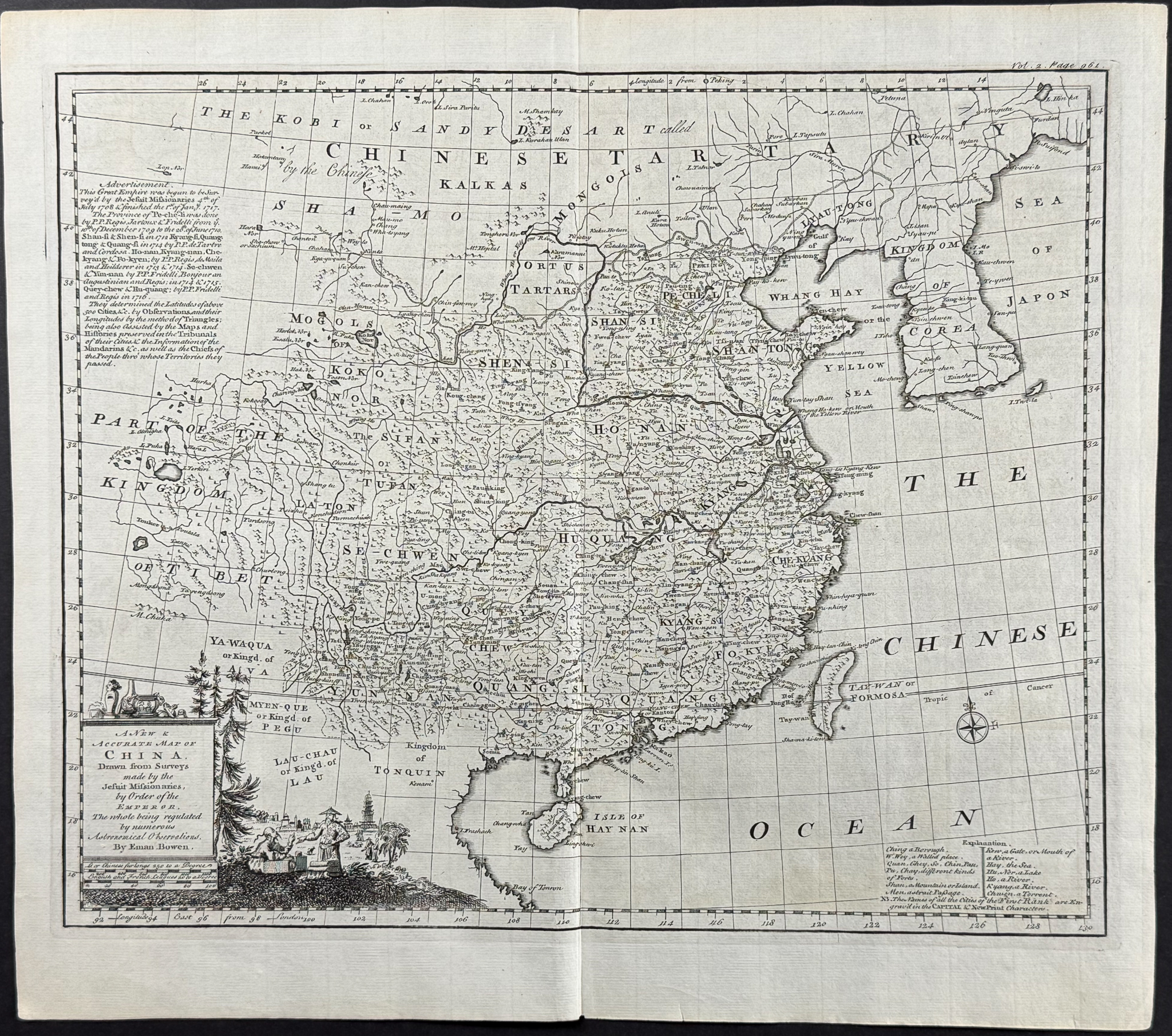
A New & Accurate Map of China
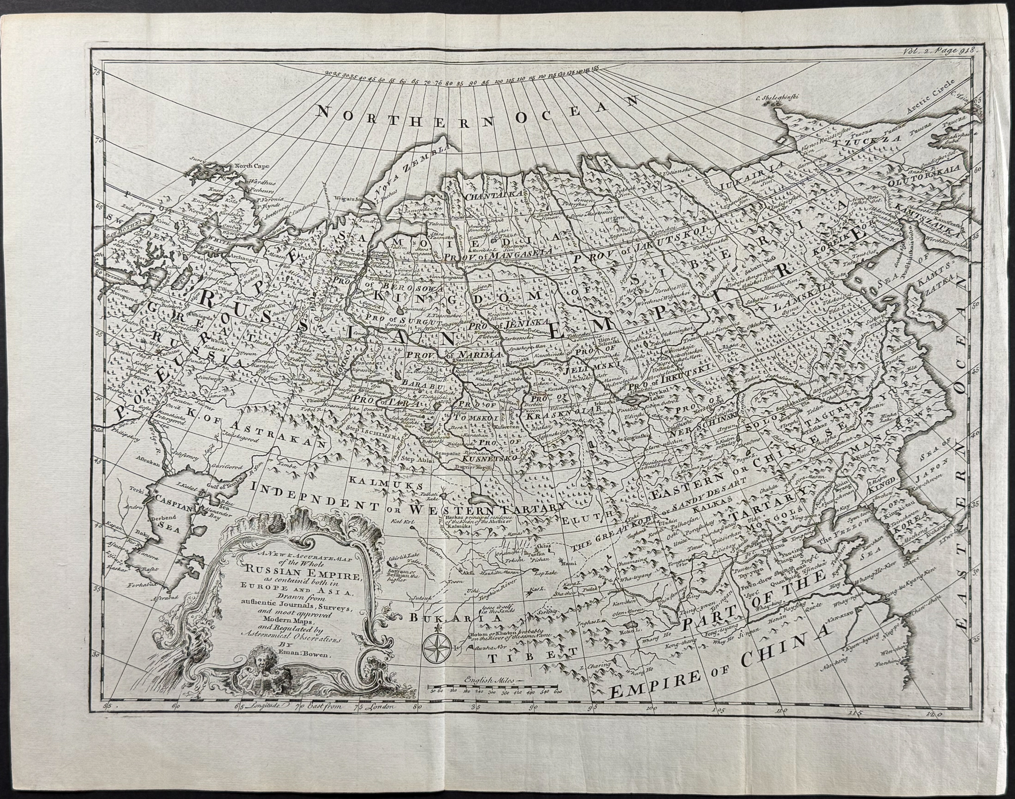
A New & Accurate Map of the Whole Russian Empire (Europe & Asia)
Description of the work:
This fascinating engraving is from John Harris’s
Navigantium atque Itinerantium Bibliotheca. Or, a Complete Collection of Voyages and Travels… The maps included in this work were mostly completed by Emanuel & Thomas Bowen. This is the second edition of the work was published in London for T. Woodward between 1744 and 1748.
"A collection of all known voyages … [Navigantium atque itinerantium bibliotheca] is valuable for the original impressions of the fine series of maps by Herman Moll, including a very good one of America. Also there is one of the world according to Mercator’s projection, with improvements, showing the northern coast line and part of the west and south coasts of Australia together with parts of Tasmania and New Zealand. Among voyages included are those of Magellan, Drake, Cavendish, Schouten, Hawkins, Narbrough, and Dampier." (Hill)
Paper Size: ~ 9 3/4” by 15 3/4”; ~ 18” by 16” (Fold Out); ~ 20 1/4” by 16” (Fold Out)
Paper Type or Special Features: Engraving
Condition report:
The work is in very good to excellent condition overall. The plates can exhibit some minor offset or imperfections to be expected with age. Some of the plates will have faint toning at the folds. Please review the image carefully for condition and contact us with any questions.
Share this lot: