
Antique Prints, Maps, & Books of Natural History, Botanicals, & More
Lot 6433:
Description
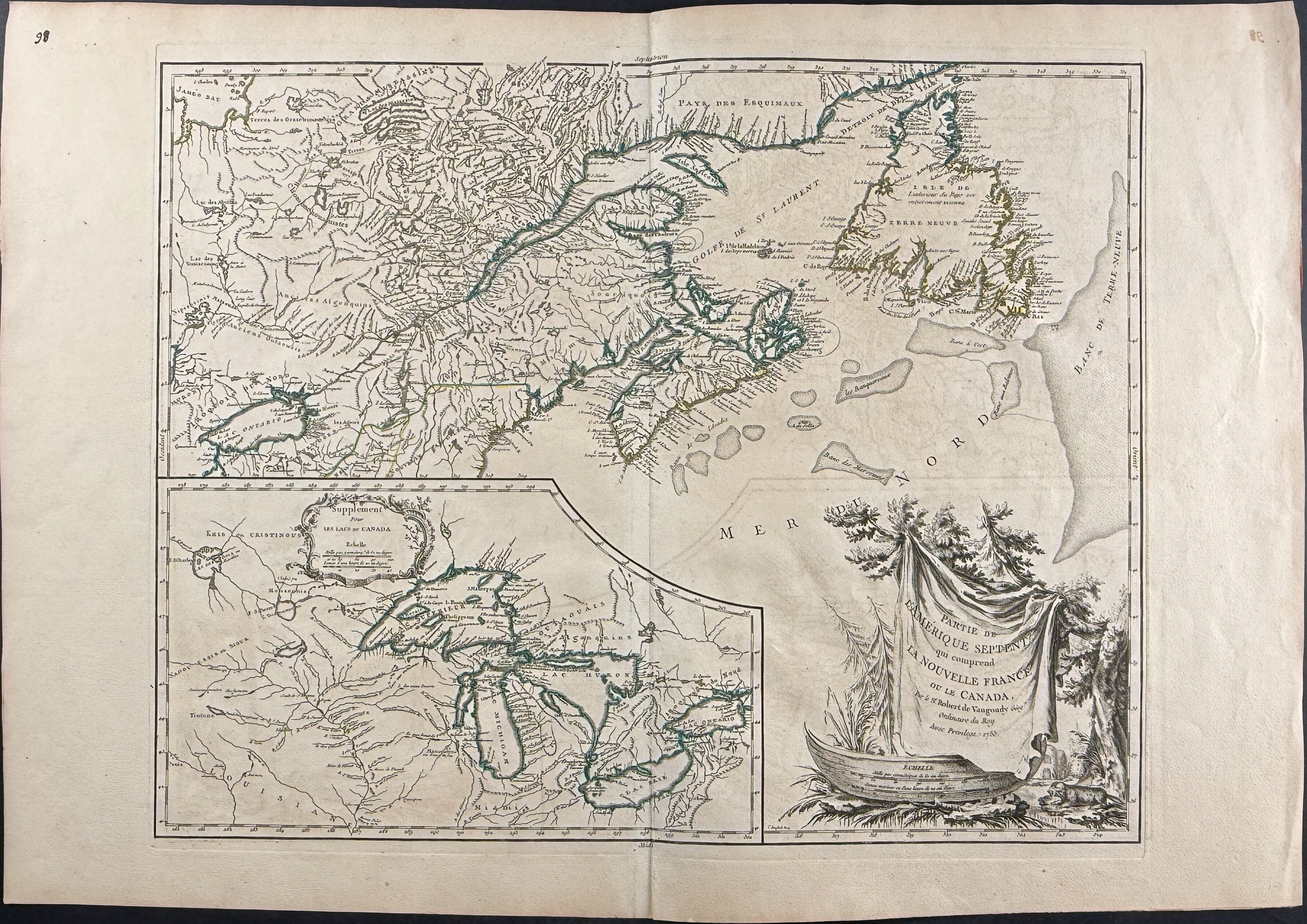
This historic map is from Gilles Robert de Vaugondy and entitled
Partie de l’Amerique septent[rionale] qui comprend la Nouvelle France ou le Canada It was published in
Atlas Universel. It was published in Paris in 1755 by Didier and Gilles Robert de Vaugondy.
The map details the region from James Bay to Newfoundland and westward to Lake Ontario.
Atlas Universel was one of the most precise French atlases produced in the 18th century. This map was published during the French and Indian War and reflects French territorial claims in North America. In 1755, the year of the map’s publication, the British captured Fort Beausejour on the border between Nova Scotia and Acadia and soon ordered the expulsion of the Acadians. The British colonial government struggled in Nova Scotia following several disastrous campaigns in 1757, including a failed expedition against Louisbourg and the siege of Fort William Henry. Between 1758 and 1760, British forces launched a campaign to capture French Canada, seizing surrounding territories and ultimately capturing Quebec in 1759. The following year, the British succeeded in the Montreal campaign, after which France ceded Canada under the Treaty of Paris (1763).
Paper Size: ~ 31 1/2" by 21 3/4" (Fold Out)
Paper Type or Special Features: Engraving
Condition report:
The work is in very good to excellent condition overall. There may be some faint offset due to the fold out nature of the plate. There may be a few minor imperfections or faint marks or fox marks to be expected with age. Please review the image carefully for condition and contact us with any questions.
Share this lot: