
Antique Prints, Maps, & Books of Natural History, Botanicals, & More
Lot 6431:
Description
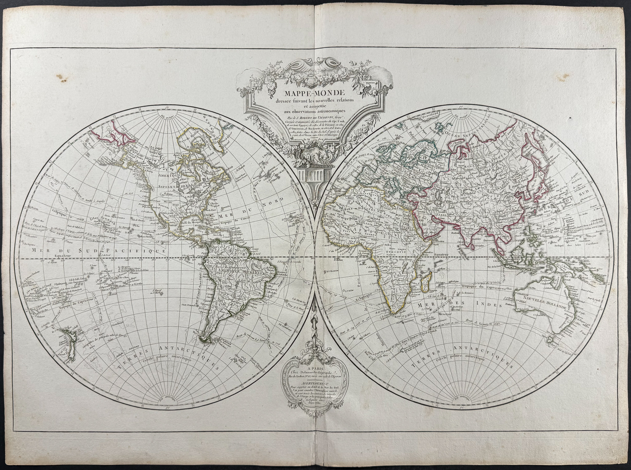
This historic map is from Didier Robert de Vaugondy and entitled
Mappe-Monde dressée suivant les nouvelles relations et assujettie aux observations astronomiques […] The map was published in Paris by Charles-Francois Delamarche in 1804.
It’s a beautiful double hemisphere world map, up to date with the latest discoveries. It incorporated findings from the three voyages of Captain James Cook in the Pacific, Count La Perouse’s 1801 expedition to Vancouver, and Mackenzie’s 1802 journey. It traced routes of numerous explorers including Tasman’s 1642 voyage, Admiral Anson’s 1743 route from Guam to the Philippines, the galleon Nuestra Senora de Cabadonga from 1778 to Manila, Taiwan, and China, and Captain Cook’s 1776 route. The map is further enriched with information drawn from the travel accounts of Tasman, Le Maire, St. Louis, Vaisseaux, Anson, Cabadonga, and others.
Paper Size: ~ 30 1/4" by 22 1/4" (Fold Out)
Paper Type or Special Features: Engraving
Condition report:
The work is in very good to excellent condition overall. There is some light wear or handling at or near the center fold. There is some minor foxing and small marginal splits along the central fold. There may be some faint offset due to the fold out nature of the plate. There may be a few minor imperfections or faint marks or fox marks to be expected with age. Please review the image carefully for condition and contact us with any questions.
Share this lot: