
Antique Prints, Maps, & Books of Natural History, Botanicals, & More
Lot 6077:
Description
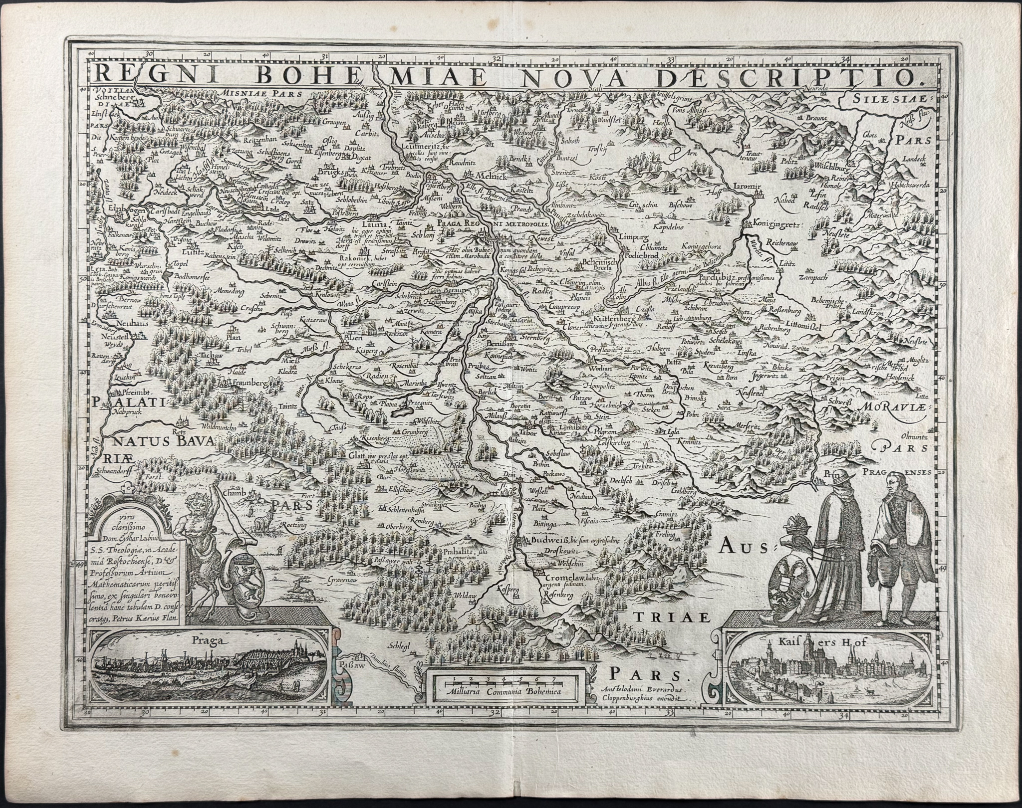
This historic map is from a composite atlas. It is from Pieter van den Keere and published in Amsterdam in the early 1600s.
The map features an inset view of Prague. Ther is a Latin dedication to Eilhard Lubinus, professor of mathematic at Rostock University. Petrus Kaerius Flan is noted in the lower left corner. In the lower right is a view of the Imperator’s (Kaisers Hof) residence in Prague with costumed couple and Imperial coat of arms. Keere based this map off of Ortelius’s map of Bohemia from 1570.
Pieter van den Keere (1571-1646) was a Dutch engraver and cartographer. He was also son of the printer, Henric van den Keere. He established his business in London after he fled Gent from religious persecution. Keere married the sister of Jodocus Hondius and further enhanced his skills through this relationship to the Hondius family. Keere would sell his plates to Jansson in 1621.
Paper Size: ~ 22 1/4" by 17 1/2" (Fold Out)
Paper Type or Special Features: Engraving
Condition report:
The work is in very good to excellent condition overall. There may be some faint offset due to the fold out nature of the plate. There may be a few minor imperfections or faint marks or fox marks to be expected with age. Please review the image carefully for condition and contact us with any questions.
Share this lot: