
Antique Maps & Prints of Natural History, Botanicals, & More
Lot 5671:
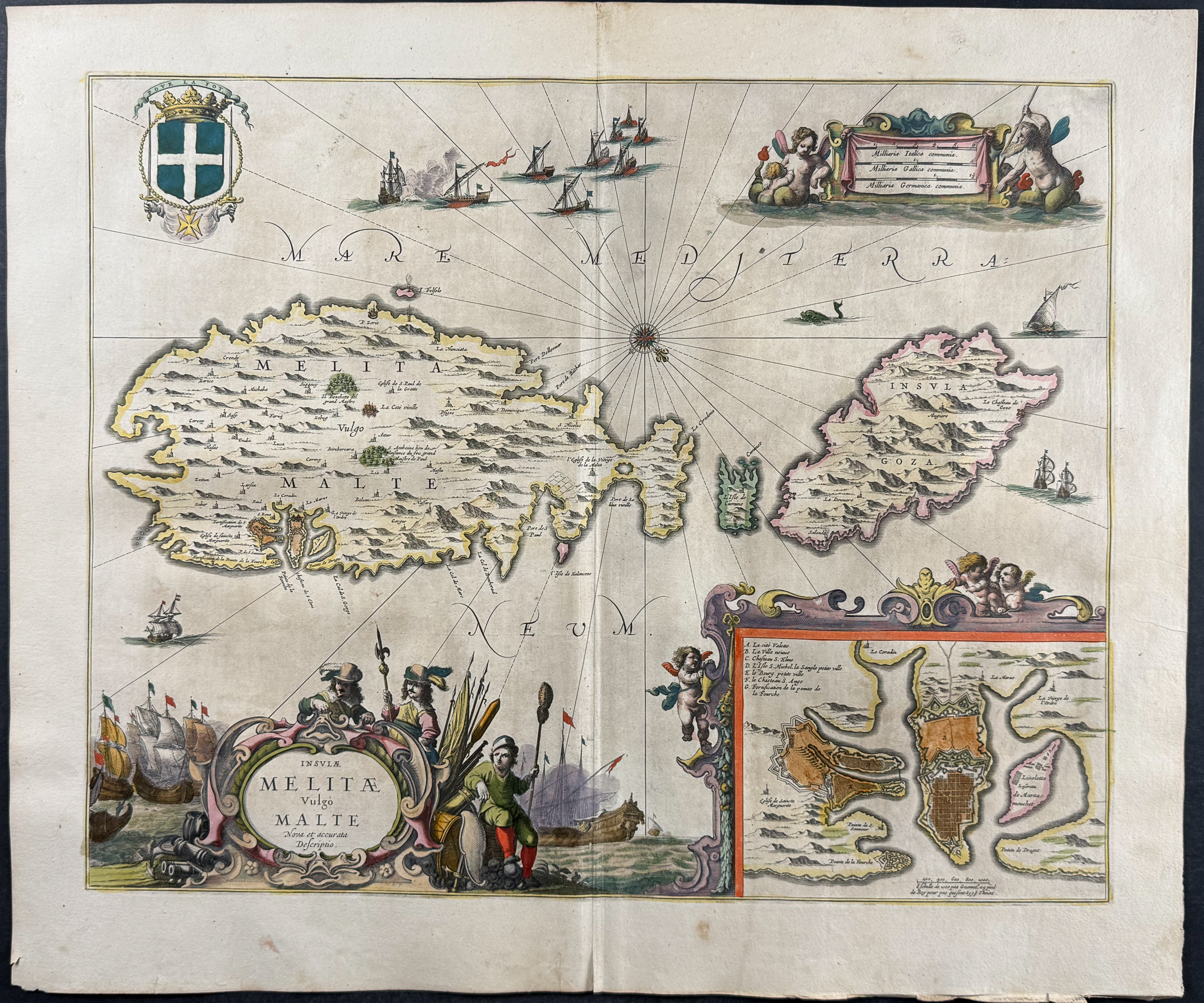
Description
This handsome, originally hand-colored map is from Jan Jansson’s
Novus Atlas, Das ist, Welt-beschreibung mit schonen newen auBfuhrlichen Taffeln inhaltende die Konigreiche und Lander des gantzen Erdreichs. This is the German edition of the work which was published in Amsterdam in 1656 by the author and Henricus Hondius. Hondius & Jansson were prominent cartographers at the height of the Golden Age of Dutch cartography.
Jan Janssonius (also known as Johann or Jan Jansson or Janszoon) (1588-1664) was part of an important family of Dutch publishers, printers, and booksellers. They were responsible for many important publications. Jan Jansson was a noted geographer in his own right. He married the daughter of another prominent mapmaker, Jodocus Hondius, and also worked with her brothers Henricus & Jodocus II.
Henricus Hondius (1597-1651) & Jodocus Hondius (1593-1629) were Dutch engravers and mapmakers. They learned the trade from their father, Jodocus Hondius, an engraver and geographer. He was involved with the republishing of Mercator’s atlas as well. The brothers worked closely together and took over their father’s engraving business. He would later start his own shop in 1621 where he would eventually partner with Jan Janssonius and continued publishing Mercator’s work where it would eventually be referred to as the Mercator-Hondius-Janssonius atlas.
Paper Size: ~ 23" by 19 1/2" (Fold Out)
Paper Type or Special Features: Originally Hand-colored Engraving
Condition report:
The work is in very good to excellent condition overall. There may be some faint offset due to the fold out nature of the plate. There may be a few minor imperfections or faint marks or fox marks to be expected with age. Please review the image carefully for condition and contact us with any questions.
Share this lot: