
Antique Maps & Prints of Natural History, Botanicals, & More
Lot 65405:
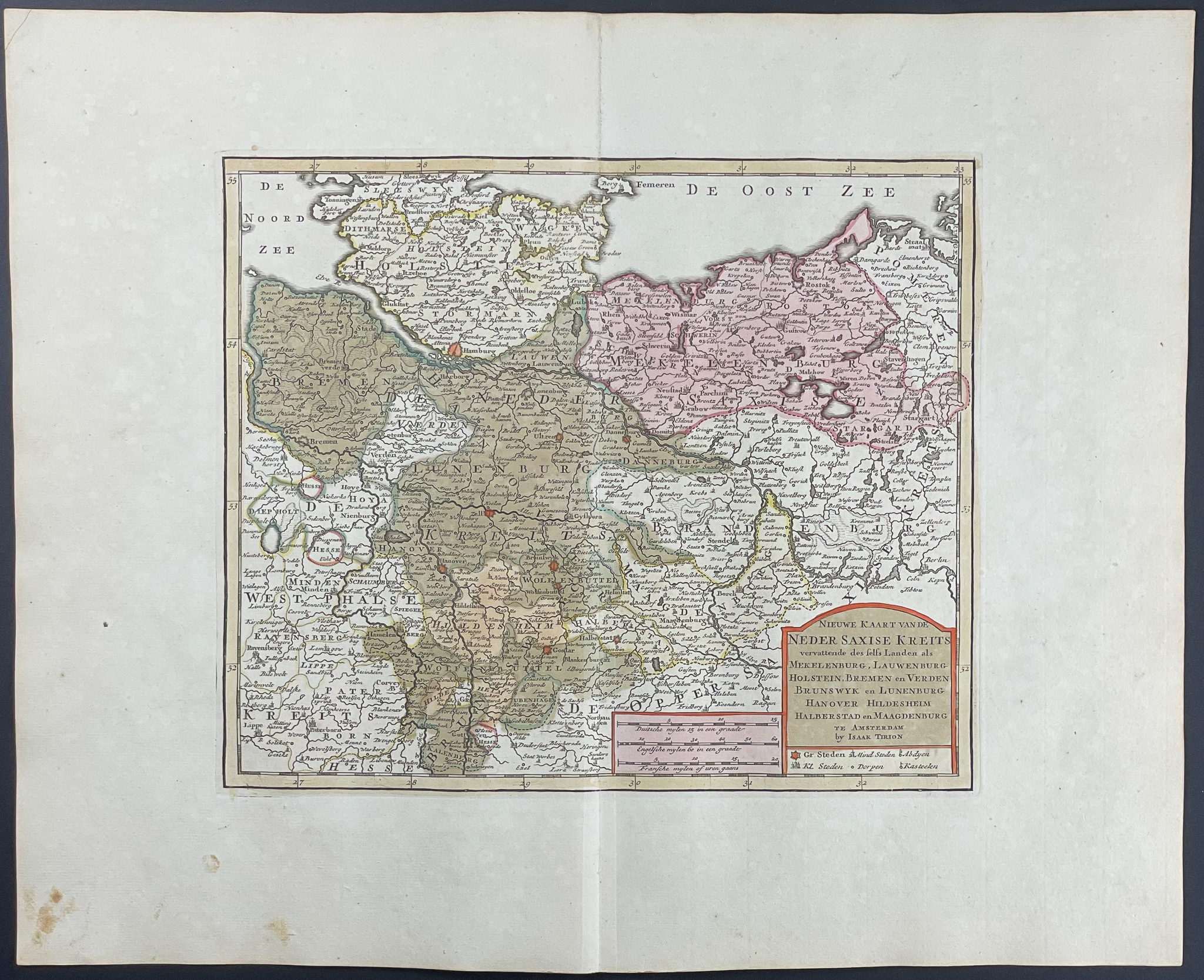
Description
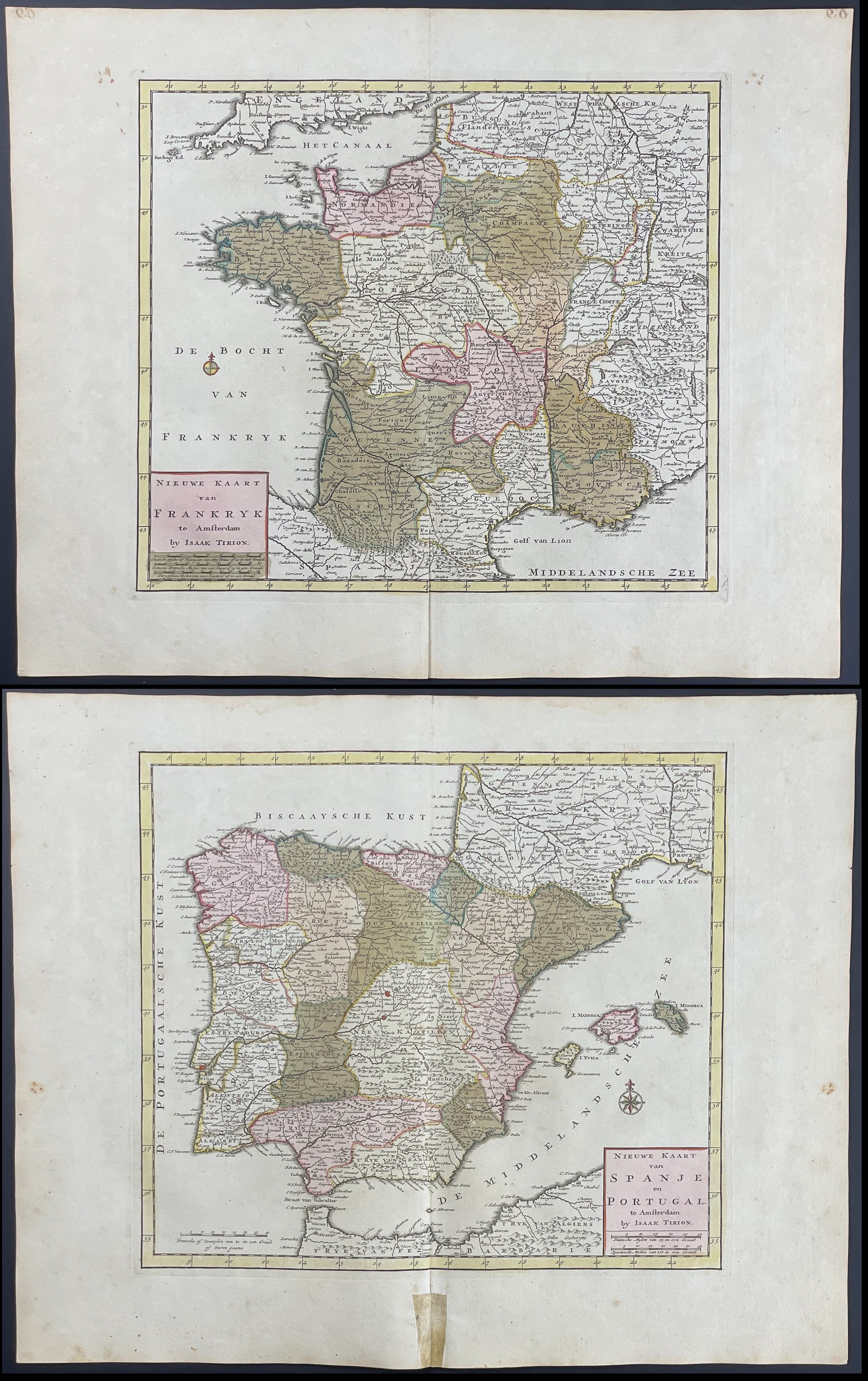
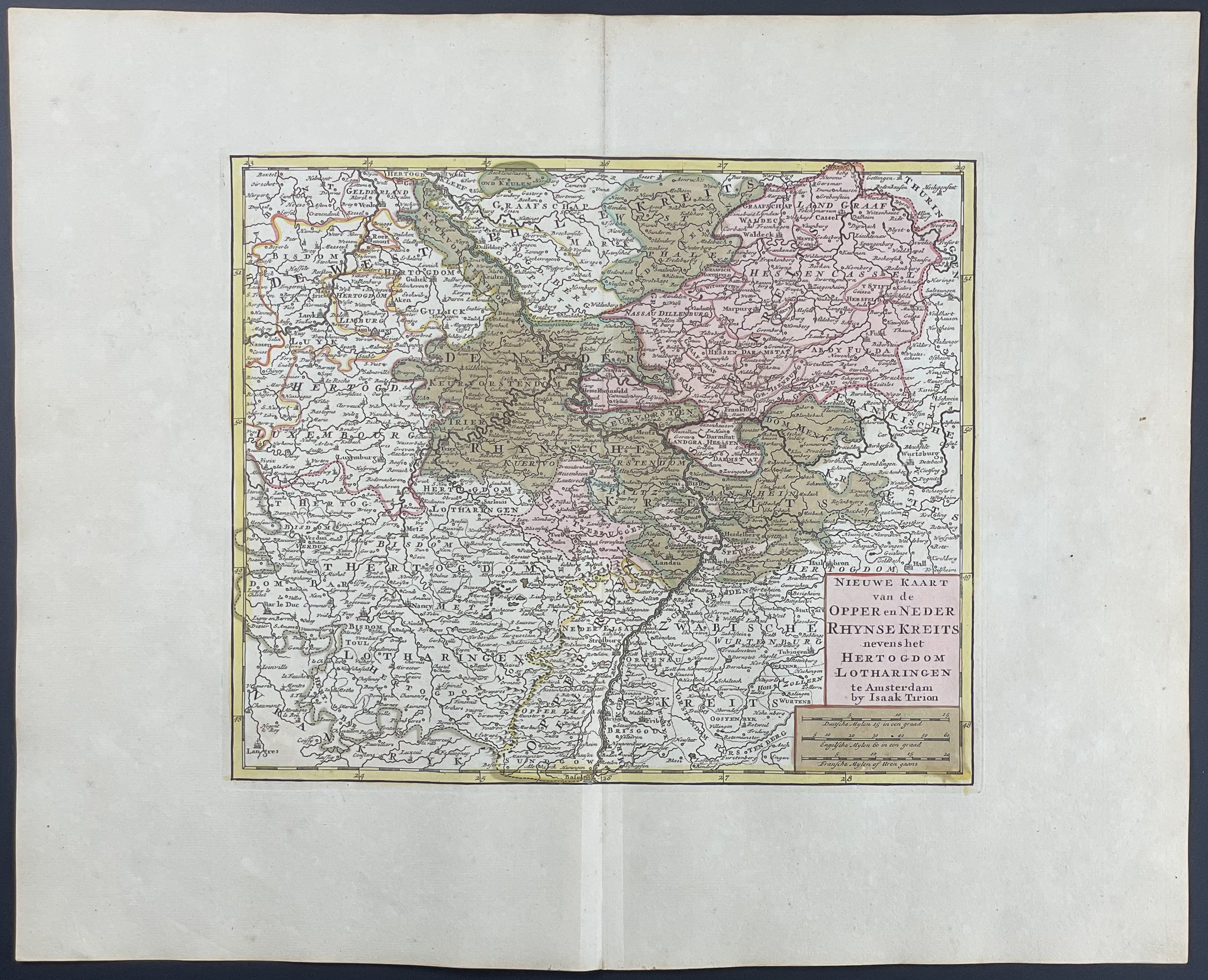
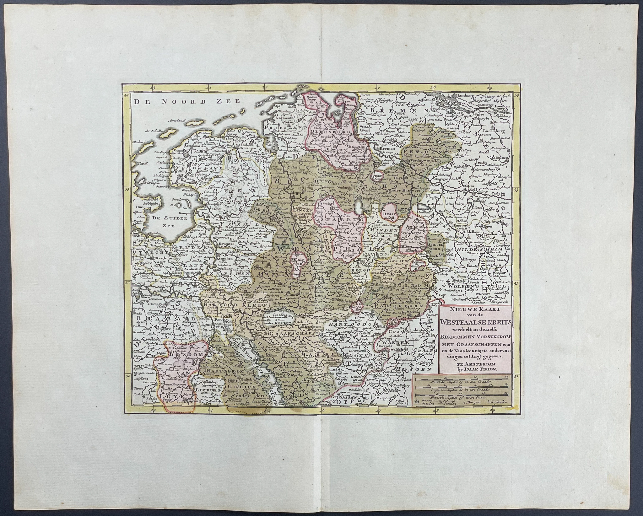
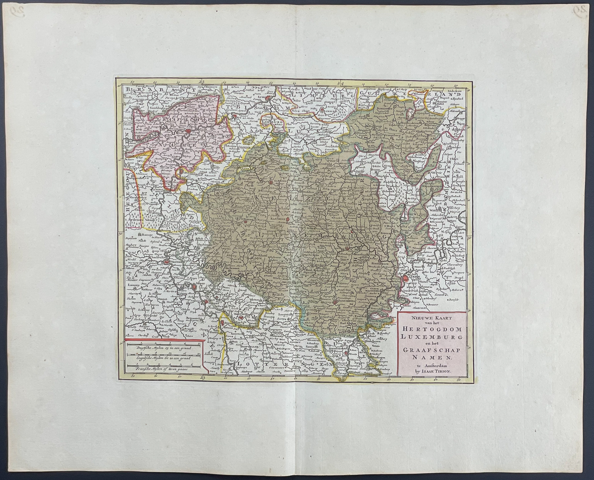
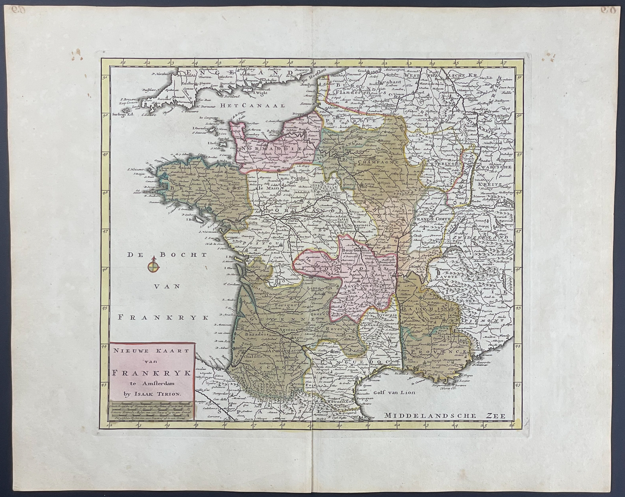
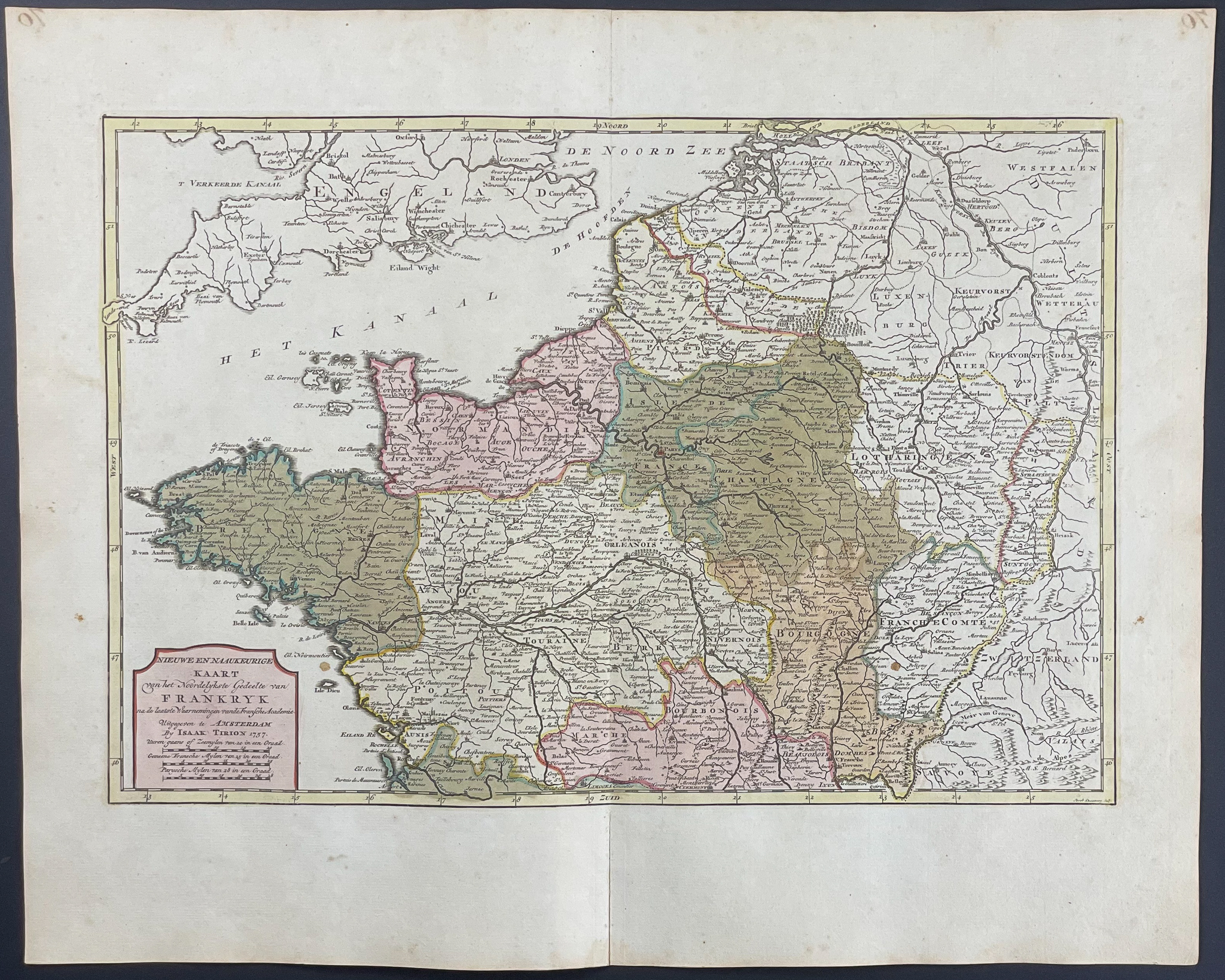
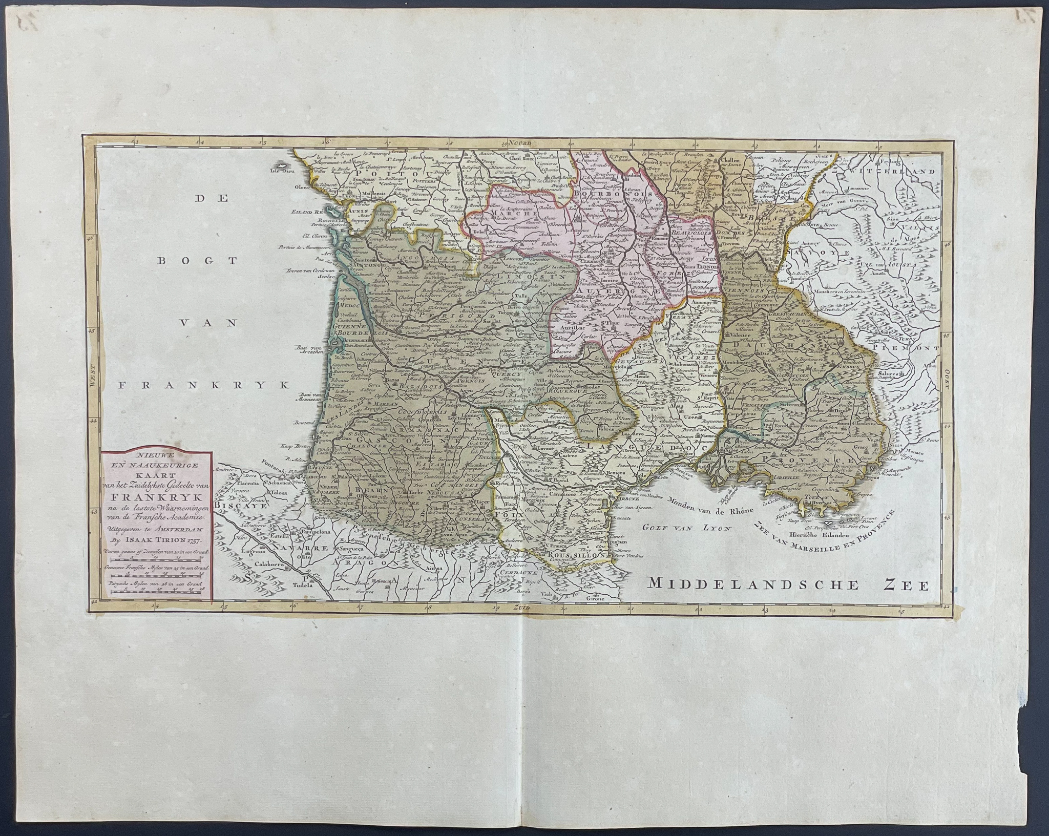
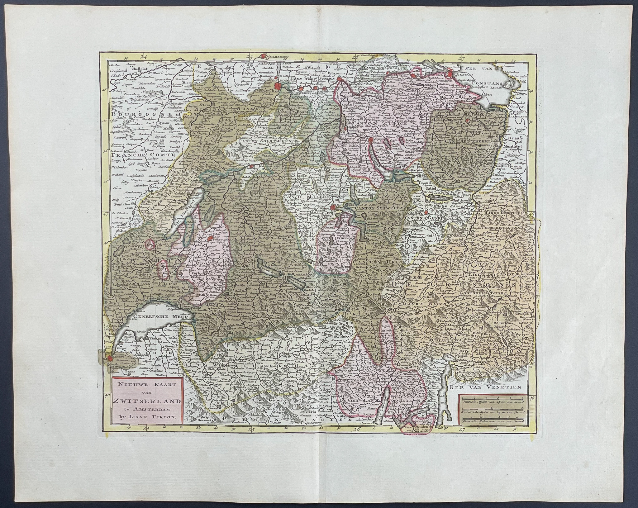
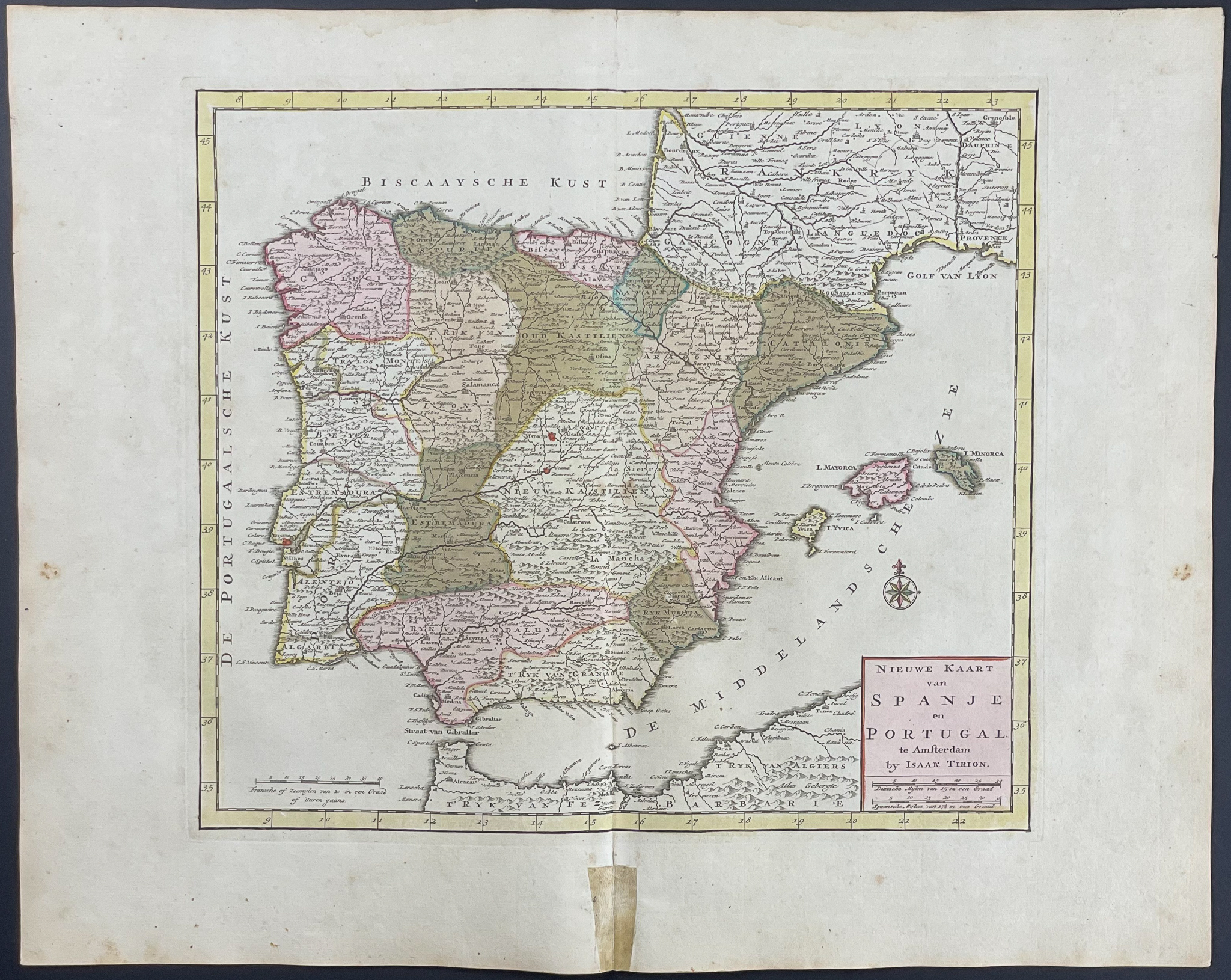
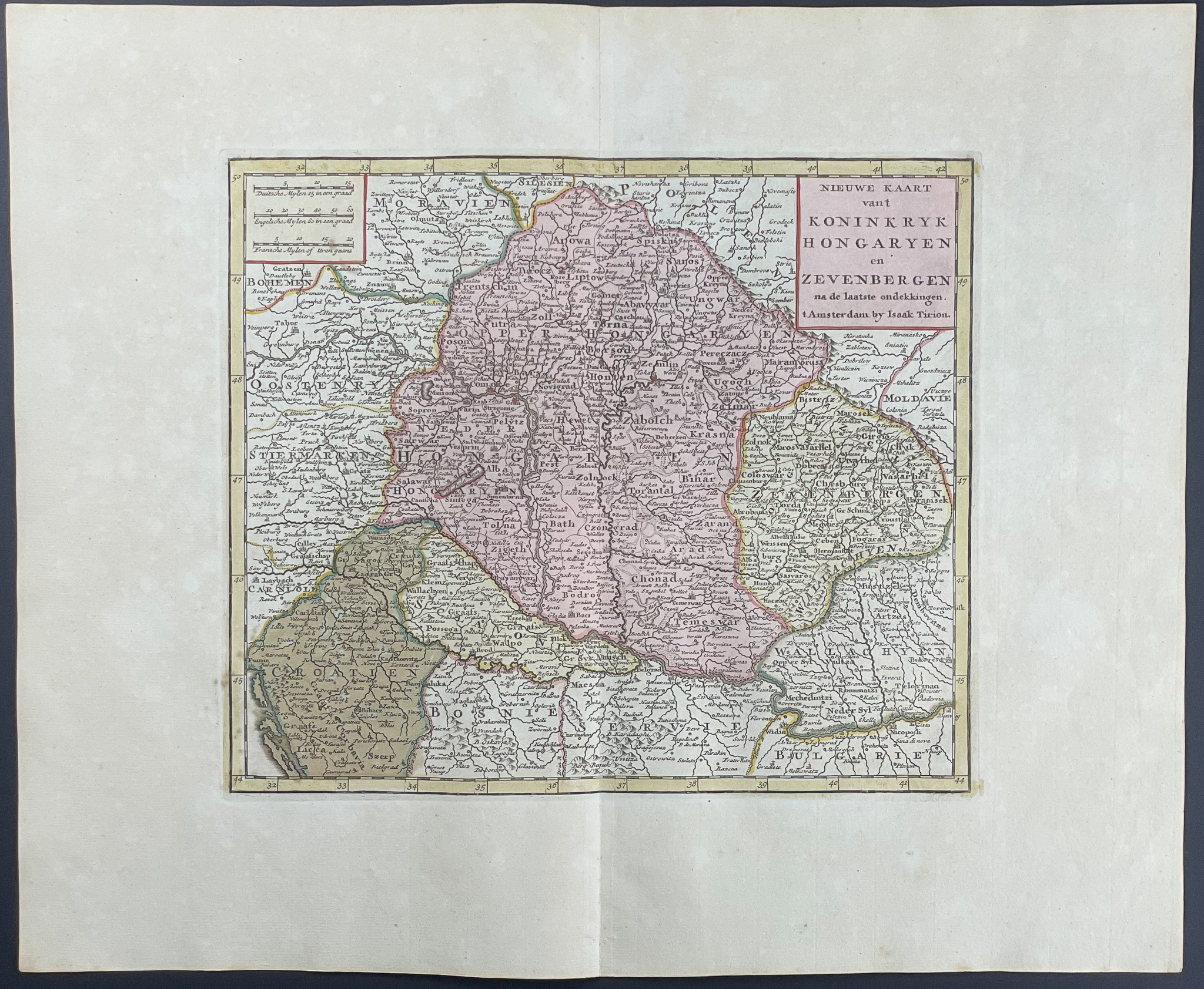
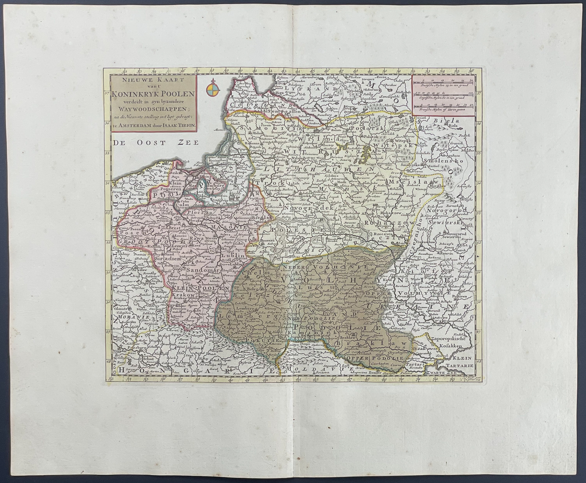
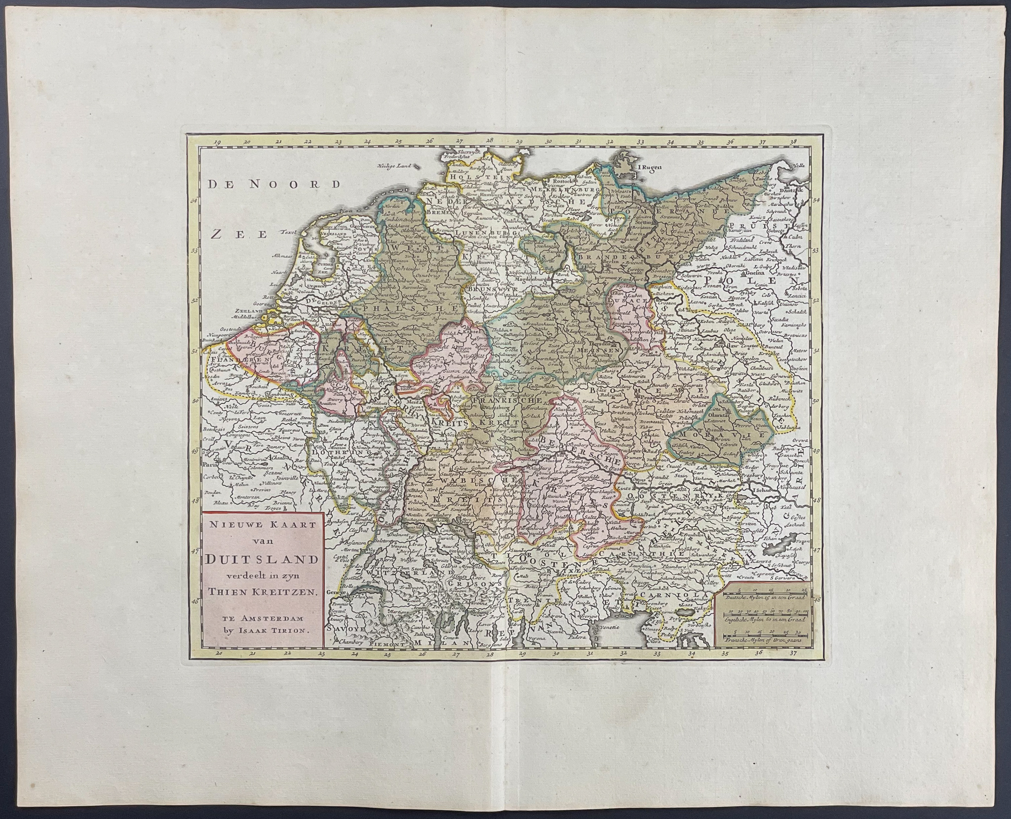
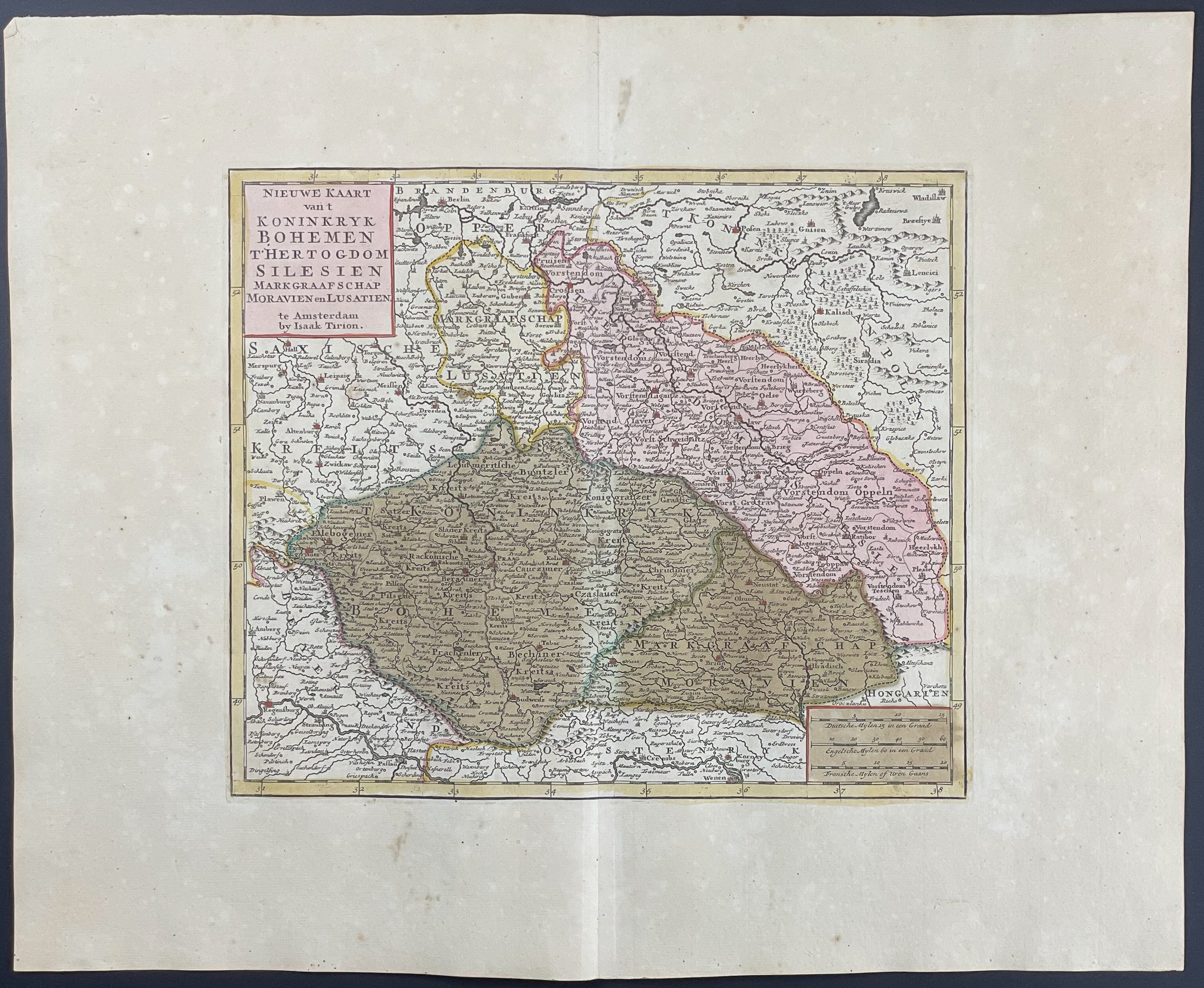
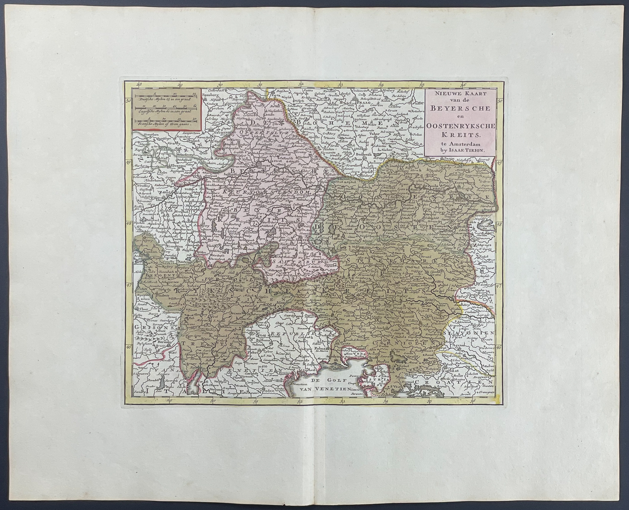
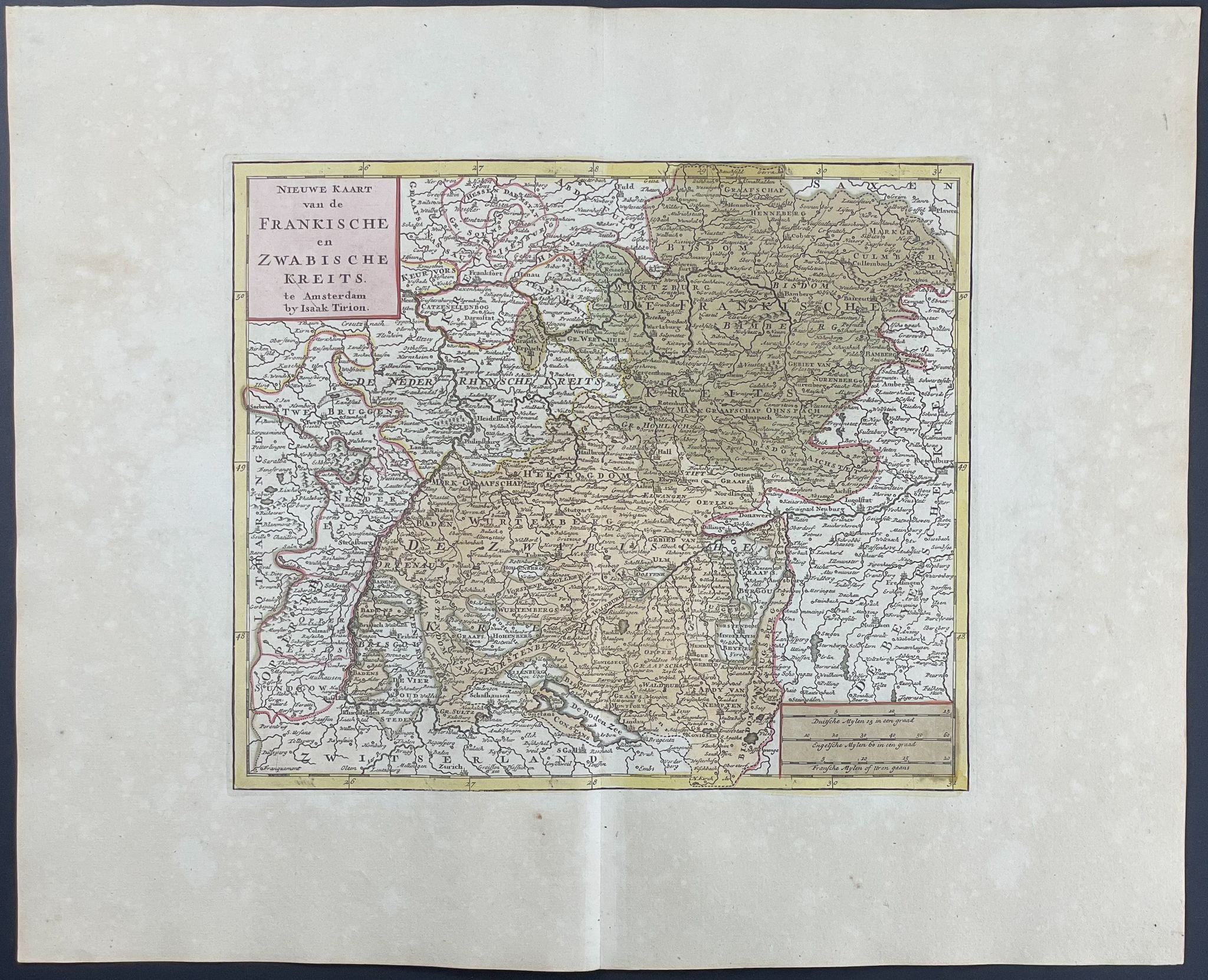
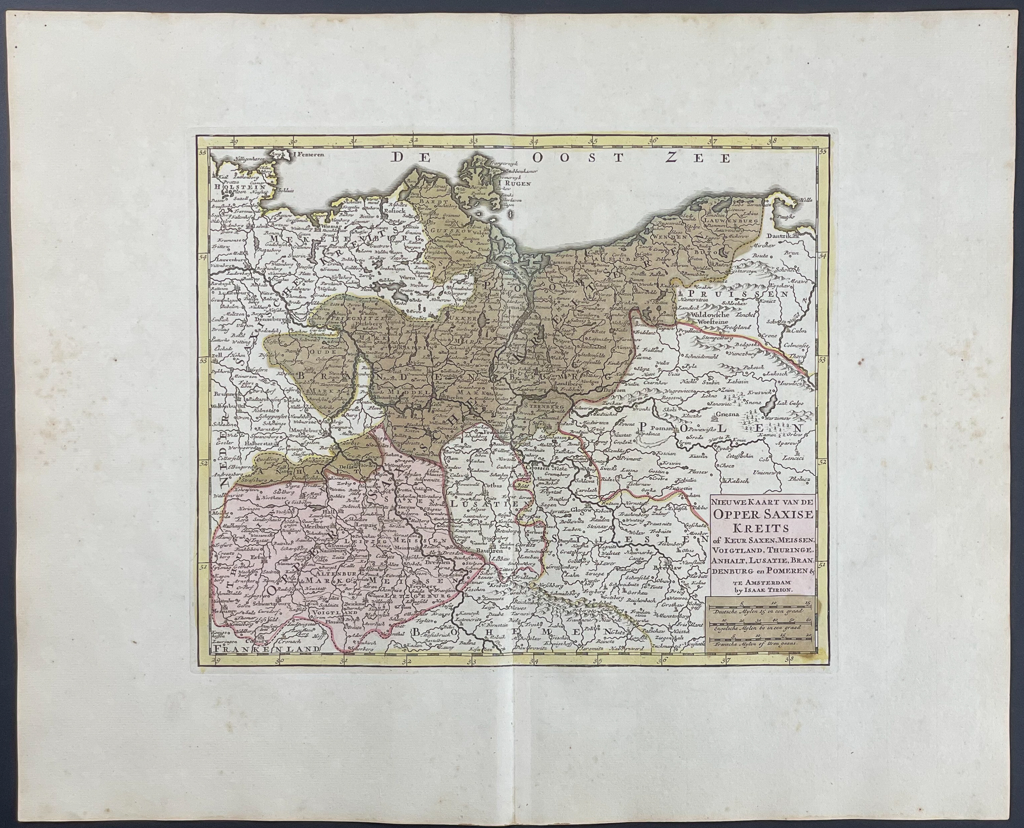
This originally hand-colored map is from Isaac Tirion’s
Nieuwe en beknopte Hand-Atlas, bestaande in eene Verzameling van eenige der algemeenste en noodigste Landkaarten. The work was published in Amsterdam by Tirion between 1759 and 1784.
Tirion’s maps are mostly based on Delisle. Tirion "was more of a bookseller and publisher than a geographer or cartographer. But he must have done very well by the cartographer under his employ as his maps excel in style and exactness…" (Koeman p. 126)
Paper Size: ~ 20 1/4" by 16 3/4"
Condition report:
The work is in very good to excellent condition. There may be a few minor imperfections or faint fox marks to be expected with age. There may be some faint offset or wear to the edges or fold. Please review the image carefully for condition and contact us with any questions.
Share this lot: