
Antique Maps & Prints of Natural History, Botanicals, & More
Lot 768:
Description
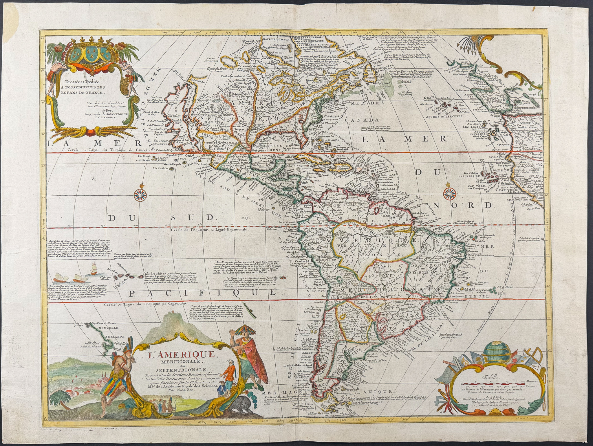
This wonderful map is Nicolas de Fer’s "L’Amerique, Meridionale, et Septentrionale". It was published by de Fer in Paris in 1727.
This map depicts the territories of the major European powers at the time in North & South America.
Nicholas de Fer (1646-1720) was one of the most famous French cartographers. He was apprenticed Louis Spirinx, an engraver, from the age of 12. His father was a print and map seller, and Nicholas eventually inherited his business after his passing. He was appointed as geographer of the Grand Dauphin and eventually the Geographer of the Kings of France and Spain.
Paper Size: ~ 26 3/4" by 20 1/8" (Fold Out)
Paper Type or Special Features: Engraving with Original Outline Color (Cartouche coloring likely added later)
Condition report:
The work is in fair to good condition overall. There may be some faint offset due to the fold out nature of the plate. There may be a few minor imperfections or faint marks to be expected with age. Please review the image carefully for condition and contact us with any questions.
Share this lot: