
Antique Prints, Maps, & Books of Natural History, Botanicals, & More
Lot 116:
Description
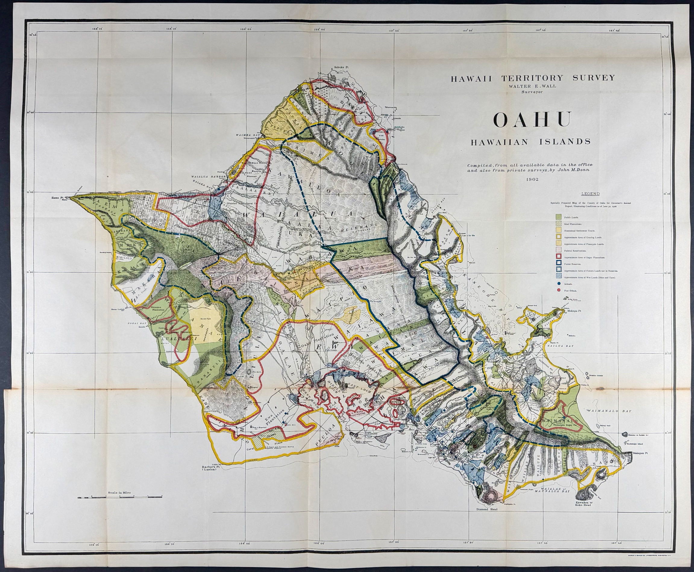
This is the first modern scientific map of the island of Oahu and was completed by Walter E. Wall and John M. Donn. It was a territory survey conducted in 1902 of the Hawaiian Islands with this focused on the island of Oahu. This is the first edition of the map and was published in Washington by the Government Printing Office in 1906-1907.
The map depicts public lands, sisal plantations, federal reservations, sugar plantations, forest reserves and lands, and wet lands. Honolulu, Diamond Head, and Pearl Harbor are nicely detailed.
It was done for the Hawaiian Governor’s Report and part of the
House of Representatives 59th Congress, 2nd Session, Document No. 5: Annual Reports of the Department of the Interior for 1906. It is marked as by Andrew B. Graham Co., Lithographers, Washington, D.C. in the lower margin.
Paper Size: ~ 29" by 35" (Fold Out)
Paper Type or Special Features: Lithograph with Original Outline Color
Condition report:
The work is in very good to excellent condition overall. There is some toning at the folds. There is some reinforced splits at the folds. There may be a few minor imperfections or faint marks to be expected with age. Please review the images carefully for condition and contact us with any questions.
Share this lot: