
Antique Prints, Maps, & Books of Natural History, Botanicals, & More
Lot 9665:
Description
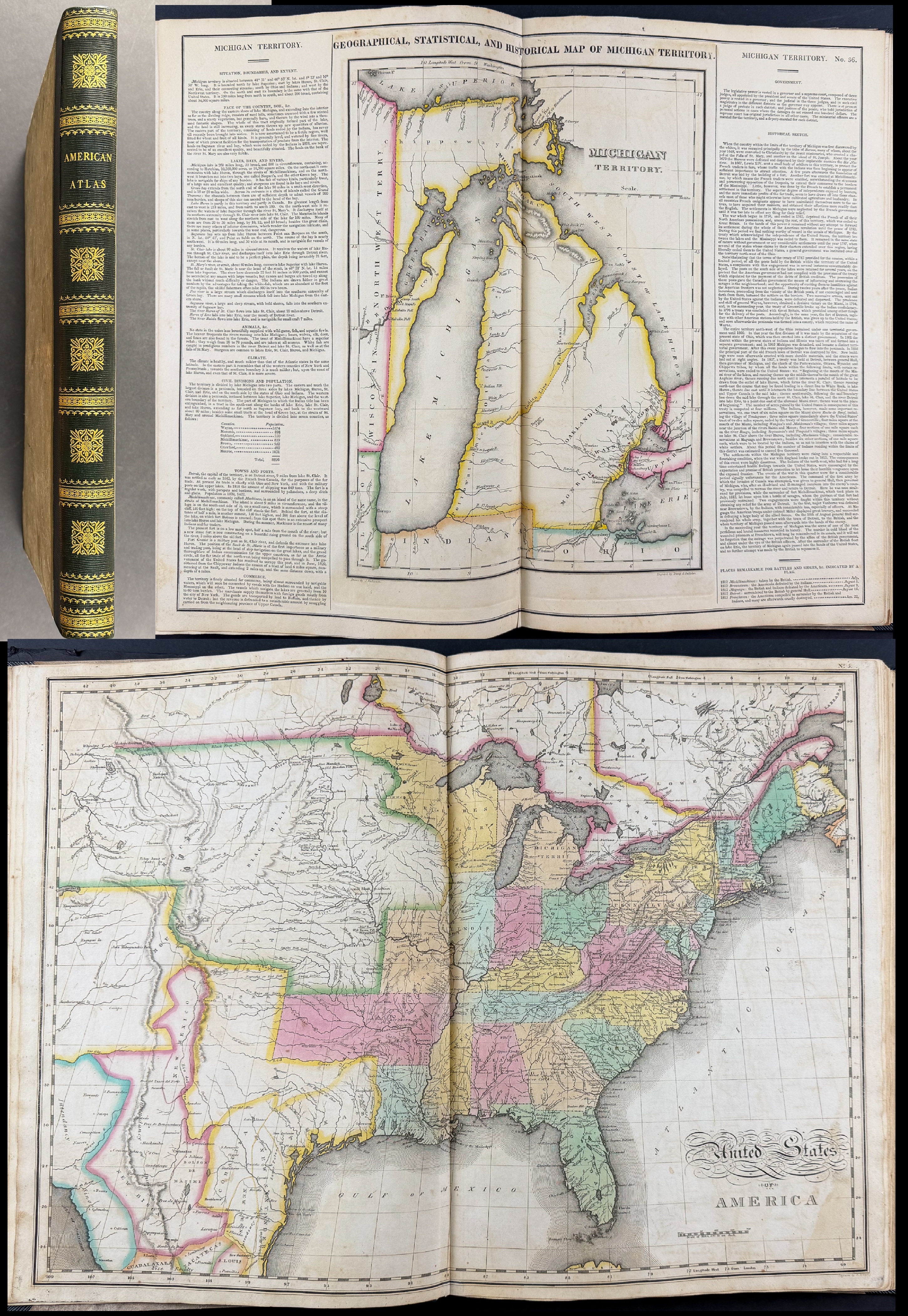
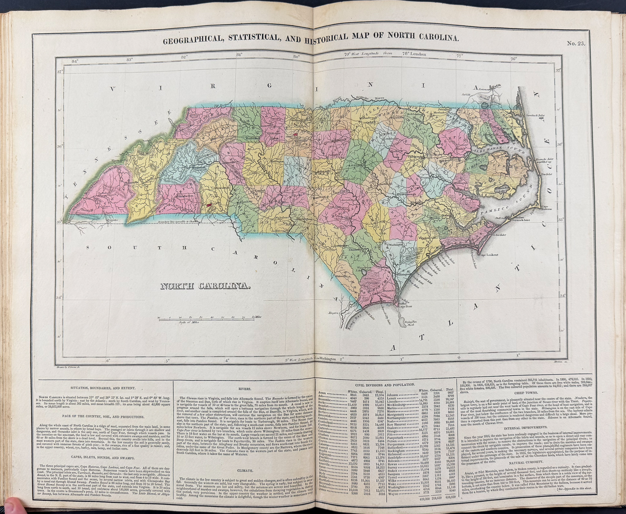
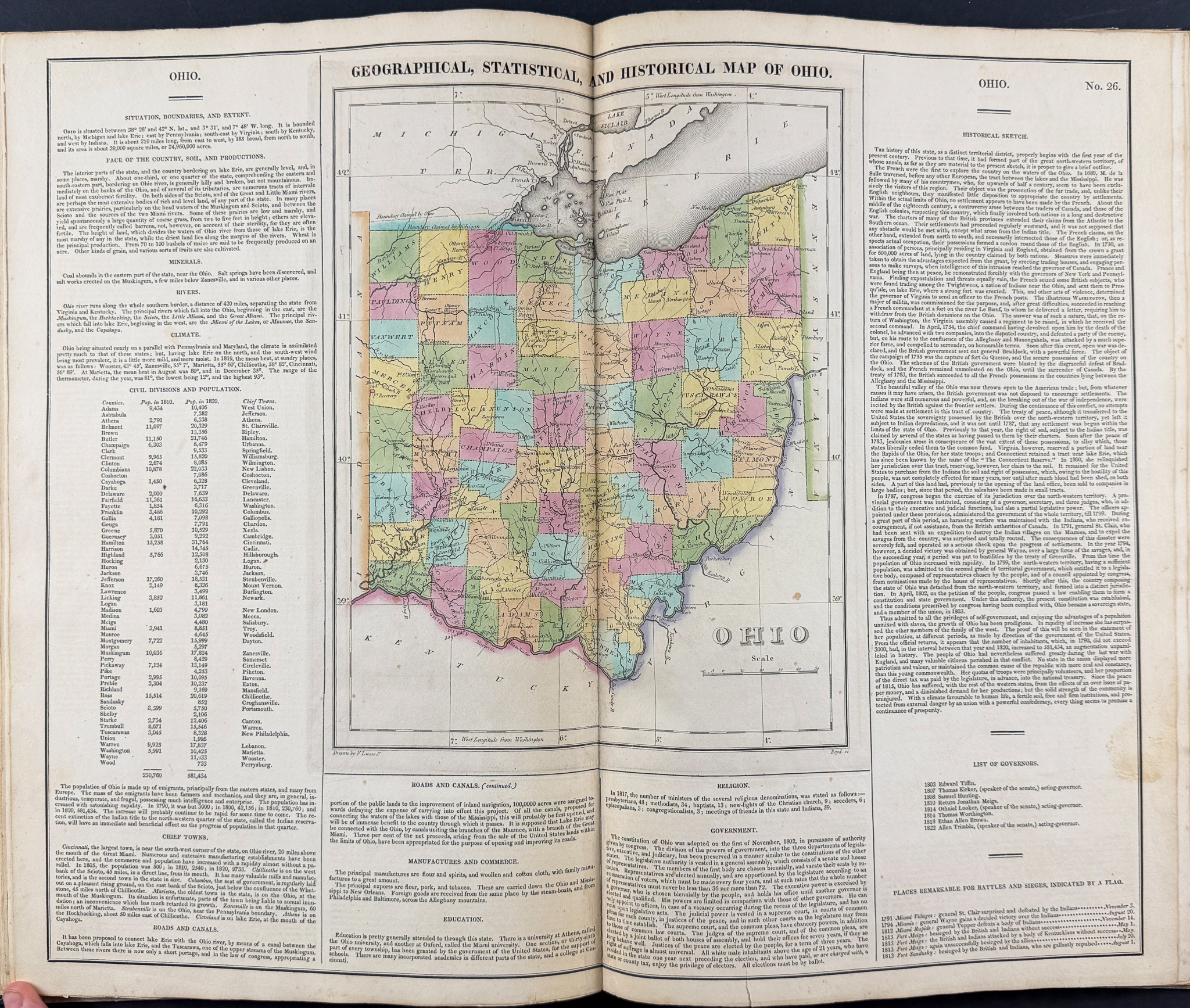
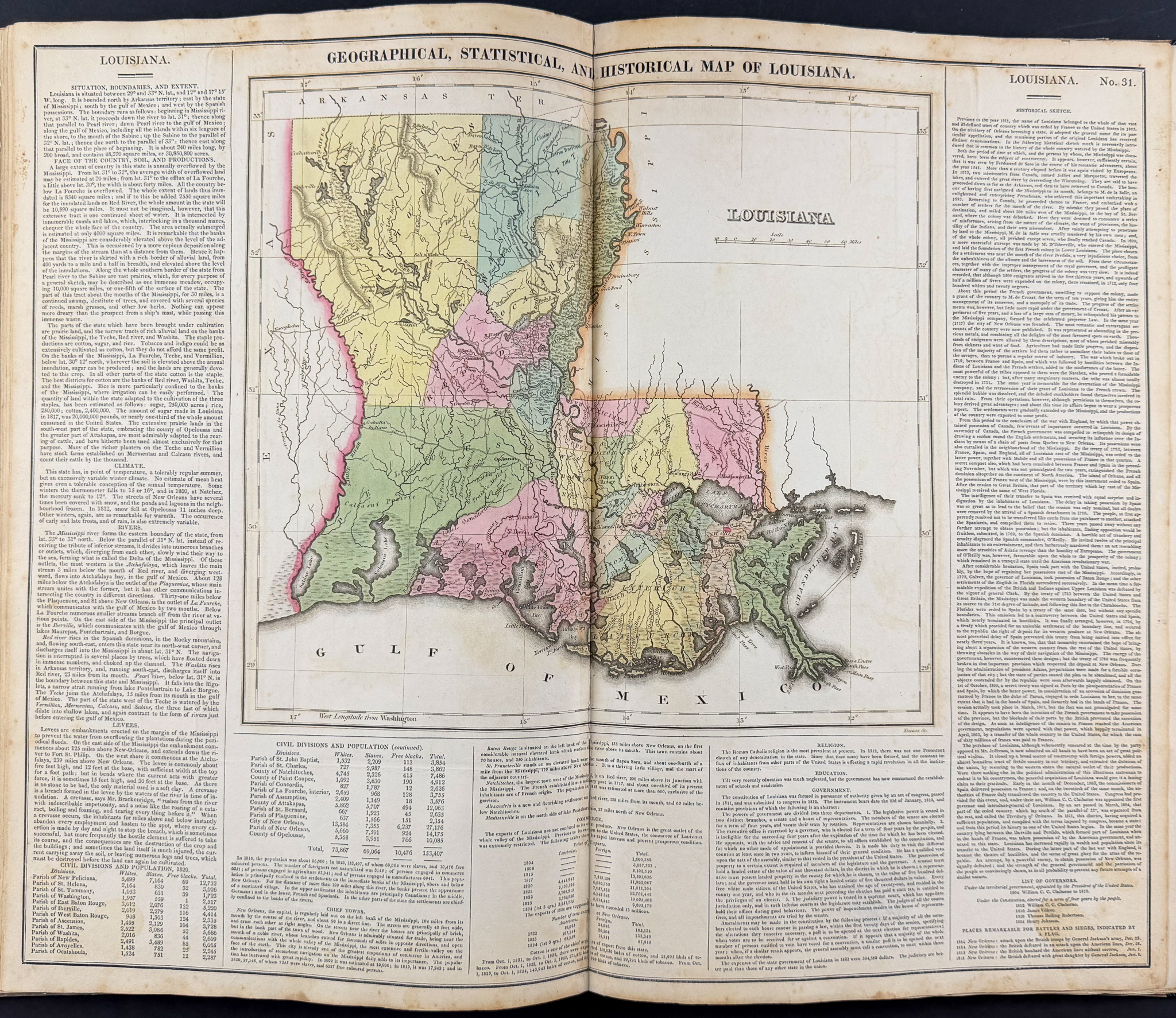
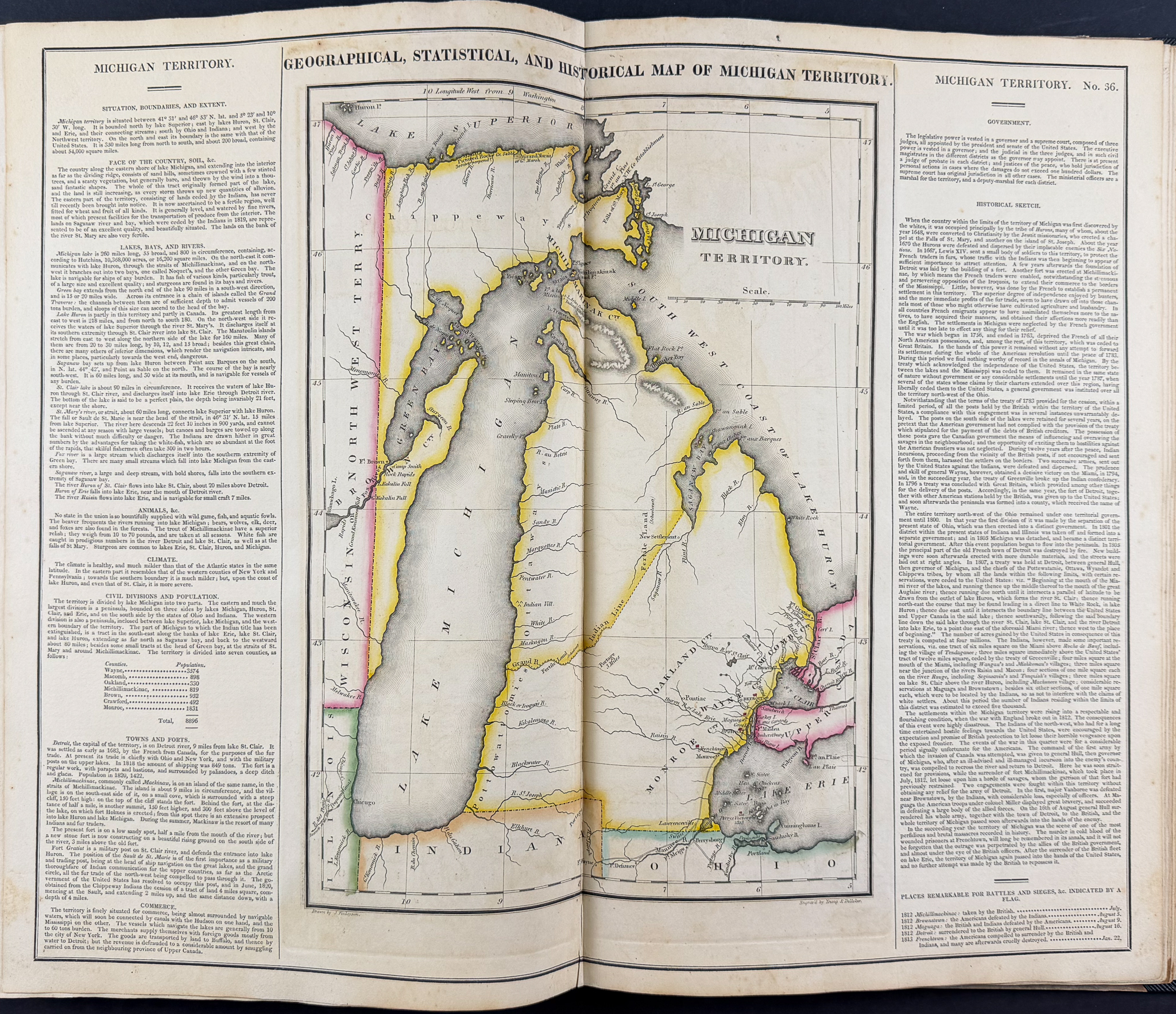
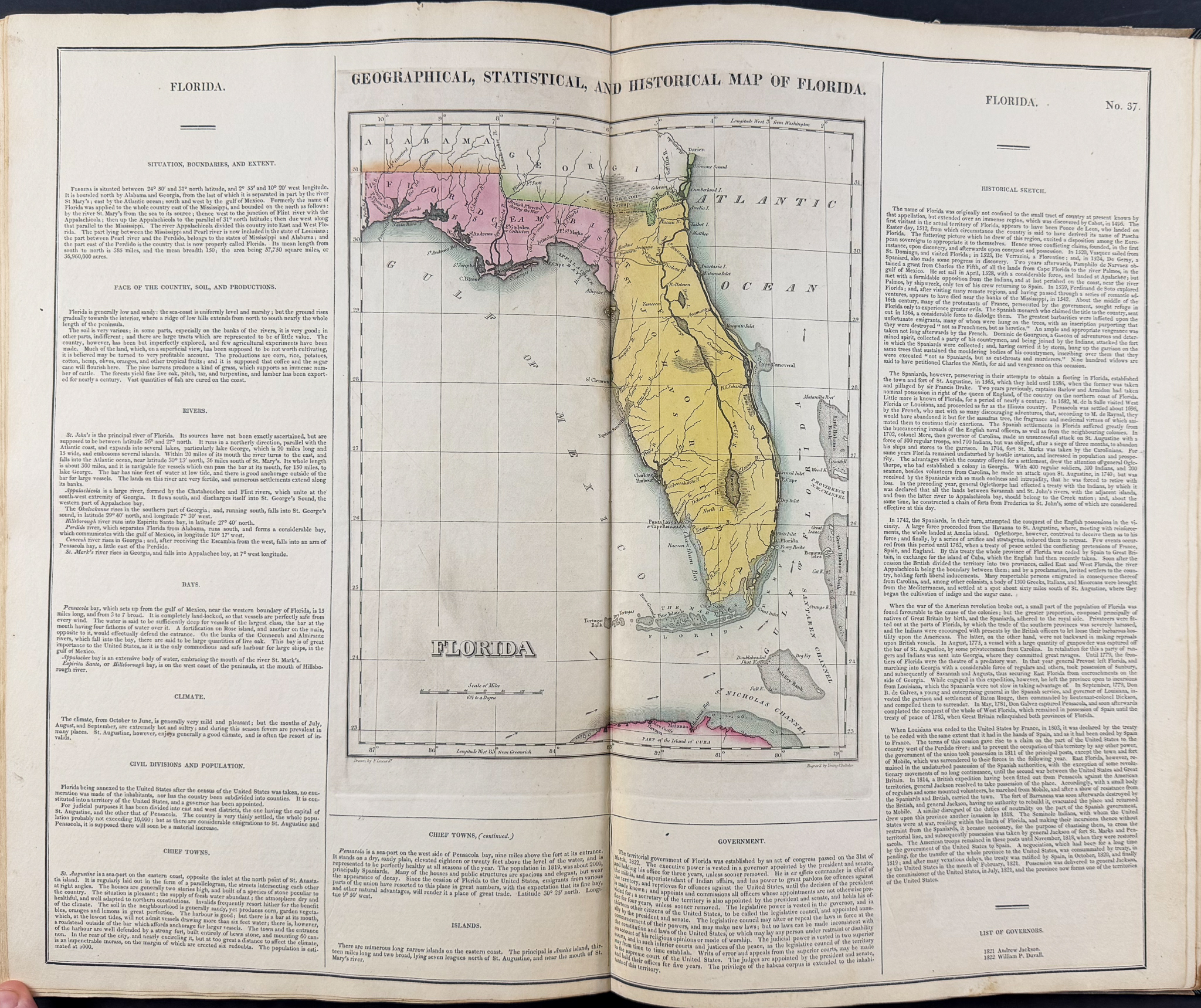
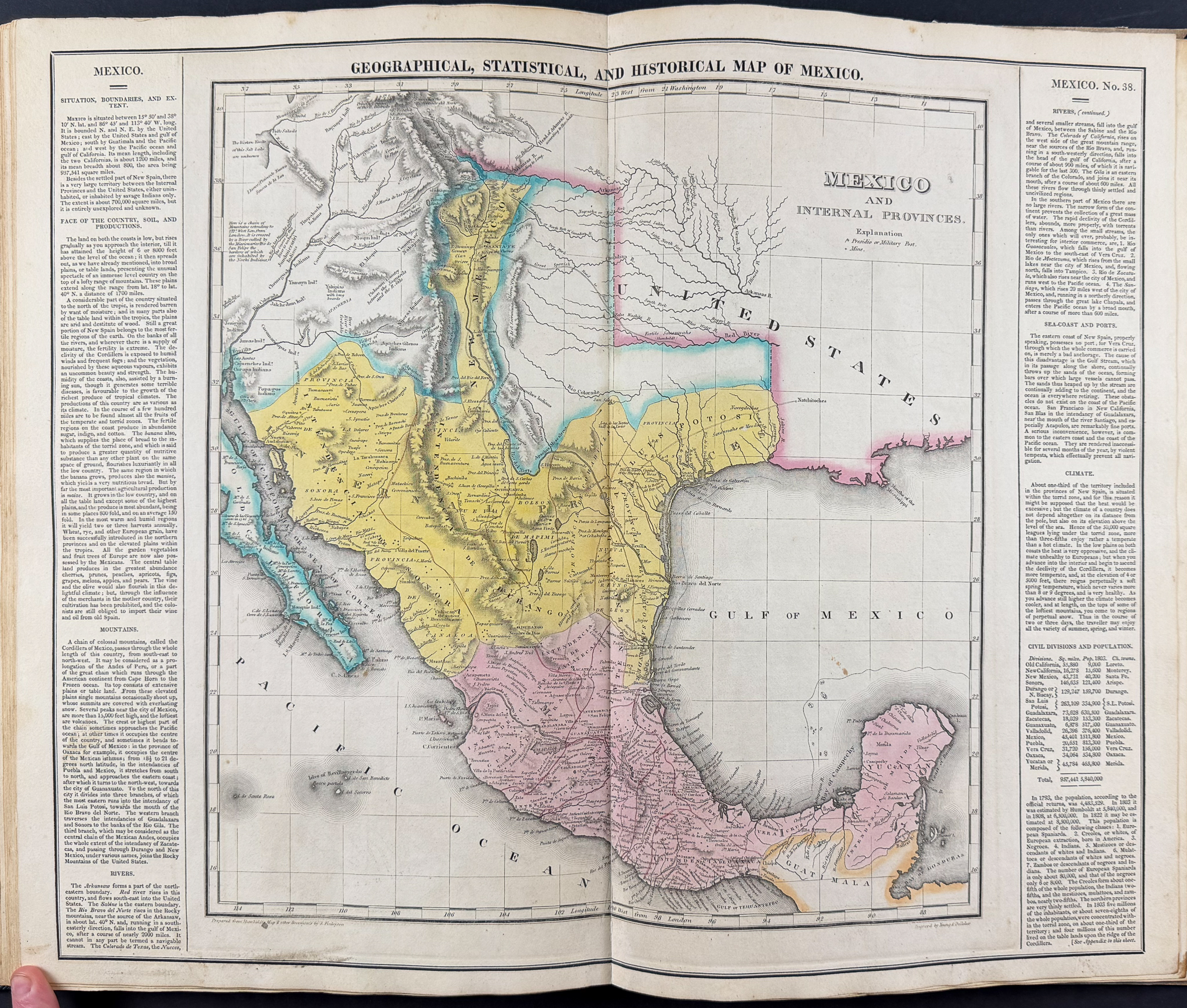
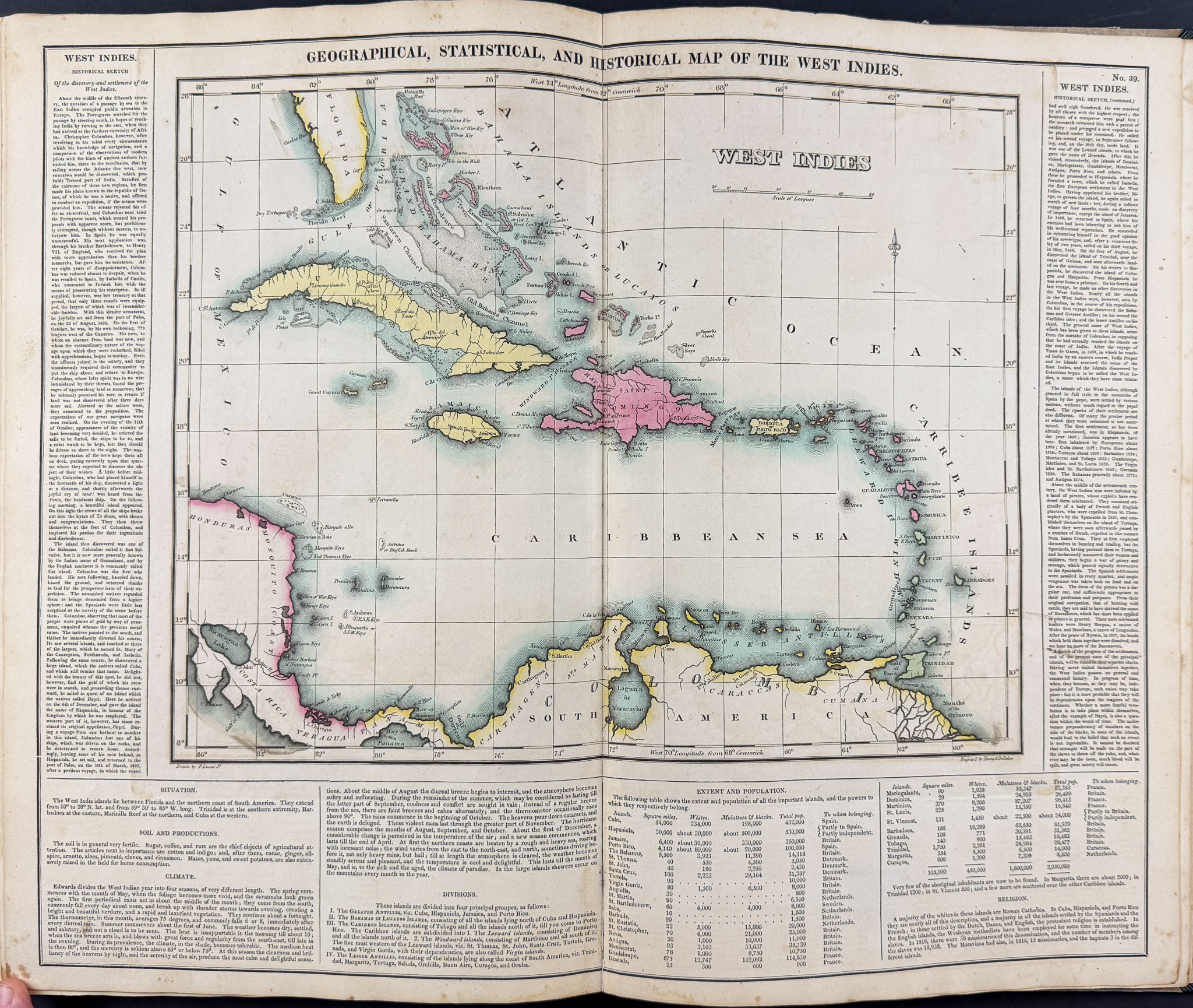
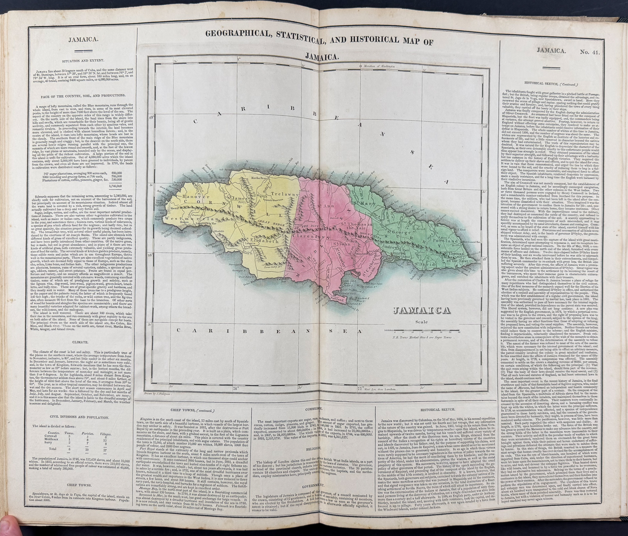
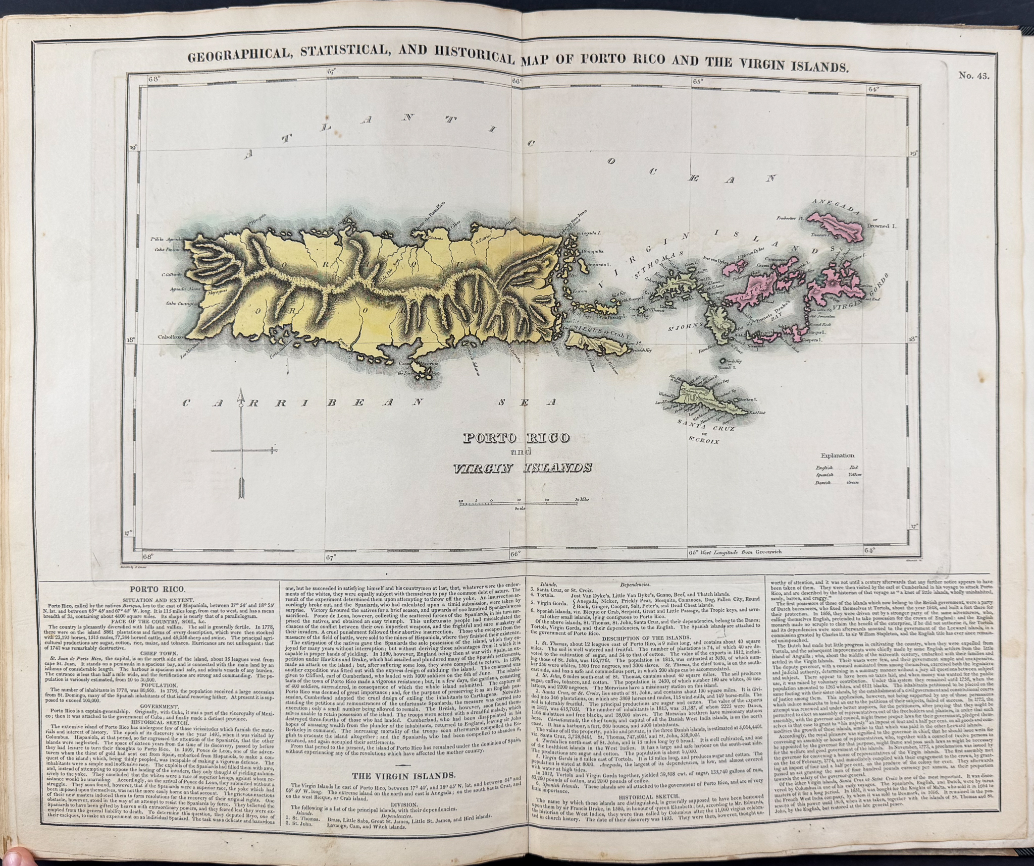
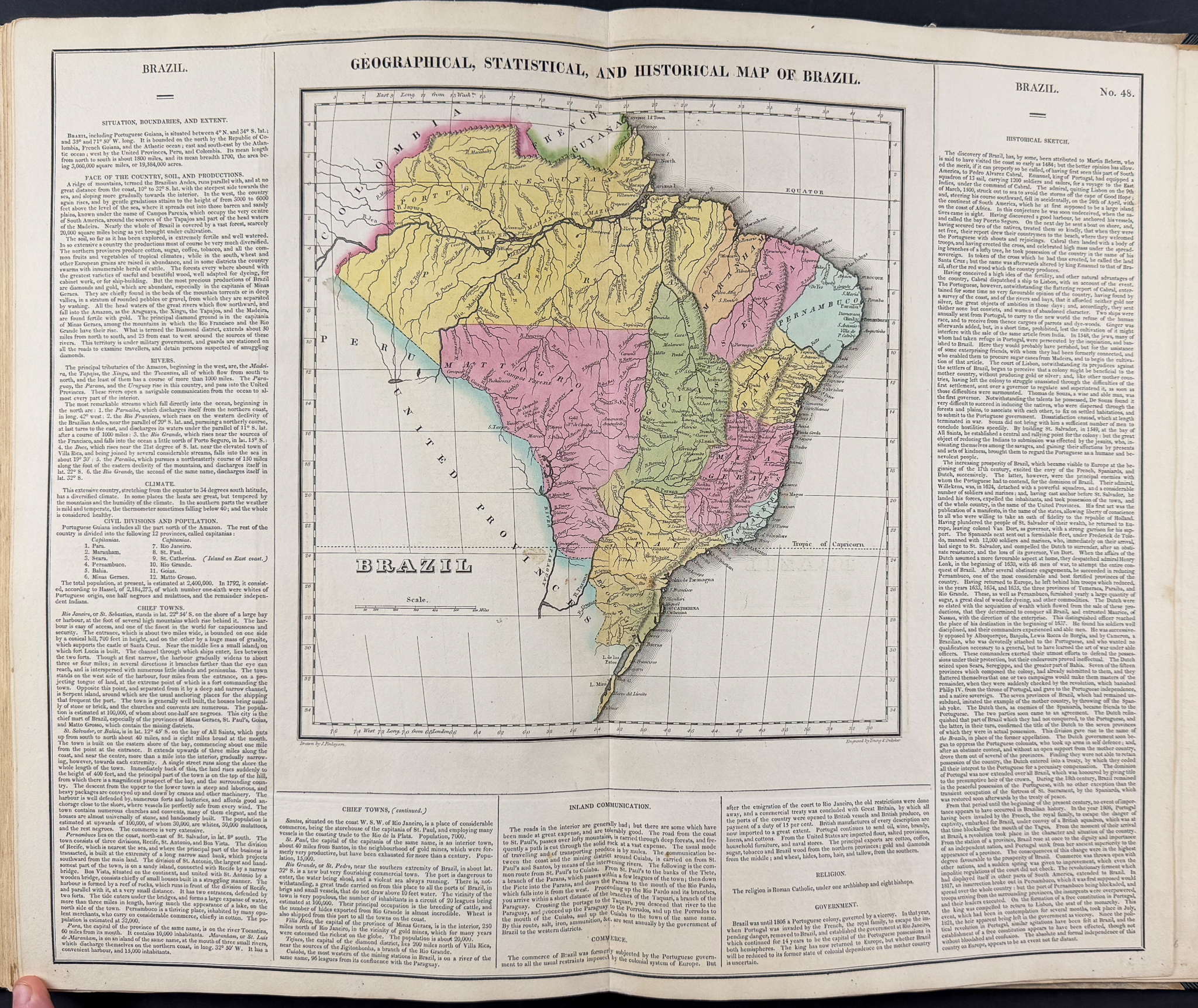
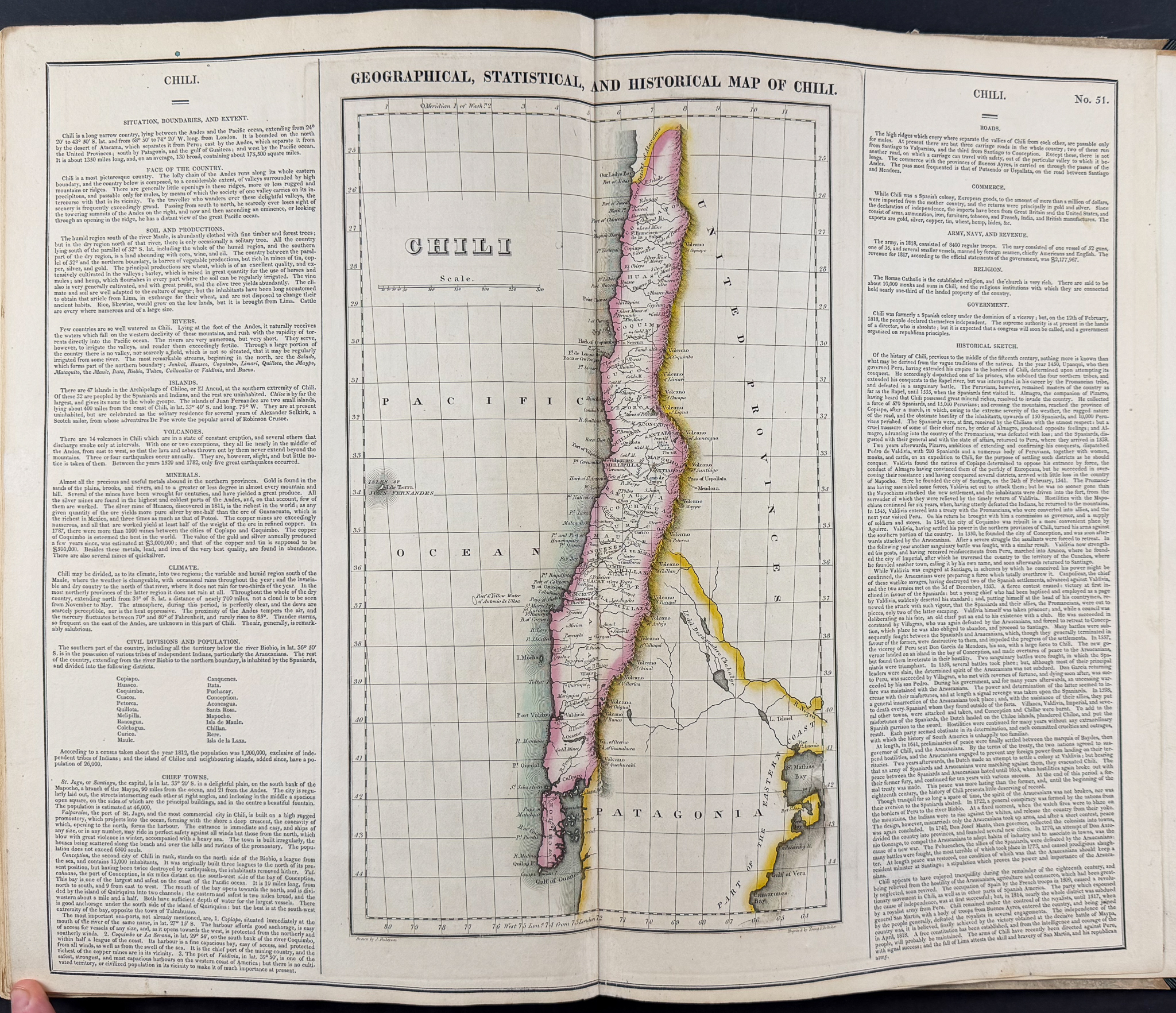
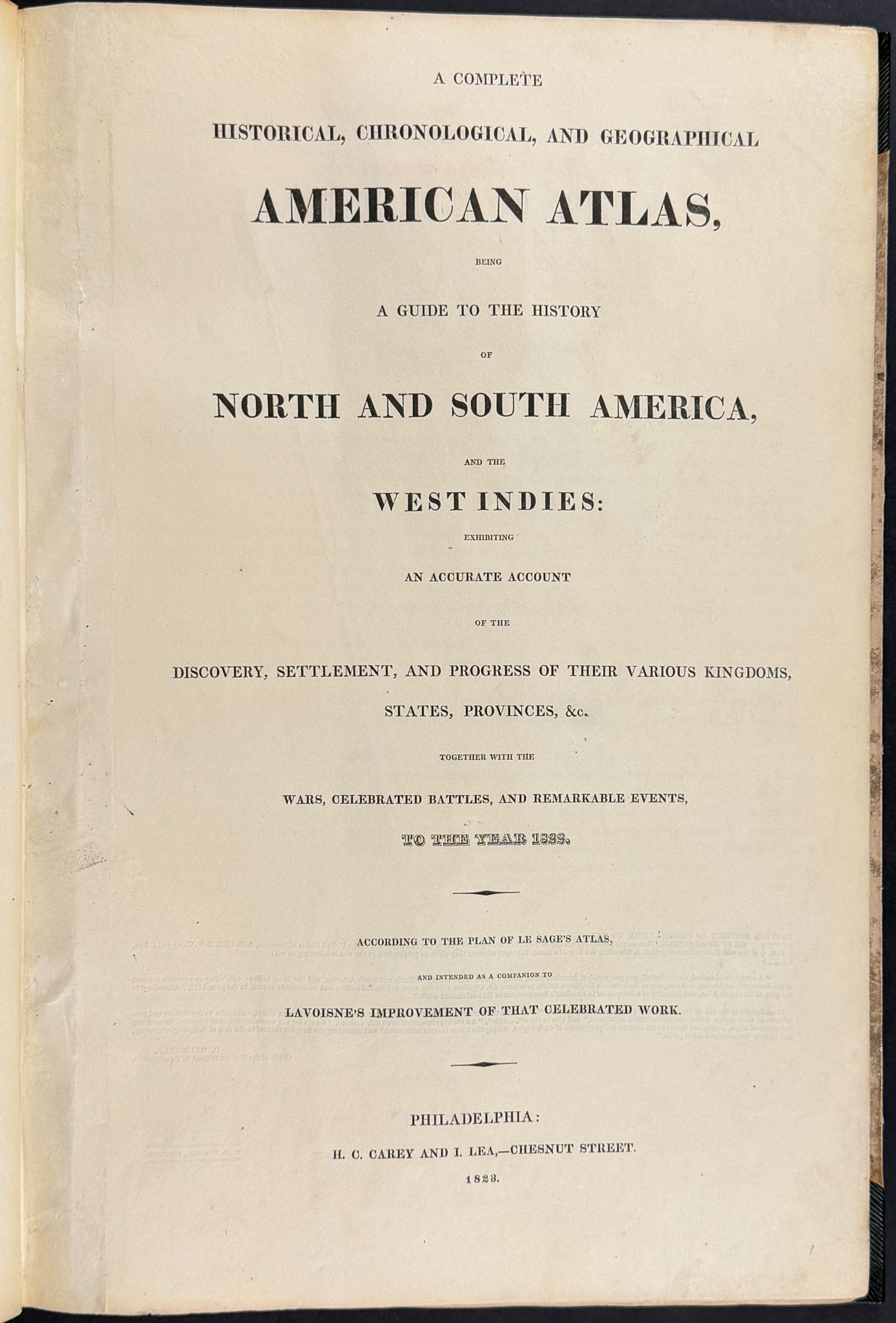
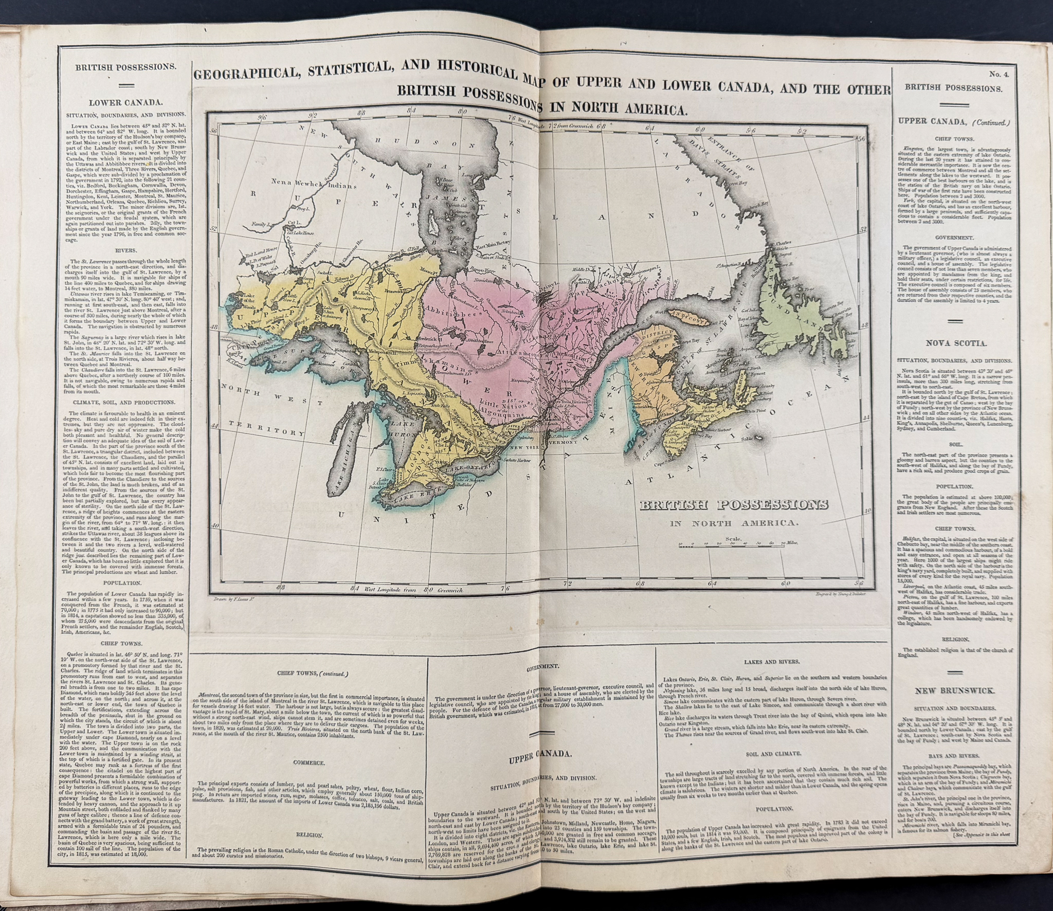
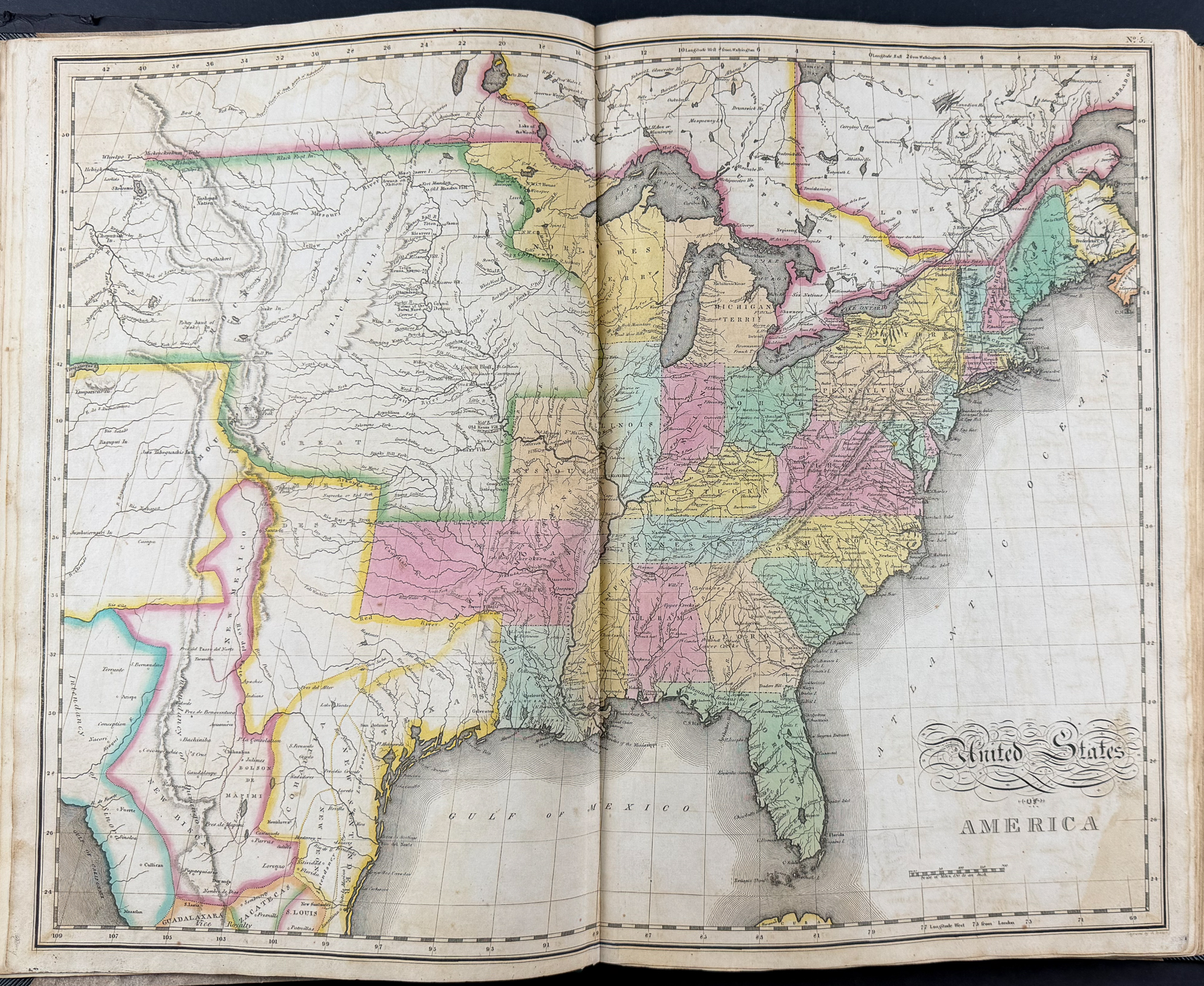
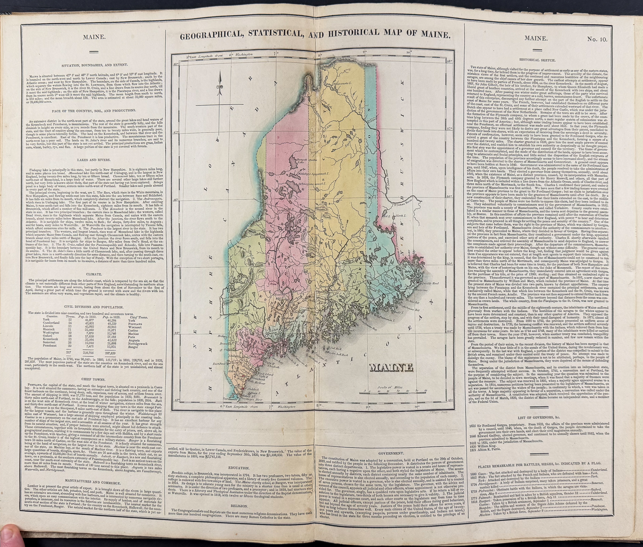
This volume is Henry Charles Carey & Isaac Lea’s
A Complete Historical, Chronological, and Geographical American Atlas, being a guide to the history of North and South America, and the West Indies: exhibiting an accurate account of the discovery, settlement, and progress, of their various kingdoms, states, provinces, &c. Together with the wars, celebrated battles, and remarkable events, to the year 1822. The work was published in Philadelphia in 1823 by Henry Charles Carey & Isaac Lea.
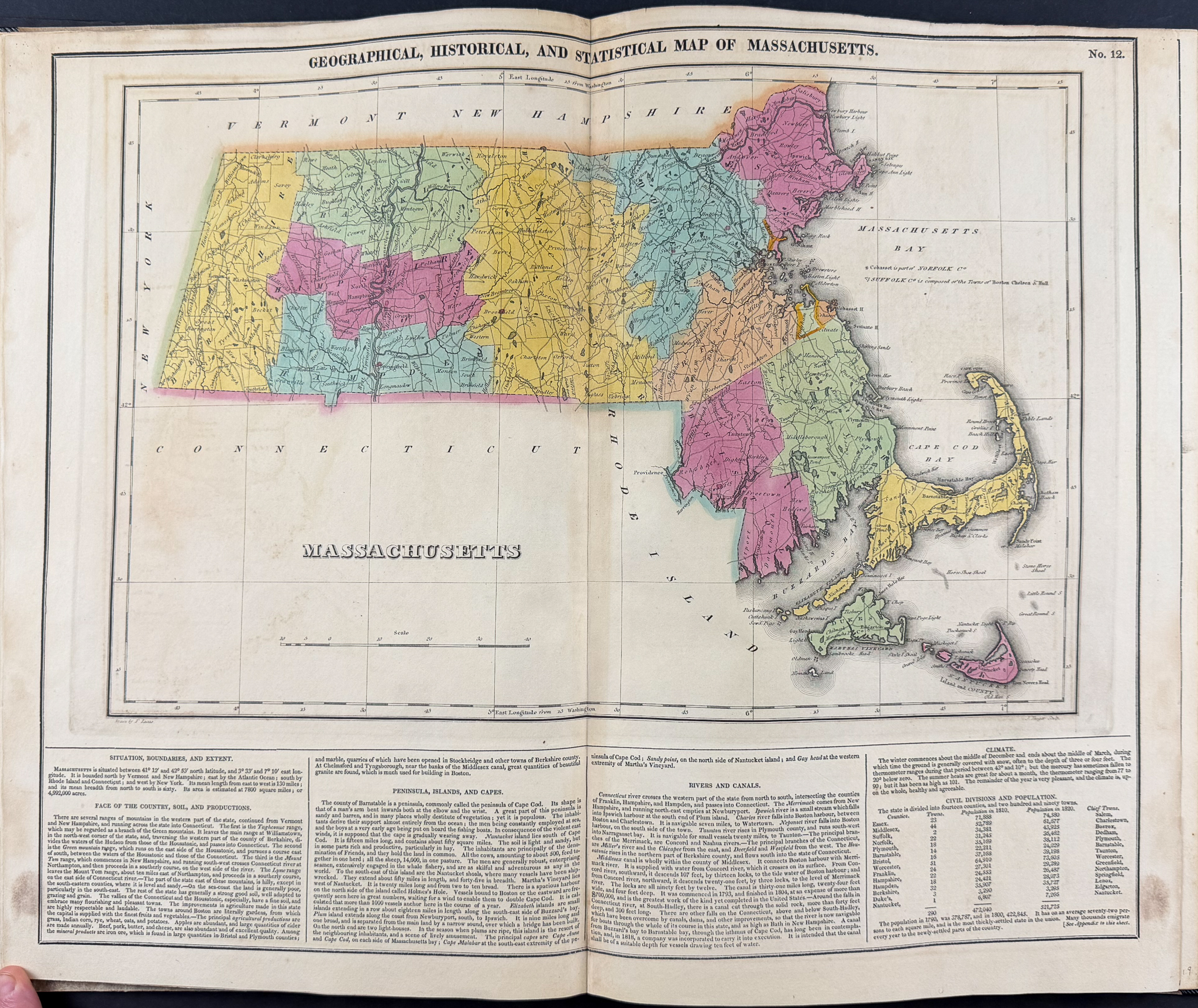
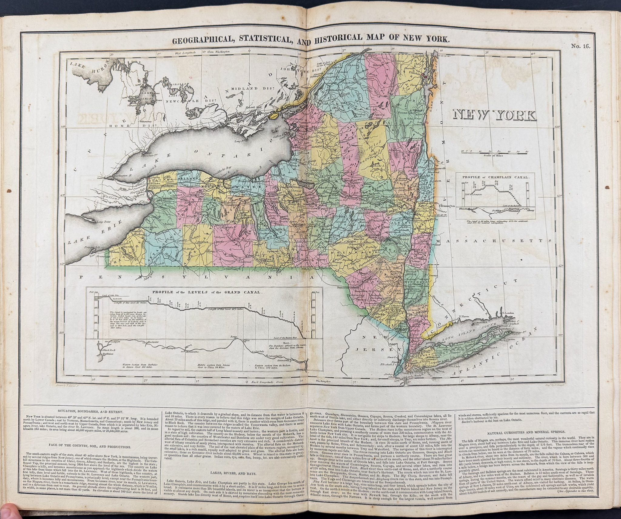
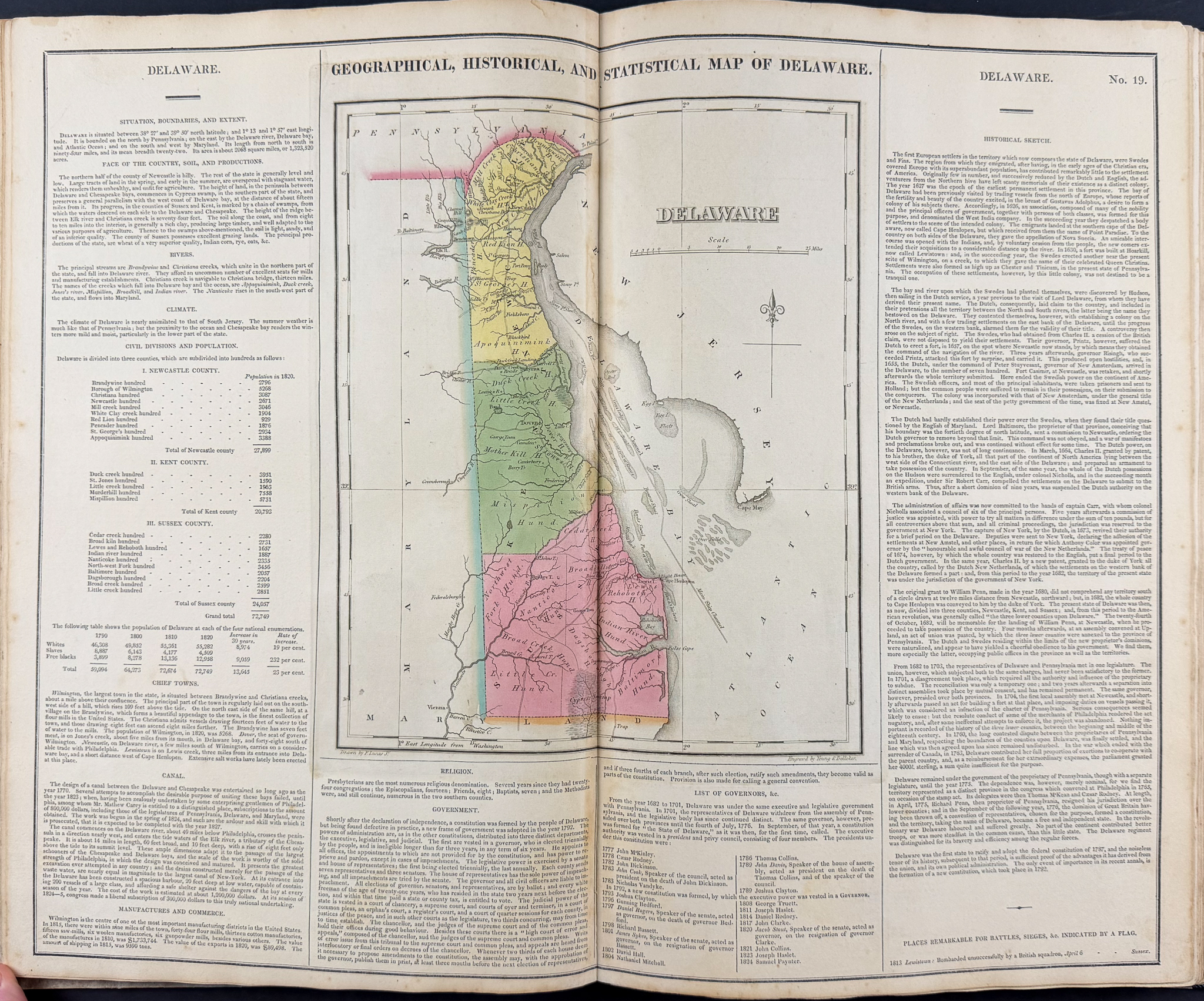
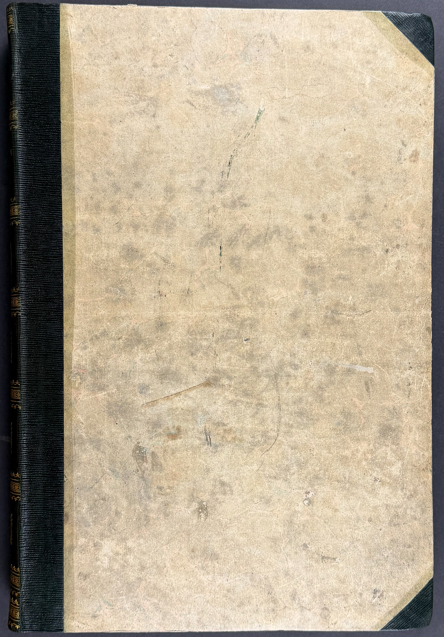
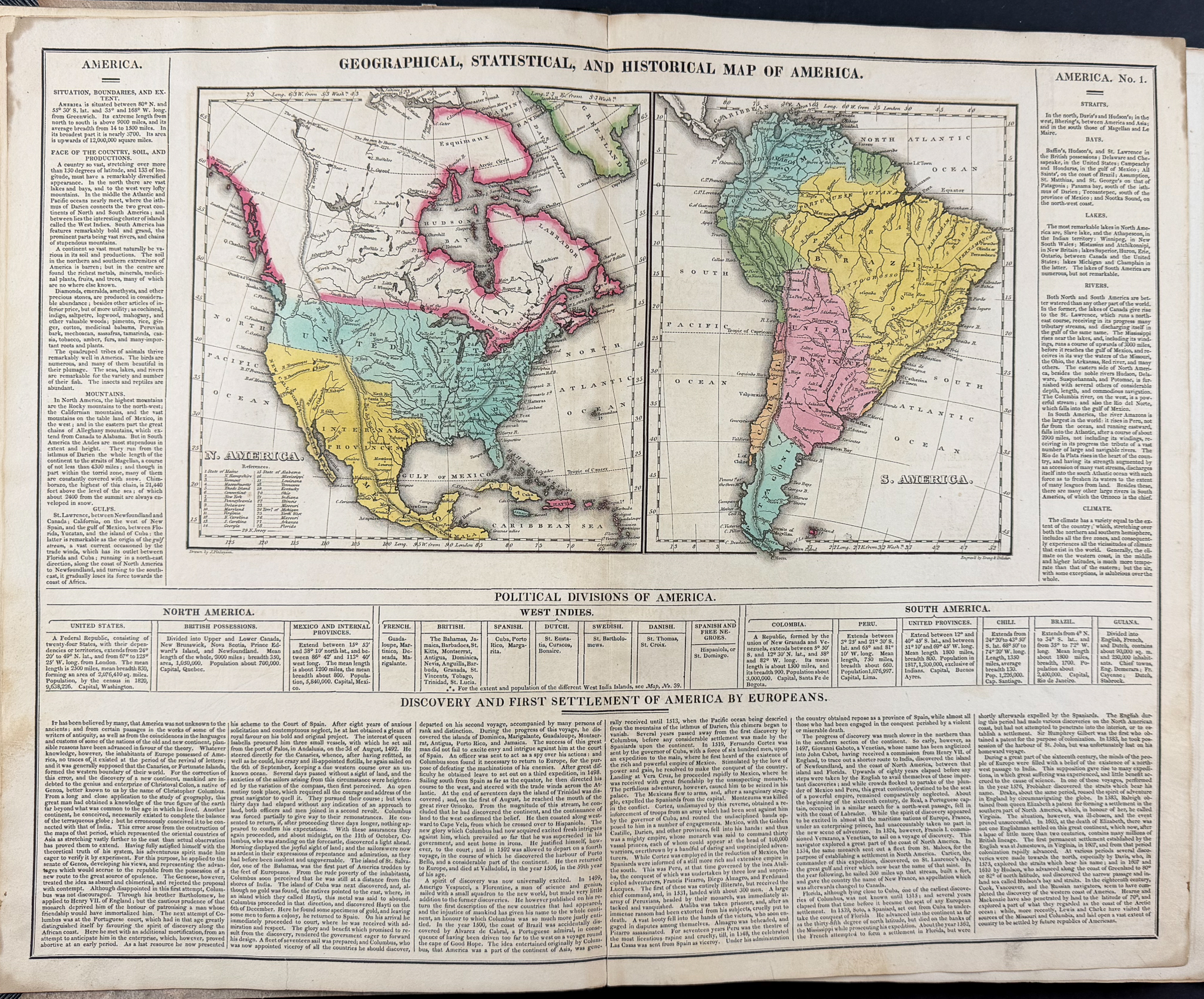
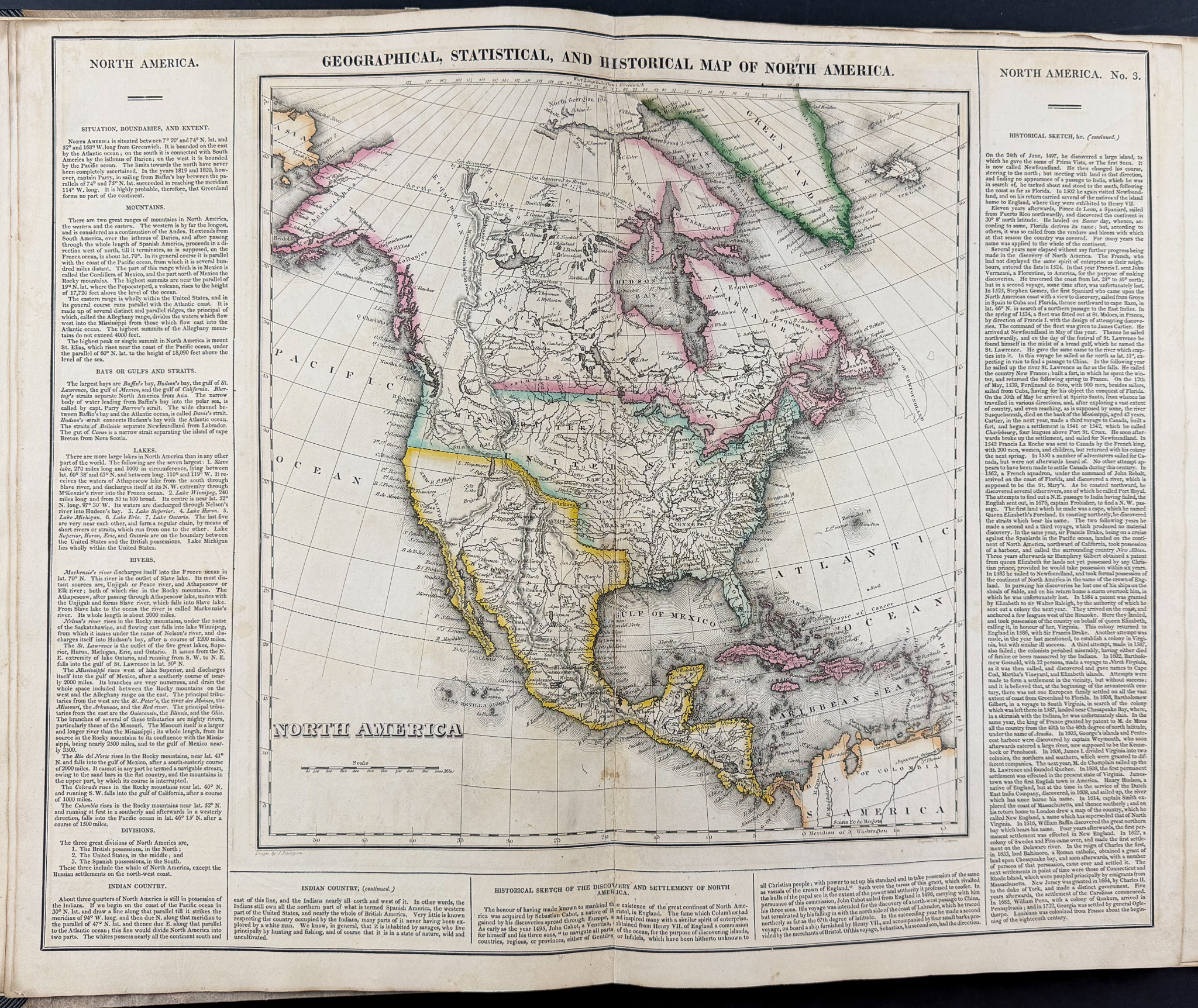
The atlas features 46 folio originally hand-colored engraved maps of America mounted on guards. There is an uncolored mountain heights plate, hand-colored plate of the river lengths, and 5 letterpress tables (4 double-page, 3 with hand-coloring). There is a letterpress title, advertisement, contents, and index. The work is expertly bound to style in half dark green straight grained morocco over contemporary marbled paper covered boards.
This one of the most important early atlases printed in the United States. Fielding Lucas, the major Baltimore printer, was the principal engraver for the work. The atlas covered the areas of North America, Central America, South America and the West Indies. The majority of the maps are surrounded by text documenting the history, climate, population of that area.
It is considered an indispensable American atlas and represented the beginning of the hand-colored commercial atlas business in the United States. It was particularly noted for its early maps of the states and territories of the United States. Of particular note was Stephen H. Long’s map of Arkansa(s) (the American West) as it showed the trans-Mississippi West and the lands of the Louisana Purchase.
Carey and Lea’s atlas was first issued in 1822; this is the 1823 second issue, substantially the same as the first but with a new title and revised states of several maps and text leaves (generally minor revisions, including additional shading to maps and improved resetting of several text leaves).
Paper Size: ~ 11 7/8" by 17 1/2"
Paper Type or Special Features: Volume with 46 Originally Hand-colored Folio Maps
Condition report:
The work is in very good to excellent condition. There may be some signs of scuffing and wear from age and handling. There may be a few minor imperfections or faint fox marks to be expected with age. Please review the image carefully for condition and contact us with any questions.
Share this lot: