
Antique Prints, Maps, & Books of Natural History, Botanicals, & More
Lot 8841:
Description
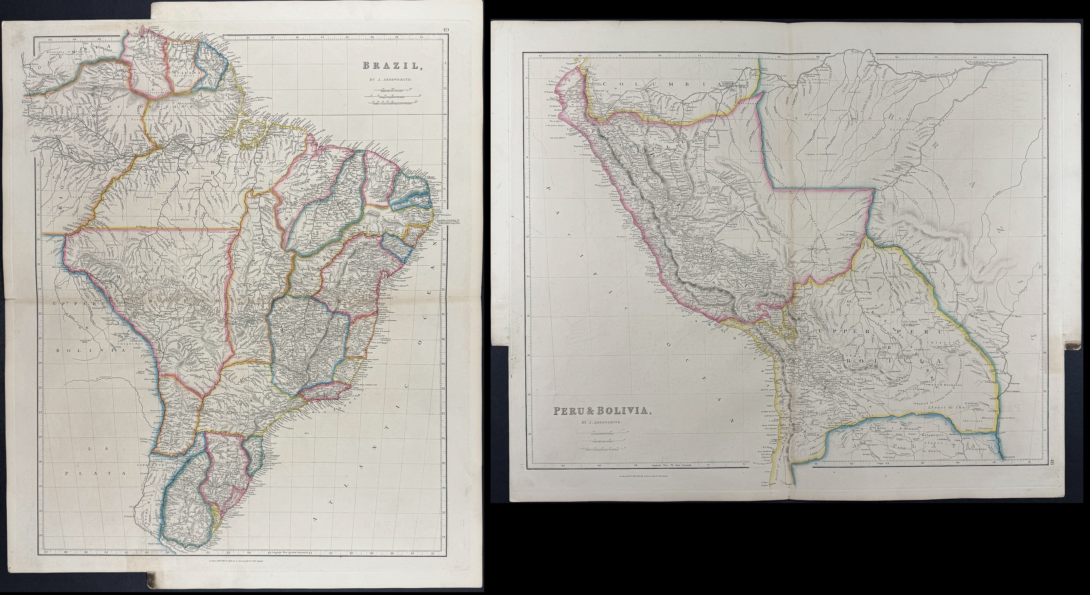
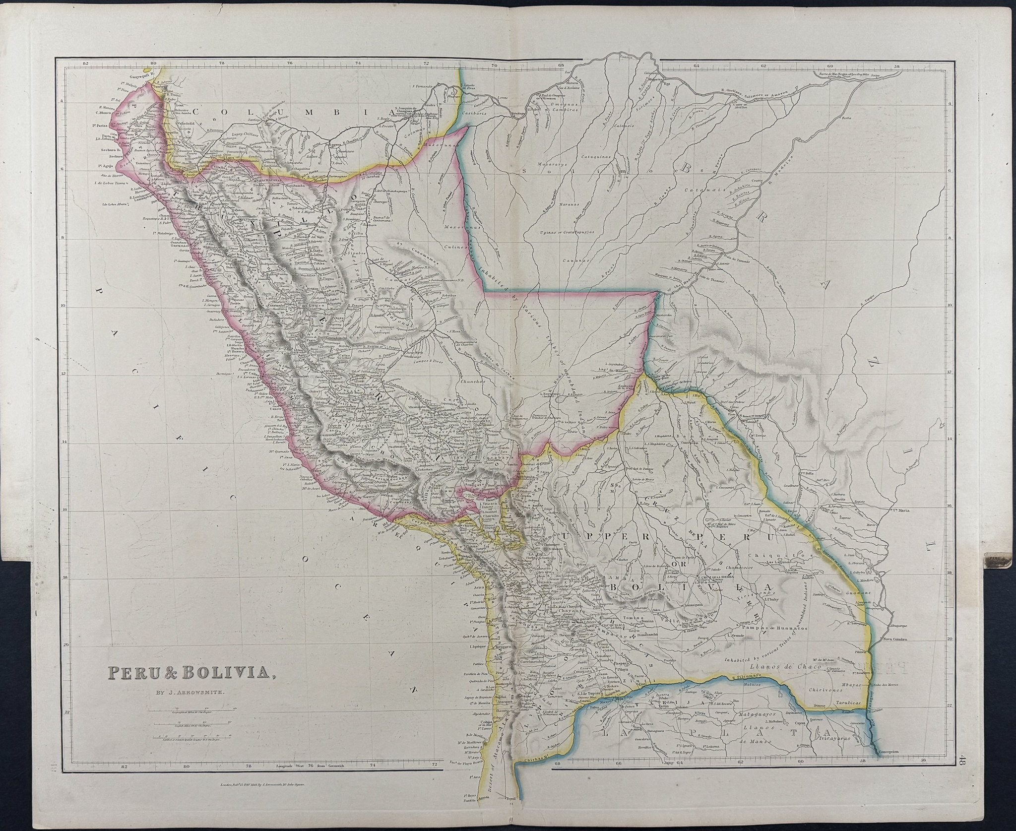
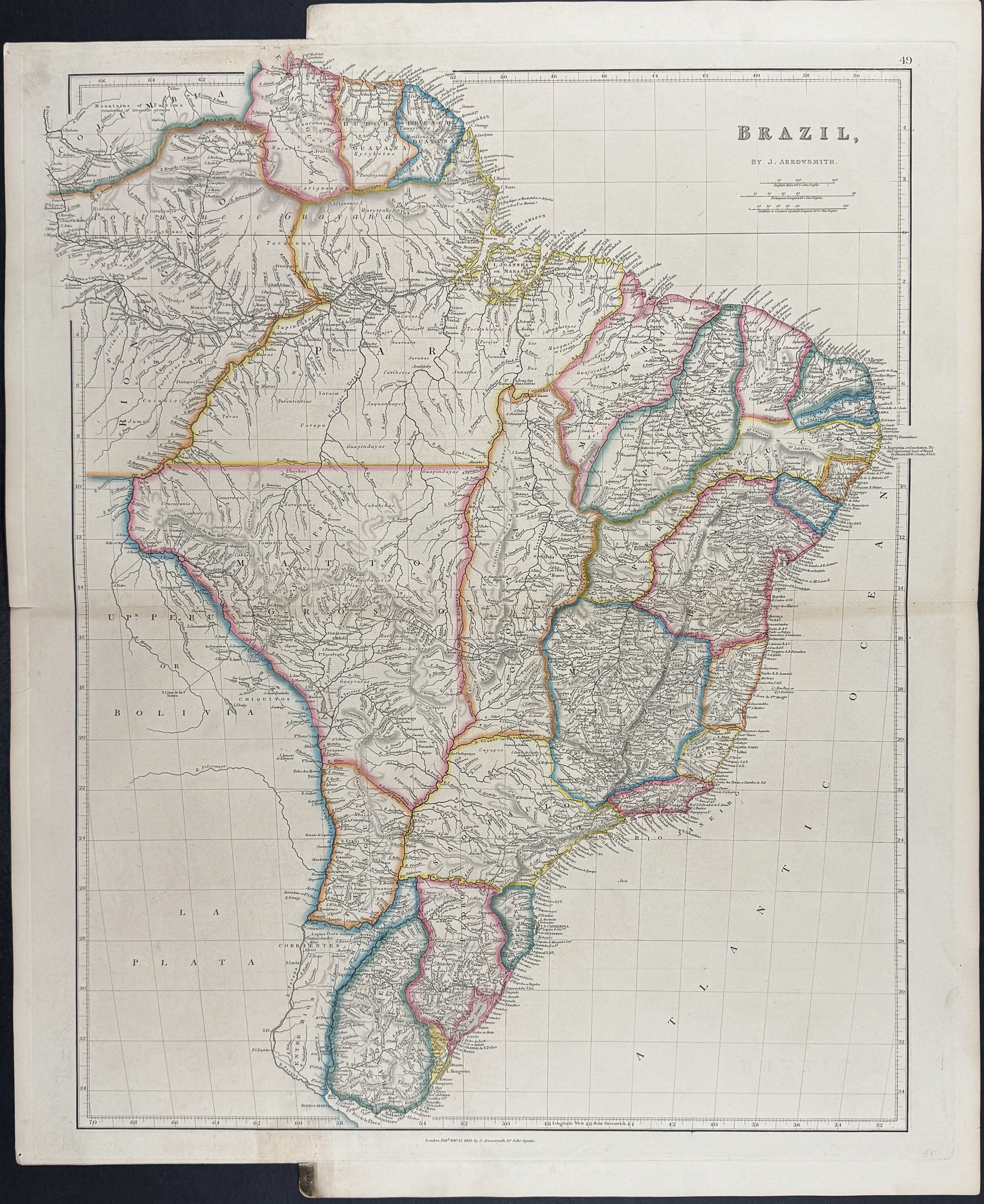
This large folio engraving is from John Arrowsmith’s
The London Atlas of Universal Geography, exhibiting the physical & political divisions of the various countries of the world, constructed from original materials. The work was published in London by J. Arrowsmith between 1841 and 1849. This is one of the finest 19th-century English atlases, and of particular note was his map of Texas and maps of Australia.
John Arrowsmith was one of the greatest geographers of his era. He was a founding member of the Royal Geographical Society. He introduced the London Atlas in 1834 with subsequent editions dated 1840, 1842, and 1858 but as he continuously added new maps there’s no determined collation for each edition. He also continuously updated and corrected his maps which drew their information from documents supplied by `The Colonial Office, the Hydrographical Office of the Admiralty, the East India Company, the Royal Asiatic Society, the Royal Geographical Society’, and numerous other `Offices, Companies, and Societies’.
Paper Size: ~ 26 1/4" by 21 1/4"
Paper Type or Special Features: Engraving
Condition report:
The work is in very good to excellent condition overall. There are two cropped corners that were used to tab the work when originally bound. There may be a few faint marks or imperfections to be expected with age. Please review the image carefully and contact us with any questions.
Share this lot: