
Antique Maps & Prints of Natural History, Botanicals, & More
Lot 7214:
Description
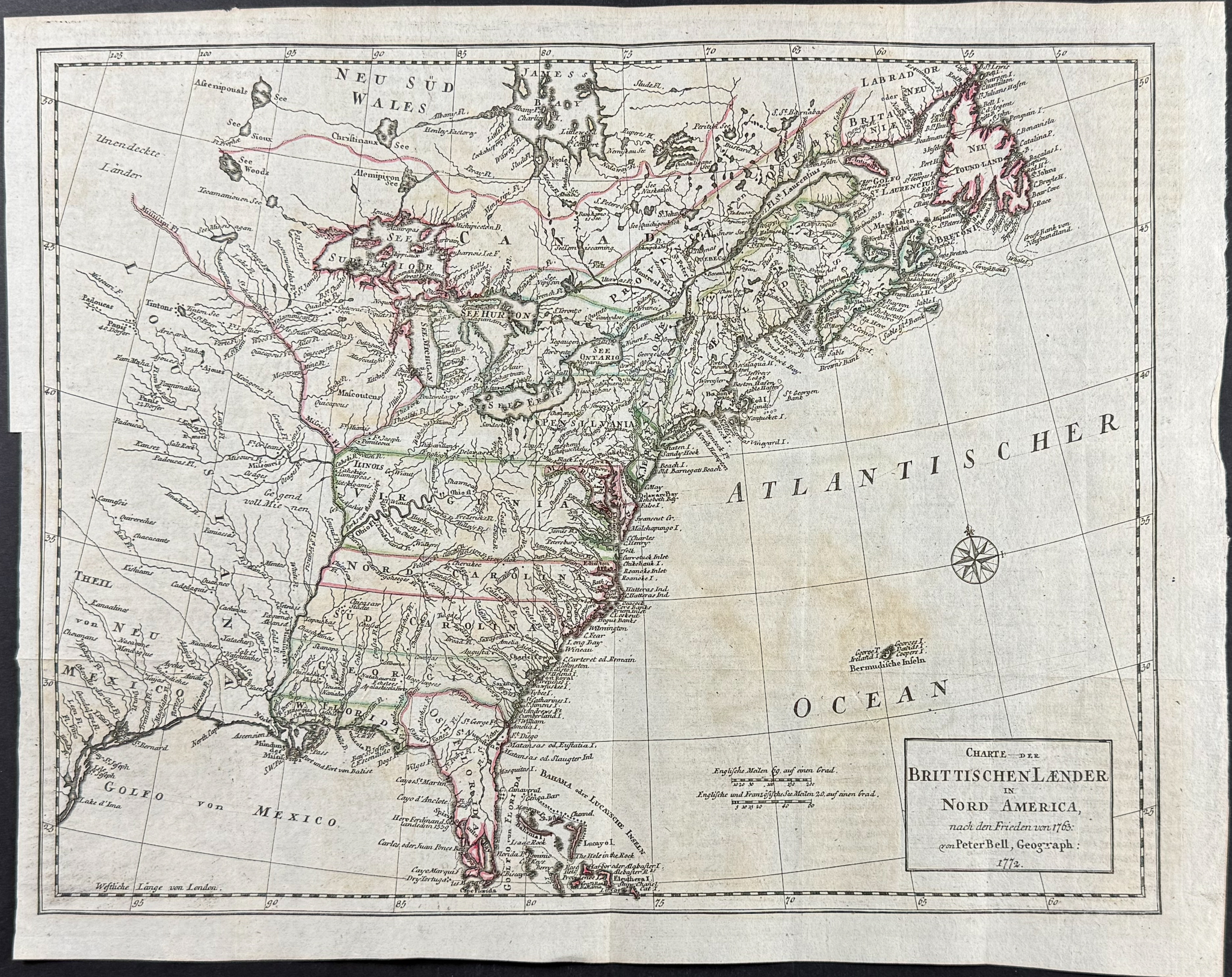
This fine map is from
Geschichte der Englischen Kolonien in Nord-Amerika… The work was published in Leipzig in 1775 by Caspar Fritsch.
The map was the German edition of Peter Bell’s map of 1772. It focused on the British Colonies and eastern North America after the treaty of 1763. It shows Newfoundland, James Bay, the Gulf of Mexico, Florida Keys, Carolinas, Georgia, and the Mississippi River.
Paper Size: ~ 16 1/4" by 13" (Fold Out)
Paper Type or Special Features: Engraving
Condition report:
The maps from the work are in generally very good to excellent condition. Due to age, some of the maps may exhibit handling or minor marks to be expected with age. There may be some light offset due to the fold out nature of the engraving. There may be a few minor imperfections or faint marks to be expected with age. Please review the image carefully for condition and contact us with any questions.
Share this lot: