
Antique Prints, Maps, & Books of Natural History, Botanicals, & More
Lot 5251:
Description
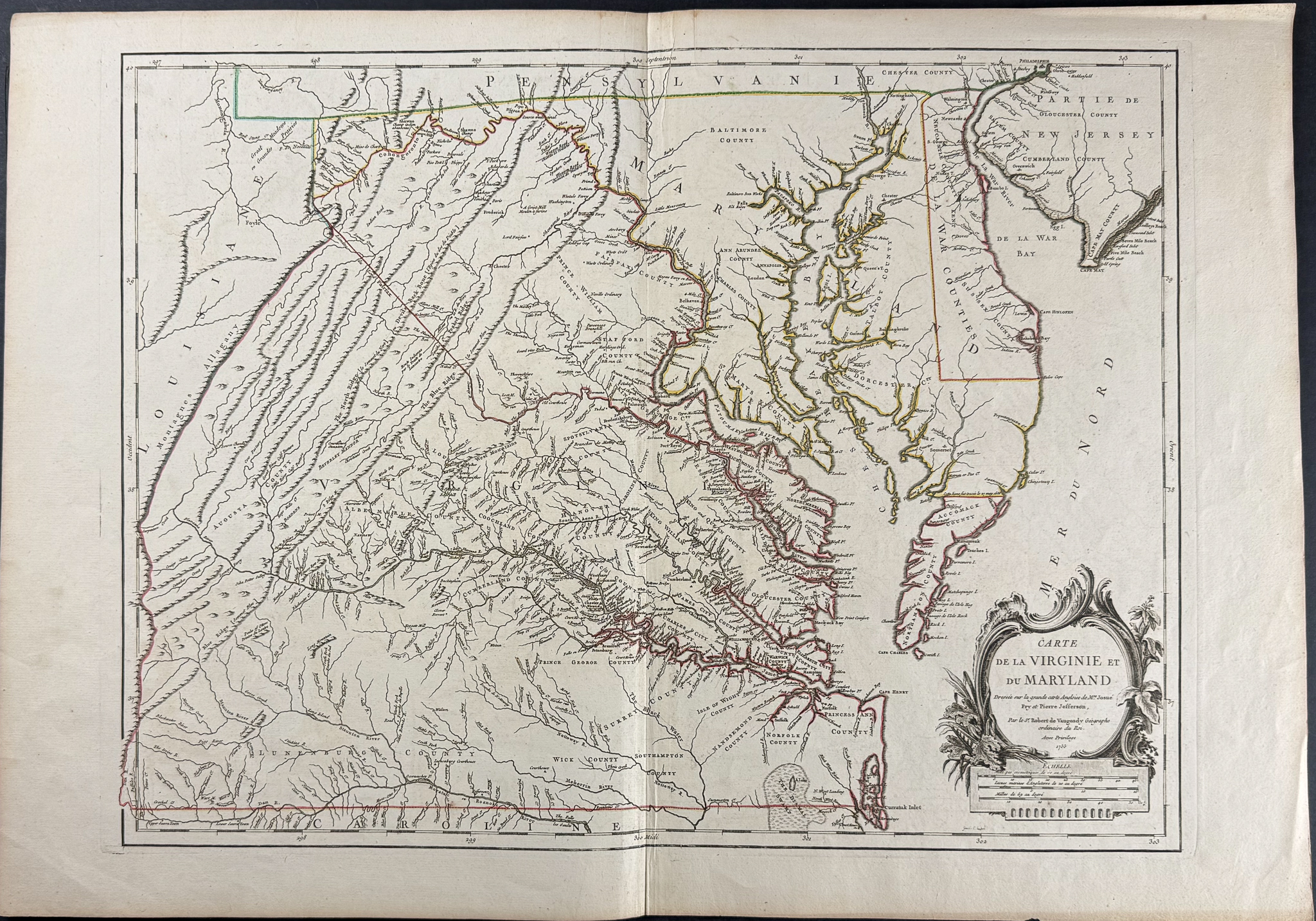
This is the rare, first state of the map from Gilles Robert de Vaugondy entitled
Carte de la Virginie et du Maryland. It was published in Paris in 1755 as part of
Atlas Universel. The map was engraved by Elisabeth Haussard.
This is the first French map of the region including Virginia and Maryland. It is reduced from the surveys of Joshua Fry and Peter Jefferson (father of President Thomas Jefferson). While the title has been translated into French, all cartographic details remain identical to the Fry and Jefferson English version.
The map was the first to depict the Blue Ridge Mountains and to chart the colonial road network in Virginia, marking a significant advance in the cartography of the region. It provides an accurate depiction of Virginia and Maryland prior to the American War of Independence. The map extends west of the Allegheny Mountains to include Delaware and part of New Jersey, as well as the area around Philadelphia. To the north, it includes part of Pennsylvania, and to the south, part of the Carolinas.
The Fry-Jefferson map served as a primary source for contemporary studies. Originally prepared in 1748 at the request of Lord Halifax, it was commissioned by Colonel Lewis Burwell, Governor of Virginia. It was published after Lord Halifax assumed the presidency of the Board of Trade and Plantations in 1748, having requested detailed information on frontier activities and potential French colonial claims on British territory.
Paper Size: ~ 21 7/8" by 31 5/8"
Paper Type or Special Features: Engraving with Original Outline Color
Condition report:
The work is in very good to excellent condition overall. There may be some faint offset due to the fold out nature of the plate. There may be a few minor imperfections or faint marks or fox marks to be expected with age. Please review the image carefully for condition and contact us with any questions.
Share this lot: