
Antique Maps & Prints of Natural History, Botanicals, & More
Lot 3870:
Description
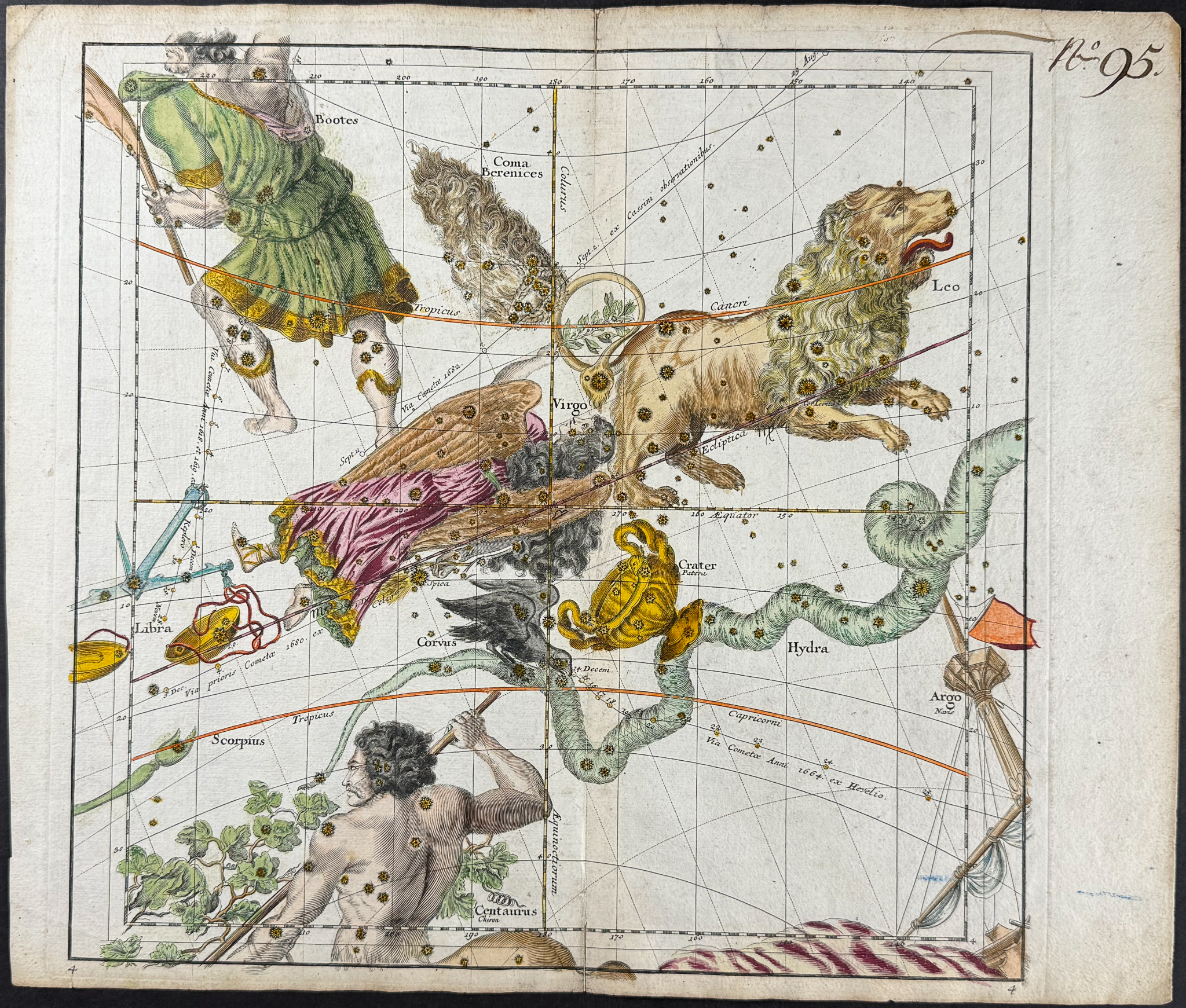
This stunning, hand-colored celestial engraving is from Christopher Weigel as part of Johann David Kohler’s
Bequemer Schul- und Reisenatlas aller zu Erlernung der alten, mittlern und neuen Geographie dienlichen Universal- und Particular-Charten or
School and Travel Atlas… That work was published in Nuremberg by J. E. Adelbulner for Christopher Weigel in 1719.
The engravings are after the work of Ignace-Gaston Pardies in his
Globi coelestis in tabulas planas redacti descriptio. Pardies (1636-1673) was a French mathematician and astronomer. He created a number of celestial schemes and maps of the heavens. Pardies’s maps were noted for the distinct stars and artistic constellation figures.
Provenance: Ex-libris P. Veron and Wilhelm Voss / Hamburg-Altona
Paper Size: ~ 17 1/4" by 14 5/8" (Fold Out)
Paper Type or Special Features: Engraving with Old Hand-coloring
Condition report:
The work is in very good to excellent condition overall. There is some separation at the lower and upper folds that has been archivally reinforced with paper. A previous owner numbered the plates elegantly in the upper right corner. There may be some reinforcement on the verso of the plates. There may be a few minor marks or imperfections to be expected with age. Please review the image carefully for condition and contact us with any questions.
Share this lot: