
Antique Maps & Prints of Natural History, Botanicals, & More
Lot 2420:
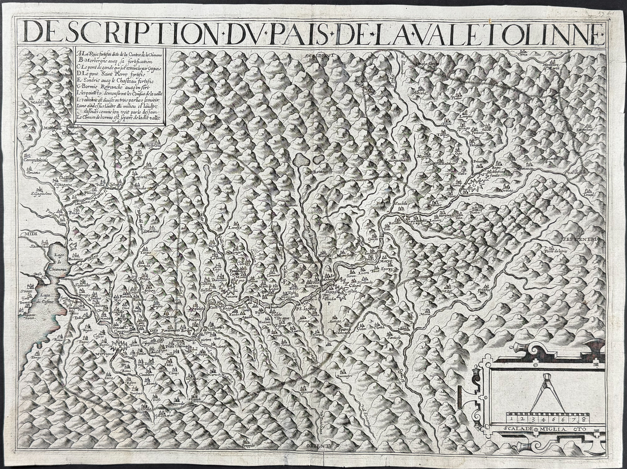
Description
This exceptionally rare engraved map entitled "Description du Pais de la Valetolinne" is by Jean Boisseau. It was published by Parigi in Paris in 1649. The map depicts Valtellina or the Valtelline, which is a valley in the Lombardy region of northern Italy, bordering Switzerland.
The map was never published for an atlas, but rather for military use. The map was drawn before 1618 as it shows the village of Piuro (which was destroyed by a landslide in 1618). It details fortified towns, castles, and bridges over the Adda River to aid French troops under the command of the Duke of Rohan and the Marquis of Coeuvers.
The map is only found in two states. One has the mile box reported at the bottom right "SCALA DE MIGLIA OTO" with compass only. The other state also with editorial notes. It is not known which is the earlier state.
Jean Boisseau (1600-1657) was a French cartographer, publisher and enlumineur.
Paper Size: ~ 19 1/4" by 14 5/8" (Fold Out)
Paper Type or Special Features: Engraving
Condition report:
The work is in very good to excellent condition. There are a few minor closed tears with old repair at eddges. There is some old paper repair from torn corner at upper right. There may be a few minor imperfections to be expected with age. Please review the image carefully for condition and contact us with any questions.
Share this lot: