
Antique Prints, Maps, & Books of Natural History, Botanicals, & More
Lot 80210:
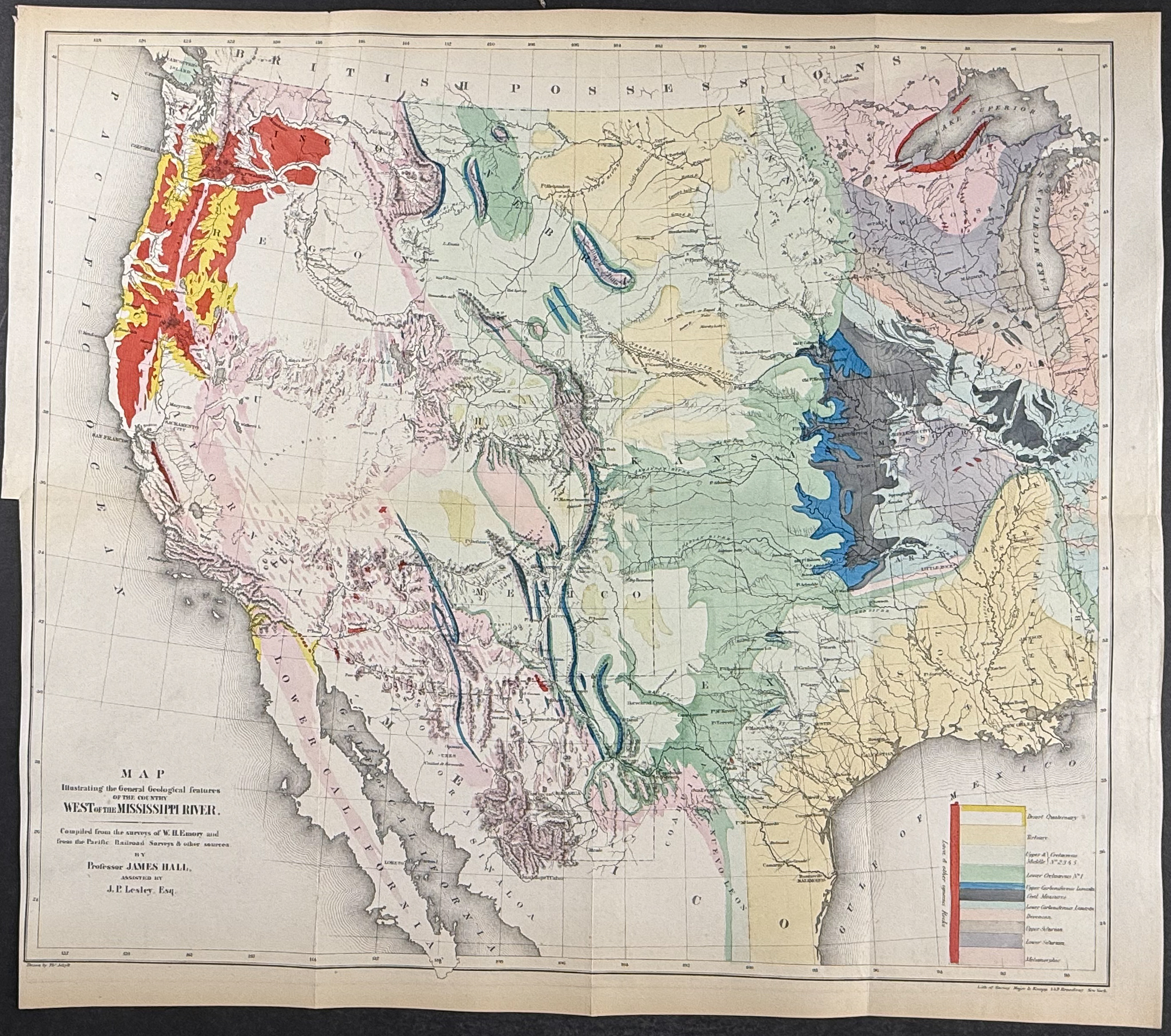
Description
This steel engraved map is from William H. Emory’s
Report on the United States and Mexican Boundary Survey. Made Under the Direction of the Secretary of the Interior. The work was published in 1857 by Cornelius WendellWashington, D.C.
This is one of the foundational works exploring the Texas-Mexican border. Emory surveyed the area after the Gadsden purchase. The work featured contributions by James Hall, T. A. Conrad, and maps from Jekyll and Hall. Many of the views were after drawings by Schott, Weyss, and Vaudricourt.
Paper Size: ~ 24 1/4" by 21 1/2" (Fold Out)
Paper Type or Special Features: Steel Engraving with Original Wash Coloring
Condition report:
The work is in very good to excellent condition overall. There may be a few minor imperfections to be expected with age. Please review the image carefully for condition and contact us with any questions.
Share this lot: