
Antique Prints, Maps, & Books of Natural History, Botanicals, & More
Lot 70654:
Description
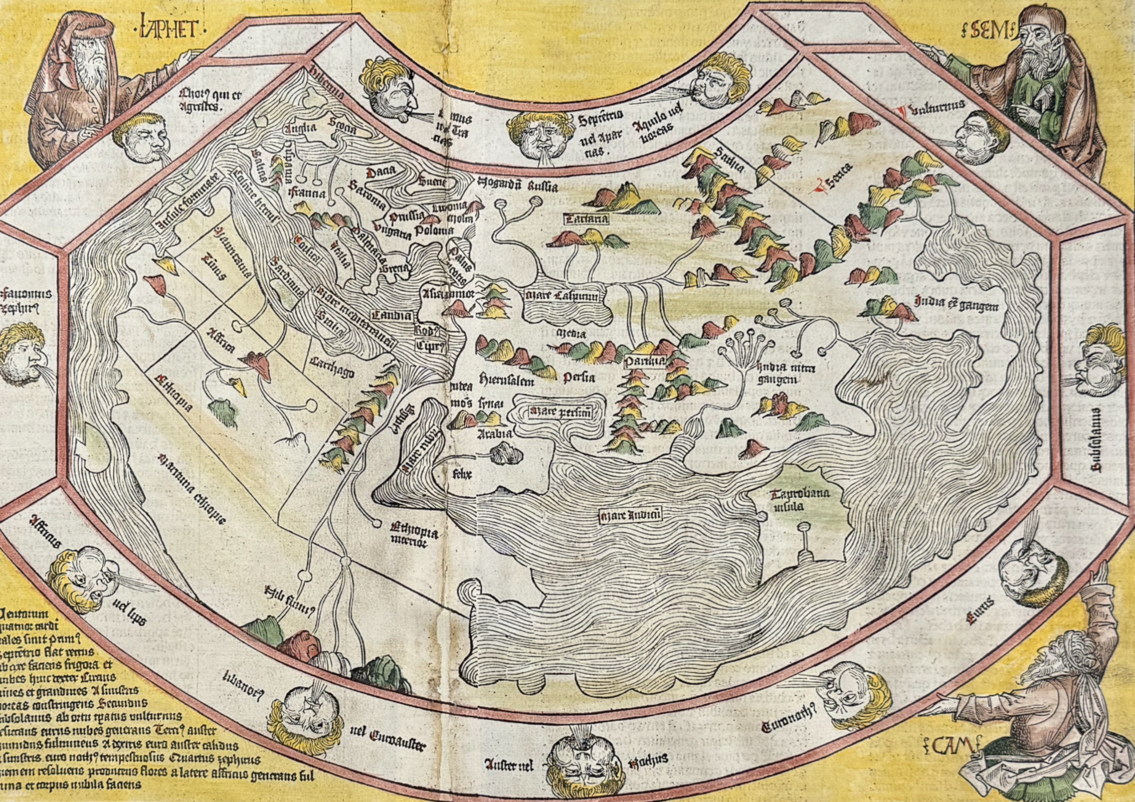
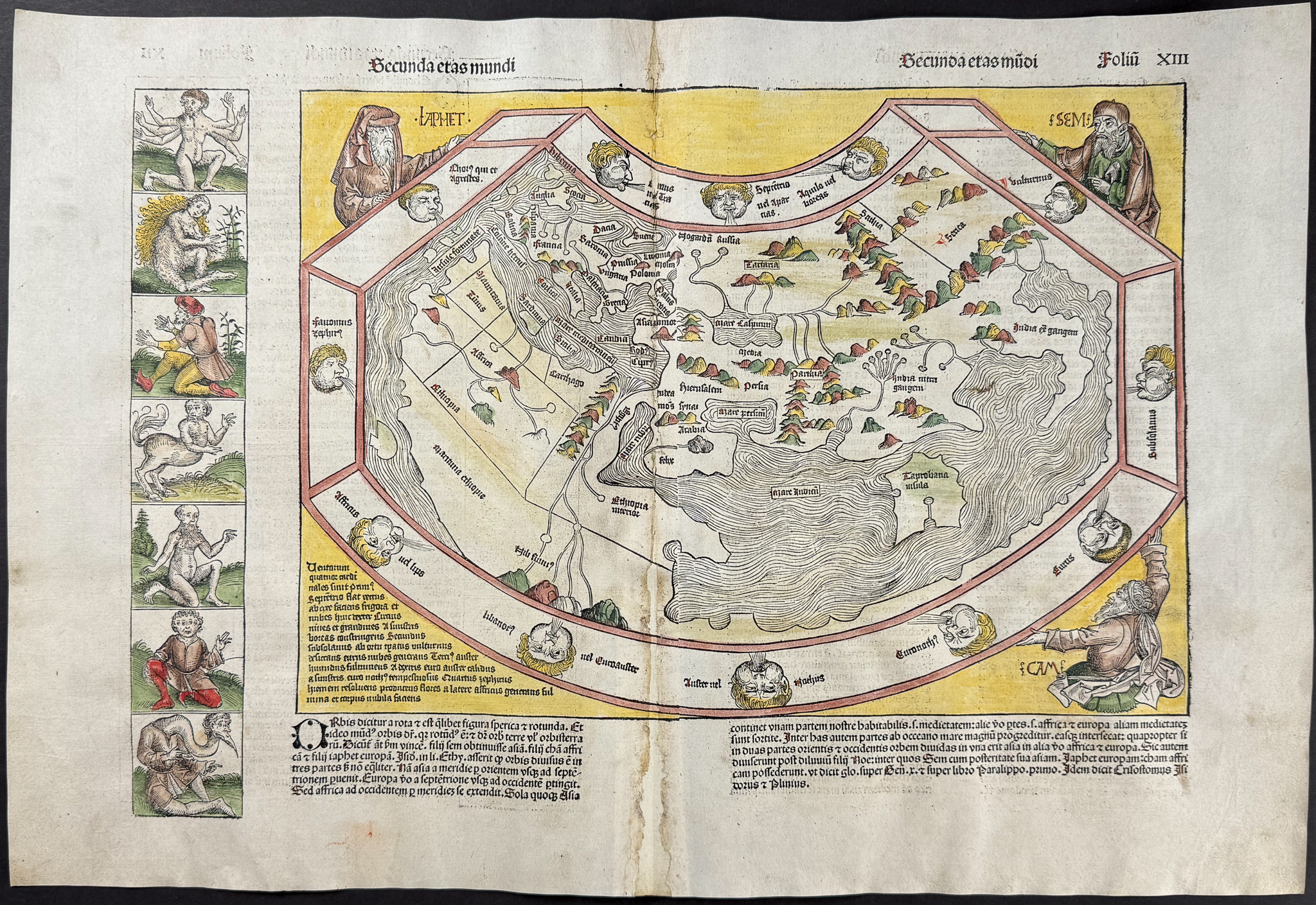
This is a beautiful example of a ptolemaic map of the ancient world. This is a particularly important map because it is one of the final represenations of the known globe before the discovery of the New World. It is undoubtedly one of the earliest obtainable printed maps of the world, published only 40 years after the invention of printing.
The map is surrounded by twelve wind heads "Holding" the map are the three sons of Noah – Sem, Ham, and Iaphet. This suggests the theological view of the sons of Noah repopulating the Earth after the Great Flood. To the left and on the opposite side of the map are illustrations of strange and mythological creatures. The creatures were used to illustrate the inhabitants of the undiscovered and unexplored lands.
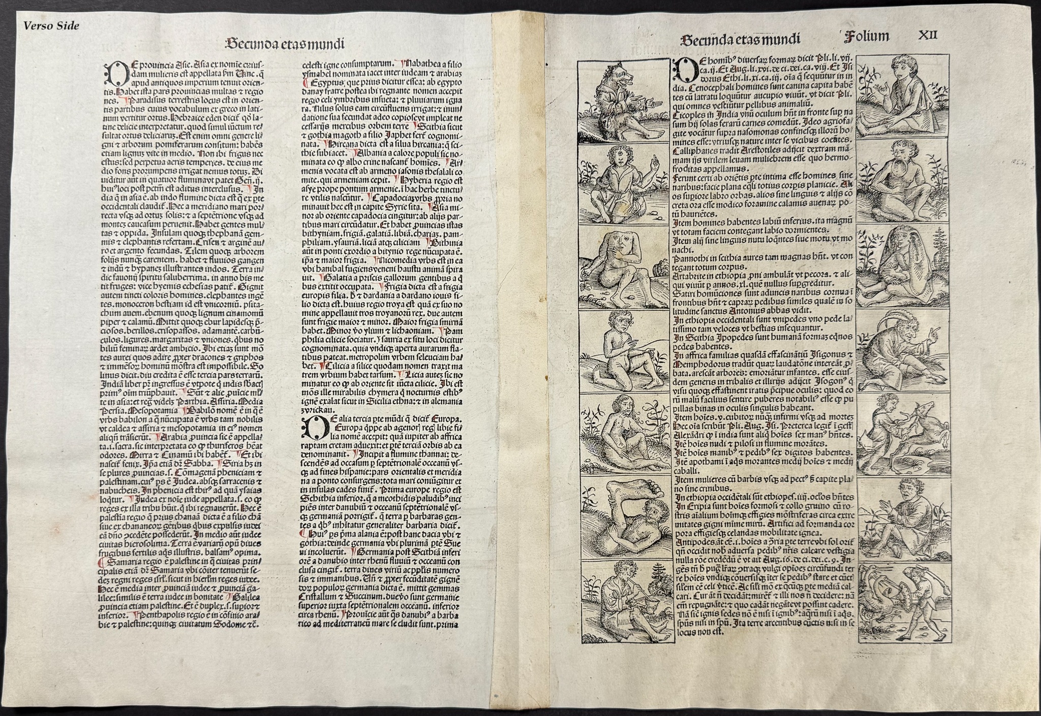
"What gives the map its present-day interest and attraction are the panels representing the outlandish creatures and beings that were thought to inhabit the furthermost parts of the earth… a six-armed man, possibly based on glimpses of a file of Hindu dancers… a six-fingered man, a centaur, a four-eyed man from a coastal tribe in Ethiopia; a dog-headed man from the Simien Mountains, a cyclops, one of those men whose heads grow beneath their shoulders, one of the crook-legged men who live in the desert and slide along instead of walking; a strange hermaphrodite, a man with one giant foot only (stated by Solinus to be used as a parasol but more likely an unfortunate sufferer from elephantiasis), a man with a huge underlip (doubtless seen in Africa), a man with waist-length hanging ears, and other frightening and fanciful creatures of a world beyond." (Shirley 19)
Descripton of the work:
This important and historic engraving is from Hartmann Schedel
Liber Chronicarum, more commonly known as the
Nuremberg Chronicle. This is the first edition / printing of the work. It is the Latin edition that was published 6 months prior to the German edition. Both editions were limited to 2000 printings. It was published in Nuremberg in 1493 by Anton Koberger for Sebald Schreyer and Sebastian Kammermeister.
The work included numerous illustrations that were completed by Michael Wolgemut, Wilhelm Pleydenwurff, and members of their workshop. This very likely included the young Albrecht Dürer as well. The work included maps and town views, but also chronicles historic information including the invention of the printing press, development of the game of chess, navigational voyages, and important constructions.
Hartmann Schedel (1440-1514) was a German writer, physician, and book collector. He is most remembered for his famous work
Liber Chronicarum or
Nuremberg Chronicle. He published some of the first printed views of many cities.
Paper Size: ~ 23 1/4 by 16 3/4" (Fold Out)
Paper Type or Special Features: Folio Woodcut Engraving with Professional Hand-coloring
Condition report:
The work is in very good to excellent condition overall. There is some paper repair at the fold with some ink or color loss. There may be a few minor imperfections, paper repair, staining, offset, or faint fox marks to be expected with age. Text and image are printed to both sides of the page, so some bleed through may be expected, pictures of both sides are provided. On some of the fold out pages from this work there has been a strip professionally added to the verso side of the fold with period paper (blank sheets from same work). Please review the image carefully for condition and contact us with any questions.
Share this lot: