
Antique Prints, Maps, & Books of Natural History, Botanicals, & More
Lot 69710:
Description
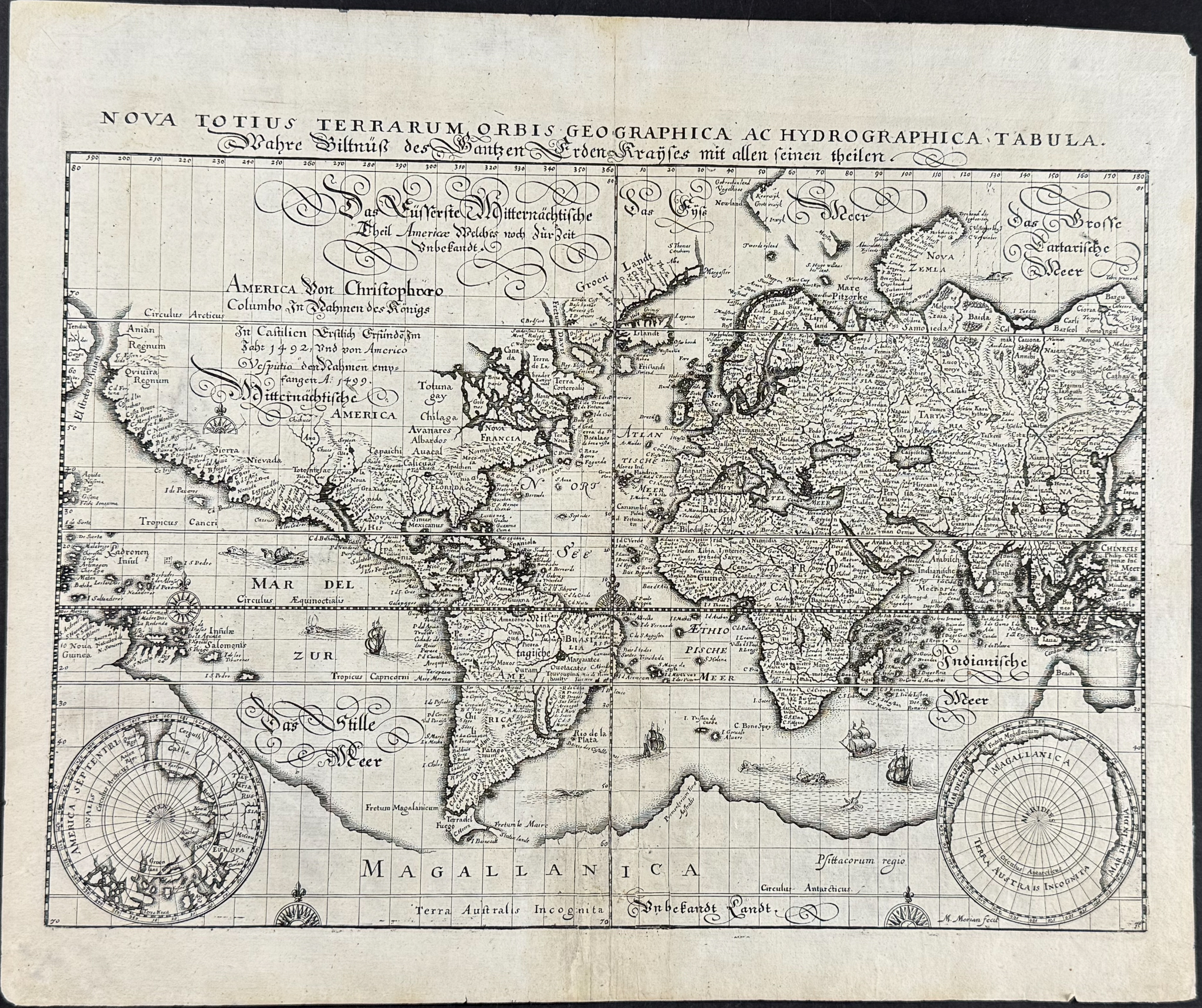
This world map is entitled
Nova Totius Terrarum Orbis Geographica ac Hydrographica tabula and was done by Mathaeus Merian. It was published in 1638. This is the first edition of the map with Merian’s signature in the lower right. The signature was removed from subsequent editions. The map was after Blaeu’s map of the World on Mercator’s Projection.
The map shows Northwest coastline leading to a narrow strait (Marco Polo’s semi-mythical Anian). It named California, the Sierra Nevadas, and the southern land mass was called Magallanica. Australia is shown attached to Magallanica with no appearance of New Zealand. It has a primitve eastern coastline of the North America with no great lakes shown. Korea is shown as an island, and an early depiction of Japan is featured. It also has decorative flourishes including sea monsters, ships, and compass roses.
Mathaus Merian (1593-1650) was born in Basel, Switzerland and traind in engraving in Zurich. He travelled to Nancy, Paris, Strasbourg, and eventually settled in Franklfurt. he worked with Johann Theodor de Bry there (publisher and son of the travel writer). Merian maried Maria Magdalena de Bry (Johann’s daughter) in 1617. Merian then took over the de Bry publishing house after Johann’s death in 1623. Merian published and engraved many wonderful engravings. He is also the father of the engraver, painter, and naturalist Maria Sibylla Merian.
Paper Size: ~ 15 1/8" by 12 3/4 (Fold Out)
Condition report:
The work is in very good to excellent condition overall. There is some professional repair at the fold to a couple weakened spots from fold out nature. There may be a few minor marks or imperfections to be expected with age. Please review the image carefully for condition and contact us with any questions.
Share this lot: