
Antique Prints, Maps, & Books of Natural History, Botanicals, & More
Lot 66455:
Description
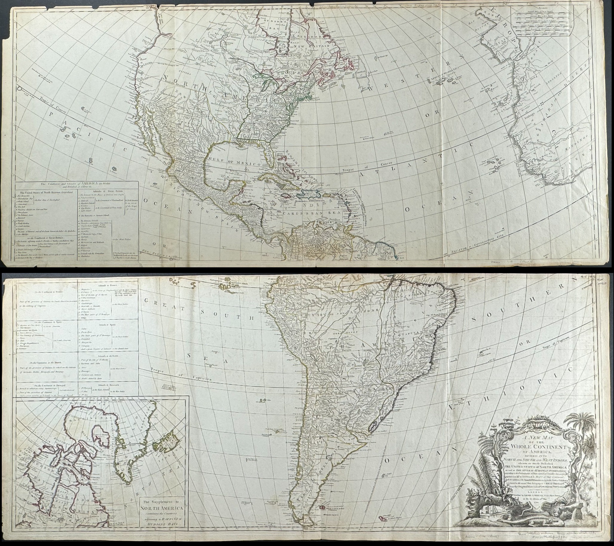
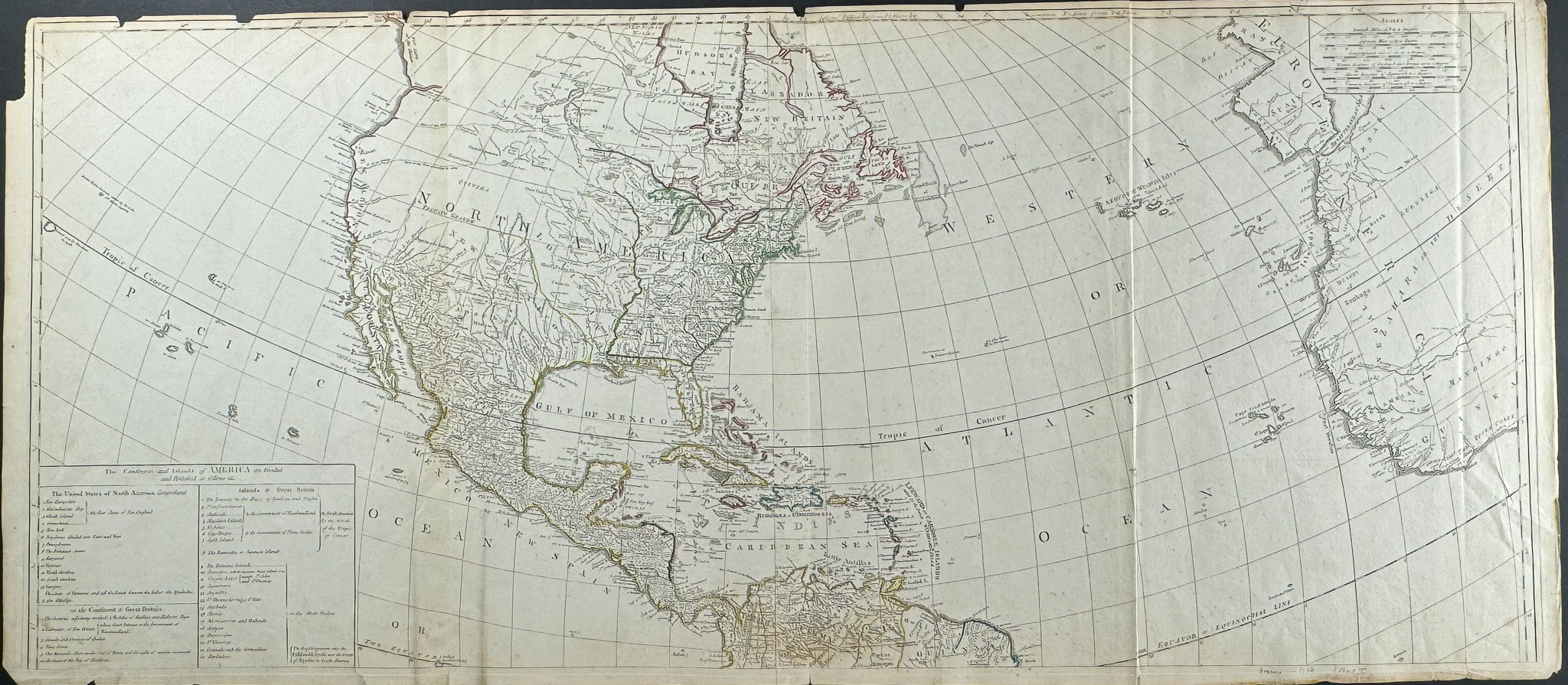
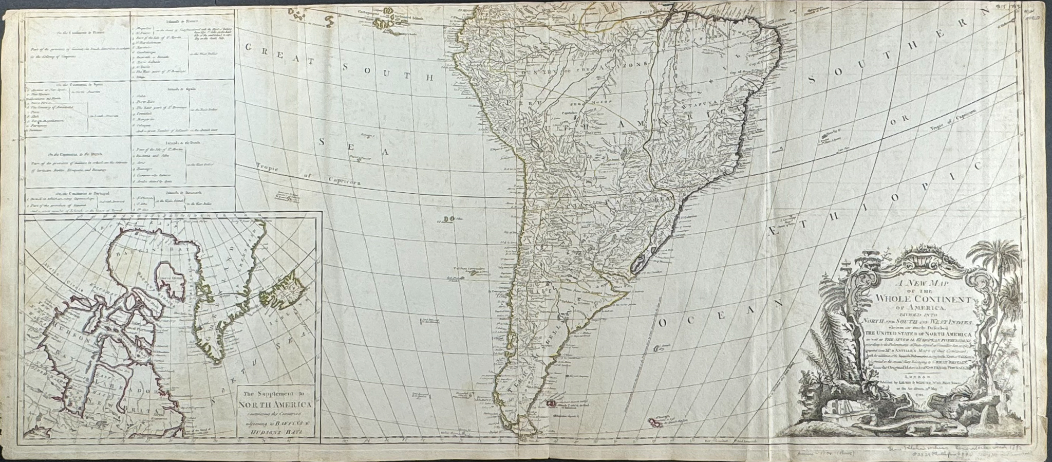
This historic map from John Gibson is titled ‘A New Map of the Whole Continent of America, divided into North and South America and West Indies…’ It was published by Robert Holmes Laurie and James Whittle in London in 1794.
This large map of the western hemisphere was printed to four sheets, presented here joined as two with original outline color. It features an inset of the arctic as well. This maps shows the United States as it was newly formed as well as European colonies. The table lists the states of the US, American possessions, and European colonial powers. The cartouche shows New World flora, a beaver, an alligator, and an Indian chieftain’s headdress.
Gibson based the map after d’Anville’s maps of America as well as information from Spanish explorations in northern California and research from Governor Pownall in English North America. The map shows to the Mississippi, Quebec is shown into US territory, and the Great Lakes are illustrated. Greenland is shown as part of the Norther American mainland in the inset of the South American portion of the map.
Paper Size: ~ 42 1/2" by 48 1/2" (Fold Out) (Two joined sheets)
Condition report:
The work is in very good to excellent condition overall. There can be some very light to negligible offset due to the fold out nature of the plate. There may be some wear or small separation at folds. There may be minor imperfections to be expected with age. Please review the image carefully for condition and contact us with any questions.
Share this lot: